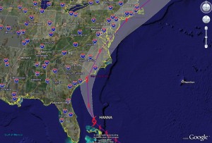
The southeastern United States is in preparations for what could be a rough period as Tropical Storm Hanna, Hurricane Ike and Tropical Storm Josephine move through the Atlantic toward its shores. After reading the details below, be sure to check out our new Hurricane Tracker!

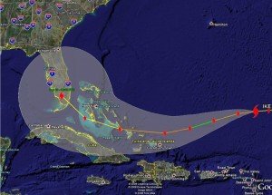
Perhaps of greater concern is Hurricane Ike. In a period of 24 hours Ike exploded from a tropical storm to a category 4 hurricane. The storm has settled down a bit and as of this morning is a category 3 storm with 125 mph winds and is moving west at 15 mph. This weakening is expected to continue for the next couple of days before it regains strength again and should become a major hurricane. Ike should continue west through Monday morning before starting to turn northwest however a pressure ridge close to the U.S. could change that. If it continues on the expected path, south Florida could take a direct hit from the storm late Tuesday into early Wednesday. This storm has the potential for widespread and serious damage and area residents should be prepared to evacuate.
Tropical Storm Josephine is a good ways from the U.S. and is not currently expected to be a threat to the mainland. Winds are currently at 50mph with northwest movement at 9mph. Josephine should continue on the northwest path and stay in the Atlantic.
For the latest updates on the positions of all of these storms, see our new Hurricane Tracker!
