All posts by Thornton Weather

ThorntonWeather.com is your local source for live Thornton, Colorado weather conditions and news!

Get ready – Old Man Winter to arrive in Thornton tonight

Current weather advisories for northeastern Colorado.  Click the image for the latest.
Current weather advisories for northeastern Colorado. Click the image for the latest.

Update, 5:30pm – The snow is still coming, it is just a little bit slower than originally anticipated.  A Winter Weather Advisory will go into effect at 8:00pm for the Front Range and a Winter Storm Warning will go into effect for the eastern plains. 

Snow will develop later this evening and we still expect to see 2 to 4 inches of snow by morning.  The snow will continue through Wednesday and when it ends we will have between 4 and 8 inches total accumulation. 

As discussed before (see below), the eastern plains are where the brunt of this storm is really going to hit.  Travel on I-70 from Limon through Kansas and I-76 from Sterling through Nebraska is likely to become hazardous later in the day tomorrow.

Original story, 4:14pm – ust in time to potentially snarl holiday travel, a winter storm is bearing down on Thornton and will have far-reaching impacts across the Great Plains. A variety of winter weather advisories and warnings have been issued stretching from Colorado through Kansas north through the Midwest to the Canadian border.

For Colorado, the storm has already begun to affect the southwestern part of the state where snow began falling earlier today. The Colorado Department of Transportation says that chain laws are in effect on US 160 and US 550. As the storm moves further into the state, similar restrictions can be expected.

In Denver, and for much of the Front Range, a Winter Weather Advisory is in effect from 8:00pm tonight through 5:00am Thursday. Snow will begin to develop this evening and continue throughout the day Wednesday before easing late Wednesday afternoon. Look for us to have 2 to 4 inches in the Denver area. By the time the storm is done, we are looking at 4 to 8 inches of total accumulation and with winds blowing from 10 to 20 mph, blowing and drifting snow is likely.

The real threat from this storm will be in areas east and northeast of Denver. The eastern plains of Colorado are forecast to receive 5 to 10 inches and the wide-open expanses and wind could lead to blizzard-like conditions. Travel on I-70 east of Limon through Kansas and I-76 northeast of Sterling through Nebraska will become difficult and possibly dangerous. A Winter Storm Warning is in effect for these areas.

This storm certainly won’t come anywhere near the level of the record-setting Christmas Eve Blizzard of 1982 however, it will virtually ensure that we have a white Christmas with snow on the ground. Temperatures will be bitterly cold Wednesday through Friday and it may be Sunday before we see them rebound to above freezing.

If you haven’t done so, be sure to follow us on Twitter and become a fan on Facebook!  They are great ways to stay up to date with the latest weather news, forecasts and conditions!

As always, stay tuned to ThorntonWeather.com for truly local weather for Thornton. 

Three years ago today – The seventh biggest snowstorm in Denver history

The Blizzard of 2006 buried all of Denver under a heavy blanket of snow that measured more than 2 feet in many areas. More images from the storm can be found at the Denver Weather Examiner - click on the image to go there. (ThorntonWeather.com)

Leading up to the Christmas holidays of 2006 the weather was nothing extraordinary in the Mile High City – until the 20th of the month. Temperatures at the middle of the month had entered into the 60’s and Denver residents were enjoying the warmth.

A few short days later, that all changed in a big way. A slow moving low pressure system coupled with upslope flow and copious amounts of moisture provided the perfect setup for a historical winter storm whose effects would be felt for months. Snow began falling on the morning of the 20th and by the early afternoon blizzard conditions began to set in and it was obvious we were in for one heck of a storm.

Businesses shut down early on the afternoon of the 20th in order to allow their employees extra time to make it home safe but by then a foot or more of snow had fallen across the Front Range. The governor called out the Colorado National Guard to help rescue stranded motorists who were in turn transported to area Red Cross shelters to wait out the storm.

Every major interstate and highway in and out of Denver was shut down and RTD suspended all service in the city for the first time since 2003. Mail service on the 21st was canceled entirely as even the mail carriers couldn’t make their way to their appointed rounds. Most area businesses were forced to shut down on the 21st as employees couldn’t even make it out of their housing developments to get to work. 

There's more to this story on the Denver Weather Examiner's site!For much more about the storm and to see photos of the aftermath, check out the story on the Denver Weather Examiner.

Philippine volcano eruption possible within days

With glowing red lava now flowing regularly down its sides and seismic activity ‘dramatically increased,’ an eruption of the Mayon Volcano in the Philippines is now considered imminent. Activity on the mountain has steadily increased over the past week and prompted the evacuation of nearly 45,000 area residents.

Today the Philippine Institute of Volcanology and Seismology (PHIVOLCS) raised the alert level for the volcano to level four which means an eruption is possible within days. A level four alert is second to only level five which would involve an actual eruption taking place.

In its latest alert, the service said “seismic activity dramatically increased in number and size” noting that nearly 2,000 volcanic quakes had been detected. Glowing, red hot lava was easily seen flowing down the slopes of the mountain at night and booms and rumbling were heard. The lava flow now extends more than three miles down the mountain and sulfur dioxide (SO2) is being emitted at a rate of more than 6,000 tons per day.

Emphasizing the danger, PHIVOLCS said in its warning that “a hazardous explosive eruption is possible within days.” With the heightened alert level, it is expected that the evacuation radius will be extended out to five miles from the mountain possibly impacting thousands of more people.

There's more to this story on the Denver Weather Examiner's site!For the amazing photos of the volcano’s recent activity and more details on the possible eruption, please visit the Natural Disasters Examiner.

December 20 to December 26 – This week in Denver weather history

December 20 to December 26 - This week in Denver weather history

The week leading up to Christmas is hectic enough but when you through in severe weather, it can be overwhelming.  This week marks a number of notable weather events in Denver weather history but two stand out.  Most recently was the storm three years ago that became the seventh biggest snowstorm in Denver weather history.  Of course probably the most memorable for longtime Denver residents is the Christmas Eve storm of 1982 that buried the city for the holiday and for days afterwards.

From the National Weather Service:

17-24

In 1924…a prolonged cold spell occurred after mild temperatures during the first half of the month.  Most low temperatures dipped below zero with the coldest reading of 15 degrees below zero occurring on the 24th. The high temperature of only 5 degrees on the 18th was a record low maximum for the date.

18-24

In 1998…a vigorous cold front with north winds gusting as high as 38 mph at Denver International Airport on the 18th dropped temperatures from a high of 51 degrees to a low of just 6 degrees before midnight.  The arctic air mass that settled over metro Denver produced intermittent light snow and a week-long protracted cold spell that caused low temperatures to plunge well below zero for 6 consecutive nights.  The coldest temperature was 19 degrees below zero on the morning of the 22nd.  High temperatures climbed only into the single digits on 4 consecutive days…from the 19th through the 22nd.  At least 15 people…mostly homeless… Were treated for hypothermia at area hospitals.  The bitter cold weather was responsible…either directly or indirectly… For at least 5 fatalities.  Three of the victims died directly from exposure.  The cold weather also caused intermittent power outages.  Following the cold snap… Thawing water pipes cracked and burst in several homes and businesses…causing extensive damage.  Only one temperature record was set.  The high temperature of only 7 degrees on the 19th set a record low maximum for the date.

19-20

In 1982…high winds buffeted the eastern foothills.  At midday on the 19th…gusts of 75 to 80 mph were recorded in the Table Mesa area of Boulder.  A gust to 62 mph was clocked in Boulder on the evening of the 20th.
 
In 1989…strong winds howled at mountain top level in clear creek and Gilpin counties.  Speeds reached 97 mph on the summit of Squaw Mountain and 84 mph one mile south of Rollinsville.  Northwest winds gusted 35 mph at Stapleton International Airport on the 20th.

19-23

In 1990…a surge of very cold arctic air invaded metro Denver.  Many temperature records were broken as the mercury remained at or below zero for 85.5 hours at Stapleton International Airport…making it the third longest period of subzero readings in 118 years of record keeping.  On the morning of the 22nd…the mercury plunged to 25 degrees below zero…which equaled the all time record low temperature for the month set on December 24…1876. In the foothills southwest of Denver at tiny town…the mercury plunged to 33 degrees below zero on the morning of the 21st.  On the same morning at Castle Rock the temperature dipped to 26 degrees below zero.  During the period…other daily temperature records were set at Denver…including:  record low maximum of 3 degrees below zero on the 20th and a record low of 17 degrees below zero on the 23rd.  The record low was equaled with 16 degrees below zero on the 20th and 21 degrees below zero on the 21st.  Snowfall totaled 2.7 inches at Stapleton International Airport from the 19th through the 21st.

20   

In 1894…southwest winds were sustained to 40 mph with gusts to 48 mph.  The Chinook winds warmed the temperature to a maximum of 69 degrees…which was a record high temperature for the date.  The minimum temperature dipped to only 33 degrees.
 
In 1903…northwest Chinook winds sustained to 54 mph with gusts to 60 mph warmed the temperature to a high of 58 degrees.
 
In 1948…strong winds occurred along the eastern foothills from Boulder north.  Wind gusts to 45 mph were recorded at Valmont with a gust to 30 mph at Boulder airport.  Some damage occurred.  Wind gusts to 50 mph caused some blowing dust at Stapleton Airport.
 
In 1957…strong Chinook winds…gusting to 51 mph from the northwest…warmed the afternoon temperature to a high of 54 degrees.
 
In 1981 high winds were reported in the foothills with a peak gust of 87 mph recorded at Wondervu.
 
In 1992…strong Chinook winds raked the eastern foothills with 69 mph recorded at Table Mesa in south Boulder. Southwest winds gusted to only 21 mph at Stapleton International Airport.
 
In 1996…five construction workers were injured…two seriously…when a sudden wind gust blew over a 30-foot- high retaining wall they were working on in western Lakewood.  The scaffolding they were standing on collapsed…and some were pinned under the rubble for 15 minutes.  Wind gusts of 60 to 75 mph were reported in the area.  Southwest winds gusted to only 24 mph at Denver International Airport.
 
In 2004…strong downslope winds developed over the eastern mountain slopes and spread over metro Denver.  Peak wind gusts approached 100 mph along the foothills of Boulder County.  In superior…a 1200-square-foot section of roof was peeled off the gymnasium at monarch high school. Two semi-trailers were toppled on Colorado Highway 58 at McIntyre Street and another at c-470 and West Bowles Avenue.  Two airplanes were damaged by wind-blown debris at Jefferson County airport.  The high winds forced the closure of State Highway 93 between Golden and Boulder for approximately two hours.  Insurance agents estimated 650 to 850 homes suffered wind damage in the Boulder and Louisville areas.  In addition…downed trees and power lines left about 1000 residents…mainly in the Boulder area…without electricity.  At least three people suffered minor injuries in the storm.  Peak wind reports included:  95 mph in superior…92 mph at Jefferson County airport…85 mph in Golden…81 mph in Boulder…80 mph in Broomfield and Evergreen…and 79 mph in Louisville.  West northwest winds gusted to 59 mph at Denver International Airport.

Continue reading December 20 to December 26 – This week in Denver weather history

Erupting deep sea volcano captured on film

Magma erupts from a newly discovered deep sea volcano. (NOAA)

An impressive display of the earth’s power was witnessed by scientists 4,000 feet below the surface of the Pacific Ocean. Scientists discovered the deepest erupting volcano yet and aided by the extreme pressure at that depth, they were able to send a remote controlled submersible within feet of it as it erupted.

Video of the event (click here) captured bubbles of magma as they shot into the ocean with a cloud of sulphur. The magma froze virtually instantly due to the extreme cold and fell to the surface as rock.

Co-Chief Scientist Bob Embley of the National Oceanic and Atmospheric Administration (NOAA) said, “It was an underwater Fourth of July – a spectacular display of fireworks nearly 4,000 feet deep.”

The mission featured a number of firsts in addition to the discovery of the volcano itself. For the first time scientists witnessed molten lava flowing across the ocean’s bottom and discovered a new type of lava.

NOAA said that the lava the volcano is producing has never before been seen on an active volcano. The Boninite lava is said to be the hottest erupting on earth in modern times. Scientists said it will allow a unique opportunity to learn how the earth recycles material when one tectonic plate subsides under another.

There's more to this story on the Denver Weather Examiner's site!Be sure to visit the Natural Disasters Examiner and watch the amazing video and view the incredible photos!

2009 likely to end with lowest level of natural disasters in a decade

Natural disasters in 2009 at lowest levels of the decade The number of natural disasters in 2009 reached the lowest point in the decade. According to preliminary numbers from the United Nations, there were 245 disasters which is far below any of the past 10 years.

Natural disasters, no matter how many there are, due have a toll in human life and economic impact. The UN International Strategy for Disaster Reduction (UNISDR) said that 8,919 people lost their lives from the events and they affected 58 million. The cost of the damage was put at $19 billion.

Weather-related disasters which exclude geological events like earthquakes and volcanoes were responsible for the lion’s share of the losses. Approximately 7,000 lives our of the total of 8,919 were lost due to weather-related events. Similarly, $15 billion of the $19 billion in damages were weather-related. 

Margareta Wahlström, the United Nations Special Representative for UNISDR said, “Statistics this year show lower figures compared to previous years, which is good news for people and countries, however extreme weather disasters remain top of the list and will continue to affect more people in the future as more than half of the world’s population highly exposed is living in coastal regions.”

There's more to this story on the Denver Weather Examiner's site!For the rest of the story including a look at the “top five” disasters of 2009, check out the story at the Natural Disasters Examiner.

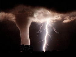
NOAA: Nighttime and winter tornadoes a real danger

Tornadoes can and do strike at night and during winter months.  Are you prepared?
Tornadoes can and do strike at night and during winter months. Are you prepared?

Tornadoes are one of nature’s most violent storms. Able to strike without warning, they bring death and destruction with frightening frequency. Twisters can be scary enough to just think about and when you consider one striking at night when you can’t see it and aren’t expecting it, the odds of survival diminish.

Over the last three years, there has been an average of 1297 tornadoes per year and on average 91 tornado-related deaths per year. While not as common during the winter months, tornadoes can and do occur every month of the year and they do strike at night.

Seeking to draw attention to the dangers nighttime tornadoes present, the National Oceanic and Atmospheric Administration (NOAA) and its National Weather Service announced an effort to increase awareness. In a press release today, the services said that with the El Niño conditions we are experiencing, Florida and the Gulf Coast region stand a greater risk of tornadoes.

NOAA reminded all residents of the United States that a NOAA All Hazards Radio is the first line in defense against not only tornadoes, but all natural disasters. Also announced were new severe weather outlooks that will be issued when conditions are favorable for such storms.

There's more to this story on the Denver Weather Examiner's site!Get all the details from the Natural Disasters Examiner about what the National Weather Service said and learn what steps you can take to protect you and your loved ones.

Questions about the ethics of Climategate scientists abound

The fallout from the release of thousands of emails from the world’s top climate scientists has been swift. Some of those involved have begun to turn on each other and even the international organization that has driven the manmade climate change debate is turning its back on them.

The Climategate scandal spans the globe and includes scientists from top universities, government agencies and private institutions. While some have said the messages call into question the very science behind anthropogenic climate change, on a more personal level it calls into question the ethics of the men involved. Data manipulation and deletion, efforts to prevent sharing of information, collusion to prevent publication of dissenting opinions and many more charges have been leveled.

Dr. Phil Jones, head of the Climate Research Unit at the University of East Anglia, was arguably featured most prominently in the emails. He apparently made requests of his colleagues to delete emails that he didn’t wish to see shared, made concerted efforts to withhold data, and worked with other scientists to stifle others opinions.

Jones temporarily stepped down from his position pending the results of an investigation. He has however seen little support from other scientists involved in the event.

Dr. Michael Mann of Penn State University and author of the discredited ‘hockey stick’ graph was the recipient of one of the emails from asking him and other scientists to delete previous correspondence. In interviews since the event, Mann did not support Jones saying, “I can’t put myself in the mind of the person who wrote that email and sent it. I in no way endorse what was in that email.”

Mann disavowed deleting any messages however, when he received the message he did not object and in fact replied that he would forward the request to Dr. Eugene Wahl at the National Climatic Data Center (NCDC).Penn State is currently investigating Mann however that inquiry is being conducted in private just leading to doubts about its impartiality.

There's more to this story on the Denver Weather Examiner's site!What do other prominent scientists and the United Nations have to say about the scientists?  Get the rest of the story at the Climate Change Examiner.

December 13 to December 19 – This week in Denver weather history

December 13 to December 19 - This week in Denver weather history

December can of course be cold and that is why Chinook winds are sometimes welcomed as they bring warm air to the Front Range.  However, those winds can also cause a great deal of damage if they blow too hard and we see that in our look back at this week in Denver weather history.  Particularly notable were winds on December 14th & 15th which caused accidents, toppled power poles and fences, ripped off roofs and more. 

From the National Weather Service:

2-17 

In 1939…more than 2 weeks of unseasonably warm weather made the month the 3rd warmest on record.  Seven daily temperature records were set…including the all time record high temperature for the month of 79 degrees on the 5th.  Daytime highs were balmy with 14 days in the 60’s and 70’s.  Low temperatures dipped to freezing or below on only 5 days.  The period was dry with only a trace of snow on the 12th.

3-15 

In 1972…a protracted cold spell held an icy grip on metro Denver when maximum temperatures never reached above freezing for 10 consecutive days from the 3rd through the 12th and minimum temperatures dipped below zero on eleven consecutive days from the 5th through the 15th. Daily low temperature records were set with 15 degrees below zero on the 5th…17 degrees below zero on the 6th… And 18 degrees below zero on the 10th.  Daily record low maximum readings were set with 3 degrees on the 6th and 6 degrees on the 9th.  The very cold temperatures were caused by 3 to 5 inches of snow cover and a Canadian air mass.

9-13 

In 1961…cold arctic air produced a protracted cold period. The temperature plunged to 16 degrees below zero on the 10th…establishing a new record for the date and the coldest reading since 25 degrees below zero on February 1… 1951.  Low temperatures dipped below zero on 5 consecutive days with 9 degrees below zero on the 9th…16 below on the 10th…10 below on the 11th…and 12 below on both the 12th and 13th.  High temperatures reached only 3 degrees on the 10th and 6 degrees on the 11th.

11-13

In 1940…5.4 inches of snow fell across downtown Denver. This was the only snowfall of the month.  Temperatures were quite cold on the 13th with a high of 6 degrees and a low of 2 degrees below zero.
 
In 1984…up to 6 inches of new snow fell over metro Denver… Hampering flight operations at Stapleton International Airport where snowfall totaled 3.8 inches and east winds gusted to 25 mph on the 11th.

12-13

In 1916…snowfall totaled 5.7 inches in downtown Denver. Northeast winds were sustained to 27 mph with gusts to 28 mph on the 12th.
 
In 1992…an upslope snowstorm whitened metro Denver.  While snowfall totaled only 4.1 inches at Stapleton International Airport…7 inches of new snow fell in Morrison…with 12 inches measured in Castle Rock.  North winds gusted to 23 mph at Stapleton International Airport on the 13th.
 
In 1995…strong winds gusting to nearly 100 mph whipped across the foothills west of Denver.  The strongest wind gusts included 98 mph atop Squaw Mountain and 75 mph at the Eldora Ski Area.  West-northwest winds gusted to 41 mph at Denver International Airport on the 13th.

12-15

In 1921…downslope Chinook winds produced warm temperatures in the city…which resulted in 4 temperature records. High temperatures of 72 degrees on the 13th and 68 degrees on the 15th were record maximums for the dates.  Low temperatures of 47 degrees on both the 12th and 13th were record high minimums for the dates.  West winds were sustained to 38 mph on the 12th and to 25 mph on the 13th.

13   

In 1955…strong winds raked the foothills.  A wind gust to 72 mph was recorded at rocky flats northwest of Denver.  Some damage occurred in Boulder.  Northwest winds were sustained to speeds of 23 mph at Stapleton Airport.
 
In 1988…high winds again occurred in Boulder where winds were clocked to 66 mph.  West winds gusted to 43 mph at Stapleton International Airport.
13-14 in 1902…heavy snowfall totaled 6.4 inches in the city overnight.  North winds were sustained to 18 mph with gusts to 20 mph on the 13th.
 
Continue reading December 13 to December 19 – This week in Denver weather history

Complete coverage of the UN Climate Change Conference in Copenhagen

The Climate Change Examiner is the place for the latest on the United Nations Climate Change Conference.

15,000 delegates, 5,000 journalists and dozens of world leaders have decended on Copenhagen, Denmark for the UN Climate Change Conference (COP15).  Decisions will be made that could shape the world in the decades to come. 

There is a lot going with the various press conferences, proposals, protests and more.  Underscoring the importance of the event, President Barack Obama will attend next week.  Will an agreement be reached?  What form will it take? 

The ultimate goal is to establish rules and limits on carbon emissions for all nations but it is not without controversy.  The recent Climategate scandal is serving as a backdrop and causing doubt in many people’s minds. 

The Climate Change Examiner is covering the story and its potentially wide-ranging effects.  Be sure to take a look!