I just read about this on channel 7’s website. Super Science Saturday is an annual event held at the National Center for Atmospheric Research (NCAR) in Boulder that gives teachers, students and families a chance to get up close and personal with the weather experts. From the NCAR website:
Every October NCAR hosts Super Science Saturday. This free public event for students, teachers, and families combines science education with Halloween fun from 10:00 a.m. to 4:00 p.m.
This year on October 25, visit Super Science Saturday and see NCAR scientists starring in live demonstrations, participate in hands-on activity tables, and take part in special science workshops.
This is a great opportunity and a lot of fun! This year the event is on October 25th from 10:00am to 4:00pm at NCAR in Boulder. More information including photos from previous years’ event can be found here:
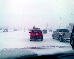
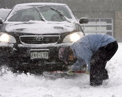
Looking back into the Denver weather history books shows Denver can receive just about any kind of weather this time of year. From heavy snow to gale force winds to 80 plus degree temperatures, it can all happen this week.
10-12 IN 1969…THE SECOND HEAVY SNOWSTORM IN LESS THAN A WEEK
DUMPED NEARLY A FOOT OF SNOW ACROSS METRO DENVER AND
PLUNGED THE AREA INTO EXTREMELY COLD TEMPERATURES FOR SO
EARLY IN THE SEASON. SNOWFALL TOTALED 11.0 INCHES AT
STAPLETON INTERNATIONAL AIRPORT. NORTH WINDS GUSTING TO
26 MPH PRODUCED DRIFTS UP TO 2 FEET DEEP. TEMPERATURES
DIPPED FROM A HIGH OF 52 DEGREES ON THE 10TH TO A RECORD
LOW FOR THE DATE OF 10 DEGREES ON THE 12TH. THERE WAS
ADDITIONAL DAMAGE TO TREES AND POWER AND TELEPHONE LINES
FROM HEAVY SNOW ACCUMULATIONS AND ICING. TRAVEL WAS
RESTRICTED OR BLOCKED BY DRIFTING SNOW IN BOTH THE
MOUNTAINS AND ON THE PLAINS EAST OF DENVER.
As recently reported in the Washington Times, if you find yourself suffering anxiety or fear from hurricanes, tornadoes or other weather phenomena, you are not alone.
In 2006 researches at the University of Iowa surveyed 139 adults. Of those more than half felt panicked by big storms and only a quarter felt no fears at all about the weather. During severe weather season it is not unusual to be quite concerned and touched by a bit of fear when you live in an area that is in danger such as along the Gulf Coast during hurricane season or closer to home here in Colorado when a tornado warning is issued. Most anyone would experience anxiety over an approaching storm that threatens to damage life and property.
Certainly one can help limit stress about severe weather by being knowledgeable about the type of weather and by extension, remaining calm. Oftentimes fear is caused by the unknown and if you are more aware and learned on the topic, you are more able to deal with the stress. Further, a bit of fear can help you survive a situation simply because you are more in tune and aware of what is going on.
A true phobia though is by definition, “an uncontrollable, irrational, and persistent fear of a specific object, situation, or activity.” Professional help of course is most likely the best way to deal with phobias. We have all heard about extremely odd phobia such as the fear of drinking (Dipsophobia) or the fear of lice (Phthiriophobia). As it turns out there is an entire range of phobias specifically related to weather as well. Davis Weather Instruments recently compiled a list of some of the weather-related phobias including:
Ancraophobia or Anemophobia – Fear of wind
Astraphobia, Astrapophobia, Ceraunophobia, Keraunophobia – Fear of thunder and lightning
Auroraphobia- Fear of Northern lights
Chionophobia- Fear of snow
Frigophobia, Cheimaphobia, Cheimatophobia, Psychrophobia – Fear of cold or cold things
Homichlophobia or Nebulaphobia – Fear of fog
Lilapsophobia – Fear of tornadoes and hurricanes
Ombrophobia or Pluviophobia – Fear of rain or of being rained on
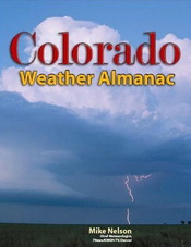
The Colorado Weather Almanac came out last year and I have added this to my short list of “must read” books for anyone interested in weather, particularly for those in Colorado. Everyone here in Colorado is well aware of the author, Mike Nelson, 7News’ chief meteorologist, and he does an extraordinary job covering the entire gamut of weather conditions we receive here.
The best part of the book is described in one of the words in the title – Colorado. This is all about our weather. It starts out with what is probably in my opinion the single most interesting section, Colorado climate. Mr. Nelson explains all the ins and outs of how our topography and our geography greatly impact the weather we have and why weather varies so greatly over short distances, even within the confines of the metro area and Front Range.
There is of course discussion about standard weather terms we all have heard such as dew point, pressure, fronts, El Nino, La Nina and on and on. The key though is that the book ties all of this into Colorado and how these things directly impact us. Other terms associated with our weather like upslope, downslope, Chinook and more are also covered; things that we hear on the news every day but may not fully understand.
In our weekly look back at Denver weather history, we see a wide range of weather has occurred in the past. From thunderstorms to rain to big time snowstorms, we can and have seen it all.
3-5 IN 1984…THE REMNANTS OF PACIFIC HURRICANE POLO PRODUCED
HEAVY RAIN OVER NORTHEASTERN COLORADO. MOST LOCATIONS
RECEIVED BETWEEN 1.00 TO 2.50 INCHES OF RAIN…BUT 3.45
INCHES FELL IN LITTLETON. RAINFALL TOTALED 1.73 INCHES
AT STAPLETON INTERNATIONAL AIRPORT…WHERE NORTH WINDS
GUSTED TO 24 MPH.
4-5 IN 1997…UNUSUALLY WARM WEATHER RESULTED IN TWO TEMPERATURE
RECORDS. HIGH TEMPERATURE OF 87 DEGREES ON THE 4TH EXCEEDED
THE OLD RECORD SET IN 1922 BY ONE DEGREE. HIGH TEMPERATURE
OF 86 DEGREES ON THE 5TH EQUALED THE RECORD SET IN 1990 AND
PREVIOUS YEARS.
Just announced! The Discovery Channel’s Storm Chasers second season will premiere on Sunday, October 19th. For those that haven’t seen this show before, it is absolutely incredible as you follow a group of chasers trying to – literally – drive into a tornado. As you know, the 2008 tornado season was one for the record books and the Storm Chasers team was right in the thick of it. I will be watching with great interest as they spent a lot of time in north central Kansas right where my family is from.
This time of year many folks head to the hills west of Denver in search of gold – fall foliage gold. This year thanks to the warm and dry weather, the season is running longer and a bit later than normal so this coming weekend looks to be a great one to get out and go for a drive in the mountains. Where to go? Below are five of ThorntonWeather.com’s favorite ones near Denver. After that, we will tell you where you can find a great website that provides regular updates on viewing conditions.
I-70 Corridor – If you’re looking for the easiest route, then this one is for you. Simply head west on I-70 about 110 miles to Avon. Between Vail and Avon, both sides of I-70 are lined beautifully with aspen.
Rocky Mountain National Park – One of the most popular summer destinations in the state is of course also a prime spot to view aspen in all their glory. Once in the park on Trail Ridge Road, head toward Bear Lake. Glacier Gorge Junction provides a beautiful spot and you of course also get to enjoy all the splendor that Rocky Mountain National Park has to offer.
Peak to Peak Highway – This little road trip can be a dual purpose trip – gambling and fall foliage viewing! Take U.S. 6 through Clear Creek Canyon and then 119 through Blackhawk and Central Center. You can of course stop there if your wallet is fat enough and donate some money to the casinos. From there continue on 119 toward Nederland. Take highway 72 toward Ward and Allenspark. There you will find more golden aspen than you can imagine, all with the Continental Divide nearby.
Poudre Valley Canyon – Heading north on I-25 take Colorado 14 west and into Poudre Canyon and Roosevelt National Forest. As you continue west you will come very near timberline as you come to Cameron Pass. Amazing views abound!
Guanella Pass – This is a nice, relatively short drive from Denver. From C470 take 85 through Bailey and Conifer, a nice drive unto itself. When you come to the town of Grant, take the Guanella Pass Scenic and Historic Byway north to Georgetown. The air is pretty thin along the way as you climb in excess of 11,500 views through the Pike and Arapahoe National Forests. Fair warning – about 10 miles of the road is gravel but it is well maintained.
So do you think you will try one of these drives? Or maybe one of the other dozens (hundreds?) that are possible? Before you go, be sure to check out the U.S. Forest Service’s Fall Colors website! It provides weekly updates on viewing conditions throughout the Rocky Mountain region and is a great resource to plan your trip. The site is usually updated once a week on Fridays. Click here to view the Rocky Mountain Region 2008 Fall Color Report.
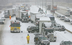
As part of a special “Best of” series on Examiner.com, I recently penned an article about what was one of the most significant storms in Denver history – the 1982 Christmas Eve blizzard. It is republished here as I thought everyone might like to check it out:
Looking back through history, Denver and Colorado have had some extraordinary weather stories. When looking to pick a “best” or most significant weather event, reaching far back into the history books one might choose the Georgetown blizzard of 1913 which dumped an astonishing 86 inches of snow or perhaps the Big Thompson Flood of 1976 which claimed 145 lives. More recently, there were the holiday storms of 2006 or the Windsor tornadoes from 2007. But, there is one storm that historically stands out not only because of its severity in terms of the weather but also because of the long lasting impact it caused in Denver and Colorado which is still being felt today – the Christmas Eve Blizzard of 1982. For those of you that didn’t live in Colorado then or are too young to remember, a trip through the history books shows why this storm was so significant. Those that do remember it have memories that will last a lifetime.
A new weekly feature for ThorntonWeather.com – This Week in Denver Weather History. The National Weather Service maintains a historical archives of weather history across the nation and makes it available to the public. ThorntonWeather.com will start publishing that information weekly.
So, let’s stroll down memory lane with This Week in Denver Weather History.
26-28 IN 1936…THE HEAVIEST SNOWFALL EVER RECORDED IN SEPTEMBER
AND THE HEAVIEST SNOWFALL EVER RECORDED SO EARLY IN THE
SEASON DUMPED A TOTAL OF 16.5 INCHES OF SNOW ON DOWNTOWN
DENVER AND 21.3 INCHES AT DENVER MUNICIPAL AIRPORT. THE
15.0 INCHES OF SNOW MEASURED FROM 6:00 PM ON THE 27TH TO
6:00 PM ON THE 28TH IS THE GREATEST 24 HOUR SNOWFALL EVER
RECORDED IN SEPTEMBER. THIS WAS THE FIRST SNOW OF THE
SEASON. THE SNOW WAS INTERMITTENT THROUGH THE 26TH…BUT
CONTINUOUS FROM EARLY AFTERNOON ON THE 27TH TO AROUND
MIDNIGHT ON THE 28TH…EXCEPT FOR A PERIOD OF RAIN DURING
THE AFTERNOON OF THE 28TH WHICH CONTRIBUTED TO A LOSS OF
DEPTH ON THE GROUND. THE GREATEST SNOW DEPTH ON THE GROUND
DOWNTOWN WAS 13 INCHES WITH 8 INCHES AT DENVER MUNICIPAL
AIRPORT. THERE WERE NO HIGH WINDS WITH THE STORM AND
TRAFFIC WAS INTERRUPTED FOR ONLY A SHORT PERIOD. THE
STORM PRODUCED PROPERTY DAMAGE ESTIMATED AT 7 MILLION
DOLLARS. WITH TREES AND SHRUBS IN FULL FOLIAGE…THE LEAVES
CAUGHT AND HELD THE HEAVY WATER-LADEN SNOW…UNTIL THE
BRANCHES SNAPPED FROM THE WEIGHT. MORE THAN 3000 WORKMEN
WERE CALLED TO REMOVE THE DEBRIS AND SNOW FROM THE CITY. THE
CITY FIREMEN WHO WERE OFF DUTY…AS WELL AS ALL THE RESERVES…
WERE ASKED TO REPORT TO THEIR STATIONS. ALL SCHOOLS IN THE
CITY REMAINED OPEN…BUT ATTENDANCE WAS ONLY 50 PERCENT OF
NORMAL. GRADE SCHOOL STUDENTS WERE SENT HOME AT NOON ON THE
28TH. THE EARLY STORM CAUGHT STOCKMEN WITH MANY CATTLE STILL
IN HIGHER RANGES. WARM WEATHER FOLLOWED THE SNOW…WHICH HAD
ALL MELTED BY THE END OF THE MONTH…EXCEPT FOR A FEW INCHES
IN SHELTERED PLACES.
With the first full month of fall here, October usually brings one of the quietest weather months in the Denver area with plenty of mild, sunny days and clear, cool nights. The month actually has our second highest amount of sunshine with 72 percent with September having the most with 74 percent. Interestingly enough, the month following, November, is one of the lowest sunshine months with only 64 percent. Typically October brings our first real taste of winter with the first freeze on average coming on the 7th of the month and the first snow on the 15th of the month.