All posts by Thornton Weather

ThorntonWeather.com is your local source for live Thornton, Colorado weather conditions and news!

New features and data added to ThorntonWeather.com

ThorntonWeather.comWe have been busy the last couple of days with some pretty neat enhancements to our website.  The most obvious one being the addition of a “fly-out” menu on the left.  The previous menu was getting quite lengthy as we added new features to the site.  The new menu allows us to group items into main menu categories that when moused over then open a list of related items.  This should make it easier to navigate plus allow you to better see items that you may be interested in. 

Weather is very data oriented and the more you have, the more you know.  To this end we have added a “Historical Statistics” page.  This page draws from data we have submitted to Weather Underground since our inception in October 2006.  Using it, you can view graphs and data for individual days, weeks, months and even full years.  Simply select a date, click View and you receive all the weather data for that day.  Click the week, month or year links and see data for those time periods as well.  There is also a dropdown that allows you to view data from our sister stations in Arvada (arvadawx.com) and Commerce City (reunionweather.com). 

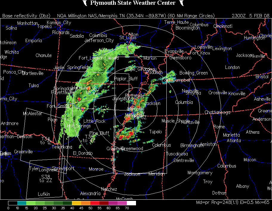
Lastly is an exciting new feature – ThorntonWeather.com’s own NEXRAD radar system.  Using specialized software, we can now generate our own radar images.  That in and of itself is interesting but what really makes this system exciting is the data we can present on it.  Not only radar images but also lightning data, thunderstorm information, and much more.  We are still studying how best to share all of this information with our visitors but it looks to be a pretty neat addition to the site.  At the current time you can view a single static image from the system or a radar loop that displays the last 2 hours of radar returns.  Be sure to look below the radar images too – you will see a table that when a severe thunderstorm appears, will show you critical information about the storm including the chance for hail and even the predicted path of the storm. 

Storms Over Louisiana 
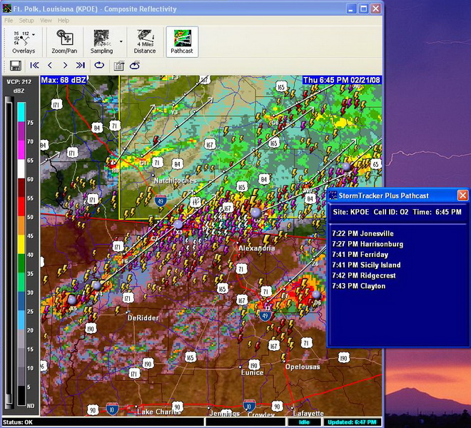
For a sample of what a severe storm looks like on our computers using this new software, click on the image to the right.  This is a screenshot of a storm as it moved across Louisana last week.  Notice how it plots the radar, lightning strikes, storm cells and a path forecast.

So what do you think?  If you have any comments, questions, suggestions or criticisms about our site please send us an email with anything you might have to say.

Eclipse Turns Out Nicely In Thornton!

Eclipse
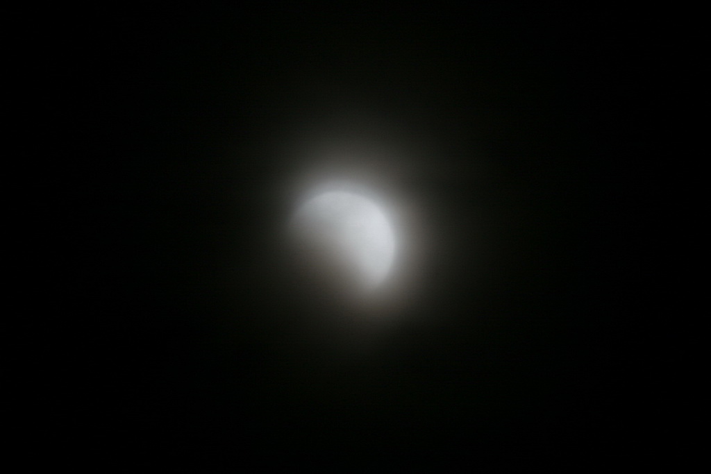
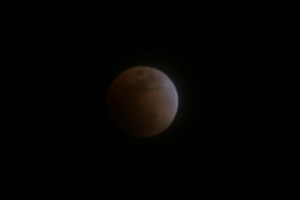
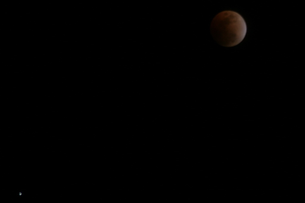
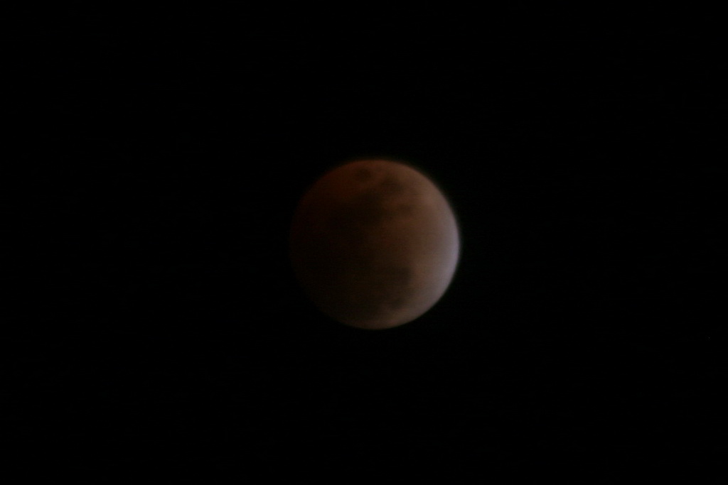
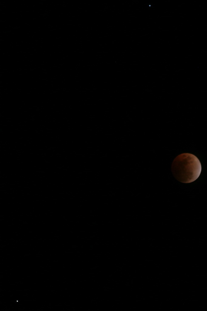
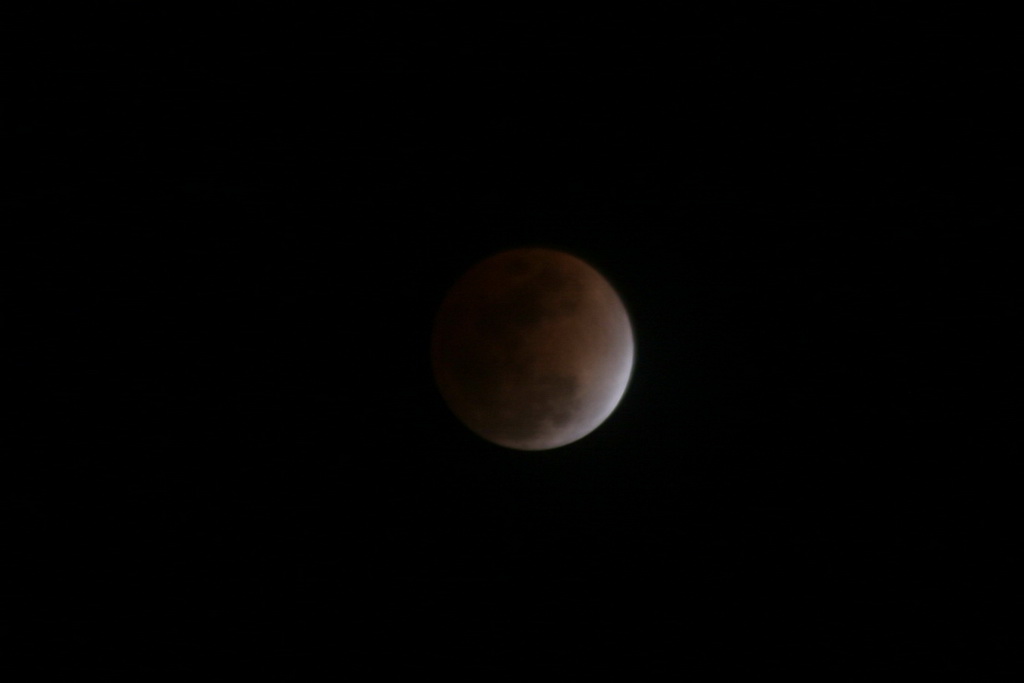
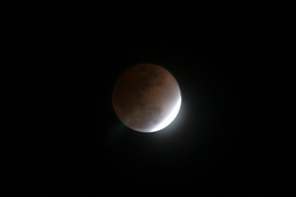
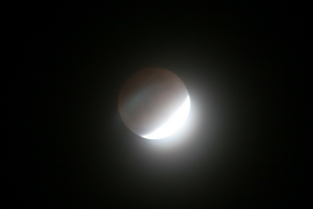
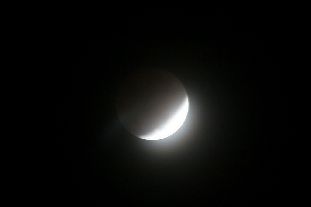
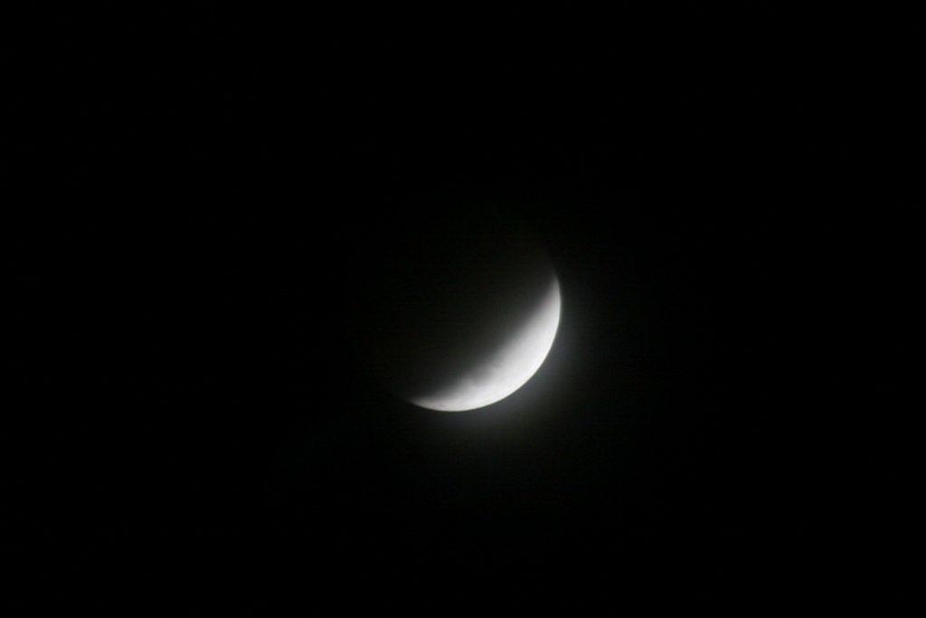
The lunar eclipse last night started out a bit rough with some light cloud cover obscuring the view.  However, a bit before the eclipse was at its maximum, the clouds cleared and we ended up with quite a nice view.  As an added treat, Regulus and Saturn were clearly visible and very bright above and below left of the moon.

Here are some pictures we took last night, in order from the start to finish. 

The start of the eclipse.  The start of the eclipse.  Eclipse  Eclipse

Eclipse  Eclipse  Eclipse  Eclipse 

Eclipse  Eclipse  Eclipse 

Total Lunar Eclipse Wednesday

Lunar eclipseThe Western Hemisphere will be given a bit of an astronomical treat Wednesday with a total lunar eclipse.  A lunar eclipse occurs whenever the moon passes through some portion of the Earth’s shadow – basically when the Earth is between the moon and the sun. 

Best up all for those of us in the Rocky Mountain area, the eclipse will occur at a good time for watching (see below).  For more information, please see the table below for viewing times and the links for more information.

Update, 2/20/08 @ 10:30am – Unfortunately it appears cloud cover in the Denver metro area may inhibit the ability to see the eclipse.  It is worth trying to get a glimpse though.

NASA Website About Tonight’s Eclipse

Wikipedia – Lunar Eclipse

AFP News Story – How an Eclipse Saved Columbus

Total Lunar Eclipse of February 20, 2008
North America Other
Event EST CST MST PST AST GMT
Partial Eclipse Begins: 08:43 pm 07:43 pm 06:43 pm 05:43 pm 04:43 pm 01:43 am*
Total Eclipse Begins: 10:01 pm 09:01 pm 08:01 pm 07:01 pm 06:01 pm 03:01 am*
Mid-Eclipse: 10:26 pm 09:26 pm 08:26 pm 07:26 pm 06:26 pm 03:26 am*
Total Eclipse Ends: 10:51 pm 09:51 pm 08:51 pm 07:51 pm 06:51 pm 03:51 am*
Partial Eclipse Ends: 12:09 am* 11:09 pm 10:09 pm 09:09 pm 08:09 pm 05:09 am*

* Event occurs on morning of February 21, 2008

Add ThorntonWeather.com to Your Website

We’ve completed work on some weather “stickers” that you can now add to your own website.  This is a great service for you and your website visitors and provides the current weather conditions in Thornton at a glance. The conditions displayed are real-time and updated every minute so you know you are seeing the latest!

You can choose from one of four designs – pick whichever best fits your site (a sample of one is below).  To get information on how to easily add these images to your site and see the other choices, please click here.

Square Sticker

Global Cooling the Concern Now?

Global Cooling
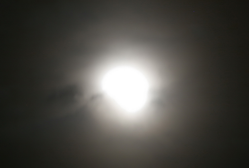
An interesting editorial recently in Investor’s Business Daily addresses concerns among many scientists no about global warming – but global cooling.  These scientists of course don’t receive the press that Al Gore and the “man made climate change” groups do but their voice is starting to be heard.  They don’t necessarily dispute that man can have an effect on the climate but they do dispute the amount of effect and they caution that there may be other, greater forces at work – solar activity for one.   From the article:

“Solar activity fluctuates in an 11-year cycle. But so far in this cycle, the sun has been disturbingly quiet. The lack of increased activity could signal the beginning of what is known as a Maunder Minimum, an event which occurs every couple of centuries and can last as long as a century.

Such an event occurred in the 17th century. The observation of sunspots showed extraordinarily low levels of magnetism on the sun, with little or no 11-year cycle.

This solar hibernation corresponded with a period of bitter cold that began around 1650 and lasted, with intermittent spikes of warming, until 1715. Frigid winters and cold summers during that period led to massive crop failures, famine and death in Northern Europe.

Tapping reports no change in the sun’s magnetic field so far this cycle and warns that if the sun remains quiet for another year or two, it may indicate a repeat of that period of drastic cooling of the Earth, bringing massive snowfall and severe weather to the Northern Hemisphere.”

In doing a critical analysis of some of what these people are saying one can’t help but wonder if they just might be correct.  You also begin to realize that the “consensus” that Al Gore and the International Panel on Climate Change (IPCC) insist exists just may not be as strong as they would like people to believe.  There is a growing body of dissenters in the scientific community that are raising the flags and saying we may be all wrong.

Critical thinking dictates that these views be taken into account and that these theories be investigated. 

The editorial:  The Sun Also Sets

Dry winter forecasts? Buried in the snow!

Dry winter?  Not here!An interesting article in the Denver Post today talks about how the forecasts for a dry winter have been way off the mark (thus far).  Even as recently as a month ago NOAA was saying that La Nina was going to wreak havoc and dry things out severely.  Yet today the mountains continue to have an amazing amount of snowpack with every basin well above normal. 

Meteorologist Klaus Wolter told the Denver Post that recent failures of their predictions may be traced to climate change.  Wolter said, “So we have two years in a row here where the atmosphere does not behave as we expect.  Maybe global changes are pulling the rug out from underneath us. We may not know the answer for 10 years, . . . but one pet answer is that you should get more variability with global change.”

 There it is!  You knew it was coming!  If all else fails, blame global warming!  🙂 

In all seriousness, assuming things continue as they have been, the concern now shifts not from drought but to possible flooding this spring.  Emergency planners are keeping a close eye and a fast run-off could not only lead to a loss of good, usable water but it could also cause a lot of problems. 

Despite the mountains of snow in the mountains, here on the plains we haven’t been quite as fortunate.  In the metro area, the historical seasonal average through the end of February is 39.6 inches of snow.  As of this morning (2/14), thus far this season ThorntonWeather.com has recorded 33.0 nches and the National Weather Service puts the official Denver measurement at 35.5 inches.  This puts us below average but there are still 15 days left in this month to catch up. 

 Please click here to view the entire Denver Post article:  Dry winter forecasts miss mark.

The snow is over; Overall storm not too bad.

Snow hits the areaUpdated 2/14/08, 4:45pm – In the end, a pretty typical late winter storm.  A decent bit of moisture in the snow that fell and it is already mostly melted.  🙂  ThorntonWeather.com recorded 2.6 inches of the white stuff which is below the low end of what was originally forecast.  It was a pretty stark contrast though between Wednesday when we reached a high of 69 and  today with a high of only 32 – a difference of 37 degrees in just a single day! 

Updated 2/14/08, 11:25am – The snowstorm is now slowly deteriorating from north to south across the metro area.  Snow will continue to diminish as the storm moves further away.  The Snow and Blowing Snow Advisory remains in effect until 2:00pm.

Updated 2/14/08, 5:20am – Nearly an inch of snow has fallen in Thornton thus far today as the storm hits the metro area.  The storm arrived a bit later than expected as it stalled over northern Colorado but it has intensified considerably just in the last hour and a half or so. 

A Snow and Blowing Snow Advisory remains in effect until 2:00pm today.  It is currently quite windy out there right now with gusts up to 25 mph.  This is blowing the snow considerably decreasing visibility and making small drifts.  Please allow extra time for your commute to work this morning as it is liable to be a rough one. 

Snow will continue this morning and may be heavy at times. Overall snowfall accumulations won’t be quite as bad as originally forecast.  Total accumulations of 3 to 6 inches can be expected before the snow diminishes early this afternoon; Thornton and the north area will be on the lighter side of that range. North winds of 15 to 25 mph with gusts as high as 35 mph east of I-25 will produce areas of blowing and drifting snow. 

For the latest closings, delays and cancellations, please visit 9News’ website

Snow on its way Wednesday evening. Warnings issued.

Snow in the forecast.Updated 2/13/08 @ 4:10pm.  A Snow and Blowing Snow Advisory has been issued and is in effect from midnight tonight until 5:00pm Thursday.  A blowing snow advisory means that winds and blowing and drifting snow will reduce visibilities sufficiently to make travel difficult.  Please continue to visit our site for the latest on the approaching storm.  If you haven’t, you may wish to sign up for our weather alert and report system to receive the latest information delivered directly to your inbox.

Updated 2/13/08 @ 7:00am.  It looks like the metro area will be in for snow this evening and into tomorrow.  We are expecting 3 to 6 inches in the Thornton area and the northern suburbs; higher accumulations will occur south with up to 9 inches across the southern metro area to the Palmer Divide.  Mountain areas could see up to a foot of snow. 

We’ll reach a high near 60 today but temperatures will drop rapidly as nighttime falls.  The storm is expecting to roll in from Wyoming and start hitting the Colorado border around 7:00pm, expanding to the Palmer Divide by 11:00pm.  Winds of 25 to 35mph are expected with the front so blowing snow will be a concern.  Evening rush hour today should at least be fine but tomorrow morning could be a bit dicey so please plan on leaving for work early and taking it slow.   Snow will continue Thursday morning and gradually diminish from north to south by Thursday afternoon. 

The National Weather Service has already issued Snow & Blowing Snow Advisories and Winter Storm Watches for some of the southern and central mountain areas.  These could be expanded as the storm develops. 

 Stay tuned to ThorntonWeather.com for the latest on this approaching system. 

Snowpack Continues to Grow

Snow in the forecast.

 The snowpack in the mountains continues to add up and we are having a great year as far as that goes.  The South Platte, which is crucial to many metro area water reserves including Thornton stands at 108% of normal. 

Colorado SNOTEL Snowpack Update Report
Based on Mountain Data from NRCS SNOTEL Sites
**Provisional data, subject to revision**
Data based on the first reading of the day (typically 00:00) for Tuesday, February 12, 2008
Basin
  Site Name
Elev
(ft)
Snow Water Equivalent Percent of
Current
(in)
Today’s
Average
(in)
Avg
Peak
(in)
Avg
Peak
Date
Today’s
Average
Avg
Peak
GUNNISON RIVER BASIN
Basin-wide percent of average 148  95 
UPPER COLORADO RIVER BASIN
Basin-wide percent of average 131  82 
SOUTH PLATTE RIVER BASIN
Basin-wide percent of average 108  66 
LARAMIE AND NORTH PLATTE RIVER BASINS
Basin-wide percent of average 110  70 
YAMPA AND WHITE RIVER BASINS
Basin-wide percent of average 115  76 
ARKANSAS RIVER BASIN
Basin-wide percent of average 169  108 
UPPER RIO GRANDE BASIN
Basin-wide percent of average 171  110 
SAN MIGUEL, DOLORES, ANIMAS AND SAN JUAN RIVER BASINS
Basin-wide percent of average 157  102 

Cleanup Continues After 57 Die In Tornadoes

Tornadoes hit the southThis past Tuesday saw over 40 tornadoes touch down across Tennessee, Arkansas, Missouri, Kentucky, Alabama and Mississippi.  The death toll from these storms currently stands at 57 making it one of the 15 worst tornado death tolls since 1950, and the nation’s deadliest swarm of tornadoes since 76 people were killed in Pennsylvania and Ohio on May 31, 1985. 

It is currently believed that because February tornadoes are not all that common, simple human nature may have been the root reason for so many fatalities.  Simply put, people weren’t expecting them or believing the warnings that were issued well in advance.  From USA Today: 

“Because February tornadoes are relatively rare, many residents didn’t respond quickly to warnings from weather forecasters because they didn’t believe the threat was serious until a storm was upon them. In fact, February tornadoes are “almost an annual event,” Brooks said. In 2007, there were three killer tornadoes in February — two in Florida and one in Louisiana — that killed a total of 22 people. During the most common months for tornadoes — March, April, May and June — fatalities typically are 15% lower and injuries are 22% lower because people expect such storms and prepare for them, said Dan Sutter, an economist at the University of Texas Pan American who has studied tornadoes for eight years.”

This truly is a tragedy and one has to wonder how many of these deaths could have been avoided had residents simply heeded the warnings that were issued.  For more information, please see:

USA Today – Cleanup continues after devastating tornadoes

The Tennessean – Nashville newspaper’s special section about the storms

Memphis Radar Image

Memphis radar image from February 5, 2008