All posts by Thornton Weather

ThorntonWeather.com is your local source for live Thornton, Colorado weather conditions and news!

November 20 to November 26: This Week in Denver Weather History

This Week In Denver Weather History
November 20 to November 26: This Week in Denver Weather History
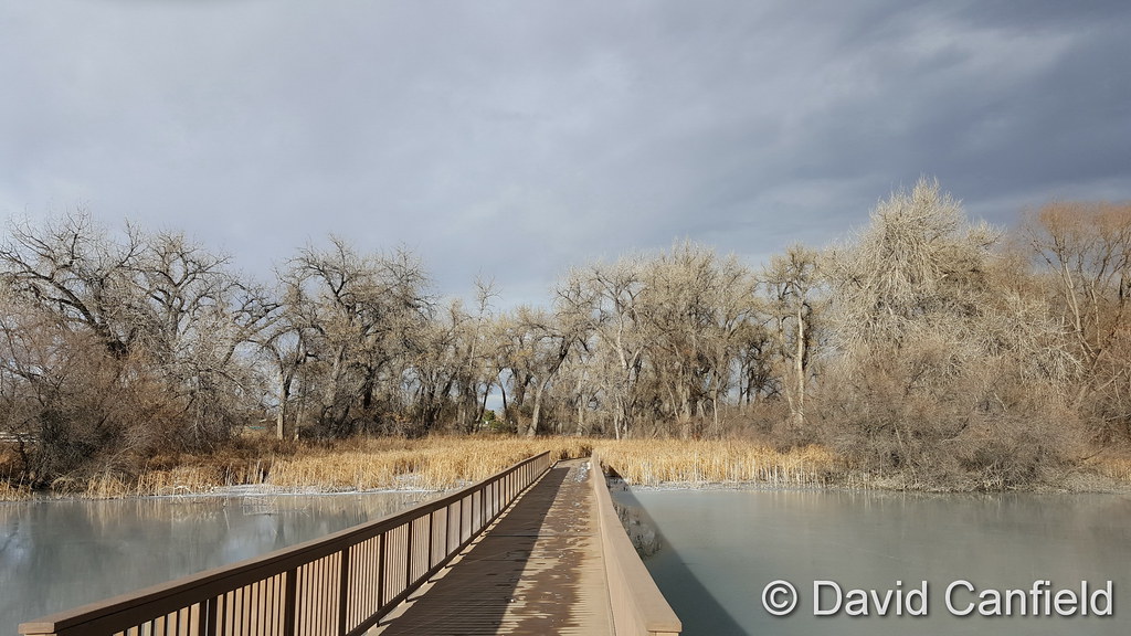
With the Thanksgiving holiday approaching, travelers cast a wary eye on Denver’s weather and in our look back at this week in Denver weather history we see they have had cause for concern in the past. Snowstorms and wind have caused their share of problems. Also notable, it was 140 years ago that Denver’s first official weather observation occurred.

  • Stay up to date with Thornton’s weather: ‘Like’ us on Facebook, follow us on Twitter and add us to your Google+ circles

From the National Weather Service:

18-20

In 1930…a major storm dumped a total of 13.6 inches of snowfall over downtown Denver. Most of the snow…9.4 inches…fell on the 19th when north winds were sustained to 23 mph. This was the only measurable snow of the month. Temperatures hovered in the 20’s and lower 30’s.

In 1956…an intense winter storm dumped 12.8 inches of snowfall on metro Denver. Strong north-northeast winds gusting to 33 mph at Stapleton Airport frequently reduced the visibility to 1/2 mile in snow and blowing snow on the 19th. Most of the snowfall…10.7 inches…occurred on the 19th.

19-21

In 1979…a heavy snowstorm buried most of Colorado under at least a foot of snow. Snowfall at Stapleton International Airport totaled 17.7 inches…the greatest snow depth since 1946. Winds to 60 mph produced 5-foot drifts paralyzing the city as temperatures hovered in the 20’s. While small airports closed…Stapleton remained open…but with long delays that snarled thanksgiving holiday traffic. Schools and businesses closed and postal deliveries were delayed. Almost all major highways leading out of Denver were closed to traffic for periods of time on the 20th and 21st. Most of the snow…13.5 inches…fell on the 20th. At Stapleton International Airport…north winds gusted to 35 mph on the 20th and to 38 mph on the 21st.

20

In 1871…the first official weather observation in Denver… Was taken by Henry Fenton…observer sergeant of the united states army signal service at 5:43 am. The office was located on the 2nd floor of a building at the corner of Larimer and g streets…now 16th street. The daily weather journal hand written entry for the day follows: “Snow fell heavily during past night. At 5:43 am it was snowing light and continued until 8 am. Wind during snow storm gentle and a little west of south…and continued there during the remainder of the day. Sky clear after 8 am. Very cold weather prevailed all day and night. Thermometer at 9:43 pm 14 degrees. Rain gauge and self-registering thermometer not in position owing to severe storm last week. Barometer falling during the morning and rising rapidly at night.”

In 1894…northwest Chinook winds sustained to 40 mph with gusts to 45 mph warmed the temperature to a high of 58 degrees in the city.

In 1909…steady and very strong winds in Boulder caused 3 thousand dollars in damage.

In 1915…post-frontal northeast winds sustained to 40 mph with gusts as high as 42 mph produced only a trace of snow. It was windy most of the day.

In 1923…west winds were sustained to 42 mph with gusts to 44 mph before daybreak. The strong winds persisted in the city for only about 3 hours.

In 1993…a wind gust to 72 mph was recorded at Table Mesa in southwest Boulder.

In 1994…winds gusted to 77 mph atop Squaw Mountain west of Denver. West winds gusted to 40 mph at Stapleton International Airport.

20-21

In 1898…snowfall totaled 4.0 inches in downtown Denver. Northeast winds were sustained to 48 mph with gusts as high as 60 mph behind an apparent cold front on the 20th… When temperatures plunged from a high of 66 degrees to a low of 9 degrees. On the 21st the high was only 24 degrees and the low was 2 degrees.

In 1970…a wind gust to 94 mph was recorded at gold hill in the foothills west of Boulder. Strong winds also swept across metro Denver. Wind gusts reached 59 mph in downtown Boulder…while at Stapleton International Airport west- northwest winds gusted to 43 mph on the 21st. Damage was minor.

In 1992…a large Canadian air mass moved into the state at the same time an upper level storm system approached from the west. The combination of cold air at the surface and very moist air aloft produced heavy snow across the entire state. Snowfall totaled 6.3 inches at Stapleton International Airport…where north winds gusted to 23 mph on the 20th. Snow was heavier in the foothills…with 14 inches at Wondervu…13 inches at Aspen Springs…Conifer… Boulder…and Gross Reservoir…8 inches at Rollinsville… And 10 inches at Golden Gate Canyon and Morrison.

In 2007…a storm system brought moderate to heavy snowfall to portions of the urban corridor. Storm totals included: 7 inches…3 miles south-southeast of Fort Collins…with 6 inches in Boulder and at Horsetooth Inlet Bay. Elsewhere… Storm totals ranged from 2 to 5 inches. Snowfall totaled 2.0 inches at the site of the former Stapleton International Airport.

21

In 1891…northwest winds were sustained to 50 mph with gusts to 60 mph.

In 1899…a trace of snow fell in the city. This…together with a trace of precipitation on the 16th and 23rd…was the only precipitation of the month…making the month the driest on record. The record was equaled in November of 1901 and 1949. This trace of snow along with a trace of snow on the 23rd was the only snow of the month…ranking the month the 2nd least snowiest on record. This record was equaled in November of 1884…1901…1905…1917…and 1939.

In 1900…west winds were sustained to 46 mph with gusts to 54 mph. The Chinook winds warmed the temperature to a high of 64 degrees.

In 1934…the latest date for the first measurable snow of the season occurred. This was not the first snow of the season… Because traces of snow had fallen earlier in September. Snowfall totaled only 1.0 inch over downtown Denver.

In 1962…strong west-northwest Chinook winds gusted to 53 mph at Stapleton Airport.

In 1998…an intense mountain wave allowed for high winds to develop in the foothills of Boulder County. Wind gusts as high as 77 mph were measured 3 miles east- northeast of Nederland.

21-22

In 1905…a trace of snow fell on both days in downtown Denver. This was the only snow of the month…ranking the month along with other Novembers…the 2nd least snowiest on record.

In 1999…the first significant snowfall of the season struck metro Denver. Snowfall totals included: 16 inches near Bailey; 13 inches near Evergreen; 12 inches at north turkey creek…Genesee…near Morrison…and near Sedalia; 11 inches near Conifer and in Evergreen; 10 inches in Louisville; 9 inches in Brighton…Broomfield…and Denver; and 8 inches at Arvada…Castle Rock…and Eldorado Springs. Snowfall totaled 8.4 inches at the site of the former Stapleton International Airport.

In 2003…heavy snow fell in and near the foothills of Boulder County. Snowfall totaled 10.5 inches in Eldorado Springs. Across the city…snowfall was lighter with 2.8 inches measured at the site of the former Stapleton International Airport on the 22nd. North winds gusted to 32 mph at Denver International Airport on the 22nd.

21-23

In 1918…post-frontal snowfall totaled 5.9 inches in downtown Denver. Most of the snow…5.3 inches…fell on the 22nd. North winds were sustained to 20 mph on the 21st.

In 1931…a major storm dumped a total of 13.2 inches of snowfall over downtown Denver. Most of the snow…11.4 inches…fell on the 21st. A very cold air mass settled over the city after the heavy snow on the 21st. After a low temperature of zero…the temperature climbed to a high of only 5 degrees on the 22nd…a record low maximum for the date.

21-25

In 1952…snowfall of 6.2 inches was measured at Stapleton Airport where northeast winds gusted to 17 mph on the 21st.

Continue reading November 20 to November 26: This Week in Denver Weather History
Denver ties all-time record high temperature for month of November

Record High TemperaturesWe thought the daily high temperature record for November 16 would fall today and indeed it did.  However the Mile High City also managed to tie the record for the warmest temperature ever recorded during the month of November.

At 1:24pm the station at Denver International Airport reported a mercury reading of 80 degrees.

This easily bested the previous record high temperature for November 16 of 77 degrees set in 1941.

Perhaps more notably, the reading also ties the all-time record high temperature for the month of November.  The old mark was 80 degrees set on November 8, 2006.  This is in turn the latest in the year an 80 degree reading has been tallied.

Here in Thornton, we were a bit warmer than DIA.  Our temperature topped out at 81.5 degrees at 1:02pm.

Showcasing the wide swings of weather we experience here in Colorado is the fact that after these records today, high temperatures tomorrow won’t go very far into the 40s.  Check out forecast for the latest.

  • Stay up to date with Thornton’s weather: ‘Like’ us on Facebook, follow us on Twitter and add us to your Google+ circles

2016 ‘Likely’ Hottest Year Ever: WMO

2016 will “very likely” be the hottest year on record, according to the United Nations World Meteorological Organization. According to a news release from the WMO, 2016 will likely eclipse the previous hottest year, 2015. “Another year. Another record. The high temperatures we saw in 2015 are set to be beaten in 2016,” said WMO Secretary-General… Continue reading 2016 ‘Likely’ Hottest Year Ever: WMO

Strong Aftershocks Hit New Zealand Following Strong Quake

A powerful aftershock shook New Zealand’s South Island Monday, just hours after being hit by a powerful 7.8-magnitude earthquake. “It looks as though it’s the infrastructure that’s the biggest problem,” said Civil Defense Minister Gerry Brownlee after flying over the affected area with Prime Minister John Key. A slip dam caused by earthquakes had blocked the… Continue reading Strong Aftershocks Hit New Zealand Following Strong Quake

November 13 to November 19: This week in Denver weather history

This Week In Denver Weather History
November 13 to November 19: This week in Denver weather history

Wind and snow are two hallmarks of Denver’s November weather and we see an abundance of those events in our look back at this week in Denver weather history. Damaging wind makes numerous appearances as does wintry weather.

From the National Weather Service:

10-13

In 2014…an Arctic cold front associated with a strong storm system over the northern Rockies blasted into northeastern Colorado.  The temperature in Denver plummeted from the high of 64 degrees at 4:37 pm to 34 degrees by 5:53 pm.  The temperatures continued to fall and dropped into the teens by early evening.  The Arctic airmass remained entrenched over the region…with the high temperatures failing to reach the teens from the 11th through the 13th.  This was the first time since records have been taken in Denver…dating back to 1872…that there were three consecutive days with the maximum temperatures remained below 20 degrees in the month of November.  In addition to the frigid temperatures…0.1 inch of snowfall was observed on 11th at Denver International Airport…which marked the first measureable snowfall for the season. An additional 2.2 inches of snowfall was measured on the 12th.  Several temperature records were broken.  A record low max of 16 degrees on the 11th broke the previous record of 19 set back in 1916.  A record low max of 6 degrees on the 12th broke the previous record of 9 degrees…also set in 1916.  The record low of -13 on the 12th…shattered the previous record of -4 degrees set back in 1872.  Even more impressive…the record low of -14 degrees on the 13th broke the previous record of -3 degrees set back in 1916.

11-14

In 1970…heavy snowfall totaled 7.2 inches at Stapleton International Airport where northeast winds gusted to 22 mph on the 12th and 14th. Most of the snow… 4.2 inches…fell on the 12th.

12-13

In 1961…heavy snowfall totaled 5.6 inches at Stapleton Airport. East-northeast winds gusted to only 20 mph.

In 2011…hurricane force winds…up to 115 mph… downed trees in and power lines across the Front Range Mountains and Foothills. Scattered outages were reported in Gilpin County.  In Boulder…a woman received minor injuries when she was struck in the head by a falling tree limb. Three women near Georgetown received minor injuries when they were pelted by glass shards after a barrage of wind driven rocks and dirt shattered their windshield. Peak wind gusts included: 109 mph…6 miles north-northwest of Berthoud Pass; 101 mph atop Kenosha Pass…100 mph… 2 miles south-southwest of Loveland Pass; 99 mph…7 miles west-northwest of Berthoud; 92 mph at Blackhawk; 90 mph…3 miles south-southwest of Boulder; 87 mph…2 miles west-northwest of Aspen Springs and at Pickle Gulch; 84 mph at Loveland Pass and Lyons; 82 mph at the National Wind Technology Center; 80 mph at Dumont and 78 mph near Rollinsville and Ward. At Denver International Airport…west winds gusted to 52 mph on the 12th.

12-15

In 1909…light snowfall totaled 6.7 inches in downtown Denver over the 4 days. This was the first measurable snowfall of the season. Northeast winds were sustained to 15 mph on the 12th.

13

In 1951…northwest wind gusts to 50 mph were recorded at Stapleton Airport.

In 1983…winds gusted to around 60 mph in and near the foothills. There were scattered power outages and a few broken windows across metro Denver. The strong winds did 10 thousand dollars in damage to awnings at the Brown Palace Hotel in downtown Denver. West winds gusted to 46 mph at Stapleton International Airport.

13-14

In 1925…heavy post-frontal snowfall totaled 6.4 inches overnight in downtown Denver. Northwest winds were sustained to 27 mph with gusts to 29 mph on the 13th.

In 1974…northwest winds gusted to 52 mph at Stapleton International Airport…warming the temperature to 60 degrees shortly after midnight on the 13th. A cold front cooled temperatures into the 20’s by late morning and produced snowfall of 3.7 inches. The low temperature dipped to 14 degrees on the 14th.

In 1993…an upper level low pressure system combined with a weak but moist upslope flow to produce heavy snow across metro Denver. Snowfall amounts averaged 6 to 8 inches with up to 16 inches in the foothills at the Eldora Ski Area. Snowfall totaled 6.0 inches at Stapleton International Airport where north winds gusted to only 20 mph on the 14th. Most of the snow fell on the 14th.

In 1994…heavy snow developed rapidly along the Front Range urban corridor with the heaviest snow over northwest metro Denver. Sixteen to 18 inches of snow fell in Boulder… Lafayette…and Louisville. This was the second heavy snowfall over northwest metro Denver in 10 days. Eleven to 14 inches of snow were measured from Longmont southward into Aurora. Snowfall totaled 12.1 inches at Stapleton International Airport where northeast winds gusted to 29 mph on the 13th. Most of the snow…9.0 inches…fell on the 14th.

In 1997…heavy snow fell overnight in portions of Jefferson and Boulder counties. About 5.5 inches of snow were reported in Boulder…while 4 inches were measured 12 miles southwest of Morrison and 6 miles southwest of Golden. Snowfall totaled only 1.8 inches at the site of the former Stapleton International Airport. Northeast winds gusted to 26 mph at Denver International Airport.

14

In 1874…west winds blew at gale speeds from midnight until mid afternoon when the winds abated. The maximum sustained velocity was 48 mph.

In 1928…strong winds caused 3 hundred to 5 hundred dollars damage in Boulder. Wind gusts to 70 mph were recorded at Valmont just east of Boulder.

In 2006…an upper level jet stream combined with a high surface pressure gradient behind a cold front to produce strong winds across metro Denver. A wind gust to 66 mph was recorded in Longmont. North winds were sustained to 38 mph with gusts to 52 mph at Denver International Airport where winds were strong and gusty most of the day.

14-15

In 1917…overnight rainfall was 0.03 inch. This was the only measurable precipitation of the month…making it the 5th driest November on record.

In 1985…3 to 6 inches of snow fell across metro Denver. Snowfall totaled 3.8 inches at Stapleton International Airport where northeast winds gusted to only 13 mph.

In 2005…a winter storm that brought heavy snow to the mountains also spread heavy snow into the foothills to the west of Denver. Snowfall totals included: 14 inches at Aspen Springs…13 inches near Pinecliffe…and 12 inches near Nederland. Interstate 70 along with U.S. Highway 40 had to be closed near Idaho Springs due to snow…poor visibility in blowing snow…numerous accidents…and an increased avalanche danger. High winds were recorded in the foothills on the 14th. Winds gusted to 89 mph at Georgetown and to 91 mph on Sugarloaf Mountain west of Boulder. Strong microburst winds associated with a dissipating rain shower gusted to 61 mph at Denver International Airport on the 14th.

14-18

In 1964…the first measurable snowfall of the season totaled 6.0 inches at Stapleton International Airport where northeast winds gusted to 32 mph on the 14th. Most of the snow…4.2 inches…fell on the 14th. This was the only measurable snow of the month.

Continue reading November 13 to November 19: This week in Denver weather history

Weather and Election Day: Will Mother Nature play a role in the outcome?

Weather – The true determining factor of who will be president?

We oftentimes hear about how weather can affect voter turnout but is there truly a link?  If there is, who does it benefit – Republicans or Democrats?  Studies seem to indicate that what might be thought of as an urban myth is indeed true and could in fact play a role in 2016.

In 2005, political science researchers Brad Gomez, Thomas Hansford and George Krause completed the first comprehensive study on the correlation between weather and voter turnout.  Their paper, “The Republicans Should Pray for Rain:  Weather, Turnout, and Voting in U.S. Presidential Elections” confirmed the conventional wisdom that weather does affect voter turnout, bad weather benefits Republicans and most interestingly, two presidential elections in the last 60 years may have had different results had the weather been different.

Looking back at presidential elections from 1948 to 2008, the study takes into account the weather in 3,000 U.S. counties.  They in turn looked at key areas of the nation and how weather, good and bad, affected voter turnout.  In the end, the study determined that precipitation is the key weather condition to affect voter turnout.

Continue reading Weather and Election Day: Will Mother Nature play a role in the outcome?

November 6 to November 12: This Week in Denver Weather History

This Week In Denver Weather History
November 6 to November 12: This Week in Denver Weather History

Our look back at this week in Denver weather history is dominated with two types of events: snow and wind. November is our second snowiest month and we see many significant snowfall events in the past. Wind is a fact of life on the plains and in Denver and damaging events have occurred with relatively frequency as we can see below.

From the National Weather Service:

5-6

In 1938…heavy snowfall totaled 7.5 inches over downtown Denver. North winds were sustained to 16 mph with gusts to 19 mph on the 5th.

5-7

In 1918…rain was mixed with and changed to snow…which became heavy and totaled 8.1 inches in downtown Denver. North winds were sustained to 21 mph with gusts to 23 mph.

6

In 1962…west winds gusted to 55 mph…briefly reducing the visibility to 1 1/2 miles in blowing dust at Stapleton Airport. The strong winds blew all day.

In 1989…high winds to 62 mph were recorded in Boulder. Northwest winds gusted to 33 mph at Stapleton International Airport.

In 1991…strong westerly Chinook winds blew into metro Denver with gusts to 88 mph recorded at Rollinsville and to 51 mph in Boulder. Later…northeast winds with gusts of 30 to 40 mph were common across all of metro Denver behind a cold front…which produced only 0.2 inch of snowfall at Stapleton International Airport.

7

In 1958…a strong cold front produced northeast wind gusts to 52 mph at Stapleton Airport where some blowing dust was observed.

In 1980…Chinook winds at sustained speeds of 40 mph were recorded with a peak gust to 71 mph measured at Wondervu southwest of Boulder. West winds gusted to 25 mph at Stapleton International Airport.

In 1989…strong winds buffeted many foothills areas. Wind gusts of 60 to 70 mph were recorded in Boulder and Longmont. Northwest winds gusted to 43 mph at Stapleton International Airport.

In 1996…wind gusts to 75 mph were recorded at Golden Gate Canyon and at the Rocky Flats Environmental Test Facility northwest of Denver. Northwest winds gusted to 40 mph at Denver International Airport.

In 1998…upslope conditions…coupled with a moist and unstable air mass…allowed heavy snow to develop in the foothills west of Denver. Snowfall generally ranged from 4 to 6 inches…but 7 inches were measured 4 miles south of Evergreen. Only 1.2 inches of snow fell at the site of the former Stapleton International Airport. This was the first measurable snow of the season.

7-8

In 1969…wind gusts to 48 mph in downtown Boulder caused minor damage.

8

In 1896…southwest Chinook winds sustained to 42 mph with gusts as high as 46 mph warmed the temperature to a high of 53 degrees.

In 1977 near-blizzard conditions in blowing snow caused the closure of I-70 to the west of Denver in clear creek canyon and east of Denver to Limon. Northeast wind gusts to 46 mph were recorded at Stapleton International Airport where snowfall totaled only 1.1 inches.

In 1984…a rare November thunderstorm produced west winds gusting to 31 mph…but only 0.04 inch of rain at Stapleton International Airport.

In 1996…high winds gusting from 80 to 100 mph were recorded at Wondervu in the foothills southwest of Boulder. West northwest winds gusted to 32 mph at Denver International Airport.

In 2006…the temperature in Denver climbed to a high of 80 degrees. This was the first time the temperature had ever exceeded the 70’s in November since records began in 1872. This new all-time record maximum temperature for the month of November was also a new daily record and the highest temperature ever recorded so late in the season.

8-9

In 1897…west winds were sustained to 45 mph with gusts as high as 50 mph in the city.

In 1919…post-frontal heavy snowfall totaled 8.4 inches over downtown Denver. Most of the snow…6.6 inches…fell on the 9th. North winds were sustained to 26 mph with gusts to 30 mph on the 8th.

In 1950…a major winter storm dumped 10.4 inches of snow at Stapleton Airport with the most snow…7.8 inches…falling on the 8th. East winds gusted to 31 mph at Stapleton Airport on the 8th. Snowfall totaled 8.2 inches in downtown Denver.

In 1958…strong winds caused some damage in Boulder. West- northwest winds gusted to 40 mph at Stapleton Airport on the 8th.

In 1975…heavy snowfall hit metro Denver. Snowfall at Stapleton International Airport totaled 8.0 inches and east winds gusted to 21 mph. Power outages caused by the storm affected over 10 thousand people in metro Denver.

In the foothills west of Denver…10 to 15 inches of snow fell. The storm produced the greatest 24-hour precipitation…1.29 inches…ever recorded during the month of November in the city.

In 1983…metro Denver received 4 to 8 inches of snow with the heaviest amounts near the foothills. It was the first measurable snow of the season in Denver. Only 1.8 inches of snow fell at Stapleton International Airport where north winds gusted to 20 mph.

In 1989…strong winds hit the Front Range. On the 9th…the wooden frame of a house under construction in Boulder was blown down. The previous evening a power outage blackened Nederland. Wind gusts to 95 mph were recorded 4 miles south of Rollinsville with 97 mph on Fritz Peak near that town. At Stapleton International Airport…northwest winds gusted to 45 mph on the 8th and to 38 mph on the 9th.

In 1998…another upslope snow event developed in the Front Range foothills. The heaviest snowfall occurred in west central Jefferson County where 14 inches were measured 8 miles west of Conifer. Other snowfall totals included: 10 inches at Evergreen and 9 miles northwest of Bergen Park; 9 inches at Genesee…Nederland…and near the Chief Hosa exit on I-70; and 8 inches in Coal Creek Canyon. On the 9th…snowfall was 2.6 inches at the site of the former Stapleton International Airport. North-northeast winds gusted to 30 mph at Denver International Airport on the 9th.

8-10

In 1985…Indian summer came to an abrupt end when a winter storm dumped 10 to 18 inches of snow in the Front Range foothills and 6 to 10 inches across metro Denver…snarling traffic and causing flight delays of up to 3 hours at Stapleton International Airport. The temperature plunged from a high of 66 degrees on the 8th to a low of only 13 degrees on the 9th…after the passage of a vigorous cold front with northeast winds gusting to 32 mph. The temperature climbed to only 19 degrees on the 10th…setting a record low maximum for the date. Snowfall totaled 7.3 inches at Stapleton International Airport with most of the snow…7.1 inches…falling on the 9th.

Continue reading November 6 to November 12: This Week in Denver Weather History

Thornton’s November 2016 preview: Will we break out of the warm, dry pattern?

Thornton's November weather previewThe weather during the month of November in Denver metro area can offer just about anything.  While it is normally a quiet month, it can be prone to extremes.

November is Denver’s second snowiest month and major snowstorms are not entirely uncommon.  However conditions can also be quite dry.

Temperatures during the month continue to cool as we get closer to winter and by the end of the month the low temperatures routinely dip to 20 degrees or below.  At times it can in fact bring conditions more like what we see in January.

Certainly given how warm and dry we were in October, we could use some relief.  Will that happen?

Get all the details on November’s weather and what we can expect in our complete preview here.

October 2016 weather recap: An exceedingly warm and dry month

High pressure was the dominant weather feature for the month of October and that led to a pattern that blocked off moisture and kept temperatures well above normal.  Record-setting highs were made while precipitation was a rare event.

The historical average monthly temperature for the month of October in Denver is 50.9 degrees.  That number was easily eclipsed.  Here in Thornton we saw an average temperature of 55.8 degrees.  Out at DIA where Denver’s official numbers are kept, it was much warmer with an average of 57.8 degrees.

Both averages for October 2016 were far above normal.  Officially the month was so warm it became the fourth warmest October on record in Denver.  The number one spot was quite secure though with an average of 59.9 degrees back in 1950.

Temperatures in Thornton ranged from a high of 84.8 degrees on the 16th down to a low of 27.1 degrees on the morning of the 20th.  Out at the airport, the warmest reading was 86 degrees and the lowest 25 degrees, both on the same days that Thornton saw its warmest and coldest readings.

Denver recorded four record daily high temperatures during the month.  The first record high came on the 15th of the month to be followed by records on the 27th and 28th then a tie for the record high on the 31st.

In terms of precipitation, the same high pressure that kept things warm, kept things dry as well.  Thornton recorded a mere 0.43 inches in its rain bucket, all during the first half of the month. The airport was a bit drier with 0.26 inches recorded.

On average Denver receives 1.02 inches of precipitation in October so both locations were far below normal.  While it was certainly dry, it was not so much so that it was a record-setter as the month failed to make it into the top 20 driest Octobers.

No snow was recorded during the month so we are still awaiting that first event of the season.  This however is not entirely unusual as historically, 27% of Denver’s October fail to see any of the white stuff.

Click here to view Thornton’s October 2016 climate report.

Thornton, Colorado's October 2016 temperature summary. (ThorntonWeather.com)
Thornton, Colorado’s October 2016 temperature summary. (ThorntonWeather.com)
Thornton, Colorado's October 2016 precipitation summary. (ThorntonWeather.com)
Thornton, Colorado’s October 2016 precipitation summary. (ThorntonWeather.com)

From the National Weather Service:

CLIMATE REPORT
NATIONAL WEATHER SERVICE DENVER/BOULDER CO
244 AM MDT TUE NOV 1 2016

................................... 

...THE DENVER CO CLIMATE SUMMARY FOR THE MONTH OF OCTOBER 2016... 

CLIMATE NORMAL PERIOD 1981 TO 2010
CLIMATE RECORD PERIOD 1872 TO 2016

WEATHER         OBSERVED          NORMAL  DEPART  LAST YEAR`S
                 VALUE   DATE(S)  VALUE   FROM    VALUE  DATE(S)
                                          NORMAL
................................................................ 
TEMPERATURE (F)
RECORD
 HIGH              89   10/16/1991
                        10/10/1910
 LOW               -2   10/29/1917
HIGHEST            86   10/16        83       3       87  10/11
LOWEST             25   10/20        22       3       28  10/28
AVG. MAXIMUM     74.5              65.3     9.2     70.1
AVG. MINIMUM     41.2              36.6     4.6     42.8
MEAN             57.8              50.9     6.9     56.5
DAYS MAX >= 90      0               0.0     0.0        0
DAYS MAX <= 32      0               0.4    -0.4        0
DAYS MIN <= 32      3               8.5    -5.5        1
DAYS MIN <= 0       0               0.0     0.0        0

PRECIPITATION (INCHES)
RECORD
 MAXIMUM         4.17   1969
 MINIMUM            T   1934
TOTALS           0.26              1.02   -0.76     1.76
DAILY AVG.       0.01              0.03   -0.02     0.06
DAYS >= .01         3               5.3    -2.3        6
DAYS >= .10         1               2.4    -1.4        3
DAYS >= .50         0               0.5    -0.5        2
DAYS >= 1.00        0               0.1    -0.1        0
GREATEST
 24 HR. TOTAL    0.22   10/05 TO 10/06           10/20 TO 10/21

SNOWFALL (INCHES)
RECORDS
 TOTAL             MM   MM
TOTALS            0.0               4.0

DEGREE_DAYS
HEATING TOTAL     231               440    -209      274
 SINCE 7/1        310               581    -271      301
COOLING TOTAL      17                 5      12       16
 SINCE 1/1        878               769     109      877

FREEZE DATES
RECORD
 EARLIEST     09/08/1962
 LATEST       06/08/2007
EARLIEST                        10/07
LATEST                          05/05
.................................................. 

WIND (MPH)
AVERAGE WIND SPEED              10.0
RESULTANT WIND SPEED/DIRECTION   4/197
HIGHEST WIND SPEED/DIRECTION    33/260    DATE  10/04
HIGHEST GUST SPEED/DIRECTION    42/270    DATE  10/03

SKY COVER
POSSIBLE SUNSHINE (PERCENT)   MM
AVERAGE SKY COVER           0.50
NUMBER OF DAYS FAIR           10
NUMBER OF DAYS PC             17
NUMBER OF DAYS CLOUDY          4

AVERAGE RH (PERCENT)     40

WEATHER CONDITIONS. NUMBER OF DAYS WITH
THUNDERSTORM              0     MIXED PRECIP               0
HEAVY RAIN                0     RAIN                       1
LIGHT RAIN                3     FREEZING RAIN              0
LT FREEZING RAIN          0     HAIL                       0
HEAVY SNOW                0     SNOW                       0
LIGHT SNOW                0     SLEET                      0
FOG                       4     FOG W/VIS <= 1/4 MILE      3
HAZE                      0

-  INDICATES NEGATIVE NUMBERS.
R  INDICATES RECORD WAS SET OR TIED.
MM INDICATES DATA IS MISSING.
T  INDICATES TRACE AMOUNT.

Time to ‘fall back’ as Daylight Saving Time comes to an end

The United States returns to Standard Time at 2:00am Sunday as Daylight Saving Time comes to an end.

The biannual ritual of changing our clocks to adjust for Daylight Saving Time occurs tonight providing yet another signal of the changing of seasons.  The United States will ‘fall back’ one hour at 2:00am Sunday morning as we return to Standard Time.

The ritual of changing our clocks twice a year can be met with some resistance as some people struggle to adjust their body’s internal clock.  Others actually like the return to standard time as they get to enjoy an extra hour of sleep.

The time change definitely has big effects on the dawning of daylight and how early it gets dark in the evening.

Sunrise on Saturday occurs at 7:34am but on Sunday it will be at 6:35am. Similarly, sunset will occur at 5:53pm on Saturday but on Sunday the sun will disappear over the horizon at 4:52pm.

For many this means that when they get home from work it will now be dark and outdoor activities will be significantly curtailed as a result.

Arizona and Hawaii are the only states that do not observe Daylight Saving Time and remain on Standard Time year round.    The U.S. territories of Puerto Rico, American Samoa, Guam, Northern Mariana Islands, and the United States Virgin Islands also do not observe the event.

It won’t be all that long though before Daylight Saving Time returns.  On March 12, 2017 we will ‘spring forward.’

Daylight Saving Time Schedule

The mandated beginning and end of Daylight Saving Time has changed in the United States over the years.

The most recent schedule was set by the Energy Policy Act of 2005 and took effect in 2007.  We now ‘spring forward’ to begin Daylight Saving Time on the second Sunday in March and ‘fall back’ with the return to Standard Time on the first Sunday in November.

Year DST Begins 2 a.m.
(Second Sunday in March)
DST Ends 2 a.m.
(First Sunday in November)
2016 13 March 2016 6 November 2016
2017 12 March 2017 5 November 2017
2018 11 March 2018 4 November 2018
2019 10 March 2019 3 November 2019
2020 8 March 2020 1 November 2020
2021 14 March 2021 7 November 2021
2022 13 March 2022 6 November 2022