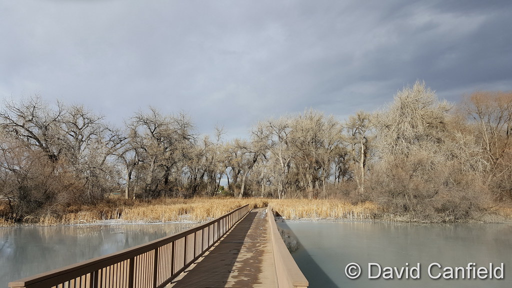
We happened across this video recently and had to share it. Photographer Jason Hatfield is a transplant to Colorado and has spent recent years filming our fall foliage. The end result? An amazing compilation of the high country in autumn.
From Jason’s description:
For the 8 years I’ve lived in Colorado, I’ve been most enthralled by the short but incredible fall foliage season in the high country. I’ve experienced the magnificent autumn colors of the East Coast and Midwest, but nothing for me has compared to the scenes of massive mountains rising from stunning forests of gold-covered aspens. For the past 5 years of filming, I’ve had this moment in my head, a finished time-lapse piece that turns Colorado’s extraordinary fall landscapes into living art. Some years I only came away with a couple good sequences, others a lot more, and finally after this season I felt I had the work I needed to produce my vision. Please enjoy this short film that embodies everything I love about my state.
Snow and wind are two common conditions we see this time of year and our look back at this week in Denver weather history certainly has those type of events. Also notable is a surprising October hail storm 13 years ago that went into the books as one of the costliest in history.
From the National Weather Service:
13-16
In 1873…smoke from several large forest fires in the mountains made the air very hazy in the city.
15-16
In 1928…a thunderstorm produced hail shortly after midnight on the 15th. Rain changed to snow by evening. Through the afternoon of the 16th…the heavy snowfall totaled 7.3 inches in the city. North winds were sustained to 23 mph on the 15th.
In 1984…the heaviest October snowstorm in several years hit eastern Colorado with a vengeance. The storm was known as the “Bronco Blizzard” since it occurred during a nationally televised Monday Night Football game in Denver. One to two feet of snow fell near the foothills in west metro Denver with 2 to 3 feet in the foothills. Wind gusts up to 55 mph whipped the snow into drifts as high as 4 feet. The storm closed schools…roads…and airports. I-70 was closed both east and west of Denver. I-25 was closed south to Colorado Springs. Flights were delayed for several hours at Stapleton International Airport. Power outages were widespread. Snowfall totaled 9.2 inches at Stapleton International Airport where north winds gusting as high as 40 mph caused frequent surface visibilities of 1/4 to 1/2 mile in moderate to heavy snow and blowing snow overnight. The high temperature of only 35 degrees on the 15th was a record low maximum for the date.
15-17
In 1989…an autumn snowstorm hit metro Denver with 2 to 6 inches of snow. Snowfall totaled 4.4 inches at Stapleton International Airport where the maximum snow depth on the ground was only 3 inches due to melting and north winds gusted to 25 mph on the 15th. The heavy wet snow caused leafy branches to sag onto power lines…resulting in a number of power outages. Five thousand homes were blacked out in Boulder on the 16th. Up to a foot of snow fell in the higher foothills with 19 inches recorded at Echo Lake.
16
In 1878…high winds reached sustained speeds of 60 mph.
In 1998…one of the costliest hail storms to ever hit metro Denver caused an estimated total of 87.8 million dollars in damage to homes…commercial buildings…and motor vehicles. At the time the storm was ranked as the 7th costliest ever. The hailstorm…rare for so late in the season…began over portions of Arvada…Wheat Ridge…and northwest Denver where mostly pea sized hail accumulated up to a depth of 6 inches near I-70. Several accidents were attributed… At least in part…to the hailstorm. Snowplows had to be called out to clear several city streets. The storm intensified as it moved to the east…into the Denver and Aurora areas. Large hail…up to 2.00 inches in diameter pounded east and southeast metro Denver. Two inch diameter hail fell in the city of Denver and at Buckley Field. Hail as large as 1 1/2 inches was measured in south Denver with 1 inch diameter hail in northern Aurora.
In 1999…upslope conditions produced snow across metro Denver with heavy amounts in the nearby foothills. Snowfall totals included: 9 inches at Eldorado Springs; 8 inches at Genesee… Golden Gate Canyon…Littleton and near Morrison; 7 inches near Nederland; and 6 inches in Louisville. Snowfall totaled 3.6 inches at the site of the former Stapleton International Airport.
16-17
In 1990…strong downslope winds raked the eastern foothills. Wind gusts from 60 to 75 mph were common. Strong winds in metro Denver resulted in wave damage to a dock used to moor several private sail boats at Cheery Creek Reservoir. Damage was confined to the dock and two anchor cables. A northwest wind gust to 43 mph was recorded at Stapleton International Airport.
17
In 1878…strong winds reached sustained speeds of 48 mph.
In 1988…a wind gust to 62 mph was recorded in central Boulder. The strong winds caused a few brief power outages. An old smoldering brush fire in the foothills west of Boulder was re-ignited by the wind gusts.
In 1994…winds gusted to 85 mph atop Squaw Mountain…5 miles south of Idaho Springs.
In 2006…a potent storm system brought heavy snowfall to the mountains and eastern foothills. Snowfall totals in the foothills included: 14 inches at Blackhawk…13.5 inches near Idaho Springs…13 inches at cabin creek…12.5 inches at Aspen Springs and Echo Lake…11.5 inches at Georgetown and Rollinsville…10.5 inches near Jamestown…and 10 inches at grant and Lake Eldora. Lesser snow amounts…from 4 to 9 inches…were recorded elsewhere in the foothills. Snowfall totaled only 3.5 inches in the Denver Stapleton area. At Denver International Airport…north winds gusted to 31 mph.
In 2012…A brief but powerful windstorm associated with a fast moving cold front across the Urban Corridor and adjacent plains during in the evening. Peak wind gusts ranging from 58 to 71 mph downed trees and power lines which damaged homes and vehicles. Several temporary structures were also damaged. Approximately fifty thousand were left without power in the Denver…Fort Collins and Greeley areas. Some schools were closed the following day until power could be restored. Around the Denver area…peak wind gusts included: 69 mph in Golden…64 mph at Littleton…62 mph at Buckley AFB and in Denver…near the intersection of Walnut St. and Interstate 25…and Longmont; 59 mph at Centennial Airport…58 mph at Denver City Park… Highlands Ranch. At Denver International Airport…a peak wind gust to 35 mph was observed from the northwest.
17-19
In 1908…a moist…heavy…wet snowfall totaled 13.0 inches in downtown Denver over the 3 days. Rain from early morning on the 17th changed to snow by late afternoon and continued through the late morning of the 19th. Due to temperatures in the 30’s and melting…the most snow on the ground was only 5.0 inches at 6:00 pm on the 18th. Northwest to northeast winds were sustained between 12 and 20 mph during the storm. Precipitation totaled 1.82 inches.
18
In 1875…the haze was so dense that the mountains were not visible from downtown Denver for most of the day.
In 1937…a vigorous cold front produced north winds sustained to 32 mph with gusts to 41 mph. Rain and snow totaled 0.16 inch. Post-frontal snowfall of 0.8 inch was the only snowfall of the month.
In 1960…post-frontal upslope rain changed to snow. Snowfall was 2.2 inches at Stapleton Airport where precipitation (rain and melted snow) totaled 1.58 inches.
In 1971…wind gusts to 48 mph were recorded in downtown Boulder. West winds gusted to 30 mph at Stapleton International Airport.
In 1999…heavy snow developed in the foothills west of metro Denver with lesser amounts across the city. Snowfall totals included: 7 inches near Nederland…6 inches in Boulder…and 5 inches at Chief Hosa. Only 1.2 inches of snow were measured at the site of the former Stapleton International Airport.
18-23
In 2003…an extended warm spell resulted in 5 new temperature records. The high temperature of 84 degrees on the 18th equaled the record high for the date. High temperatures of 86 degrees on the 19th…83 degrees on the 21st…and 84 degrees on the 22nd were record highs for the dates. Low temperature of 49 degrees on the 23rd was a record high minimum for the date. Low temperatures during the period were in the 40’s and lower 50’s.
Our unseasonably warm and dry weather of recent months has continued right into October and culminated with a record high for the date.
At Denver International Airport, where the Mile High City’s official measurements are taken, the high temperature today topped out at 85 degrees. That bests the previous record high for the date of 83 degrees set in 2014.
Here in Thornton, we came close to Denver’s mark with our high of 83.5 degrees coming at 1:35pm.
Looking ahead, we’ll see similar high temperature readings tomorrow. We will then start to cool down as a system moves through from the Pacific Northwest. Get the forecast here.
In the wake of Hurricane Matthew, Hillary Clinton has called on Al Gore to help boost her candidacy among voters concerned about climate change. If Tuesday’s Clinton-Gore climate change rally in Miami is any indication, we are in for a wild ride in the coming weeks. Their speeches were riddled with science misrepresentations and outright mistakes.… Continue reading Hillary Clinton taking advantage of Hurricane Matthew→
Mexico City (dpa) – Hurricane Nicole is expected to arrive in the British overseas territory of Bermuda on Thursday, with officials telling locals to be wary of the category 4 storm. Late on Wednesday evening the centre of the hurricane was situated around 290 kilometres south-south west of Bermuda with wind speeds of up to 215… Continue reading Hurricane Nicole bears down on Bermuda→
CHARLOTTE, N.C. — North Carolina’s Hurricane Matthew death toll has risen yet again in the ninth day of recovery to 19 people, most of them drownings that occurred when people were trapped in vehicles and swept away. The toll could rise even more, as rivers in five more counties are expected to surpass record levels between… Continue reading NC hurricane death toll now 19, with 3,800 in shelters, 143,000 without power→
Hurricane Matthew proved to be a dangerous storm that killed hundreds, and caused floods and property damage from Haiti to the Carolinas. Thanks a lot, global warming. That, at least, is what some alarmists would have us believe. “Hurricane Matthew, a record-shattering storm that is unusual for October, is a reminder of climate change’s potential to… Continue reading An overblown link between hurricanes and global warming→
WILMINGTON, N.C. — Hurricane Matthew was downgraded to a post-tropical cyclone Sunday morning but still had some dangerous fight left in it, dumping more than a foot of rain on North Carolina in a deluge that flooded homes and businesses as far as 100 miles inland. What will go down as one of the most potent… Continue reading Deadly Hurricane Matthew downgraded, but still dangerous→
Denver has yet to get a taste of wintry weather this year as we continue what has been a very dry period the last few months. In the past that hasn’t always been the case and our look back at this week in Denver weather history shows that heavy, winter-like snowstorms can and do strike in October.
From the National Weather Service:
9
In 1910…light smoke from forest fires in the mountains was sighted over the city.
In 1982…northwest winds gusted to 49 mph at Stapleton International Airport.
9-10
In 2005…a major winter storm brought heavy…wet snowfall to the Front Range mountains…eastern foothills…portions of metro Denver…and the Palmer Divide. Snow accumulations ranged from 8 to 26 inches with drifts from 3 to 4 feet in places. The heaviest snow occurred to the east and southeast of the city…closing most major highways in that area…including I-70 from Denver to Limon. The Red Cross opened four shelters for people who were stranded along I-70 in eastern Colorado. Since many trees had not yet shed their leaves…the storm caused significant tree damage. One woman in Denver was killed when a tree branch… 8 to 10 inches in diameter…snapped under the weight of the heavy…wet snow and struck her as she was shoveling her driveway. Xcel Energy reported power outages to about 35 thousand customers. Several incoming flights were delayed at Denver International Airport. Snow totals included: 16 inches in the foothills near Boulder…12 inches at Genesee and near Golden…22 inches near Watkins…19 inches near Bennett…17 inches southeast of Aurora…14 inches near Parker…13 inches near Castle Rock…12 inches in centennial… 11 inches in Parker…and 10 inches at Denver International Airport and in Littleton. While many areas of metro Denver received heavy snow…others experienced almost entirely rain. This included west and northwest metro Denver…Boulder…and Longmont. Rainfall amounts were significant as storm totals ranged between 1.50 and 2.50 inches. The steady rainfall triggered 3 rockslides in foothills canyons. Two of the slides occurred on State Highway 119 in Boulder Canyon and the longest slide…7 feet in length…on State Highway 74 in Bear Creek Canyon at Idledale. North winds were sustained to around 23 mph with gusts to 31 mph at Denver International Airport on the 9th. The high temperature of only 34 degrees on the 10th was a record low maximum for the date. The low temperature on both days was 32 degrees.
10
In 1901…an evening thunderstorm produced east winds to 43 mph with gusts to 48 mph.
In 1949…strong winds believed to be the worst in Boulder’s history at the time caused over 100 thousand dollars damage in the city. Peak winds were estimated to 85 mph at Valmont…just east of Boulder. High winds also occurred over most of metro Denver and caused damage to trees…window glass…and utility lines. The damage was most pronounced over the northwest metro area…including north Denver and Lakewood. Falling tree branches caused damage to parked autos and houses. Wind gusts to 70 mph were recorded at Stapleton Airport.
In 1964…lightning struck and killed a 13-year-old boy…while he was riding his bicycle along a tree-lined residential street in south Denver. Apparent microburst winds gusted to 54 mph at Stapleton International Airport.
10-11
In 1986…the first significant snowstorm of the season produced 2 to 5 inches of snow over metro Denver with 5 to 10 inches in the foothills west of Denver. Wondervu recorded the most snow from the storm…13 inches. The heavy wet snow caused numerous power outages. The storm was accompanied by strong north winds with gusts to 41 mph recorded on the 10th. The first snowfall of the season totaled 3.1 inches at Stapleton International Airport with only one inch on the ground due to melting. The strong cold front accompanying the storm cooled the temperature from a high of 73 degrees on the 10th to a high of only 33 degrees on the 11th…which was a record low maximum for the date.
10-12
In 1969…the second heavy snowstorm in less than a week dumped nearly a foot of snow across metro Denver and plunged the area into extremely cold temperatures for so early in the season. Snowfall totaled 11.0 inches at Stapleton International Airport. North winds gusting to 26 mph produced drifts up to 2 feet deep. Temperatures dipped from a high of 52 degrees on the 10th to a record low for the date of 10 degrees on the 12th. There was additional damage to trees and power and telephone lines from heavy snow accumulations and icing. Travel was restricted or blocked by drifting snow in both the mountains and on the plains east of Denver.
11
In 1997…damaging winds ahead of an approaching storm system developed in the foothills and spread across metro Denver. Winds gusted to 88 mph at conifer…71 mph at the National Center for Atmospheric Research on the mesa in Boulder… And 53 mph at Denver International Airport. Several trees and street signs were blown down with scattered power outages reported throughout metro Denver. In Arvada…a car window was blown out by a strong wind gust.
In 2013…high winds occurred in and near the Front Range Foothills. Peak gusts included: 85 mph at Rooney Road…84 mph…2 miles south of Marshall; 82 mph at Rocky Flats National Wind Technology Center and Wondervu; 79 mph at the Mesa Lab at NCAR and 75 mph…3 miles south-southwest of Boulder; 73 mph in Superior and 68 mph in Golden. The wind downed trees and power lines. As a result…scattered electrical outages affected 20000 Xcel Energy customers through the morning hours. The main outages affected the cities of Boulder…Golden and Lakewood. Smaller outages were reported in areas of Gold Hill…Ward… Westminster and Wheat Ridge.
11-12
In 1901…an apparent cold front produced northeast winds sustained to 42 mph with gusts to 48 mph on the 11th. General rain changed to snow overnight and totaled 2.0 inches. This was the first snowfall of the season. Total precipitation was 0.32 inch.
11-13
In 1892…apparent post-frontal rainfall totaled 3.33 inches in downtown Denver over the 3 days. A trace of snow on the 12th melted as it fell. Rainfall of 2.58 inches on the 12th into the 13th was the greatest 24-hour precipitation ever recorded during the month of October. Northwest winds were sustained to 48 mph with gusts as high as 55 mph on the 12th.
12
In 1873…smoke from several very large forest fires was sighted along the mountains.
In 1923…post-frontal rain changed to snow and totaled 4.0 inches. North winds were sustained to 14 mph.
In 1978…northeast winds gusting to 35 mph with a strong cold front briefly reduced visibility to 2 miles in blowing dust at Stapleton International Airport.
12-13
In 2001…overnight peak wind gusts to 82 mph and 70 mph were measured atop Niwot Ridge and Squaw Mountain…respectively.
12-14
In 1969…record breaking extremely cold temperatures for so early in the season occurred. The high temperature of 26 degrees on the 13th was two degrees lower than the previous record minimum temperature of 28 degrees for the date set in 1885. The high temperature of 24 degrees on the 12th exceeded the record low temperature (22 degrees set in 1885) for the date by only 2 degrees. In addition… 3 new record low temperatures for the dates were set. The low temperature dipped to 10 degrees on the 12th breaking the old record (22 degrees in 1885) by 12 degrees. On the 13th the mercury plunged to a low of 3 degrees breaking the old record (28 degrees in 1885) by 25 degrees. On the 14th the temperature reached a minimum of 4 degrees breaking the old record (25 degrees in 1966) by 21 degrees.
After devastating parts of Haiti and Cuba, Hurricane Matthew now has its sights set on the southeastern United States. Florida Governor Rick Scott has warned that the storm could be catastrophic and ordered the evacuation of nearly 2 million residents.