Category Archives: Climatology

November 2008 weather preview posted

A Preview of Denver's November Weather - Will it be a Fall Month or a Winter Month?

A preview of Denver’s November weather – Will it be a fall month or a winter month?  Typically November is a quiet weather month with plenty of nice, fall days but it can also turn wet with plenty of snow and moisture.  Just like Forest Gump’s proverbial box of chocolates, you never quite know what you are going to get.

Looking into the weather history books, we see that November is actually Denver’s second snowiest month, second only to March (April is third).  Historically we average 10.7 inches of snow during the month.

Click here to read our complete November preview and see what to expect for the month.

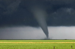
ThorntonWeather.com junior stormchaser chases tornado for 7News

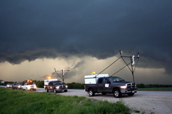
ThorntonWeather.com junior stormchaser Bobby pursued a tornado in Weld County yesterday and provided live reports for 7News.  Watch the video below (you may need to turn up the sound due to a lot of background noise).

[hana-flv-player video=’https://www.thorntonweather.com/blog/wp-content/uploads/2008/10/7news.flv’ /]

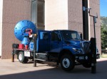
The DOW - Doppler On Wheels - as seen on Storm Chasers.

🙂  Okay, so maybe not but it still is kind of fun.  This was taken yesterday at NCAR’s Super Science Saturday in Boulder.  Channel 7 was there with their “24 / 7 Weather Experience” which was a lot of fun as it gives folks a small taste of what goes into a weather broadcast.  Unfortunately Mike Nelson, author of our favorite weather book, wasn’t there when we were but this was probably the highlight of the day up at NCAR for the kids.

There was also a bit of a celebrity there too as Justin Walker from Discovery Channel’s Storm Chasers TV show was there with their Doppler On Wheels (DOW) truck – a mobile radar vehicle.  Justin serves as one of the team members from the Center for Severe Weather Research that chases the storms.  He in particular is tasked with placing scientific probes in the path of the tornadoes.  We got to spend a good bit of time chatting with Justin about their chases this past tornado season and in particular the ones in the north central Kansas area where a good bit of my family lives.  He had some fascinating anecdotes to share about the storms, in particular the one that struck near Glen Elder, KS.

Bobby with Justin Walker of Storm Chasers.

For those that didn’t make it up there, you really missed a great opportunity for kids to learn more about not only the weather but also things like energy, the environment and more.

October 2008 weather preview posted

A Preview of Thorntons October Weather - Fall is Here
A Preview of Thornton's October Weather - Fall is Here

With the first full month of fall here, October usually brings one of the quietest weather months in the Denver area with plenty of mild, sunny days and clear, cool nights. The month actually has our second highest amount of sunshine with 72 percent with September having the most with 74 percent. Interestingly enough, the month following, November, is one of the lowest sunshine months with only 64 percent. Typically October brings our first real taste of winter with the first freeze on average coming on the 7th of the month and the first snow on the 15th of the month.

Click here to read our complete October preview and see what to expect for the month.

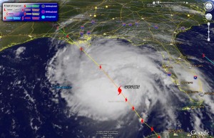
Gustav imagery via Google Earth

Below you will find the latest satellite imagery (as of 10:00am MDT) with tracking for Gustav generated with Google Earth.  For those that haven’t played with it, Google Earth is a very fun – and useful – program for any number of tasks.  Using it you can download place files with a wide variety of information including weather related items.  Here are a few links to get your started:

Hurricane Gustav image from Google Earth as of 10:00am MDT Sunday.
Hurricane Gustav image from Google Earth as of 10:00am MDT Sunday. Click on image for larger view.

Forecasters increase hurricane chances

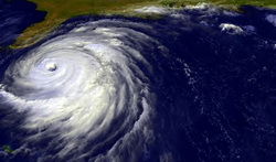
NOAA says there is a greater chance for hurricanes in the coming months.

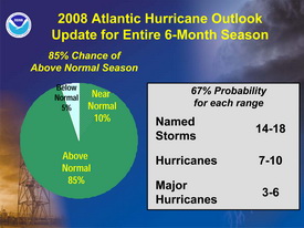
In their August update to hurricane season forecasts, experts at the National Oceanic and Atmospheric Administration (NOAA) have changed their predictions for the season and now expect a greater chance of hurricanes this season.  They are now predicting an “above normal” season with 14 to 18 named storms – up from the 12 to 16 they predicted in May.

The forecasters now believe there is an 85 percent chance that this above normal trend will take place (up from 65 percent in May). 

“Leading indicators for an above-normal season during 2008 include the continuing multi-decadal signal – atmospheric and oceanic conditions that have spawned increased hurricane activity since 1995 – and the lingering effects of La Niña,” said Gerry Bell, Ph.D. of NOAA’s Climate Prediction Center. “Some of these conditions include reduced wind shear, weaker trade winds, an active West African monsoon system, the winds coming off of Africa and warmer-than-average water in the Atlantic Ocean.”

The updated 2008 hurricane outlook.

Thus far in 2008 there have been five named storms and the most active hurricane period – August to October – is just now beginning.  Will this prediction hold true?  Unfortunateley forecasters have struggled in recent years with their predictions.  Last year NOAA predicted 10 hurricanes and only six formed. The year prior, 2006, nine hurricanes were forecasted by NOAA but only five formed.  In 2005, the year Hurricane Katrina devastated New Orleans in the worst U.S. natural disaster, the forecasts underestimated storm activity.

Red Flag Warning in Effect, Experts Warn of Wildfire Danger

Red Flag Warning TodayA Red Flag Warning has been issued for most of the state as warm temperatures and low humidities have increased the danger of fires getting out of control. This was witnessed first hand last week with the four wildfires in southern Colorado that quickly got out of hand.

Further, the AP is reporting that while we have had record snowpack this winter, that doesn’t necessarily translate to decreased fire danger.

Wildfire experts say the problem is the winter was short, which means the trees and plants absorbed less moisture than if the snow cover had been around longer.

They say that’s one of the factors behind a fire near Carbondale last week that burned 1 and 1/2 square miles.

Capt. Shaun Moore of the Greater Eagle Fire Protection District says the snowpack could actually boost the wildfire risk because the snow has helped grass grow taller. That could make it easier for flames to leap to trees when the grass dries out.

PLEASE be careful out there!

A RED FLAG WARNING REMAINS IN EFFECT FROM NOON TODAY TO 8 PM MDT THIS EVENING.

GUSTY SOUTHWEST WINDS AND VERY LOW RELATIVE HUMIDITIES ARE EXPECTED THIS AFTERNOON INTO THE EARLY EVENING HOURS. AS A RESULT A RED FLAG WARNING HAS BEEN ISSUED FROM 12 PM TO 8 PM MDT. AREAS IN THE WARNING WILL AGAIN INCLUDE THE INTERSTATE 25 CORRIDOR AND NORTHEAST PLAINS OF COLORADO.

SOUTHWEST WINDS OF 15 TO 30 MPH WITH A FEW HIGHER GUSTS CAN BE EXPECTED THIS AFTERNOON AND WILL CONTINUE INTO THE EARLY EVENING HOURS. IN ADDITION…RELATIVE HUMIDITY WILL DROP TO AROUND 10 PERCENT. THE GUSTY WINDS AND LOW HUMIDITIES WILL COMBINE WITH DRY FUELS TO CREATE CRITICAL FIRE CONCERNS THROUGH EARLY THIS EVENING.

A RED FLAG WARNING MEANS THAT CRITICAL FIRE WEATHER CONDITIONS ARE EITHER OCCURRING OR IMMINENT.

April Weather Preview – Something for Everyone

April Weather PreviewApril marks a transition between winter and summer for most of the country but for Denver it is especially true as we can see a stunning variety of weather. The proverbial April showers are certainly a possibility for Denver. Snow? Tornadoes? Thunderstorms? You bet – all can happen! For good measure throw in a chance for hail and even dust storms and April gives every type of weather condition you could like – or hate.   Click here to read our April 2008 weather preview.

NOAA: Increased Flood Risk, Minimal Drought

Yesterday NOAA released its spring drought and flood risk predictions and in it are some good and bad news for Colorado. 

Beware of the dangers of flooding!First, the good news.  With the extraordinary amount of snow the mountains have experienced this winter, the chances of drought are negligible for most of the state.  The southeastern corner of Colorado however could see some risk.

Second, the bad news.  With all that snow comes a risk of flooding.  The danger could be especially great if we experience a warmer than normal spring and the mountain runoff occurs too quickly.  Most of the state, with the exception of the northeast corner, runs above normal risks of flooding this spring.  Locations in the mountains of Colorado have 150 to 200 percent of average water contained in snowpack leading to a higher than normal flood potential.  Flooding is the number one weather killer in the country so everyone needs to be aware of the dangers this presents! 

For more information, please see NOAA’s report here.

2008 Spring Drought Outlook     2008 Spring Flood Danger Outlook

NOAA: Coolest Winter Since 2001 for U.S. & Globe

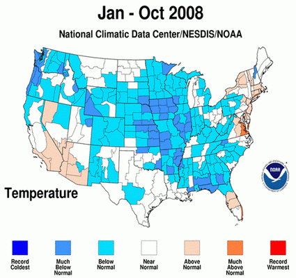
A cold winter!This week NOAA’s National Climatic Data Center announced that from December 2007 to February 2008 temperatures across the United States and the globe were their coolest since 2001.  In the contiguous United States, the average winter temperature was 33.2°F which ranks it as the 54th coolest winter since national records began in 1895.  Globally, the combined land and ocean surface temperature was the 16th warmest on record for the period.

In terms of precipitation, as everyone here in Colorado knows, large swaths of the country experienced at or well-above normal levels of precipitation.  Indeed, some basins here in Colorado were in excess of 150% of normal.  Record February precipitation in the Northeast helped make the winter the fifth wettest on record for the region. New York had its wettest winter, while Pennsylvania, Connecticut, Vermont, and Colorado to the West, had their second wettest.

The charts below give a good view of both temperature and precipitation for the winter.  You can also view the NCDC’s complete summary on their website here.

Winter Temperatures     Winter Precipitation

March 2008 Weather Preview Now Available

March 2008 PreviewMarch in Denver typically means frequent and rapid weather changes. The days grow longer and we start enjoying more sunshine and sometimes summer-like weather. However, on occasion arctic air masses can still force their way south into Colorado dropping temperatures quickly and markedly.  Occasional thunderstorms do start to happen in March as well.

To see what to expect in the coming month, click here to view our March 2008 Preview.