Category Archives: Climatology

Red Flag Warning in Effect, Experts Warn of Wildfire Danger

Red Flag Warning TodayA Red Flag Warning has been issued for most of the state as warm temperatures and low humidities have increased the danger of fires getting out of control. This was witnessed first hand last week with the four wildfires in southern Colorado that quickly got out of hand.

Further, the AP is reporting that while we have had record snowpack this winter, that doesn’t necessarily translate to decreased fire danger.

Wildfire experts say the problem is the winter was short, which means the trees and plants absorbed less moisture than if the snow cover had been around longer.

They say that’s one of the factors behind a fire near Carbondale last week that burned 1 and 1/2 square miles.

Capt. Shaun Moore of the Greater Eagle Fire Protection District says the snowpack could actually boost the wildfire risk because the snow has helped grass grow taller. That could make it easier for flames to leap to trees when the grass dries out.

PLEASE be careful out there!

A RED FLAG WARNING REMAINS IN EFFECT FROM NOON TODAY TO 8 PM MDT THIS EVENING.

GUSTY SOUTHWEST WINDS AND VERY LOW RELATIVE HUMIDITIES ARE EXPECTED THIS AFTERNOON INTO THE EARLY EVENING HOURS. AS A RESULT A RED FLAG WARNING HAS BEEN ISSUED FROM 12 PM TO 8 PM MDT. AREAS IN THE WARNING WILL AGAIN INCLUDE THE INTERSTATE 25 CORRIDOR AND NORTHEAST PLAINS OF COLORADO.

SOUTHWEST WINDS OF 15 TO 30 MPH WITH A FEW HIGHER GUSTS CAN BE EXPECTED THIS AFTERNOON AND WILL CONTINUE INTO THE EARLY EVENING HOURS. IN ADDITION…RELATIVE HUMIDITY WILL DROP TO AROUND 10 PERCENT. THE GUSTY WINDS AND LOW HUMIDITIES WILL COMBINE WITH DRY FUELS TO CREATE CRITICAL FIRE CONCERNS THROUGH EARLY THIS EVENING.

A RED FLAG WARNING MEANS THAT CRITICAL FIRE WEATHER CONDITIONS ARE EITHER OCCURRING OR IMMINENT.

April Weather Preview – Something for Everyone

April Weather PreviewApril marks a transition between winter and summer for most of the country but for Denver it is especially true as we can see a stunning variety of weather. The proverbial April showers are certainly a possibility for Denver. Snow? Tornadoes? Thunderstorms? You bet – all can happen! For good measure throw in a chance for hail and even dust storms and April gives every type of weather condition you could like – or hate.   Click here to read our April 2008 weather preview.
NOAA: Increased Flood Risk, Minimal Drought

Yesterday NOAA released its spring drought and flood risk predictions and in it are some good and bad news for Colorado. 

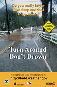
Beware of the dangers of flooding!First, the good news.  With the extraordinary amount of snow the mountains have experienced this winter, the chances of drought are negligible for most of the state.  The southeastern corner of Colorado however could see some risk.

Second, the bad news.  With all that snow comes a risk of flooding.  The danger could be especially great if we experience a warmer than normal spring and the mountain runoff occurs too quickly.  Most of the state, with the exception of the northeast corner, runs above normal risks of flooding this spring.  Locations in the mountains of Colorado have 150 to 200 percent of average water contained in snowpack leading to a higher than normal flood potential.  Flooding is the number one weather killer in the country so everyone needs to be aware of the dangers this presents! 

For more information, please see NOAA’s report here.

2008 Spring Drought Outlook     2008 Spring Flood Danger Outlook

NOAA: Coolest Winter Since 2001 for U.S. & Globe

A cold winter!This week NOAA’s National Climatic Data Center announced that from December 2007 to February 2008 temperatures across the United States and the globe were their coolest since 2001.  In the contiguous United States, the average winter temperature was 33.2°F which ranks it as the 54th coolest winter since national records began in 1895.  Globally, the combined land and ocean surface temperature was the 16th warmest on record for the period.
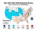
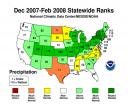

In terms of precipitation, as everyone here in Colorado knows, large swaths of the country experienced at or well-above normal levels of precipitation.  Indeed, some basins here in Colorado were in excess of 150% of normal.  Record February precipitation in the Northeast helped make the winter the fifth wettest on record for the region. New York had its wettest winter, while Pennsylvania, Connecticut, Vermont, and Colorado to the West, had their second wettest.

The charts below give a good view of both temperature and precipitation for the winter.  You can also view the NCDC’s complete summary on their website here.

Winter Temperatures     Winter Precipitation

March 2008 Weather Preview Now Available

March 2008 PreviewMarch in Denver typically means frequent and rapid weather changes. The days grow longer and we start enjoying more sunshine and sometimes summer-like weather. However, on occasion arctic air masses can still force their way south into Colorado dropping temperatures quickly and markedly.  Occasional thunderstorms do start to happen in March as well.

To see what to expect in the coming month, click here to view our March 2008 Preview.

Dry winter forecasts? Buried in the snow!

Dry winter?  Not here!An interesting article in the Denver Post today talks about how the forecasts for a dry winter have been way off the mark (thus far).  Even as recently as a month ago NOAA was saying that La Nina was going to wreak havoc and dry things out severely.  Yet today the mountains continue to have an amazing amount of snowpack with every basin well above normal. 

Meteorologist Klaus Wolter told the Denver Post that recent failures of their predictions may be traced to climate change.  Wolter said, “So we have two years in a row here where the atmosphere does not behave as we expect.  Maybe global changes are pulling the rug out from underneath us. We may not know the answer for 10 years, . . . but one pet answer is that you should get more variability with global change.”

 There it is!  You knew it was coming!  If all else fails, blame global warming!  🙂 

In all seriousness, assuming things continue as they have been, the concern now shifts not from drought but to possible flooding this spring.  Emergency planners are keeping a close eye and a fast run-off could not only lead to a loss of good, usable water but it could also cause a lot of problems. 

Despite the mountains of snow in the mountains, here on the plains we haven’t been quite as fortunate.  In the metro area, the historical seasonal average through the end of February is 39.6 inches of snow.  As of this morning (2/14), thus far this season ThorntonWeather.com has recorded 33.0 nches and the National Weather Service puts the official Denver measurement at 35.5 inches.  This puts us below average but there are still 15 days left in this month to catch up. 

 Please click here to view the entire Denver Post article:  Dry winter forecasts miss mark.

Snow on its way Wednesday evening. Warnings issued.

Snow in the forecast.Updated 2/13/08 @ 4:10pm.  A Snow and Blowing Snow Advisory has been issued and is in effect from midnight tonight until 5:00pm Thursday.  A blowing snow advisory means that winds and blowing and drifting snow will reduce visibilities sufficiently to make travel difficult.  Please continue to visit our site for the latest on the approaching storm.  If you haven’t, you may wish to sign up for our weather alert and report system to receive the latest information delivered directly to your inbox.

Updated 2/13/08 @ 7:00am.  It looks like the metro area will be in for snow this evening and into tomorrow.  We are expecting 3 to 6 inches in the Thornton area and the northern suburbs; higher accumulations will occur south with up to 9 inches across the southern metro area to the Palmer Divide.  Mountain areas could see up to a foot of snow. 

We’ll reach a high near 60 today but temperatures will drop rapidly as nighttime falls.  The storm is expecting to roll in from Wyoming and start hitting the Colorado border around 7:00pm, expanding to the Palmer Divide by 11:00pm.  Winds of 25 to 35mph are expected with the front so blowing snow will be a concern.  Evening rush hour today should at least be fine but tomorrow morning could be a bit dicey so please plan on leaving for work early and taking it slow.   Snow will continue Thursday morning and gradually diminish from north to south by Thursday afternoon. 

The National Weather Service has already issued Snow & Blowing Snow Advisories and Winter Storm Watches for some of the southern and central mountain areas.  These could be expanded as the storm develops. 

 Stay tuned to ThorntonWeather.com for the latest on this approaching system. 

Snowpack Continues to Grow

Snow in the forecast.

 The snowpack in the mountains continues to add up and we are having a great year as far as that goes.  The South Platte, which is crucial to many metro area water reserves including Thornton stands at 108% of normal. 

Colorado SNOTEL Snowpack Update Report
Based on Mountain Data from NRCS SNOTEL Sites
**Provisional data, subject to revision**
Data based on the first reading of the day (typically 00:00) for Tuesday, February 12, 2008
Basin
  Site Name
Elev
(ft)
Snow Water Equivalent Percent of
Current
(in)
Today’s
Average
(in)
Avg
Peak
(in)
Avg
Peak
Date
Today’s
Average
Avg
Peak
GUNNISON RIVER BASIN
Basin-wide percent of average 148  95 
UPPER COLORADO RIVER BASIN
Basin-wide percent of average 131  82 
SOUTH PLATTE RIVER BASIN
Basin-wide percent of average 108  66 
LARAMIE AND NORTH PLATTE RIVER BASINS
Basin-wide percent of average 110  70 
YAMPA AND WHITE RIVER BASINS
Basin-wide percent of average 115  76 
ARKANSAS RIVER BASIN
Basin-wide percent of average 169  108 
UPPER RIO GRANDE BASIN
Basin-wide percent of average 171  110 
SAN MIGUEL, DOLORES, ANIMAS AND SAN JUAN RIVER BASINS
Basin-wide percent of average 157  102 

Latest Snowpack Reports Continue to Hold Promise

Snowpack above normalSnowpack reports as of this morning continue to hold great promise for Colorado.  All of the major basins are above average with the exception of the South Platte.  Another major snowstorm is hitting the mountains today and yet another is forecast for Wednesday.  We can only hope this pattern continues and NOAA’s forecasts of a dry first quarter don’t hold true.

It would however be nice if some of that moisture would move out onto the front range and into the Denver area and the plains.  There is a chance for a bit of snow in the metro area tomorrow and again on Wednesday although right now it doesn’t look like they will amount to much.

Colorado SNOTEL Snowpack Update Report
Based on Mountain Data from NRCS SNOTEL Sites
**Provisional data, subject to revision**
Data based on the first reading of the day (typically 00:00) for Sunday, January 27, 2008
Basin
Site Name
Elev
(ft)
Snow Water Equivalent Percent of
Current
(in)
Today’s
Average
(in)
Avg
Peak
(in)
Avg
Peak
Date
Today’s
Average
Avg
Peak
GUNNISON RIVER BASIN
Basin-wide percent of average 132 72
UPPER COLORADO RIVER BASIN
Basin-wide percent of average 114 61
SOUTH PLATTE RIVER BASIN
Basin-wide percent of average 93 49
LARAMIE AND NORTH PLATTE RIVER BASINS
Basin-wide percent of average 99 54
YAMPA AND WHITE RIVER BASINS
Basin-wide percent of average 99 56
ARKANSAS RIVER BASIN
Basin-wide percent of average 148 80
UPPER RIO GRANDE BASIN
Basin-wide percent of average 150 83
SAN MIGUEL, DOLORES, ANIMAS AND SAN JUAN RIVER BASINS
Basin-wide percent of average 141 78

Storm Chaser Convention Coming to Denver

Storm Chaser Convention Coming to DenverFebruary 15th -17th Denver will play host to the 10th Annual National Storm Chaser Convention.  The event will be held at the Raddison Hotel at I-225 and Parker Road (3200 South Parker Road).  Most notably, the keynote speakers will be Dr. Josh Wurman and Sean Casey who appeared in the recently aired Discovery Channel special, Storm Chasers.  This is a great opportunity for weather enthusiasts to share storm stories, learn more about severe weather and storm chasing, see new weather gadgetry and hear from some of the experts in weather related fields. 

To learn more, please visit the National Storm Chaser Convention website at:  http://chaserconvention.com