Category Archives: Colorado Weather

Colorado fall colors 2018: When and where to go

Rocky Mountain National Park is a prime spot for viewing the fall foliage. (Tony's Takes)
Rocky Mountain National Park is a prime spot for viewing the fall foliage. (Tony’s Takes)

This time of year many folks start thinking about heading to the hills west of Denver in search of gold – fall foliage gold.

Where to go?  Below are five of ThorntonWeather.com’s favorite ones near Denver – plus a few further out and some bonus ideas.  After that, we will tell you where you can find a great website that provides regular updates on viewing conditions.

I-70 Corridor – If you’re looking for the easiest route, then this one is for you.  Simply head west on I-70 about 110 miles to Avon.  Between Vail and Avon, both sides of I-70 are lined beautifully with aspen.

Rocky Mountain National Park – One of the most popular summer destinations in the state is of course also a prime spot to view aspen in all their glory.  Once in the park head toward Bear Lake.  Glacier Gorge Junction provides a beautiful spot and you of course also get to enjoy all the splendor that Rocky Mountain National Park has to offer.  Extend your viewing by taking Trail Ridge Road all the way through to the west side of the park and the Grand Lake and Granby area.

Peak to Peak Highway – This little road trip can be a dual purpose trip – gambling and fall foliage viewing!  Take U.S. 6 through Clear Creek Canyon and then 119 through Blackhawk and Central City.  You can of course stop there if your wallet is fat enough and donate some money to the casinos.  From there continue on 119 toward Nederland.  Take highway 72 toward Ward and Allenspark.  There you will find more golden aspen than you can imagine, all with the Continental Divide nearby.
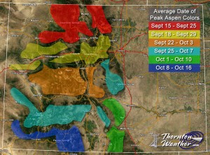
Colorado Fall Foliage - Average Date of Peak Aspen Colors. Click for larger view. (ThorntonWeather.com)
Colorado Fall Foliage – Average Date of Peak Aspen Colors. Click for larger view. (ThorntonWeather.com)

Poudre Valley Canyon –  Heading north on I-25 take Colorado 14 west and into Poudre Canyon and Roosevelt National Forest.  As you continue west you will come very near timberline as you come to Cameron Pass.  Amazing views abound!

Guanella Pass – This is a nice, relatively short drive from Denver.  From C470 take 85 through Bailey and Conifer, a nice drive unto itself.  When you come to the town of Grant, take the Guanella Pass Scenic and Historic Byway north to Georgetown.  The air is pretty thin along the way as you climb in excess of 11,500 views through the Pike and Arapahoe National Forests.

A couple other possibilities further from the Front Range:

Leadville / Aspen – From Denver take I-70 west to Copper Mountain and then Colorado 91 south over Freemont Pass to Leadville. Along the way there are plenty of viewing opportunities and Leadville is a nice little town to make a stop. From here you can take Highway 24 north back through Minturn and Vail. To extend the drive, take Highway 24 south to Colorado 82 and head toward Aspen. You can stop by the Maroon Bells in White River National Forest to view some of the most photographed mountains in Colorado.

Cottonwood Pass – From Denver take Highway 285 to Buena Vista. Head west on Main Street for seven miles then west on County Road 344 / Colorado 82. From there you start the climb up Cottonwood Pass with absolutely stunning views from the top. If you are up for it, you can continue down the west side of the pass into the Taylor Park area. Be forewarned though that the western half of the pass is unpaved and twisty.  Editor’s note: The west side of Cottonwood Pass is closed until sometime this fall so that it can be paved.

Honorable mentions worth considering:

  • Boreas Pass between Breckenridge and Como (County Road 10)
  • Kenosha Pass on Highway 285 between Bailey and Fairplay
  • Independence Pass (Colorado 82 between Aspen and Twin Lakes)
  • Colorado 103 from Evergreen to Echo Lake. Throw in a drive up Mount Evans for a bonus.

If you do head out, be sure to send us your pictures for inclusion in our monthly photo slideshows!

For more information:

Weather and Election Day: Will Mother Nature play a role in the outcome?

Weather – The true determining factor of who will be president?

We oftentimes hear about how weather can affect voter turnout but is there truly a link?  If there is, who does it benefit – Republicans or Democrats?  Studies seem to indicate that what might be thought of as an urban myth is indeed true and could in fact play a role in 2016.

In 2005, political science researchers Brad Gomez, Thomas Hansford and George Krause completed the first comprehensive study on the correlation between weather and voter turnout.  Their paper, “The Republicans Should Pray for Rain:  Weather, Turnout, and Voting in U.S. Presidential Elections” confirmed the conventional wisdom that weather does affect voter turnout, bad weather benefits Republicans and most interestingly, two presidential elections in the last 60 years may have had different results had the weather been different.

Looking back at presidential elections from 1948 to 2008, the study takes into account the weather in 3,000 U.S. counties.  They in turn looked at key areas of the nation and how weather, good and bad, affected voter turnout.  In the end, the study determined that precipitation is the key weather condition to affect voter turnout.

Continue reading Weather and Election Day: Will Mother Nature play a role in the outcome?

Stunning video captures Colorado’s gorgeous fall colors

We happened across this video recently and had to share it. Photographer Jason Hatfield is a transplant to Colorado and has spent recent years filming our fall foliage. The end result? An amazing compilation of the high country in autumn.

From Jason’s description:

For the 8 years I’ve lived in Colorado, I’ve been most enthralled by the short but incredible fall foliage season in the high country. I’ve experienced the magnificent autumn colors of the East Coast and Midwest, but nothing for me has compared to the scenes of massive mountains rising from stunning forests of gold-covered aspens. For the past 5 years of filming, I’ve had this moment in my head, a finished time-lapse piece that turns Colorado’s extraordinary fall landscapes into living art. Some years I only came away with a couple good sequences, others a lot more, and finally after this season I felt I had the work I needed to produce my vision. Please enjoy this short film that embodies everything I love about my state.

Colorado – A Living Landscape 4K from Jason Hatfield on Vimeo.

Top of Trail Ridge Road closed due to snow

Ah yes, the changing of the seasons is here and that means our weather conditions go from one extreme to the next.  Following a dry, warm week, Mother Nature brought snow to Colorado’s high country Friday night into Saturday leading to the closure of the highest, continues road in North America.

Rocky Mountain National Park reported dangerous conditions near the top of the Trail Ridge Road resulting in its temporary closure at Rainbow Curve on the east side and Milner Pass on the west side.  Also closed was Old Fall River Road.  Video from Trail Ridge showed a wintry scene looking like the Arctic tundra.

The agency said this was not the seasonal closure – yet.

Fall Colors 2016: Top spots to view the golden foliage near the Front Range

The leaves in the high country are changing and certainly give meaning to the moniker 'Colorful Colorado.' (ThorntonWeather.com)
The leaves in the high country are changing and certainly give meaning to the moniker ‘Colorful Colorado.’ (ThorntonWeather.com)

This time of year many folks start thinking about heading to the hills west of Denver in search of gold – fall foliage gold.

Where to go?  Below are five of ThorntonWeather.com’s favorite ones near Denver – plus a few further out and some bonus ideas.  After that, we will tell you where you can find a great website that provides regular updates on viewing conditions.


I-70 Corridor – If you’re looking for the easiest route, then this one is for you.  Simply head west on I-70 about 110 miles to Avon.  Between Vail and Avon, both sides of I-70 are lined beautifully with aspen.

Rocky Mountain National Park – One of the most popular summer destinations in the state is of course also a prime spot to view aspen in all their glory.  Once in the park head toward Bear Lake.  Glacier Gorge Junction provides a beautiful spot and you of course also get to enjoy all the splendor that Rocky Mountain National Park has to offer.  Extend your viewing by taking Trail Ridge Road all the way through to the west side of the park and the Grand Lake and Granby area.

Peak to Peak Highway – This little road trip can be a dual purpose trip – gambling and fall foliage viewing!  Take U.S. 6 through Clear Creek Canyon and then 119 through Blackhawk and Central City.  You can of course stop there if your wallet is fat enough and donate some money to the casinos.  From there continue on 119 toward Nederland.  Take highway 72 toward Ward and Allenspark.  There you will find more golden aspen than you can imagine, all with the Continental Divide nearby.

Colorado Fall Foliage - Average Date of Peak Aspen Colors. Click for larger view. (ThorntonWeather.com)
Colorado Fall Foliage – Average Date of Peak Aspen Colors. Click for larger view. (ThorntonWeather.com)

Poudre Valley Canyon –  Heading north on I-25 take Colorado 14 west and into Poudre Canyon and Roosevelt National Forest.  As you continue west you will come very near timberline as you come to Cameron Pass.  Amazing views abound!

Guanella Pass – This is a nice, relatively short drive from Denver.  From C470 take 85 through Bailey and Conifer, a nice drive unto itself.  When you come to the town of Grant, take the Guanella Pass Scenic and Historic Byway north to Georgetown.  The air is pretty thin along the way as you climb in excess of 11,500 views through the Pike and Arapahoe National Forests.  Fair warning – about 10 miles of the road is gravel but it is well maintained.

A couple other possibilities further from the Front Range:

Leadville / Aspen – From Denver take I-70 west to Copper Mountain and then Colorado 91 south over Freemont Pass to Leadville. Along the way there are plenty of viewing opportunities and Leadville is a nice little town to make a stop. From here you can take Highway 24 north back through Minturn and Vail. To extend the drive, take Highway 24 south to Colorado 82 and head toward Aspen. You can stop by the Maroon Bells in White River National Forest to view some of the most photographed mountains in Colorado.

Cottonwood Pass – From Denver take Highway 285 to Buena Vista. Head west on Main Street for seven miles then west on County Road 344 / Colorado 82. From there you start the climb up Cottonwood Pass with absolutely stunning views from the top. If you are up for it, you can continue down the west side of the pass into the Taylor Park area. Be forewarned though that the western half of the pass is unpaved and twisty.

Honorable mentions worth considering:

  • Boreas Pass between Breckenridge and Como (County Road 10)
  • Kenosha Pass on Highway 285 between Bailey and Fairplay
  • Independence Pass (Colorado 82 between Aspen and Twin Lakes)
  • Colorado 103 from Evergreen to Echo Lake. Throw in a drive up Mount Evans for a bonus.

If you do head out, be sure to send us your pictures for inclusion in our monthly photo slideshows!

For more information:

Firenado captured on video at Beaver Creek Fire

WildfiresThus far, Colorado has been fortunate with relatively few large wildfires. The one notable exception is the Beaver Creek Fire where a firefighter recently captured video of a ‘firenado.’

Also called a fire whirl, a firenado occurs when the rising heat from the blaze meets whirling winds.  The effect and appearance is much like a tornado – but made of fire and ash instead of dust and debris.  Check out the amazing video below.

As of today, the Beaver Creek Fire has scorched over 36,000 acres since it started on June 19th.  Burning northwest of Walden near the Colorado / Wyoming border, the blaze is only 44 percent contained and full containment isn’t expected until cooler temperatures arrive late next month into October.

Click here for the latest details on the blaze from Inciweb.

National Weather Service rates damaging May 24 tornadoes

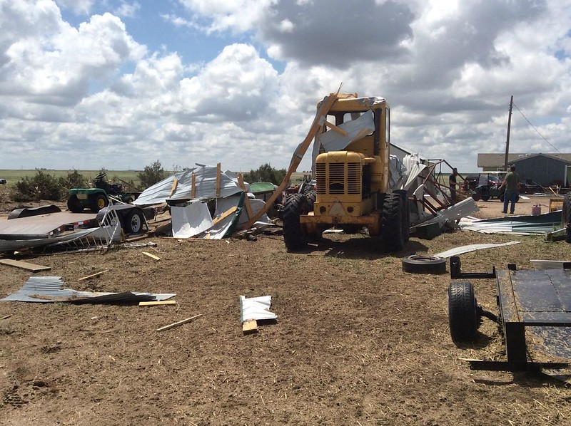
Damage from a May 24, 2016 tornado is seen on a farm near Platner, Colorado. (National Weather Service)

The thunder rolled across eastern Colorado on Tuesday, May 24 – as did hail, wind and tornadoes.  Washington County saw the most intense activity with multiple twisters including one damaging tornado that has been rated an EF-1.

The National Weather Service sent survey teams to the area to evaluate the damage inflicted by Mother Nature.

They found two tornadoes of relatively weak EF-0 strength occurred near Akron.  Neither any caused damage.

Near Platner though, a more powerful tornado ripped through a farm at about 6:50pm that evening.  The twister lifted a pole barn, destroying it.  Debris was found one mile away.

Wind and hail ripped across an area six miles wide near Akron causing extensive damage.  Farm equipment was toppled and a barn heavily damaged by the wind while houses saw the siding punctured and windows broken from hail.

Below are images taken by the National Weather Service of the area.

[flickr_set id=”72157668536532282″]
Public Information Statement
National Weather Service Denver/Boulder CO
1056 AM MDT THU MAY 26 2016

...NWS DAMAGE SURVEY FOR 05/24/16 TORNADO EVENT... 

.OVERVIEW...A long-lived supercell thunderstorm moved across
eastern Colorado and produced two EF-1 tornadoes and two EF-0
tornadoes in Washington County on May 24, 2016. Widespread wind
and hail damage also occurred, with a swath of damage nearly 6
miles wide at some points east and northeast of Akron.

.Washington County tornado near Platner...

Rating:                 EF-1
Estimated peak wind:    86-110 mph
Path length /Statute/:  0.9 miles
Path width /Maximum/:   20 yards
Fatalities:             0
Injuries:               0

Start date:             May 24 2016
Start time:             650 PM MDT
Start location:         1 mile northeast of Platner / Washington County / CO
Start Lat/Lon:          40.1647 / -103.0467

End date:               May 24 2016
End time:               655 PM MDT
End location:           1 mile east of Platner / Washington County / CO
End_lat/lon:            40.155 / -103.0366

This tornado struck one farm, lofting and completely destroying
a pole shed, and also damaging trees. Power lines were snapped
just to the southeast of the farm.

.Washington County tornado near Yuma County line...

Rating:                 EF-1
Estimated peak wind:    110 mph
Path length /Statute/:  0.1 mile
Path width /Maximum/:   90 yards
Fatalities:             0
Injuries:               0

Start date:             May 24 2016
Start time:             715 PM MDT
Start location:         9 miles north/northwest of Yuma / Washington County / CO
Start Lat/Lon:          40.2350 / -102.7943

End date:               May 24 2016
End time:               716 PM MDT
End location:           9 miles north/northwest of Yuma / Washington County / CO
End_lat/lon:            40.2348 / -102.7936

This tornado struck one farm, destroying a pole shed. Slight roof damage
occurred to the house, along with some tree damage.

.Washington County tornado 1 mile Northeast of Akron...

Rating:                 EF-0
Estimated peak wind:    65-85 mph
Path length /Statute/:  0.0 miles
Path width /Maximum/:   10 yards
Fatalities:             0
Injuries:               0

Start date:             May 24 2016
Start time:             644 PM MDT
Start location:         1 mile southeast of Akron / Washington County / CO
Start Lat/Lon:          40.1490 / -103.1981

End date:               May 24 2016
End time:               644 PM MDT
End location:           1 mile southeast of Akron / Washington County / CO
End_lat/lon:            40.1490 / -103.1981

Brief touchdown with no damage.

.Washington County tornado 1 mile Southeast of Akron...

Rating:                 EF-0
Estimated peak wind:    65-85 mph
Path length /Statute/:  0.0 miles
Path width /Maximum/:   10 yards
Fatalities:             0
Injuries:               0

Start date:             May 24 2016
Start time:             647 PM MDT
Start location:         1 mile northeast of Akron / Washington County / CO
Start Lat/Lon:          40.1708 / -103.1959

End date:               May 24 2016
End time:               647 PM MDT
End location:           1 mile northeast of Akron / Washington County / CO
End_lat/lon:            40.1708 / -103.1959

Brief touchdown with no damage.

EF Scale: The Enhanced Fujita Scale Classifies
Tornadoes into the following categories.

EF0...Weak...... 65 to 85 mph
EF1...Weak...... 86 to 110 mph
EF2...Strong.... 111 to 135 mph
EF3...Strong.... 136 to 165 mph
EF4...Violent... 166 To 200 mph
EF5...Violent... >200 mph*

NOTE:
The information in this statement is PRELIMINARY and subject to
change pending final review of the events and publication in
NWS Storm Data.

May 7, 2016 Eastern Colorado tornadoes rated at EF-2s

Severe weather more typical of June than late September hit Colorado yesterday.Severe weather struck the plains of Colorado on Saturday spawning multiple tornadoes.  The two most powerful of these, one near Wiggins and another near Wray, have been rated EF-2s on the Enhanced Fujita Scale.

Damage and injuries from both twisters were relatively light, certainly not as bad as they could have been.

The tornado west of Wiggins crossed I-76 and traveled nearly 9 miles reaching 3/4 of a mile wide at one point.  It ripped through a private campground at Empire Reservoir damaging and destroying multiple RVs.  There were some minor injuries with the storm.

Further east, near Wray, multiple tornadoes were reported, the most significant of which damaged three residences and businesses near the town’s borders.  It traveled about 8 miles and at its widest was 440 yards across.

Three other tornadoes were confirmed near Wray although they caused no damage and were rated EF-0s.

Below is some amazing video of the tornado near Wray. Scroll below that for the detailed damage survey from the National Weather Service.

PUBLIC INFORMATION STATEMENT
NATIONAL WEATHER SERVICE DENVER/BOULDER CO
314 PM MDT MON MAY 9 2016

...NWS DAMAGE SURVEY FOR 05/07/16 TORNADO EVENT ACROSS MORGAN
AND WELD COUNTIES - UPDATE # 1...

.UPDATE...ADDING ADDITIONAL TORNADOES.

.OVERVIEW...A TORNADO DEVELOPED JUST SOUTH OF INTERSTATE 76 OVER
WELD COUNTY AND THEN MOVE NORTH ACROSS EMPIRE RESERVOIR BEFORE
LIFTING 2 MILES NORTHWEST OF ORCHARD IN MORGAN COUNTY.  THERE WERE
TWO MINOR INJURIES WHEN A CAMPER WAS ROLLED OVER.  IN ADDITION SEVERAL
CAMPERS WERE DESTROYED AT EMPIRE RESERVOIR.

.TORNADO # 1

RATING: EF-2
ESTIMATED PEAK WIND: 115-120 MPH
PATH LENGTH /STATUTE/: 8.8 MILES
PATH WIDTH /MAXIMUM/:  1320 YARDS
FATALITIES: 0 INJURIES: 2

START DATE:             MAY_07_2016
START TIME:             255 PM_MDT
START LOCATION:         5 WEST OF WIGGINS/WELD COUNTY


END DATE:               MAY_07_2016
END TIME:               310 PM_MDT
END LOCATION:           2 NORTHWEST OF ORCHARD/MORGAN COUNTY


SURVEY_SUMMARY:  MOST OF THE DAMAGE WAS EF0 TO EF1 HOWEVER THERE
WERE A FEW AREAS OF EF2.  THE TORNADO WAS LARGE AND 3/4 OF A
MILE WIDE AT ITS PEAK.

.TORNADO # 2...

RATING:                 EF-0
ESTIMATED PEAK WIND:    85 MPH
PATH LENGTH /STATUTE/:  0.5 MILES
PATH WIDTH /MAXIMUM/:   50 YARDS
FATALITIES:             0
INJURIES:               0

START DATE:             MAY_07_2016
START TIME:             315 PM_MDT
START LOCATION:         6 NORTH OF ORCHARD/MORGAN COUNTY

END DATE:               MAY_07_2016
END TIME:               316 PM_MDT
END LOCATION:           7 NORTH OF ORCHARD/MORGAN COUNTY


.TORNADO # 3...

RATING:                 EF-0
ESTIMATED PEAK WIND:    85 MPH
PATH LENGTH /STATUTE/:  0.5 MILES
PATH WIDTH /MAXIMUM/:   50 YARDS
FATALITIES:             0
INJURIES:               0

START DATE:             05_07_2016
START TIME:             325 PM_MDT
START LOCATION:         14 SOUTHWEST NEW RAYMER/WELD COUNTY

END DATE:               05_07_2016
END TIME:               326 PM_MDT
END LOCATION:           13 SOUTHWEST NEW RAYMER/WELD COUNTY


.TORNADO # 4...

RATING:                 EF-0
ESTIMATED PEAK WIND:    85 MPH
PATH LENGTH /STATUTE/:  0.5 MILES
PATH WIDTH /MAXIMUM/:   50 YARDS
FATALITIES:             0
INJURIES:               0

START DATE:             05_07_2016
START TIME:             335 PM_MDT
START LOCATION:         7 NORTHWEST FORT MORGAN/MORGAN COUNTY

END DATE:               05/07/2016
END TIME:               336 PM_MDT
END LOCATION:           8 NORTHWEST FORT MORGAN/MORGAN COUNTY

PUBLIC INFORMATION STATEMENT
NATIONAL WEATHER SERVICE GOODLAND KS
500 PM MDT SUN MAY 8 2016 /600 PM CDT SUN MAY 8 2016/

THIS INFORMATION IS PRELIMINARY AND SUBJECT TO CHANGE PENDING
FURTHER REVIEW OF DOPPLER RADAR, STORM SPOTTER REPORTS AND STORM
VIDEOS, WHICH ARE STILL ARRIVING INTO THE OFFICE.

...NWS DAMAGE SURVEY FOR 05/07/2016 TORNADO EVENT... 

.TORNADO #1...

RATING:                 EF-2
ESTIMATED PEAK WIND:    130 MPH
PATH LENGTH /STATUTE/:  8 MILES
PATH WIDTH /MAXIMUM/:   440 YARDS
FATALITIES:             0
INJURIES:               0

START DATE:             MAY 07 2016
START TIME:             551 PM MDT
START LOCATION:         2 N WRAY

END DATE:               MAY 07 2016
END TIME:               616 PM MDT
END LOCATION:           10 NNE WRAY

TORNADO PATH WAS ONLY SURVEYED BETWEEN 2 AND 5 MILES NORTH OF
WRAY ALONG AND JUST EAST OF HIGHWAY 385. TORNADO LIKELY CONTINUED
WELL NORTH-NORTHEAST OF WRAY BUT LACK OF ROADS PREVENTED FURTHER
SURVEY. THREE RESIDENCES AND TWO BUSINESSES NORTH OF WRAY WERE
IMPACTED...MAJORITY OF TRACK WAS OVER OPEN COUNTRY.


.TORNADO #2...

RATING: EF-0
ESTIMATED PEAK WIND:    85 MPH
PATH LENGTH /STATUTE/:  0.5 MILES
PATH WIDTH /MAXIMUM/:   25 YARDS
FATALITIES:             0
INJURIES:               0

START DATE:             MAY 07 2016
START TIME:             410 PM MDT
START LOCATION:         4 N HEARTSTRONG

END DATE:               MAY 07 2016
END TIME:               411 PM MDT
END LOCATION:           5 N HEARTSTRONG


.TORNADO #3...

RATING:                 EF-0
ESTIMATED PEAK WIND:    85 MPH
PATH LENGTH /STATUTE/:  3 MILES
PATH WIDTH /MAXIMUM/:   50 YARDS
FATALITIES:             0
INJURIES:               0

START DATE:             MAY 07 2016
START TIME:             454 PM MDT
START LOCATION:         4 N ECKLEY

END DATE:               MAY 07 2016
END TIME:               458 PM MDT
END LOCATION:           7 N ECKLEY


.TORNADO #4...

RATING:                 EF-0
ESTIMATED PEAK WIND:    85 MPH
PATH LENGTH /STATUTE/:  1 MILE
PATH WIDTH /MAXIMUM/:   50 YARDS
FATALITIES:             0
INJURIES:               0

START DATE:             MAY 07 2016
START TIME:             539 PM MDT
START LOCATION:         3 S WRAY

END DATE:               MAY 07 2016
END TIME:               541 PM MDT
END LOCATION:           2 S WRAY

THE ENHANCED FUJITA SCALE CLASSIFIES
TORNADOES INTO THE FOLLOWING CATEGORIES.

EF0...WEAK......65 TO 85 MPH
EF1...WEAK......86 TO 110 MPH
EF2...STRONG....111 TO 135 MPH
EF3...STRONG....136 TO 165 MPH
EF4...VIOLENT...166 TO 200 MPH
EF5...VIOLENT...>200 MPH

NOTE:
THE INFORMATION IN THIS STATEMENT IS PRELIMINARY AND SUBJECT TO
CHANGE PENDING FINAL REVIEW OF THE EVENTS AND PUBLICATION IN
NWS STORM DATA.

National Weather Service announces storm spotter training dates for 2016

On June 3, 1981 a tornado struck Thornton in what is the worst twister to have struck the Denver metro area. Are you ready should disaster strike again? Image courtesy the City of Thornton archives.

Severe weather is a fact of life in Colorado – from blizzards to tornadoes we can and do see it all.  Each year the weather is responsible for claiming lives in our state and across the nation and the threat is very real.  Storm spotter training allows you to learn how to protect yourself and your family while providing a public service.

Education is key to knowing how to protect you and your family.  Whether you want to be an official storm spotter or maybe just want to learn more about severe weather, storm spotter training can provide you an incredible opportunity to learn.

The National Weather Service Denver / Boulder office has announced a series of Skywarn storm spotter training dates for Colorado for the 2015 season.

The storm spotter program is a nationwide program with more than 280,000 trained spotters.  These volunteers report weather hazards to their local National Weather Service office providing vital information when severe strikes.  Data from spotters include severe wind, rain, snow measurements, thunderstorms and hail and of course tornadoes.

Storm spotters are part of the ranks of citizens who form the Nation’s first line of defense against severe weather. There can be no finer reward than to know that their efforts have given communities the precious gift of time–seconds and minutes that can help save lives.

By completing one of these training classes you can become an official storm spotter.  When severe weather strikes, you can report it by calling a special toll free number or submit your report via the National Weather Service’s website.

These are great sessions for anyone wanting to learn more about the severe weather we experience in Colorado, whether you want to be an official spotter or not.  All training is free.  Topics include:

  • Basics of thunderstorm development
  • Fundamentals of storm structure
  • Identifying potential severe weather features
  • Information to report
  • How to report information
  • Basic severe weather safety

To learn more about the program, see here: http://www.crh.noaa.gov/bou/awebphp/spotter.php

Below are the dates, times and locations announced thus far.  The embedded calendar should automatically update with new dates and changes but be sure to check the National Weather Service site for the latest.

NOAA details the chances for a white Christmas for the United States

White Christmas probability map for the contiguous United States. (NOAA)
White Christmas probability map for the contiguous United States. Click for larger view. (NOAA)

With our most recent snowstorm, the Colorado Front Range is likely to enjoy a white Christmas (defined as 1 inch of snow on the ground on Christmas Day).  Other locations in the United States of course are not quite so lucky and historically, Colorado can be quite hit or miss.

Below is the latest narrative from NOAA.  To the right is a probability map – click it to view full size.

From NOAA:

Minnesota. Maine. Upstate New York. The Allegheny Mountains of Pennsylvania and West Virginia. Practically anywhere in Idaho. And of course, the Rockies or the Sierra Nevada Mountains. These are the places where weather history suggests you want to be if you’re looking for the best chance of a white Christmas.

The map at right shows the historic probability of there being at least 1-inch of snow on the ground in the Lower 48 states on December 25 based on the latest (1981-2010) U.S. Climate Normals from NOAA’s National Climatic Data Center.  Dark gray shows places where the probability is less than 10 percent, while white shows probabilities greater than 90  percent.

The 1981–2010 Climate Normals are the latest three-decade averages of several climatological measurements. This dataset contains daily and monthly Normals of temperature, precipitation, snowfall, heating and cooling degree days, frost/freeze dates, and growing degree days calculated from observations at approximately 9,800 stations operated by NOAA’s National Weather Service.

While the map shows the climatological probability that a snow depth of at least one inch will be observed on December 25, the actual conditions this year may vary widely from these probabilities because the weather patterns present will determine the snow on the ground or snowfall on Christmas day. These probabilities are useful as a guide only to show where snow on the ground is more likely.  For prediction of your actual weather on Christmas Day, check out your local forecast at Weather.gov.

You can locate Normals data for the observing station closest to you using the NCDC’sinteractive map.

If you would like to keep track of the snowfall across the United States on a daily basis, see the National Operational Hydrologic Remote Sensing Center’s National Snow Analyses. For a more detailed assessment of the probability of a white Christmas as well as documentation of the methodology used to calculate the map’s underlying climatological statistics, see the scientific paper, White Christmas? An Application of NOAA’s 1981-2010 Daily Normals, by NCEI scientists and published in the Bulletin of the American Meteorological Society. You can also download a spreadsheet to see the full list of stations and their historic probabilities.

This post was adapted from an article first published by the National Climatic Data Center. It was first published on December 11, 2013, and is reviewed each year and updated as needed.