Category Archives: Colorado Weather

That isn’t clouds on Tuesday morning’s satellite imagery

This morning’s satellite imagery runs are showing some interesting white cover on Colorado’s landscape and it isn’t clouds.  In fact, we see virtually entirely cloudless skies across the state.

That white stuff is in fact snow, the first covering of the season at higher elevations.  Some locations Sunday night / Monday morning received up to six inches of the white stuff.

Satellite imagery clearly shows the snow in parts of the San Juan Mountains to the southwest as well as the Elk and Sawatch ranges, the Flat Tops and even the western parts of the Front Range mountain areas.

It likely won’t be long before the Front Range sees its own snowfall.  Denver’s first freeze on average occurs on October 7th.  Its first snowfall on October 19th.

More Denver cold weather statistics can be found here.

Before and after: NASA satellite imagery reveals flood damage in Colorado

Colorado’s September 2013 floods have been absolutely devastating with over 1,500 homes destroyed and a death toll yet to be finalized. NASA satellites flew over the area near Greeley in recent days and the before and after pictures provide a stunning view from above of the devastation.

Using the ‘sliders’ on the two image sets below you can compare how the area looks normally versus how it looked in the days immediately after the flooding.

[wpw_ba_viewer width=”600″ height=”auto” anim_speed=”600″ start_percent=”0.5″ disable_intro=”false”]
[wpw_ba_img src=”http://lh6.googleusercontent.com/-EHZnr2QxwDo/UjxBTiFTICI/AAAAAAAAArY/lN8SZl9OGLs/s600/greeley-before.jpg” data_second=”http://lh3.googleusercontent.com/-Afkp7QnthD8/UjxBTnDEMrI/AAAAAAAAArU/QsAh-2SWRkw/s600/greeley-after.jpg” title=”Satellite imagery comparison of the area near Greeley, Colorado before and after the September 2013 flooding. (NASA EO)” data_info=”Satellite imagery comparison of the area near Greeley, Colorado before and after the September 2013 flooding. (NASA EO)”]
[/wpw_ba_viewer]Satellite Imagery of Flooding Near Greeley, Colorado – “Though water levels on the South Platte River were receding, muddy brown waters were still out of the river’s banks near Greeley, Colorado, on September 17, 2013, when the Operational Land Imager (OLI) on the Landsat 8 satellite acquired this image. At the time, the river was more than six feet above flood stage, down from more than eight feet above flood stage.” The before image was acquired on June 29, 2013 and shows the area as it normally appears. (NASA EO)


[wpw_ba_viewer width=”600″ height=”auto” anim_speed=”600″ start_percent=”0.5″ disable_intro=”false”]
[wpw_ba_img src=”http://lh4.googleusercontent.com/-4P17RwE0yJ4/UjxBUXq6AEI/AAAAAAAAArc/jf6eRTTMaeQ/s600/platte-before.jpg” data_second=”http://lh6.googleusercontent.com/-oFx1h0x653Y/UjxBTgBj2KI/AAAAAAAAArM/-rgcmbR2otk/s600/platte-after.jpg” title=”Satellite imagery comparison of the area near Greeley, Colorado before and after the September 2013 flooding. (NASA EO)” data_info=”Satellite imagery comparison of the area near Greeley, Colorado before and after the September 2013 flooding. (NASA EO)”]
[/wpw_ba_viewer]Infrared Satellite Imagery of Flooded South Platte River – “Intense rainfall in northern and eastern Colorado brought widespread, destructive flooding in mid-September 2013. Local citizens reported as much as 18 inches (46 centimeters) of rain from September 9 to 15, with some of the heaviest accumulation along the Front Range of the Rocky Mountains. A break in the precipitation allowed the Moderate Resolution Imaging Spectroradiometer (MODIS) on NASA’s Aqua satellite to acquire the top image of the floods on September 14. The second image, taken by Terra MODIS on September 7, 2013, shows the region before the rains began. The images were made from infrared light to increase the contrast between water and land.” (NASA EO)

Colorado floods extensively damage homes serving the developmentally disabled

The full toll from Colorado’s floods won’t be known for months but for one local Denver area non-profit, the devastation of the waters hit home – nine of them in fact.

The flood waters from Colorado’s floods have destroyed homes and taken lives. In one case, nine homes crucial to serving the needs of the most vulnerable among us were part of the toll.

Read more about their plight, the heroism of their employees and more importantly, find out how you can help.

The basement of a home run by Imagine! for developmentally disabled individuals had water four feet deep due to the flooding in Colorado.  Note the water line.
The basement of a home run by Imagine! for developmentally disabled individuals had water four feet deep due to the flooding in Colorado. Note the water line. (Imagine!) Click to view the photo slideshow.

Interactive map: Rainfall totals from Colorado’s September 2013 flood event

Damage in Jamestown on September 15, 2013. (Boulder OEM)
Damage in Jamestown on September 15, 2013. See the map of rainfall totals from the flooding event below. Click the image to view a photo slideshow of the devastation. (Boulder OEM)

By the numbers, the rainfall experienced across northeastern Colorado since Monday, September 9 has been nothing short of extraordinary.  Over the span of a week, many locations received half of what they normally receive in an entire year.  Some received more than what they expect annually.

We have created and interactive map (below) that shows precipitation totals from Monday, September 9, 2013 to Monday, September 16, 2013.  The numbers are totals as reported by CoCoRaHS volunteers – the Community Collaborative Rain, Hail & Snow Network.

Looking at the map, it is clear that the Boulder area received the most with one station recording an astonishing 21.13” over the 7 day timespan.  The official station in Boulder has recorded 16.69” inches this month and 29.65” for the year. These numbers break Boulder’s monthly record and its annual precipitation record.

Denver’s official station at Denver International Airport (DIA) has recorded 4.65 inches this month, enough to put September 2013 in the books as the 2nd wettest on record.  However, that total hardly reflects what locations closer to the city’s center received with many recording over 7” this month.

Here in Thornton we have seen 8.85” of rain so far this month, an extraordinary total that brings our total for 2013 to 18.81”.  This is clearly the biggest month and year for precipitation since ThorntonWeather.com came online in 2007 and likely the biggest month ever in Thornton.

If you have a hard time viewing the map in the window below, click here to launch a larger version.

  • Don’t miss a thing when it comes to our ever-changing weather! Be sure to ‘like’ us on Facebook, follow us on Twitter and add us to your Google+ circles.

In pictures: Colorado’s record-setting September 2013 rains and flooding

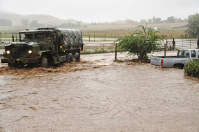
Colorado National Guardsmen respond to floods in Boulder County, Colo., Sept.12, 2013. (Army National Guard Photo by Sgt. Joseph K. VonNida/RELEASED)
Colorado National Guardsmen respond to floods in Boulder County, Colo., Sept.12, 2013. See more images from Colorado’s devastating September 2013 floods in the slideshow below. (Army National Guard Photo by Sgt. Joseph K. VonNida/RELEASED)

September 2013 will forever be etched in the memory of all Coloradans as one which brought amazing destruction – and death.  Images of the truly historical event tell the story of the damage in the aftermath but also show the indomitable human spirit and the willingness of Americans to come together and help in times of need.

Northeastern Colorado has a surprisingly arid climate but also is an environment ripe for extreme weather events like the rain and floods we  experienced.

The cost and final death toll from the floods will be determined in the coming days, weeks and months but we know already this is one for the record books.

The September 2013 event lasted multiple days and effects were felt from the mountains and foothills to the flat eastern plains.  Many locations saw rainfall totals over four days equal to half of what they normally receive in an entire year.

The images in the slideshow below were gathered from a variety of sources.  If you have photos to share, please email them to info@thorntonweather.com and we will add them.

  • Don’t miss a thing when it comes to our ever-changing weather! Be sure to ‘like’ us on Facebook, follow us on Twitter and add us to your Google+ circles.
[flickr_set id=”72157697969563182″]

Raw video: Colorado’s flooding in Boulder and Estes Park

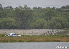
Water flows over the banks of the South Platte River into Sprat-Platte Lake near Thornton on the afternoon of September 12, 2013.   Click for a larger view.  (Ed Dalton)
Water flows over the banks of the South Platte River into Sprat-Platte Lake near Thornton on the afternoon of September 12, 2013. Click for a larger view. (Ed Dalton)

What has been called a 100-year storm and even referred to as being of ‘biblical’ proportions is very slowly coming to an end.  The worst of the rain fell on Thursday, September 12 with locations in Colorado’s foothills reporting in excess of 8 inches of rainfall.

Among the hardest hit areas were the college town of Boulder and picturesque Estes Park.  Both cities have seen extensive flooding and damage totals across the state will be well into the tens, if not hundreds, of millions of dollars.

The two videos below capture the raging waters as they pummeled the communities.

The first video shows Boulder as well as some commentary by Gov. John Hickenlooper.  The second is of downtown Estes Park.

  • Don’t miss a thing when it comes to our ever-changing weather! Be sure to ‘like’ us on Facebook, follow us on Twitter and add us to your Google+ circles.

Our view while on vacation in southwestern Colorado

Many folks noticed the lack of new stories post last week other than a photo or two on our Facebook page.  We took the week off for some much needed R & R and were able to enjoy one of our favorite parts of the state.

The image below was taken in Gunnison National Forest a little ways north of Taylor Reservoir.  In the foreground is Lilly Pond, in the background the Collegiate Peaks.

The stunning greens and blues truly were as bright as the image shows.  While rain was far too prevalent for our liking during our time in the area, the scenery was amazing.

Lilly Pond and the Collegiate Peaks in Gunnison National Forest (ThorntonWeather.com).
Lilly Pond and the Collegiate Peaks in Gunnison National Forest (ThorntonWeather.com). Click for a larger view.

Mid-summer snow dusts Loveland Ski Area

July 18, 2013 - Loveland Ski Area received a dusting of snow.  While a bit unusual in mid-summer, certainly not unheard of given an altitude at the base of 10,800 feet. (Loveland Ski Area)
July 18, 2013 – Loveland Ski Area received a dusting of snow. While a bit unusual in mid-summer, certainly not unheard of given an altitude at the base of 10,800 feet. (Loveland Ski Area)

At an altitude of 10,800 feet, Loveland Ski Area is certainly in some rarified air.  Yesterday the resort saw a dusting of snow while Colorado residents below in the Mile High City simmered in 90+ degree temperatures.

Snowfall can occur in Colorado’s high country any time of year, even in mid-summer, and yesterday’s event was not particularly unusual.

Here in Denver however there has never officially been snow in July.  The key word though is ‘officially.’

Unofficially there has been snow in the Mile High City in July – almost exactly one year ago today in fact.

Check out this tidbit from the National Weather Service archives:

“On July 17, 1872…the U.S. Army Signal Service weather observer recorded snowfall during the early morning hours in the hand written daily weather journal: “rain commenced at 1:30 a.m. changing about 3 a.m. to snow & in about half an hour to rain again; it continued until 6 a.m.” This is the only recorded occurrence of snowfall in Denver in July…but this report is not included in the “official” station snowfall records…which did not begin in Denver until January 1…1882. The low temperature on this morning was 45 degrees…which is sufficiently cold for the occurrence of light stratiform snowfall.”

Satellite imagery captures explosion of West Fork Complex Fire, Papoose Fire and thunderstorms

Satellites provide an amazing eye in the sky for monitoring the weather and climate.  Their usefulness today was once again proven as they captures wildfires exploding in Colorado’s southwest and thunderstorms to the northeast.

The satellite imagery animation comes from the NOAA GOES East satellite and was assembled by Colorado State University RAMSDIS.  It covers the period from 1:55pm to 4:40pm on Friday, June 21, 2013.

The tandem West Form Fire and Papoose Fire in southwestern Colorado are seen sending massive smoke plumes into the sky.  Afternoon thunderstorms are exploding in the northeastern corner of the state.

Internet resources for wildfire information and education

Wildfires are a very real danger here in Colorado.

As wildfires burn across much on the western United States late this summer, the Internet can be a wealth of information for residents that are affected by these blazes or for anyone else. Resources are available for everything from the latest news updates, finding out where the fires are right down to the street level, to safety and education.

This list is by no means all inclusive – if you have a wildfire related link we are missing, please post a comment and let us know and we will update our list!

Updated 6/21/2013


National Level Agencies


Fire Mapping


Weather


Wildfire Imagery


Wildfire Education & Information


Wildfire Assistance


State Agencies