Category Archives: Weather Education

Lightning Safety and Wildfire Awareness Week highlights real dangers for residents

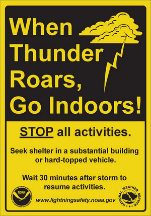
Lightning Warning Sign - When Thunder Roars, Go Indoors
Protecting yourself and your family from the dangers of lightning can be summed up in one phrase: When Thunder Roars, Go Indoors

Colorado is starting its annual Lightning Safety and Wildfire Awareness Week, an important opportunity to educate residents of the dangers lightning presents.  One statistic serves to highlight the very real hazard of lightning in Colorado – the Centennial State ranks as the second deadliest state for lightning fatalities in the nation.

We oftentimes read about the results of lightning strikes in our weekly look at Denver weather history.  They spark wildfires, cause property damage and injuries and in some cases result in death.  From 2001 to 2010 26 people were killed by lightning in Colorado – second only to Florida.

Each day during the National Weather Service’s Lightning Safety and Wildfire Awareness Week a new message is publicized covering a range of topics.  From lightning safety to the science of lightning, residents can learn more about this very real danger.

The following is the introductory message from the National Weather Service for this year with links to more information.  Education is key to protecting you and your family and we encourage you to study these pages and remember – When Thunder Roars, Go Indoors!

From the National Weather Service:

PUBLIC INFORMATION STATEMENT
NATIONAL WEATHER SERVICE BOULDER CO
600 AM MDT Sun Jun 24 2021

The governor of Colorado has declared the week of June 24 through June 30 as Colorado Lightning Safety Awareness Week. Lightning strikes the ground in our state over a half million times each year and with many of us participating in outdoor activities, we need to learn how to protect ourselves from lightning hazards.

Lightning is also responsible for about half of the wildfires in Colorado each year. When lightning or other conditions are conducive to a high wildfire threat, the National Weather Service will issue Fire Weather Watches or Red Flag Warnings.

During this week a series of statements will cover a variety of topics related to lightning and wildfires.

Monday…Lightning Overview for Colorado
Tuesday…The Science of Lightning
Wednesday…Outdoor lightning safety
Thursday…Indoor lightning safety
Friday…Lightning medical issues for survivors
Saturday…Lightning and wildfires

Here are a couple web sites that contain additional lightning information.

NOAA`s lightning website which contains abundant information on lightning safety can be found at:  www.lightningsafety.noaa.gov

Lightning information specific for the State of Colorado can be found at: www.weather.gov/pub/lightning

Steve Hodanish
Senior Forecaster
NWS Pueblo, CO

Colorado Flood Safety and Wildfire Preparedness Week in Review

Colorado Flood Safety and Wildfire Preparedness
Colorado Flood Safety and Wildfire Preparedness Week, March 15 – 21, 2015.

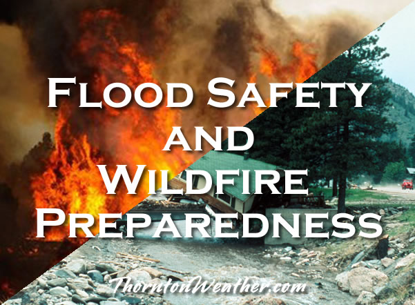
Floods and wildfires are arguably the two most common disasters Coloradans face with numerous such events occurring each year.  To better prepare residents for the danger of these disasters, this week is Colorado Flood Safety and Wildfire Preparedness Week.
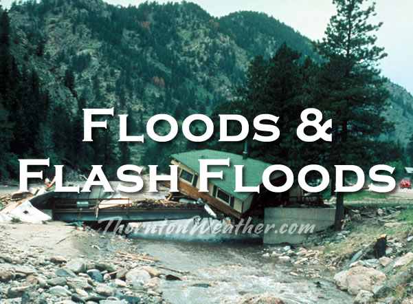
Each day this week the National Weather Service will be posting public information statements covering a number of different topics about floods and wildfires.  These important messages should be required reading for all Coloradans so they know what to do to prepare for these events and handle them when they occur.

ThorntonWeather.com will be posting each of these messages as a service to our readers.  The first of these messages is below.  Check back each day this week for further topics.

PUBLIC INFORMATION STATEMENT
NATIONAL WEATHER SERVICE GRAND JUNCTION CO
600 AM MDT SAT MARCH 13 2021

…COLORADO FLOOD SAFETY AND WILDFIRE PREPAREDNESS WEEK IN REVIEW…

Colorado has more than its fair share of floods, flash floods, and wildfires. During the past week, in our effort to build a Weather-Ready Nation, we have presented information to you on how to stay safe and minimize property damage during flood and wildfire threats.

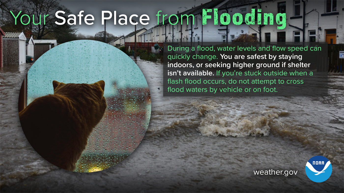
When a flash flood warning is issued for your area, you need to quickly move to higher ground out of drainages or other low spots. It may be just a short run or climb to that higher ground.

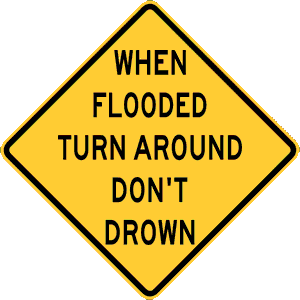
Nearly half of all flash flood fatalities occur in vehicles. Do not drive through a flooded roadway. Instead turn around…do not drown. The water may be much deeper than you think, because it may not be possible to see below the surface of flood waters that the roadway has been washed away. One to two feet of water will carry away most vehicles. Additional flood safety information can be found at www.floodsafety.noaa.gov

Areas burned by wildfires are highly susceptible to flash floods, especially within the first two or three years after the wildfire has occurred. Wildfires by themselves destroy much property and occasionally result in fatalities within Colorado. There are actions you can take to protect yourself and minimize the wildfire threat to your property.

If you live near or within a forest or rangeland, you are encouraged to make a defensible space around your home and other structures. Information on how to make a defensible space around your home can be found on the Colorado State Forest Service website at http://csfs.colostate.edu/pages/defensible-space.html

River flooding from snowmelt or persistent rainfall can cause extensive damage to property. There are estimated to be 65 thousand homes and 15 thousand commercial, industrial, and business structures in identified floodplains within Colorado. FEMA has online maps that show if you are in a flood risk area. To access those maps, go to https://msc.fema.gov

If you live in a flood prone area, buying flood insurance is the best thing you can do to protect your home, your business, your family and your financial security. To find an insurance agent and obtain other flood insurance information, go to FEMA’s National Flood Insurance Program web site at www.floodsmart.gov

As a reminder, there is generally a 30-day waiting period from the time a flood insurance policy is purchased to when it goes into effect.

Additional information on floods and wildfires is available from your local National Weather Service web sites…

http://www.weather.gov/denver NWS Denver/Boulder web site
http://www.weather.gov/pueblo NWS Pueblo web site
http://www.weather.gov/goodland NWS Goodland web site
http://www.weather.gov/gjt NWS Grand Junction web site


Colorado Flood Safety and Wildfire Preparedness Week

Wildfire Safety and Mitigation – Colorado Flood Safety and Wildfire Preparedness Week

WildfiresFloods and wildfires are arguably the two most common disasters Coloradans face with numerous such events occurring each year.  To better prepare residents for the danger of these disasters, this week is Colorado Flood Safety and Wildfire Preparedness Week.
Each day this week the National Weather Service will be posting public information statements covering a number of different topics about floods and wildfires.  These important messages should be required reading for all Coloradans so they know what to do to prepare for these events and handle them when they occur.

ThorntonWeather.com will be posting each of these messages as a service to our readers.  Please check back daily for a new topic.

PUBLIC INFORMATION STATEMENT
NATIONAL WEATHER SERVICE GRAND JUNCTION CO
600 AM MDT FRI MARCH 12 2021

…WILDFIRE SAFETY AND MITIGATION…

During this Colorado Flood Safety and Wildfire Preparedness Week we have discussed floods, flash floods, and how to stay safe when flooding threatens. We also told you that areas burned by wildfires are highly susceptible to flash floods within the first two or three years after the wildfire.

Today we will provide you with information about wildfire safety and mitigation that could save your life and minimize destruction to your personal property.

Colorado experienced some very devastating wildfires in 2013, including the Black Forest Fire, the Royal Gorge Wildfire, and the West Fork Complex which burned over a hundred thousand acres of forest. Two people were killed and over five hundred houses and other buildings were destroyed from the Black Forest Wildfire.

All wildfires need fuel to burn, typically in the form of dry vegetation, as often occurs in forests, grasslands, and cured wheat fields. Tragically, some wildfires also kill people and destroy homes, vehicles, and other personal property. If you live near or within a forest, grassland, or wheat field, there are some actions you can take to minimize your vulnerability to wildfires.

If you are a homeowner, the first defense against wildfires is to create and maintain a defensible space around your home. Defensible space is the area around a home or other structure where fuels and vegetation are treated, cleared or reduced to slow the spread of wildfire. Creating wildfire-defensible zones also reduces the chance of a structure fire spreading to neighboring homes or the surrounding forest. Defensible space also provides room for firefighters to do their jobs when fighting a wildfire.

More information on how to make a defensible space around your home can be found on the Colorado State Forest Service website at http://csfs.colostate.edu/pages/defensible-space.html

During periods of extreme fire danger in forests and rangelands…

…you should avoid being in areas where you might become trapped by a wildfire.

…you should avoid the use of matches or anything else which could ignite a fire.

…make sure that hot parts of motorized equipment, such as mufflers, are not allowed to come in contact with dry grasses or other potentially flammable material.

If you become trapped or cut off by a wildfire, seek shelter in areas with little or no fuel, such as rock slide areas or lakes.

For more information on wildfires and fire safety, please check out the following web addresses…

http://www.srh.noaa.gov/ridge2/fire/

Colorado State Forest Service


http://www.ready.gov/wildfires
http://www.nifc.gov

Colorado Flood Safety and Wildfire Preparedness Week continues through this Saturday.

JIM PRINGLE
WARNING COORDINATION METEOROLOGIST
WFO GRAND JUNCTION CO

Colorado Flood Safety and Wildfire Preparedness Week

Wildfire Awareness – Colorado Flood Safety and Wildfire Preparedness Week

WildfiresFloods and wildfires are arguably the two most common disasters Coloradans face with numerous such events occurring each year.  To better prepare residents for the danger of these disasters, this week is Colorado Flood Safety and Wildfire Preparedness Week.
Each day this week the National Weather Service will be posting public information statements covering a number of different topics about floods and wildfires.  These important messages should be required reading for all Coloradans so they know what to do to prepare for these events and handle them when they occur.

ThorntonWeather.com will be posting each of these messages as a service to our readers.  Please check back daily for a new topic.

PUBLIC INFORMATION STATEMENT
NATIONAL WEATHER SERVICE BOULDER CO
600 AM MDT THU MARCH 11 2021

…Wildfire in Colorado…where do you get your information…

A mixture of large and small wildfires occurred across Colorado in 2018. These fires were due to a mixture of dry conditions, combined with gusty, warm winds and, sometimes, careless fire prevention efforts. There were instances when residents had to be evacuated as a large wildfire moved toward larger communities. Would you know what to do to protect yourself and your loved ones in this situation? In addition, if you live in an area that is susceptible to wildfires, how can you prepare yourself and your home?

To assist in your preparation for fire…the National Weather Service provides a variety of fire weather forecast products. Twice a day in Colorado…fire weather planning forecasts are made from each weather service office serving the state.

A Fire Weather Watch may be issued if in the next 12 to 48 hours the forecast includes gusty winds of 25 mph or greater…relative humidities of less than 15 percent for at least three hours, dry lightning, or a combination of weather and fuel conditions that may make large wildfires possible.

A Red Flag Warning will be issued if these same critical fire conditions are forecast within the next 24 hours. Both Fire Weather Watches and Red Flag Warnings are issued in coordination with land management agencies.

The fire weather spot program supports land management agencies for both prescribed burns and for wildfires. A fire weather spot forecast is a detailed forecast for an individual fire. For national type 2 or type 1 fires the National Weather Service will detail an IMET…incident meteorologist to a fire team to provide onsite weather support and detailed fire forecasts.

If you live in the urban interface there are a number of actions you can take to reduce your personal fire threat including reducing vegetation near the home and putting a fire resistant roof on your home. More information is available from your National Weather Service at: http://www.nws.noaa.gov/om/fire or from your Department of Homeland Security at: http://www.ready.gov/wildfires.

When a fire occurs, there may be years of increased flood threat on the burn scar, as a healthy forest can handle an inch to inch and a half of rain with no flood risk. Once the litter and vegetation is removed by fire…as little as a half inch of rain in a short period can cause serious and possibly life threatening flooding.

Colorado Flood Safety and Wildfire Preparedness Week continues through this Saturday

Colorado Flood Safety and Wildfire Preparedness Week

Flash Flooding – Colorado Flood Safety and Wildfire Preparedness Week

Floods and Flash FloodsFloods and wildfires are arguably the two most common disasters Coloradans face with numerous such events occurring each year.  To better prepare residents for the danger of these disasters, this week is Colorado Flood Safety and Wildfire Preparedness Week.

Each day this week the National Weather Service will be posting public information statements covering a number of different topics about floods and wildfires.  These important messages should be required reading for all Coloradans so they know what to do to prepare for these events and handle them when they occur.

ThorntonWeather.com will be posting each of these messages as a service to our readers.  Please check back daily for a new topic.

PUBLIC INFORMATION STATEMENT
NATIONAL WEATHER SERVICE PUEBLO CO
600 AM MDT WED MARCH 10 2021

Today’s topic during this Flood Safety and Wildfire Preparedness week is flash floods.

Flash floods are no strangers to Colorado. Since the year 1900, nearly 300 people have been killed in flash floods across the Centennial state.

In terms of lives lost, the worst flash flood occurred on July 31, 1976 in the Big Thompson Canyon between Estes Park and Loveland. A nearly stationary storm produced around 12 inches of rain in 4 hours, claiming 144 lives.

Three other notable flash floods in Colorado were:

In 1904, just north of Pueblo, a bridge failed and around 100 people drowned when a passenger train plunged into Fountain Creek.

The 1997 Fort Collins episode drowned 5 people and caused 200 million dollars of property damage.

In 2013, 9 people drowned during the historic September rain episode, which was a combination of flash floods and river floods. These floods were much more extensive than the Big Thompson Canyon flood of 1976, but because of timely and accurate warnings, many people stayed out of harms way and lives were saved.

A flash flood is defined as a rapid rise in water levels, generally occurring in less than 6 hours, along large creeks, normally dry washes, arroyos, or over normally dry land areas, and can occur with little advanced notice.

Flash floods frequently result from high rainfall rates, and infrequently result from dam failures, levee failures, or sudden breaks in river ice jams. Flash floods are very destructive, due to the force of the moving water, and the accompanying debris. This tremendous force can easily damage or destroy roadways, bridges, and buildings.

In recent years, Colorado has seen major flooding and damage when heavy rains have occurred on wildfire burn scar areas. If you are in or near a burn scar area, you need to plan ahead. Be aware of general flash flood plans and procedures that have been developed and implemented by your local emergency management officials. You should know your flash flood risks, and make your plans to save your life and those around you.

The National Weather Service forecast offices will discuss flash flood potential in daily hazardous weather outlooks, and in graphical weather stories on National Weather Service forecast office web sites.

During days when flash flooding is possible a Flash Flood Watch will be issued.

During days when flash flooding is likely or occurring, a Flash Flood Warning will be issued.

When a Flash Flood Warning is issued for your area, you need to act quickly if you are in a drainage area or in other low spots. Know your escape routes to higher ground and act as quickly as possible. It may be just a short walk or climb to that higher ground.

Many flash flood deaths occur in vehicles. Do not drive through a flooded roadway. The water may be much deeper than you think, because the roadway may be damaged or washed away. One to two feet of water will carry away most vehicles. Instead turn around, do not drown.

For more information on flood safety go to…

http://www.floodsafety.noaa.gov

Colorado Flood Safety and Wildfire Preparedness Week

Long Time Frame Flooding – Colorado Flood Safety and Wildfire Preparedness Week

Floods and Flash FloodsFloods and wildfires are arguably the two most common disasters Coloradans face with numerous such events occurring each year.  To better prepare residents for the danger of these disasters, this week is Colorado Flood Safety and Wildfire Preparedness Week.

Each day this week the National Weather Service will be posting public information statements covering a number of different topics about floods and wildfires.  These important messages should be required reading for all Coloradans so they know what to do to prepare for these events and handle them when they occur.

ThorntonWeather.com will be posting each of these messages as a service to our readers.  Please check back daily for a new topic.

PUBLIC INFORMATION STATEMENT
NATIONAL WEATHER SERVICE PUEBLO CO
600 AM MDT TUESDAY MARCH 9 2021

Today’s topic during this Colorado Flood Safety and Wildfire Awareness Week is flooding which develops in the time frame of longer than 6 hours to several days. Floods in Colorado can result from snow melt, ice jams, a combination of snow melt and heavy rain, or just heavy rain. National Weather Service forecast offices in Colorado closely collaborate with regional River Forecast Centers that monitor the Colorado River, South Platte River, Arkansas River, and Rio Grande to come to a consensus on the likelihood of flooding along rivers and large creeks.

The National Weather Service will discuss flood potential in hydrologic outlooks, daily hazardous weather outlooks, and in graphical weather stories on National Weather Service forecast office websites.

Hydrologic statements may be issued for high flows that are within the banks of a river or large creek.

When flooding is possible on a river or large creek, a Flood Watch will be issued, meaning flooding is possible within the designated watch area.

When flooding is likely or occurring on a river or large creek, a Flood Warning will be issued, meaning flooding is expected or has been reported at designated river forecast points.

Flood Advisories may be issued for minor flooding on rivers and creeks.

An Areal Flood Warning may also be issued for flooding on a river or large creek in areas away from the designated river forecast points.

You can easily monitor potential flooding along rivers in Colorado and large creeks using the Advanced Hydrologic Prediction Service monitoring system. Information on this monitoring system can be obtained from this web site: https://water.weather.gov/ahps2

This monitoring system can be accessed on Colorado National Weather Service forecast office websites by clicking Rivers and Lakes.

At each river and large creek gauge you can easily look at current and forecast water levels, flood categories, historic crests, and flood impacts. Probabilities of exceedance of certain water levels by week or over the long term are also available.

In general, there will be some time to prepare for river and large creek flooding, and emergency management in your area has plans in place to address flooding issues. Know these plans and how you should act accordingly when Flood Watches and Flood Warnings are in effect.

For more information on flood safety go to… http://www.floodsafety.noaa.gov

Colorado Flood Safety and Wildfire Preparedness Week

Types of Floods – Colorado Flood Safety and Wildfire Preparedness Week

Floods and Flash FloodsFloods and wildfires are arguably the two most common disasters Coloradans face with numerous such events occurring each year.  To better prepare residents for the danger of these disasters, this week is Colorado Flood Safety and Wildfire Preparedness Week.

Each day this week the National Weather Service will be posting public information statements covering a number of different topics about floods and wildfires.  These important messages should be required reading for all Coloradans so they know what to do to prepare for these events and handle them when they occur.

ThorntonWeather.com will be posting each of these messages as a service to our readers.  Check back each day for a new topic.

PUBLIC INFORMATION STATEMENT
NATIONAL WEATHER SERVICE BOULDER CO
600 AM MDT MON MARCH 8 2021

Flooding can be a major problem in Colorado as we experienced in September 2013. Heavy rain fell over a large area of the foothills south to the Pikes Peak Region, resulting in flash flooding. Much of the water that fell across northeast Colorado eventually ended up in the South Platte River, with major river flooding having occurred from Greeley to the state line.

River flooding can result from heavy rain during the summer and from rapid snow melt or thunderstorm rain combining with runoff from melting snow. Flash flooding refers to a dangerous sudden rise in water within an urban area, in a canyon, or along a creek or wash over normally dry land area. Flash floods result from heavy rainfall, sudden breaks in river ice jams, and dam or levee failures.

Flash floods can occur within a few minutes or hours, and can move at surprisingly high speeds, striking with little warning. Flash floods are quite destructive because of the force of the moving water, and the debris that accumulates in flood waters, such as trees and boulders, which can destroy roadways, bridges and buildings.

Another complication in Colorado is the serious flooding that can result when heavy rain falls on recently burned areas. Anyone living downstream from a recently burned area should be aware of the changed conditions, which result in much faster, turbulent, debris and ash clogged waters from the burned area.

The National Weather Service will discuss flood and flash flood potential in daily Hazardous Weather Outlooks and in the graphical weather story on National Weather Service websites. On days with a high threat for flooding, you may hear of a Flash Flood or Flood Watch, which means that flash flooding or flooding is possible within the watch area.

A Flood Warning means that flooding is imminent or has been reported along a river.

A Flash Flood Warning means that flash flooding has been reported or is imminent.

When a Flash Flood Warning is issued for your area, act quickly. If advised to evacuate, do so immediately. Go to higher ground or climb to safety before access is cut off by flood waters. Go Up, Not Out. Nearly half of all flash flood fatalities are vehicle related. Do not enter a flooded roadway, instead Turn Around…Don’t Drown. In rapidly rising waters, backing up away from water would be safer. One to two feet of water will carry away most vehicles, and you also cannot tell if the road is damaged beneath the water.

More information on flooding hazards can be found on the National Weather Service Flood Safety page here.

Colorado Flood Safety and Wildfire Preparedness Week continues through this Saturday.

Colorado Flood Safety and Wildfire Preparedness Week

Colorado Flood Safety and Wildfire Preparedness Week begins

Colorado Flood Safety and Wildfire Preparedness
Colorado Flood Safety and Wildfire Preparedness Week, March 3 – 9, 2019.

Floods and wildfires are arguably the two most common disasters Coloradans face with numerous such events occurring each year.  To better prepare residents for the danger of these disasters, this week is Colorado Flood Safety and Wildfire Preparedness Week.

Each day this week the National Weather Service will be posting public information statements covering a number of different topics about floods and wildfires.  These important messages should be required reading for all Coloradans so they know what to do to prepare for these events and handle them when they occur.

ThorntonWeather.com will be posting each of these messages as a service to our readers.  The first of these messages is below.  Check back each day this week for further topics.

PUBLIC INFORMATION STATEMENT
NATIONAL WEATHER SERVICE BOULDER CO
600 AM MDT SUN MARCH 7 2021

Flood and wildfire season is approaching. The National Weather Service Offices in Colorado have joined with Colorado Governor Jared Polis to declare March 7 to 13 Colorado FLOOD SAFETY AND WILDFIRE AWARENESS WEEK. Use the information provided during the coming days to help understand your risks from floods and wildfire and make your plans to be prepared.

The National Weather Service wants everyone in the United States to be part of a Weather-Ready nation. Colorado has more than its fair share of floods, flash floods, and wildfires. You should be weather alert and weather-ready, knowing how to stay safe when floods and wildfires affect your area.

Floodprone areas have been identified in over 250 cities and towns and in all 64 counties in Colorado. Over 250 thousand people live in floodplains in Colorado. There are estimated to be 65 thousand homes and 15 thousand commercial, industrial, and business structures in identified floodplains. There are likely many more structures located within unmapped flood hazard areas. The value of the property, structures, and contents located in the identified floodplains is estimated to be around 15 billion dollars.

Floods and flash floods have killed over 400 people in Colorado since the turn of the 20th century. The historic weather pattern of September 2013 reminds us all that floods are a major concern across the Centennial state. Floods have caused billions of dollars of damage in Colorado.

On average, 2500 wildfires occur across Colorado each year. Since 2012, 8 people have been killed when wildfires occurred in the wildland-urban interface.

The National Weather Service forecast offices which serve Colorado will issue a series of public information statements during this Colorado Flood Safety and Wildfire Awareness Week…covering the following topics:

Sunday…Introduction to the week
Monday…Flood watches and warnings
Tuesday…River floods
Wednesday…Flash floods
Thursday…Fire forecasts…watches…and warnings
Friday…Wildfire safety and mitigation
Saturday…Review of the week

More information on floods and wildfires is available at your local National Weather Service web sites…

http://www.weather.gov/denver NWS Dnver/Boulder web site
http://www.weather.gov/pueblo NWS Pueblo web site
http://www.weather.gov/goodland NWS Goodland web site
http://www.weather.gov/gjt NWS Grand Junction web site

Colorado Flood Safety and Wildfire Preparedness Week

National Weather Service announces storm spotter training dates for 2020

On June 3, 1981 a tornado struck Thornton in what is the worst twister to have struck the Denver metro area. Are you ready should disaster strike again? Image courtesy the City of Thornton archives.

Severe weather is a fact of life in Colorado – from blizzards to tornadoes we can and do see it all.  Each year the weather is responsible for claiming lives in our state and across the nation and the threat is very real.  Storm spotter training allows you to learn how to protect yourself and your family while providing a public service.

Education is key to knowing how to protect you and your family.  Whether you want to be an official storm spotter or maybe just want to learn more about severe weather, storm spotter training can provide you an incredible opportunity to learn.

The National Weather Service Denver / Boulder office has announced a series of Skywarn storm spotter training dates for Colorado for the 2020 season.

The storm spotter program is a nationwide program with more than 280,000 trained spotters.  These volunteers report weather hazards to their local National Weather Service office providing vital information when severe strikes.  Data from spotters include severe wind, rain, snow measurements, thunderstorms and hail and of course tornadoes.

Storm spotters are part of the ranks of citizens who form the Nation’s first line of defense against severe weather. There can be no finer reward than to know that their efforts have given communities the precious gift of time–seconds and minutes that can help save lives.

By completing one of these training classes you can become an official storm spotter.  When severe weather strikes, you can report it by calling a special toll free number or submit your report via the National Weather Service’s website.

These are great sessions for anyone wanting to learn more about the severe weather we experience in Colorado, whether you want to be an official spotter or not.  All training is free.  Topics include:

  • Basics of thunderstorm development
  • Fundamentals of storm structure
  • Identifying potential severe weather features
  • Information to report
  • How to report information
  • Basic severe weather safety

To learn more about the program, see here: http://www.crh.noaa.gov/bou/awebphp/spotter.php

Below are the dates, times and locations announced thus far.  The embedded calendar should automatically update with new dates and changes but be sure to check the National Weather Service site for the latest.


–>

National Weather Service announces storm spotter training dates for 2019

On June 3, 1981 a tornado struck Thornton in what is the worst twister to have struck the Denver metro area. Are you ready should disaster strike again? Image courtesy the City of Thornton archives.

Severe weather is a fact of life in Colorado – from blizzards to tornadoes we can and do see it all.  Each year the weather is responsible for claiming lives in our state and across the nation and the threat is very real.  Storm spotter training allows you to learn how to protect yourself and your family while providing a public service.

Education is key to knowing how to protect you and your family.  Whether you want to be an official storm spotter or maybe just want to learn more about severe weather, storm spotter training can provide you an incredible opportunity to learn.

The National Weather Service Denver / Boulder office has announced a series of Skywarn storm spotter training dates for Colorado for the 2019 season.

The storm spotter program is a nationwide program with more than 280,000 trained spotters.  These volunteers report weather hazards to their local National Weather Service office providing vital information when severe strikes.  Data from spotters include severe wind, rain, snow measurements, thunderstorms and hail and of course tornadoes.

Storm spotters are part of the ranks of citizens who form the Nation’s first line of defense against severe weather. There can be no finer reward than to know that their efforts have given communities the precious gift of time–seconds and minutes that can help save lives.

By completing one of these training classes you can become an official storm spotter.  When severe weather strikes, you can report it by calling a special toll free number or submit your report via the National Weather Service’s website.

These are great sessions for anyone wanting to learn more about the severe weather we experience in Colorado, whether you want to be an official spotter or not.  All training is free.  Topics include:

  • Basics of thunderstorm development
  • Fundamentals of storm structure
  • Identifying potential severe weather features
  • Information to report
  • How to report information
  • Basic severe weather safety

To learn more about the program, see here: http://www.crh.noaa.gov/bou/awebphp/spotter.php

Below are the dates, times and locations announced thus far.  The embedded calendar should automatically update with new dates and changes but be sure to check the National Weather Service site for the latest.


–>