Category Archives: National Weather

Forecasters increase chances for hurricane activity during second half of season

The 2012 Atlantic hurricane season has been a relatively active one although not particularly notable. NOAA forecasters have updated their outlook for the season though and are cautioning that hurricane activity may soon increase in the basin.  Read the rest of this story on Examiner.com

Tropical Storm Ernesto is seen lashing the Yucatán Peninsula on August 8, 2012.
Tropical Storm Ernesto is seen lashing the Yucatán Peninsula on August 8, 2012. (NASA)


NOAA: July 2012 goes into record books as hottest month ever for United States

Sweltering, unseasonably warm temperatures gripped much of the contiguous United States last month breaking many records. In the final analysis of the month, NOAA announced that July was the hottest month ever recorded in the U.S.  How hot was it?  Read the rest of this story on Examiner.com

Much of the Lower 48 states saw above average temperatures during July 2012.  Click the image to view the story and slideshow.
Much of the Lower 48 states saw above average temperatures during July 2012. Click the image to view the story and slideshow. (NOAA)

Smoke from northwestern United States wildfires blankets neighboring Colorado

The Mile High City found itself in a bit of a haze yesterday that continues into today as smoke from wildfires to Colorado’s northwest moves into the state. Dozens of fires are burning across the region and while none have been as devastating as those seen in recent months, their effects are being felt far and wide. Read the rest of this story and view satellite imagery of the smoke plume on Examiner.com.

A shocking broadcast: Lightning strikes TV studio during weather forecast

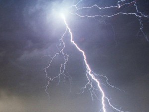
Lightning strike (NOAA)The old saying says not to mess with Mother Nature and she apparently wanted to drive that point home in Boston yesterday.  During a live weather forecast on WBZ-TV yesterday a lightning strike knocked the lights out in the studio.

Thunderstorms rolled through much of the northeastern United States yesterday.  The storms brought heavy rain, strong wind and plenty of lightning.

Ironically Chief Meteorologist Todd Gutner was discussing those exact weather conditions when the bolt hit.

Following the boom of thunder and a burst of static the lights went out and some of the displays flickered.  Amazingly enough the station was able to continue broadcasting and Gutner finished his forecast, albeit a bit in the dark.

Check out the video below.

Weather warnings and disaster alerts now being delivered to mobile phones

The next time severe weather strikes, don’t be surprised to receive a message on your cellular phone from Uncle Sam warning you of the danger. A new service launched by NOAA’s National Weather Service and the nation’s wireless service providers has begun sending out weather warnings to mobile phones.  Get more details on this new potentially life-saving system on Examiner.com.  Remember too that ThorntonWeather.com offers severe weather alerts via email.

The Wireless Emergency Alerts (WEA) system takes the system into the 21st century giving targeted alerts for weather, natural disasters, AMBER alerts and even alerts from the President of the United States.


Weather Channel purchase of Weather Underground stirs passions, controversy

In big news for the commercial weather industry, The Weather Channel recently announced it was buying competing weather website Weather Underground. Reaction to the merger of the nation’s most commercial weather company and the nation’s first commercial weather website was swift and not very supportive.

Here at ThorntonWeather.com we are big fans of the Weather Undergound (despite their co-founder’s global warming alarmism).  As for The Weather Channel, we pretty much ignore them.

Find out more about this business deal and why many are unhappy about it.

The Weather Channel's Jim Cantore reports during Hurricane Irene in 2011. TWC's purchase of Weather Underground has been met with storms as well. (Getty Images)

Military and firefighting community mourn loss of C-130 crew members

Wildfires are dangerous in and of themselves and fighting them is even more hazardous, a deadly reminder of which occurred Sunday night. A North Carolina Air National Guard C130 Hercules fighting a fire in South Dakota crashed while making a retardant drop killing at least three crew members.  Read the rest of this story on Examiner.com.

Another Colorado wildfire: Pine Ridge Fire forces evacuations, closes highway

Just as firefighters finally seemed to be gaining ground on massive fires along the Colorado Front Range, a new fire has erupted on the state’s Western Slope. The Pine Ridge Fire in De Beque Canyon has forced some area residents to evacuate and temporarily closed Interstate 70.  Read the rest of this story on Examiner.com and be sure to check out the amazing photos.


NASA’s newest climate and weather satellite captures stunning ‘blue marble’

When NASA launched the National Polar-orbiting Operational Environmental Satellite System Preparatory Project, or NPP, in October, it ushered in a new generation of climate and weather satellites.  The school bus size spacecraft is now securely in polar orbit making 14 passes over the Earth each day.

The five main instruments are critical to enhancing not only short term weather forecasting but also in aiding long term climate modeling.  NASA has performing an initial checkout of the craft and its instruments, a process which will take several  more weeks before it begins its regular science mission.

This week NASA released an astounding ‘blue marble’ image captured by its Visible Infrared Imaging Radiometer Suite (VIIRS).  The image is a composite from multiple orbits of the spacecraft on January 4, 2012 showing much of North and Central America.

'Blue marble' image from NASA's NPP.
"This awe-inspiring image, released today by NASA, was taken by the the VIIRS instrument aboard NPP, the nation's newest polar-orbiting environmental satellite that was launched Oct. 28, 2011 (http://www.nesdis.noaa.gov/npp_launch.html). Renamed "Suomi NPP" in honor of the the late Verner E. Suomi of the University of Wisconsin (http://j.mp/Ahfvt9), the satellite will enable NOAA to continue issuing accurate forecasts and provide advanced warnings for severe weather, such as deadly tornado outbreaks, blistering heat waves, floods, snowfall and wildfires. This composite NASA image uses a number of swaths of the Earth's surface taken on January 4, 2012." (NASA)

Hurricane Irene set to become nation’s 10th billion dollar disaster of the year

Satellite imagery from NOAA shows Hurricane Irene, then a tropical storm, making landfall in New York City. (NOAA)
Satellite imagery from NOAA shows Hurricane Irene, then a tropical storm, making landfall in New York City. (NOAA) Click the image to view a slideshow on Examiner.com of Irene's impact.

The Atlantic’s first major hurricane struck the United States over the weekend becoming the first hurricane to make landfall in the country since 2008.  It adds to the nation’s tally of billion dollar disasters this year and leaves at least two dozen people dead in its wake.

As reported by the Natural Disasters Examiner, initial damage estimates put losses from the storm  at $7 billion.  Total losses including the economic impact may approach $20 billion.

More than the economic impact though is the human toll.  At latest count, at least 26 people were killed in the massive storm.  Eight states stretching from Florida to Connecticut saw citizens lose their lives.

For complete coverage of Hurricane Irene, check out the links from the Natural Disasters Examiner below: