Category Archives: Natural Disasters

2008 Atlantic hurricane season sets record

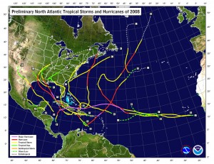
This image shows the tracks of hurricanes that occurred during the 2008 season.  Click for larger image.
This image shows the tracks of hurricanes that occurred during the 2008 season. Click for larger image.

Sunday, November 30th marks the close of the hurricane season and the National Oceanic and Atmospheric Administration says it was one for the record books.  The season marks one of the more active in the last 64 years overall and resulted in a record number of consecutive storms striking the United States.

According to Gerry Bell, Ph.D, the lead seasonal forecaster at NOAA, “This year’s hurricane season continues the current active hurricane era and is the tenth season to produce above-normal activity in the past 14 years.”  It is important to note however that comprehensive record keeping of hurricanes has only been occurring for the last 64 years so there is not a great deal of data to draw upon.

In all, a total of 16 named storms formed this season, eight of which were hurricanes.  Five of those were major hurricanes of category 3 strength or higher.  An average hurricane season has 11 named storms, six hurricanes and two major hurricanes.  In May at the start of the 2008 season, NOAA forecasters predicted 12 to 16 named storms and then in August upped their predictions to 14 to 18 named storms.  This represents the first time in recent years forecasters had accurately bracketed the number of storms.  In 2007 NOAA predicted 10 hurricanes and only six formed. The year prior, 2006, nine hurricanes were forecasted by NOAA but only five formed.  In 2005, the year Hurricane Katrina devastated New Orleans in the worst U.S. natural disaster, the forecasts underestimated storm activity.

2008 ties as the fourth most active season in terms of named storms (16) and major hurricanes (5).  It also tied as fifth most active in terms of hurricanes overall (8) since 1944. 

From NOAA, most notably:

For the first time on record, six consecutive tropical cyclones (Dolly, Edouard, Fay, Gustav, Hanna and Ike) made landfall on the U.S. mainland and a record three major hurricanes (Gustav, Ike and Paloma) struck Cuba. This is also the first Atlantic season to have a major hurricane (Category 3) form in five consecutive months (July: Bertha, August: Gustav, September: Ike, October: Omar, November: Paloma).

Bell attributes the active season to ongoing increased activity since 1995, lingering La Nina effects and warmer tropical Atlantic Ocean effects.

Here is a fascinating video from NOAA using satellite imagery of the entire hurricane season:

Remote control hurricane hunters set to deploy

NASA uses unmanned UAVs as hurricane hunters.

Anyone who has followed the wars in Iraq or Afghanistan has heard about the use of Unmanned Aerial Vehicles (UAV).  These are essentially remote control airplanes capable of performing a number of tasks from surveillance to actually carrying weapons. 

NASA and NOAA have over the last year been experimenting with a small UAV from Aerosonde, an Australian manufacturer.  NOAA currently uses manned hurricane hunter aircraft (WP-3D Orion and Gulfstream IVs) to take measurements from inside and immediately surrounding hurricanes.  This data is essential to not only predicting hurricane paths and guaging the storms’ strength but also to learning more about them. 

These new UAVs offer many advantages over the traditional, manned hurricane hunter aircraft.  For one, they can fly at much lower altitudes into the storms without endangering human lives.  Further, they can be called into service on much shorter notice than a manned crew and remain on station around a storm for longer periods of time.  In November of 2007 NOAA sent an Aerosonde UAV into Hurricane Noel and the unit was airborne for over 17 hours and collected more than seven hours worth of data. 

The technology has many applications within NOAA’s mission of monitoring our globe.  In addition to hurricane hunting, UAVs can be used to monitor ice flows, wildfires, severe weather, animal life and much more.  The program is really just getting started and funding is minimal in comparison to the military equivalent but the applications are very promising.  Maybe a tornado hunter is next!

Here’s a video from Aerosonde discussing the potential applications.

Hurricane Ike makes landfall; Fear for what daybreak will bring

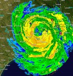
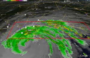
Houston radar image as of 3:45am MDT on Saturday, September 13 as Hurricane Ike moves ashore. The eye of the storm is about 17 miles east of the city.  Click for larger image.
Houston radar image as of 3:45am MDT on Saturday, September 13 as Hurricane Ike moves ashore. The eye of the storm is about 17 miles east of the city. Click for larger image.

The eye of Hurricane Ike made landfall Saturday morning as a category 2 storm with winds of 110 mph at 1:10am MDT.  Long before that though the effects of the storm were being felt as the winds and storm surge began to batter Galveston Island and the Texas coast.  Now the waiting for daybreak begins as no one is sure exactly what will be found once daylight comes.

The sheer size of this massive storm has wreaked havoc across much of the Texas and Louisiana coast.  Measuring 900 miles wide, Ike’s tropical storm-force winds extended out to 275 miles – effectively the length of the Texas coastline – from its center.  Evacuation orders were issued for over 1 million people but tens of thousands are expected to have taken the chance and tried to ride the storm out raising fears of potentially massive counts of dead.  Area officials were telling those that stay behind to write their social security numbers on their arms so their bodies could be identified in the worst case scenario. 

Satellite image of the continental United States at 3:45am MDT on Saturday, September 13 as Hurricane Ike moves ashore. You can see the massive size of the storm.  Click for larger image.
Satellite image of the continental United States at 3:45am MDT on Saturday, September 13 as Hurricane Ike moves ashore. You can see the massive size of the storm. Click for larger image.

The Galveston County Office of Emergency Management has said on its website, “Much of the Galveston Island is currently flooded and there are several fires in that area.”  Emergency management officials have reported receiving numerous calls asking for help but rescuers will be unable to aid anyone for hours until the storm subsides.  In perhaps one of the most dramatic moments, early yesterday evening a distress call was received from a 584-foot Cyprus-flagged freighter that was adrift without power 90 miles from the center of the storm.  The Coast Guard sent planes and helicopters to attempt a resuce of the 22 people on board but were forced to turn back due to the conditions.  The ship was told they would simply have to ride it out. 

Now the world waits for daybreak to see what sort of devastation Ike has brought to Texas.

As Gustav winds down, Hanna and Ike spool up

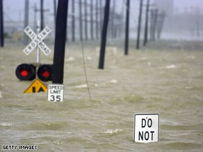
Water from the Industrial Canal floods a road in New Orleans after Hurricane Gustav made landfall Monday. Image courtesy Getty Images.

A weakend Hurricane Gustav came ashore Monday morning shutting down power and swamping much of the Gulf Coast with torrential rain.  Initially making landfall as a category 2 storm, by 3:00pm MDT the storm had lost much of its power and was downgraded to a category 1 system with winds of 80 mph. 

Much of the Louisiana and Mississippi coast lines were subject to extensive rains and high storm surge.  Winds pushed the water over many levees but the Army Corps of Engineers reported no major problems.  The largest provider of electric power in Louisiana, Entergy, said more than 700,000 homes and businesses were without power in the region. 

The Federal Emergency Management Agency (FEMA) reported two Navy boats, each about 350 feet long, that were being scrapped at a facility on the canal broke away from their moorings Monday. They are currently pinned against a wharf in the Industrial Canal but there is concern that should they move they could strike some of the canal walls. 

Much remains to determine the extent of damage from the storm.  The center of the storm is currently north of Lafaette, LA and steadily moving north.  As it does, it will weaken to a tropical storm tonight.

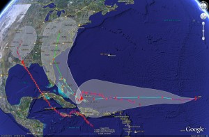
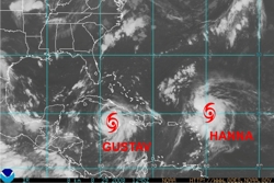
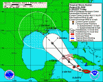
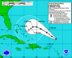
Satellite imagery of the potential tracks of Gustav, Hanna and Ike.  Click for larger version.
Satellite imagery of the potential tracks of Gustav, Hanna and Ike. Click for larger version.

A stark reminder that hurricane season is far from over is the appearance of two additional storms – Hurricane Hanna and Tropical Storm Ike.  Both will bear close watching over the coming days. 

Hanna became a category one hurricane today and as of 3:00pm MDT was  just east of Mayaguana Island in the southeastern Bahamas.  Hanna is expected to meander for a couple of days before making a turn to the northwest with a possible landing anywhere between southern Florida and the Carolinas late this week.   

Ike formed out of a tropical depression today and is currently in the middle of the Atlantic, 1400 miles east of the Leeward Islands moving west at 16 mph.  A warm ocean along Ike’s path is expected to help it reach hurricane strength in the next 36 hours.  It is still very early to tell where Ike will end up but on its current course, it could strike Cuba, the Bahamas and possibly Florida early next week.

Gustav ready to strike Monday AM

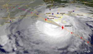
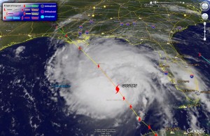
Satellite image of Gustav as of 5:00am MDT showing the storms predicted path.  Click for a larger version.
Satellite image of Gustav as of 5:00am MDT showing the storms predicted path. Click for a larger version.

Hurricane Gustav continues its march to the Louisiana coast Monday morning with landfall expected sometime between 5:00am and 7:00am MDT. At 5:00am MDT the eye of the hurricane was approximately 85 miles south of New Orleans and about 150 miles southeast of Layfayette moving at 16 mph.  Current tracks have it making landfall in the Terrebone / Lafourche areas, just to the east of New Orleans. 

**  Special Coverage:  Click here to view New Orleans radar  **

The good news, if there is any, is that Gustav has not strengthened as was originally expected.  The latest hurricane hunter aircraft report at 3:00am MDT reported sustained winds of 115 mph.  While that is still a category three storm, satellite observations show the storm is not as organized as it could be.  In fact, a station in southwest Pass Louisiana measured only 91mph as Gustav passed over it.  It is important to note that the greatest damage and danger associated with hurricanes is not the winds.  The severe rain, storm surge and the flooding associated with those present the greatest danger.  Rainfall of 6 to 12 inches can be expected and most notably storm surge of 10 to 14 feet. 

Radar image of Gustav showing current warnings and watches. Click for large version.

Also, one little known additional danger with hurricanes is that of the threat of tornadoes.  In fact, New Orleans and much of the surrounding area is under a Tornado Warning and some twisters have been reported by local law enforcement in Gulfport, MS.  Further, National Weather Service radar indicated the potential for tornadoes right near New Orleans in Jefferson Parish, Southern St. Charles Parish and Plaquemines Parish.

Here are a couple sites with webcams in Louisiana you may wish to check out:

Louisiana DOT

WWLTV.com

Gustav imagery via Google Earth

Below you will find the latest satellite imagery (as of 10:00am MDT) with tracking for Gustav generated with Google Earth.  For those that haven’t played with it, Google Earth is a very fun – and useful – program for any number of tasks.  Using it you can download place files with a wide variety of information including weather related items.  Here are a few links to get your started:

Hurricane Gustav image from Google Earth as of 10:00am MDT Sunday.
Hurricane Gustav image from Google Earth as of 10:00am MDT Sunday. Click on image for larger view.

Evacuations as Gulf Coast prepares for Hurricane Gustav

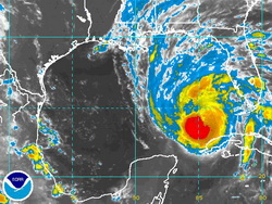
Satellite image of Hurrican Gustav as of 2:00am Sunday.

Residents along the Gulf Coast, particularly in Louisiana, are being ordered to evacuate as Hurricane Gustav bears down on the state.  With Hurricane Katrina still fresh on everyone’s mind, New Orleans is under a mandatory evacuation order and states all along the coast from Texas to Mississippi prepare for a possible hit from Gustav. 

National Hurricane Center forecasters were surprised by how quickly Gustav strengthened in recent days.  Within 24 hours the storm went from a tropical storm to a category 4 hurricane.  Gustav is currently a category 3 storm with sustained winds of 125 mph (gusting to 145 mph) and is expected to intensify in the next 12 hours, possibly reaching category 5 status for a time.  As of 3:00am MT Sunday the storm was 425 miles southeast of the mouth of the Mississippi River and heading northwest at 16 mph. 

By the time it makes landfall, forecasters expect it to be a category 3 storm, possibly a category 4.  The current forecast path for Gustav has it striking the central Louisiana coast with devastating results.  Storm surges of 18 to 25 feet on the eastern side of the hurricane are possible and 6 to 12 inches of rain may fall in Louisiana, southern Mississippi and southern Arkansas. 

John McCain and Sarah Palin await a determination on whether or not the RNC will proceed as scheduled.

In related news, the Republican National Committee was waiting to determine whether or not to proceed with its convention set to begin Monday it St. Paul, MN.  If it proceeds, it is unlikely President Bush would address  the delegates in person Monday as scheduled and would probably do so instead by video link.  John McCain in an interview with Chris Wallace of Fox News said, “It just wouldn’t be appropriate to have a festive occasion while a near-tragedy or a terrible challenge is presented in the form of a natural disaster.  So we’re monitoring it from day to day, and I’m saying a few prayers, too.”

For more information:

National Hurricane Center

2008 Republican National Convention

Hurricane season heats up with Gustav and Hanna

Satellite imagery of Gustav and Hanna.

Today, on the three year anniversary of Hurricane Katrina, preparations are underway along the Gulf Coast for the possibility that Tropical Storm Gustav will strike the region next week.  At 3:00am MDT Friday Gustav had tropical storm strength sustained winds of 65mph extending out 140 miles however it is fully expected to become a hurricane today.  It possibly could increase in intensity to a category four storm with 130mph winds by the time it makes landfall toward the beginng of next week. 

Gustav's current predicted track as of Friday morning.

It goes without saying that the storm presents a serious threat to life and property with landfall expected late Monday or early Tuesday.  The greatest danger lies between Houston, TX and Mobile, AL but anywhere along the Gulf Coast remains at risk for a hit from the storm.  State, federal and local officials are preparing for the worst as they should. Disaster declarations have been issued by Louisiana Governor Bobby Jindal and Texas Governor Rick Perry.  Mississippi Governor Haley Barbour has declared a state of emergency.  New Orleans Mayor Ray Nagin is expected to issue an evacuation order for the city, but it likely would not go into effect until Saturday.

Hanna's current predicted track as of Friday morning.

Tropical Storm Hanna, while less of a threat for the United States, also bears watching.  Hanna currently has winds of 50mph and should remain near those levels today but it is expected to become a hurricane in the coming days.  The storm this morning was located about 245 miles north-northeast of the northern Leeward Islands.  Hanna’s track at this point is uncertain.  A system currently over the Great Lakes could force Hanna to turn to the northeast thus missing any major land features.

How do you know when something bad is coming?

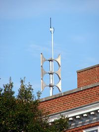
Emergency Alert Sirens - Not in Thornton!I was recently asked how prevelant tornado sirens are in the metro area and thought that would be a good discussion to have.  Tornado and alert sirens do exist in some municipalities in the Denver metro area but not all. Boulder has a system (primarily due to flood dangers) as does the city of Denver itself. Many of the other suburbs however do not.  Unfortunately, Thornton does not which to me is somewhat odd as in 1981 Thornton was struck by one of the few tornadoes to have hit the metro area so you would think that would have caused them to consider building a system back then.  If you are reading this and live in another municipality, give them a call to find out if one is available in your area.
The sirens definitely do provide a service to the community.  However, USA Today just had an article discussing these types of systems and pointing out that they were expensive to maintain and of limited effectiveness.  Some municipalities have depended on reverse 911 systems to alert residents but it is my opinion that these to are limited because they rely on someone being home to answer the phone.  What if you are in an area park and a tornado is coming? People today are very mobile and a solution that takes that into account and can warn people wherever they are would be ideal.

The city of Dacono recently deployed a system that I think Thornton should give some thought to.  You can read more about it here but in essence residents can sign up to receive alerts on their home phone, cellular phone and email.  Within a matter of seconds, thousands of subscribers can be notified of everything from weather events to disaster updates to AMBER alerts for much less than the cost of a siren system.  ThorntonWeather.com is going to be discussing the idea of this type of system with Thornton City Council members in coming weeks so be sure to check back to see what we learn.

NOAA All Hazards Weathe RadioIn the meantime, probably the best way to ensure you are warned about approaching dangers is to purchase what is commonly known as a “weather radio.” These radios are relatively inexpensive (around $40.00) and allow you to listen to and monitor the NOAA Weather Radio All Hazards (NWR) system. NWR broadcasts official Weather Service warnings, watches, and forecasts as well as other hazard information like earthquakes, avalanches, chemical spills, and even AMBER alerts. These broadcasts continually run 24 hours a day, 7 days a week and provide a great way to stay up to date with developing weather conditions.  One of these radios is actually what broadcasts our weather radio system here on ThorntonWeather.com.

Some of the nicer units even use what is called SAME – Specific Alert Message Encoding – which I would highly recommend. In essence you program in a code for the area in which you live and the radio will automatically turn on and sound an alert when something of note is in your area. These weather radios are very popular in rural areas in Tornado Alley but as we saw last week in Windsor, they definitely can be useful here along the Front Range as well. More information about the system can be found on the National Weather Service’s website and you can find these at many electronics retailers, particularly those on the Internet like Amazon or NewEgg.

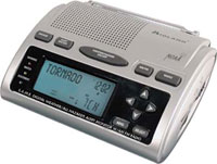
Midland WR-300 Weather RadioWhich weather radio do we use?  We are hesitant to recommend specific products but our radio of choice at the current time is the Midland WR-300.  This radio has the important SAME coding feature, a text display to show you what sort of alert is occurring, battery backup and more.  We have been pleased with the two we have.  NewEgg carries this model for $47.99.

Adventures in Tornado Alley: The Storm Chasers

Adventures in Tornado AlleyI just read about this new book Adventures in Tornado Alley: The Storm Chasers.  Most notably I saw some of the pictures in the book – absolutely incredible.  See below.  From Amazon’s description: 

The destructive power of nature has always been a source of fear and fascination, and never more so than now, when climate change and extreme weather conditions are constantly in the news. Across the central United States, the infamous storms of Tornado Alley are fueled by the collision of cold fronts from Canada and warm fronts from the Gulf of Mexico. People have been chasing these storms for decades in pursuit of thrilling experiences, but now a new generation of storm chasers is combining scientific knowledge with powerful images.

This book follows Mike Hollingshead and Eric Nguyen on seventeen chases through Colorado, Iowa, Kansas, Nebraska, New Mexico, Oklahoma, and South Dakota, illustrating the unfolding events with sequential shots and a running commentary by the chasers themselves. These spectacular storm portfolios are expanded with special features on weather phenomena like hail and mammatus clouds plus insights into forecasting and research. 340 color illustrations.

Definitely looks like a good one to check out!  You can find it here on Amazon.com

 Bolts from the blue  Independence Day II  Touchdown  Heaven’s Hammer