Category Archives: Severe Weather

Another chance at storm spotter training in the north area

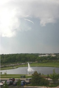
Do these clouds have the potential to bring a tornado?  Learn more at National Weather Service storm spotter training.
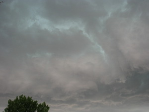
Do these clouds have the potential to bring a tornado? Learn more at National Weather Service storm spotter training.

We have written before about the great opportunity the National Weather Service provides by giving storm spotter training during the start of the severe weather season.  Normally these sessions are held in the spring but in response to the very active severe weather of early June, and the increased interest in severe thunderstorms, the National Weather Service in Boulder has added to additional spotter training session next week. 

  • When:  Saturday, July 11
  • Time: 10:00am
  • Where: Broomfield, CO.
  • Exact location: Rocky Mountain Metropolitan Airport, Terminal Building, 11755 Airport Way (formerly Jefferson County Airport)
  • For more information: robert.glancy@noaa.gov

The storm spotter program is a nationwide program with more than 280,000 trained spotters.  These volunteers report weather hazards to their local National Weather Service office providing vital information when severe strikes.  Data from spotters include severe wind, rain, snow measurements, thunderstorms and hail and of course tornadoes. 

Don’t think tornadoes can hit Thornton?  Click here for a look back at the June 3, 1981 twister that hit the city!

Storm spotters are part of the ranks of citizens who form the Nation’s first line of defense against severe weather. There can be no finer reward than to know that their efforts have given communities the precious gift of time–seconds and minutes that can help save lives.

By completing one of these training classes you can become an official storm spotter.  When severe weather strikes, you can report it by calling a special toll free number or submit your report via the National Weather Service’s website. 

Taking the training though doesn’t obligate you to being a storm spotter.  These are great sessions for anyone wanting to learn more about the severe weather we experience in Colorado, whether you want to be an official spotter or not.  All training is free.  Topics include:

  • Basics of thunderstorm development
  • Fundamentals of storm structure
  • Identifying potential severe weather features
  • Information to report
  • How to report information
  • Basic severe weather safety

To learn more about the program, see here:  http://www.crh.noaa.gov/bou/awebphp/spotter.php

Severe weather strikes Thornton again

Ominous clouds tinged by green appeared over Thornton on Sunday.
Ominous clouds tinged by green appeared over Thornton on Sunday. More images of the severe weather are posted below.

What had been a relatively quiet Sunday was shattered by severe storms moving across the Denver metro area and Thornton on Sunday.  A deluge of rain coupled with hail and funnel clouds sent Thornton residents scrambling for cover and caused a rain delay for the Colorado Rockies when a funnel cloud was spotted near Coors Field.  Hail up to 1 1/2 inches fell in parts of Thornton. 

  • New photos added – Funnel cloud near Coors Field.  See below.

A Tornado Warning was issued for a large swath of the metro area including Thornton.  The warning has since expired but a  Tornado Watch remains in effect for Thornton until 9:00pm Sunday evening so residents should remain aware.

[nggallery id=6]

Northglenn-Thornton Sentinel covers the recent severe weather

This funnel cloud was seen on Tuesday from the Thornton Civic Center (looking north).  Image courtesy Lisa Wilson, the City of Thornton.
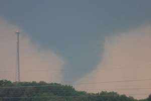
This funnel cloud was seen on Tuesday, June 9, from the Thornton Civic Center (looking north). Image courtesy Lisa Wilson, the City of Thornton.

MetroNorth Newspapers in the Northglenn-Thornton Sentinel covered the recent bout of severe weather in the most recent edition of Thornton’s hometown newspaper. In part, the article says:

As a former producer for 9News, Todd Barnes has chased a few tornadoes in his time. On Sunday, however, the storm found him.

Barnes, communications manager for the City of Thornton, was shopping at Costco in the Larkridge development near 162nd Avenue and Interstate 25 when he witnessed the funnel cloud form. The tornado touched down at 1:17 p.m. one mile north of Broomfield, near the northwestern edge of Thornton.

“There’s nothing like watching a tornado touch down,” Barnes said Monday. “It’s incredible.”

Another funnel cloud was spotted over the city at about 4:30 p.m. Tuesday. It appeared only briefly, high in the sky at a nearly 90-degree angle, before disappearing, according to witnesses. A tornado did touch down outside Firestone shortly after 5 p.m., but no serious damage was reported.

Click here for the complete story on MetroNorth’s website or click here to view a PDF.

Related stories from ThorntonWeather.com:

Do you subscribe to the Sentinel? Why not? There is no other source of truly local news available to Thornton and Northglenn residents and MetroNorth News and the Sentinel do an outstanding job of providing the depth of news and information area residents really need. If you haven’t read the Sentinel, pick up a copy and check it out. They do have a website but it isn’t particularly noteworthy and doesn’t have the same information you get in the print version. Subscriptions for the paper are very inexpensive and I would highly recommend it to everyone who lives in the area. Check it out and support Thornton’s hometown newspaper!

City of Thornton addresses residents’ concerns about tornadoes

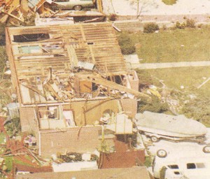
On June 3, 1981 a tornado struck Thornton in what is the worst twister to have struck the Denver metro area. Despite this, Thornton does not have any sort of emergency alert system to warn citizens of tornadoes or other civil disasters.  Image courtesy the City of Thornton archives.
On June 3, 1981 a tornado struck Thornton in what is the worst twister to have struck the Denver metro area. Despite this, Thornton does not have any sort of emergency alert system to warn citizens of tornadoes or other civil disasters. Image courtesy the City of Thornton archives.

As we have discussed before, the City of Thornton is lacking any type of system to alert citizens of severe weather like we have seen recently. In the last week, parts of Thornton have been under Tornado Warnings as funnel clouds circled in the sky and citizens are understandably concerned.

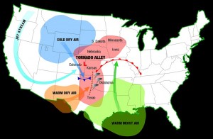
We at ThorntonWeather.com continually remind people that the Denver metro area is at the far western edge of Tornado Alley and funnel clouds, tornadoes, hail and other types of severe weather are not unusual at all. It was 28 years ago last Wednesday in fact that the costliest tornado to ever hit the Denver metro area struck Thornton. Accounts vary but 53 people were injured, at least 25 homes were destroyed and hundreds more damaged.

The danger is real – tornadoes can and do strike in the Thornton area. In some ways it is surprising that the city did not implement some sort of system in the wake of the tornado in 1981. Many municipalities in the metro area do have warning sirens including Denver, Aurora, Englewood, Commerce City and Brighton.

Thornton Mayor Erik Hansen has told ThorntonWeather.com that the city will look at ways to inform citizens when severe weather is imminent. This may take the form of utilizing the reverse 911 system or as we suggested to him, a possible new text alert system that would deliver alerts to citizen’s mobile phones. It is our firm belief that some sort of system to be used not only for severe weather but for other civil disasters is a wise and prudent investment for the city to take.

The Denver area is at the western edge of Tornado Alley and as we have seen historically and in recent days, the danger is real.  Click image for larger view.  Image courtesy NOAA.
The Denver area is at the western edge of Tornado Alley and as we have seen historically and in recent days, the danger is real. Click image for larger view. Image courtesy NOAA.

This week the city posted some tornado safety tips on its website that are worth reviewing. You may also wish to review our Severe Weather 101 series which provides more in depth information on the entire array of spring and summer severe weather (links below).

We will continue our conversations with the city about how they can improve communication with Thornton residents about severe weather and keep you updated as appropriate. If you are so inclined, contact your city council representatives and let them know you want to see Thornton implement an emergency alert system.

ThorntonWeather.com Severe Weather 101 Series

Severe weather returns as funnel clouds spotted over Thornton, tornado near Firestone

This funnel cloud was seen on Tuesday from the Thornton Civic Center (looking north).  Image courtesy the City of Thornton.
This funnel cloud was seen on Tuesday from the Thornton Civic Center (looking north). Image courtesy the City of Thornton.

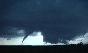
Severe weather has returned to the Denver metro area and the Front Range Tuesday afternoon.  At approximately 4:50pm and for nearly one half hour afterwards trained spotters reported numerous funnel clouds over the Northglenn, Thornton, and Broomfield areas.  No tornadoes touched down however.

At 5:11pm local law enforcement reported a tornado four miles northwest of Firestone moving at 20mph.  This area remains under a Tornado Warning until 5:00pm. 

If you are in an area under a Tornado Warning, do not try to outrun the storm or chase it in your vehicle.  Immediately seek shelter in a building.  If no structure is available, seek shelter in a ditch or low spot.  If in your home or other building go to an interior hallway or ideally the basement.

[nggallery id=5]

Reports: Lightning may have brought down Air France flight

Air France Flight 447 is missing over the Atlantic this morning and presumed lost.  (AP Photo)
Air France Flight 447 is missing over the Atlantic this morning and presumed lost. (AP Photo)

An Air France jet en route from Rio de Janeiro to Paris carrying 228 people appears to have been lost over the Atlantic Ocean.  The plane which disappeared approximately 190 miles northeast of the Brazilian city of Natal may have been brought down by severe weather the plane was flying through at the time it lost contact with air traffic controller.

Air France Flight 447 is reported to have hit strong turbulence and possibly lightning as the result of a thunderstorm.  Air France says the plane, an Airbus A330, left Rio de Janeiro at 7:00pm local time and approximately four hours late the plan sent an automated signal indicating electrical problems.  The airline said the plane “crossed through a thunderous zone with strong turbulence.”  The automated message was received 14 minutes later at 0214GMT (10:14 pm  EDT Sunday) “signaling electrical circuit malfunction.”

Francois Brousse, head of communications at Air France, “The plane might have been struck by lightning. It’s a possibility.”

For the complete story and the latest images from the tragedy, please visit our Denver Weather Examiner pages. Examiner.com - Get inside Denver weather

Is global warming responsible for a slow tornado season?

Is global warming responsible for fewer tornadoes in 2009?  Stu Ostro of the Weather Channel thinks so.  Image courtesy NSSL.
Is global warming responsible for fewer tornadoes in 2009? Stu Ostro of the Weather Channel thinks so. Image courtesy NSSL.

Stormchasers across Tornado Alley have been frustrated this spring by what seems to be a lack of tornadoes and severe weather.  Indeed, VORTEX2, the largest tornado field study ever, has been running for more than two weeks now and has not seen one twister.  Last week, Weather Channel Senior Meteorologist Stu Ostro speculated that global warming was the cause.

In a segment with on-air meteorologist Stephanie Abrams, Ostro explained that the jet stream lingering over Canada and a continual ridge of high pressure were suppressing severe weather.  Without the collision of low and high pressure (among other factors), tornadoes and supercell thunderstorms have a hard time forming.

Ostro continued his explanation saying that atmospheric pressure in the Northern Hemisphere’s mid-latitudes between 30 and 60 degrees has increased steadily since 1970.  He then overlaid a chart showing this increase with that of a chart that shows global average temperatures having increased over the same period.  As he says in his blog entry, “That parallels remarkably well the trend of globally-averaged temperatures, which has also shown a significant rise since the mid 1970s.”

For the rest of the story story – and a response from Stu Ostro – check out the complete story on the Denver Weather Examiner’s pages. Examiner.com - Get inside Denver weather

Rare tornado touches down in Mesa County

A tornado touched down in Mesa County on Tuesday - only the ninth twister since 1950 in the county.  (File photo)
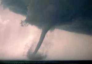
A tornado touched down in Mesa County on Tuesday - only the ninth twister since 1950 in the county. (File photo)

Mesa County, Colorado reported a rare tornado on Tuesday afternoon.  The National Weather Service in Grand Junction reports that the twister touched down in an open area around 3:25pm yesterday near Mount Garfield (map). 

The Associated Press reported that Meteorologist Jeff Colton said a National Weather Service employee was in the area and saw it happen. No damage or injuries were reported.

This was only the ninth tornado recorded in Mesa County since 1950 and the first since August 2, 2005. 

For more information:  Click here to view a history of tornadoes in Mesa County.

Mother Nature doesn’t cooperate with VORTEX2 stormchasers

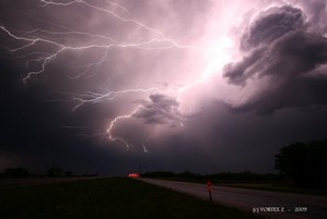
Last Tuesday the VORTEX2 teams chased a system that generated hail, wind and lightning but no tornadoes. Image courtesy VORTEX2 / NSSL.

The scientists and researchers taking part in VORTEX2, the largest ever tornado field study, have been confounded by Mother Nature in their search for twisters.  The Verification of Origin of Rotation in Tornadoes EXperiment2 (VORTEX2) and its accompanying 80 scientists and 40 vehicles have yet to track a tornado since the project launched just over a week ago.

The team has tracked severe weather systems from northwestern Texas to Oklahoma and while they have seen severe thunderstorms that produced significant rainfall and winds, twisters have eluded them thus far.  While this is undoubtedly frustrating for the team, it has given them time to practice the coordination and deployment of the researchers. 

Last Tuesday the team was on their first chase day in west Texas and was able to deploy their mobile radar units and mobile mesonet vehicles.  That storm yielded little more than wind and hail but it provided a valuable opportunity to view their plan in action and highlight areas where improvement is needed. 

Tornadoes wreak havoc, kill three in Missouri

A tornado tears through Adair County Wednesday evening. This photograph was taken by Dr. Curtis Roof from Highway 6, facing west. The tornado traveled on a northeastern path, damaging several homes along the way. (Dr. Curtis Roof/Kirksville Daily Express)

The quiet rural area of Kirksville, Missouri was ripped apart Wednesday evening by four tornadoes that destroyed and damaged homes and claimed the lives of three people.  The first of the series of tornadoes was reported at 5:49pm local time near this town 120 miles northeast of Kansas City.

Adair County bore the brunt of the line of severe storms as they moved northeast across the nation’s midsection.  Two twisters were reported near Novinger, one near Troy Mills and the most damaging one in Kirksville.  The Kirksville tornado destroyed at least one house and damaged 30 – 40 others as well as a car dealership. 

Two victims were killed in Adair County according to the Missouri State Highway Patrol.  No details on the circumstances or their names have been released other than to say they were tornado related.  One woman was killed in neighboring Sullivan County when a tornado struck her mobile home.

Get complete details on the twisters and see some incredible images of the destruction on Examiner.com.