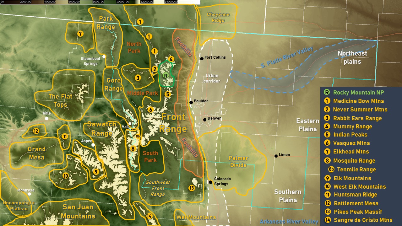
Flat Tops? Middle Park? Palmer Divide? Where the heck are those? Certainly some of the common geographical features / locations you see in a weather forecast are easily recognized but some are lesser known.
The Denver / Boulder office of the National Weather Service created a very handy map that shows where the most common geographical features are located in northeastern Colorado. It is a fantastic resource to knowing these locations. Learn them and you will be a Colorado pro in no time!