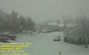
A two-day storm that saw areas around Denver measuring snow in terms of feet has moved out of the area and onto the plains. The lingering effects of the storm will be felt Friday in terms of slick roads in Denver and blizzard conditions to the east.
The early winter storm, while not entirely unusual, was the first major snow storm of the season and put Coloradoans to the test. Mercifully, the snow never fell at a particularly heavy rate and while it lingered for a long time, it allowed road crews and residents time to stay on top of the snowfall. Most schoolchildren were pleased to have received at least one snow day from the storm and many were the recipients of two unplanned days off.
At Denver International Airport, initial success at holding the storm’s effects at bay on Wednesday began to whither under the white onslaught on Thursday as winds picked up and the storm shifted east. Hundreds of flights were canceled from the airport’s major carriers including United Airlines, Frontier Airlines and Southwest Airlines.
At the height of the storm’s effects, the airport was reduced to two operating runways from the usual six and delays of up to four hours were occurring. All airlines anticipate being able to operate a normal flight schedule today.
How much snow did the Denver area receive? Here are some of the snowfall totals:
Aurora: 16 inches
Boulder: 18.8 inches
Broomfield: 20 inches
Centennial: 17 inches
Coal Creek Canyon: 46 inches
Denver International Airport: 12 inches (as of 6:00am Thursday)
Evergreen: 30 inches
Highlands Ranch: 24.5 inches
Littleton: 28.5 inches
Longmont: 12.4 inches
Parker: 14.5 inches
Thornton: 14.1 inches
Click here for a complete listing of storm reports.
The storm did push Denver into the record books and the ‘top 10 snowiest Octobers’ list. The National Weather Service will publish the official snow total from DIA for yesterday but even without the snow from yesterday, October 2009 makes the list. As of 6:00am on Thursday, DIA had recorded 14.5 inches for the month (12 inches from this storm). That makes it number 7 on the top 10 list for snowiest Octobers on record since 1882. Once today’s measurement is released, it is possible it will climb further.
 For the rest of the storm recap, the latest photos and much more, please visit the story on the Denver Weather Examiner.
