Next generation weather satellite to be built in Denver

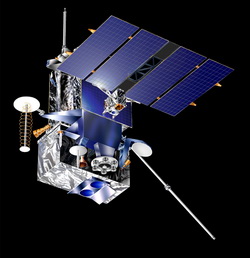
Lockheed Martin Space Systems Company of Denver will build the next generation of weather satellites. Image courtesy Lockheed Martin Space Systems.

The National Oceanic and Atmospheric Administration (NOAA) has selected Lockheed Martin Space Systems Company of Denver to build their next generation of weather and environment monitoring satellites.  When the GOES-R satellites are launched in 2015, they will provide unprecedented capability to NOAA, the National Weather Service and all weather forecasters through the use of advanced technology. 

These extraordinary satellites will provide everything from lightning mapping and improved hurricane forecasting to monitoring of sea surface temperatures.  The press release from NOAA provides some of the details on this exciting endeavor: 

NOAA, NASA Select Contractor to Build GOES-R Series Spacecraft
New Geostationary Satellites Will Give Forecasters Better Information

December 2, 2008

NOAA and NASA officials announced today Lockheed Martin Space Systems Company, of Denver, Colo., has been selected to build two spacecraft for NOAA’s next generation geostationary satellite series, GOES-R. There are two options, each providing for one additional satellite. Scheduled for launch in 2015, the new satellites will provide more data in greater detail which is essential to creating accurate weather forecasts.

The contract has a total value of $1.09 billion for the two satellites. A separate contract to build the GOES-R ground system, which receives, processes and distributes data transmitted from the spacecraft, will be announced later in 2009, officials said.

“GOES-R, with its highly advanced instruments and sensors, will provide about 50 times more weather and climate data than is available with NOAA’s current fleet of geostationary satellites,” said Mary Kicza, assistant administrator for NOAA Satellite and Information Service. “The American public will see real life-saving benefits from this satellite system with more timely forecasts and warnings for severe weather.”

GOES-R will improve the monitoring of sea surface temperatures and also provide more data to hurricane forecasters by giving sharper images of storms every 30 seconds, instead of every 7.5 minutes as the current satellites provide.

Additionally, GOES-R will carry a first-of-its-kind instrument called the Geostationary Lightning Mapper, which will quickly locate all lightning flashes occurring anytime, anywhere in the Western Hemisphere. The lightning mapper will aid in predicting tornadoes, which often spawn from lightning-packed thunderstorms.

Other key benefits expected from GOES-R include: greater monitoring of surface temperatures in metropolitan areas to improve warnings for heat stress, and better data to bolster the forecasts for unhealthy air quality days. GOES-R will feature advanced solar monitoring instruments for space weather forecasts and warnings of solar storms. These storms endanger billions of dollars worth of commercial and government assets in space and cause power surges for the satellite-based electronics and communications industry.

George Morrow, director of Flight Project for NASA’s Goddard Space Flight Center in Greenbelt, Md. said, “NASA Goddard is excited to be NOAA’s partner in this next generation GOES development and we look forward to delivering an outstanding observatory for their operational use.”

NOAA funds, manages and will operate the GOES-R program. NASA’s Goddard Space Flight Center oversees the acquisition of the GOES-R spacecraft and instruments for NOAA.

For more information:  NOAA / NASA GOES-R website

Where to shop for gifts for weather enthusiasts

The tornado warning logo is one of many from Weather Geek Stuff that is available on everything from clothing to cups.

So do you have someone on your Christmas shopping list that simply must know what temperature it is, no matter where they are or what time it is?  Here are some great places to look for gifts for them:

Weather Geek Stuff – Looking for something with a bit of humor to it?  Weather Geek Stuff is a great place for shirts, cups and novelties with a variety of “weather geek” logos.  They have items with their “Weather Geek” and “Weather Diva” logos and some very amusing weather warning sign logo merchandise that are sure to be a hit.

Galileo Shop – The Galileo thermometer – or thermoscope – was invented by Galileo Galilei in the early 1600s.  These glass tubes filled with water use floating spheres to tell the temperature based on Galileo’s specific density principle.  They are beautiful to look at in addition to be a fascinating experiment.  Galileo Shop has tons of different types and styles to choose from.

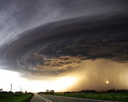
One of the many incredible images available in print from Extreme Instability.

Extreme Instability – Storm chaser Mike Hollingshead has a knack for capturing some of the most incredible images of severe weather you have ever seen.  From tornadoes to wall clouds to lightning, his images are striking to say the least.  On his website you can order prints of his best photos.  

Ambient Weather – This company is known amongst personal weather station owners as being one of the best not only in terms of prices but also customer service.  They carry every type of weather station from basic wireless outside temperature monitors to professional level weather stations. 

Amazon.com – Amazon carries everything from books to bread makers and they have plenty of weather related items.  Books, DVD’s, weather radios and more are all available in this one stop shop.  Not sure what book to buy?  We have you covered there with a guide to some of our favorites – even some for kids.

Continuing snow sure to cause a rough afternoon commute

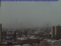
Where's Denver?  This webcam view from the Colorado Department of Public Health and Environment shows Denver obscured in the snowfall at 1:00pm Thursday.
Where's Denver? This webcam view from the Colorado Department of Public Health and Environment shows Denver obscured in the snowfall at 1:00pm Thursday.

If you can, get out of work early today as the roads are sure to be a mess during rush hour.  Snow has been falling across the Front Range all day and snow totals for the metro area are in the 2 to 4 inch range.  Probably just as notable is the bitter cold we are seeing – at 1:00pm DIA was showing 17 degrees and a wind chill of only 2 degrees.  Denver’s high temperature today will most likely be 22 degrees but that was reached at 1:00am!  The wind will continue to keep the wind chills down around zero so bundle up if you head out.

The snow will continue through 11:00pm although accumulations will be pretty light.  The north, west and southern suburbs could see up to 6 inches of snow while the central metro area will end up with around 2 to 4 inches.  Areas of Larimer and Weld Counties including Fort Collins and Greeley will see between 5 to 10 inches of snow. 

A Winter Weather Advisory is in effect for the I-25 corridor north of Longmont as well as most of the central and northern mountains areas.  The extreme eastern portions of the state are under an advisory as well.  In the mountains, eastbound I-70 has chain restrictions in place at the Eisenhower Tunnel, Loveland Pass and at Vail.

Tonight we will dip into the single digits but Friday brings us back into the 40’s and the weekend looks great.

A snowy and slick commute for Thursday

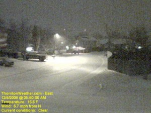
The scene at ThorntonWeather.com at 5:50am today.  Click the image for a current weather webcam view.
The scene at ThorntonWeather.com at 5:50am today. Click the image for a current weather webcam view.

The snow arrived overnight and as of 5:00am ThorntonWeather.com had measured 1.3” and it was still coming down pretty good.  Due to the extreme cold – 17 degrees and a windchill of 5 degrees as of this writing – the roads are quite slick.  This morning we found residential streets to be the worst of course but main arterials like 120th Ave were not in too good of shape either.  Please allow plenty of time to get the kids to school and yourselves to work, allow plenty of distance between you and other cars and just take your time. 

A surge of cold air from the north is expected to intensify the snowfall in the coming hours and a bit of upslope will keep the flakes falling for most of the day.  Accumulations though won’t be all that great – look for 2 to 4 inches overall.  Snow will taper off this evening from the north to the south and completely end in the metro area around midnight.

Friday and this weekend are shaping up great but that could be short lived.  We are watching a cold front coming from Montana that could bring more cold and snow toward the first part of next week.

November 30 to December 6 – This week in Denver weather history

28-30
28-30

Major snowstorms and hurricane force winds highlight our look back at Denver weather for this week, November 30th to December 6th. 

From the National Weather Service

28-30

IN 1991…A WINTER STORM DUMPED HEAVY SNOW IN THE FOOTHILLS AND NEAR THE PALMER DIVIDE WITH 10 INCHES RECORDED AT CONIFER AND GOLDEN GATE CANYON…12 INCHES IN MORRISON… 6 INCHES AT CASTLE ROCK AND PARKER.  ONLY 3.4 INCHES OF SNOW FELL AT STAPLETON INTERNATIONAL AIRPORT WHERE NORTH WINDS GUSTING TO 35 MPH ON THE 29TH…PRODUCED SOME BLOWING SNOW.  SOME LIGHT FREEZING DRIZZLE ALSO FELL ON THE 28TH AND 29TH.

30   

IN 1899…WEST WINDS WERE SUSTAINED TO 45 MPH WITH GUSTS AS HIGH AS 48 MPH.

IN 1903…WEST WINDS SUSTAINED TO 44 MPH WITH GUSTS TO 54 MPH WARMED THE TEMPERATURE TO A HIGH OF 57 DEGREES.

IN 1981…STRONG WINDS BLASTED THE FOOTHILLS.  IN WONDERVU… WINDS WERE CLOCKED TO 81 MPH WITH MANY OTHER LOCATIONS IN THE FOOTHILLS REPORTING OVER 60 MPH.  NORTHWEST WINDS GUSTED TO 28 MPH AT STAPLETON INTERNATIONAL AIRPORT.

Continue reading November 30 to December 6 – This week in Denver weather history

Snow finally comes to the Front Range

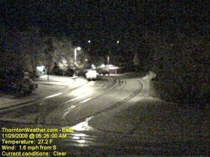
An early morning image from the ThorntonWeather.com east webcam.  Click for larger view.
An early morning image from the ThorntonWeather.com east webcam. Click for larger view.

With only two days to go in the month, things were pretty bleak and we were dangerously close to joining the “top 10” for the least snowiest Novembers in Denver.  That changed in pretty short order last night.  Forecasters were expecting about an inch of snow but the local storm reports indicate most areas exceeded that handily. 

Here in Thornton we started with a touch of rain in the evening which changed to snow as time went on and the temperature dropped.  In the end we recorded 4.1″ of the white stuff, most of which fell between 10:00pm and midnight. 

The National Weather Service in Denver is officially showing 2.4″ of snow at the old Stapleton International Airport site.  At Denver International Airport they recorded 1.6″. 

Some of the other snow reports that have come in (Updated @ 11:15am):

  • Arvada – 2.4″
  • Brighton – 1.5″
  • Conifer – 2.5″
  • Denver (north) – 1.5″
  • Denver (Stapleton) – 3.2″
  • Denver (DIA) – 1.7″
  • Elizabeth – 3.2″
  • Evergreen – 3.2″
  • Erie – 4.5″
  • Highlands Ranch – 3.0″
  • Henderson – 3.0″
  • Highlands Ranch – 4.5″
  • Lakewood – 3.8″
  • Lone Tree – 3.2″
  • Parker – 1.8″
  • Thornton – 4.1″
  • Westminster – 2.2″

For other totals, please see our local storm reports page.

2008 Atlantic hurricane season sets record

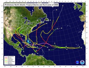
This image shows the tracks of hurricanes that occurred during the 2008 season.  Click for larger image.
This image shows the tracks of hurricanes that occurred during the 2008 season. Click for larger image.

Sunday, November 30th marks the close of the hurricane season and the National Oceanic and Atmospheric Administration says it was one for the record books.  The season marks one of the more active in the last 64 years overall and resulted in a record number of consecutive storms striking the United States.

According to Gerry Bell, Ph.D, the lead seasonal forecaster at NOAA, “This year’s hurricane season continues the current active hurricane era and is the tenth season to produce above-normal activity in the past 14 years.”  It is important to note however that comprehensive record keeping of hurricanes has only been occurring for the last 64 years so there is not a great deal of data to draw upon.

In all, a total of 16 named storms formed this season, eight of which were hurricanes.  Five of those were major hurricanes of category 3 strength or higher.  An average hurricane season has 11 named storms, six hurricanes and two major hurricanes.  In May at the start of the 2008 season, NOAA forecasters predicted 12 to 16 named storms and then in August upped their predictions to 14 to 18 named storms.  This represents the first time in recent years forecasters had accurately bracketed the number of storms.  In 2007 NOAA predicted 10 hurricanes and only six formed. The year prior, 2006, nine hurricanes were forecasted by NOAA but only five formed.  In 2005, the year Hurricane Katrina devastated New Orleans in the worst U.S. natural disaster, the forecasts underestimated storm activity.

2008 ties as the fourth most active season in terms of named storms (16) and major hurricanes (5).  It also tied as fifth most active in terms of hurricanes overall (8) since 1944. 

From NOAA, most notably:

For the first time on record, six consecutive tropical cyclones (Dolly, Edouard, Fay, Gustav, Hanna and Ike) made landfall on the U.S. mainland and a record three major hurricanes (Gustav, Ike and Paloma) struck Cuba. This is also the first Atlantic season to have a major hurricane (Category 3) form in five consecutive months (July: Bertha, August: Gustav, September: Ike, October: Omar, November: Paloma).

Bell attributes the active season to ongoing increased activity since 1995, lingering La Nina effects and warmer tropical Atlantic Ocean effects.

Here is a fascinating video from NOAA using satellite imagery of the entire hurricane season:

Green skies – Storm Chasers episode 7 sneak peek

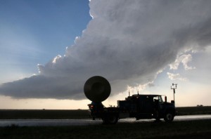
The Doppler On Wheels (DOW) surveys storm clouds looking for tornadoes.

Our friendly little bird from the Discovery Channel continues to offer us – and you – sneak peeks of coming episodes of Storm Chasers.  The episode guide for this coming Sunday’s episode says:

HAIL TO THE BEAST – Nov. 30 at 9 p.m. ET/PT
Reed and Josh’s teams struggle to find the perfect storm in Nebraska. Reed’s girlfriend Jene gets lost in a deadly hailstorm while the DOW fleet mistakenly drives into an oncoming tornado.

The sneak peek the Discovery Channel has offered us this week is aptly titled, “Green Skies.”  As anyone who has been around severe weather knows, green skies mean hail – and tornadoes.  We see this is Denver occasionally but in this clip, the TornadoVideos.net team finds themselves separated from each other while under a sky completely filled with green clouds.  It is a rather eerie – and scary – effect.

For more information:  The Discovery Channel – Storm Chasers

December weather preview – What to expect

December weather preview - what can we expect in Denver?

December brings with it the official start to winter and at the same time we find ourselves hoping we get moisture in the near future. As of this writing, the mountain snowpack in all basins are well below normal, with some as low as 27% of normal. Here in town our our annual snowfall is well below normal as well. In Colorado the snow season starts on July 1st and between that date and November 30th, Denver averages 16.9 inches of snow. Thus far, ThorntonWeather.com has measured a meager 0.2 inch and the official total for Denver taken at the site of the old Stapleton International Aiport stands at 0.8 inch!

So what can we expect in the coming month?  Click here to read our December 2008 climate and weather preview to find out!

Remote control hurricane hunters set to deploy

NASA uses unmanned UAVs as hurricane hunters.

Anyone who has followed the wars in Iraq or Afghanistan has heard about the use of Unmanned Aerial Vehicles (UAV).  These are essentially remote control airplanes capable of performing a number of tasks from surveillance to actually carrying weapons. 

NASA and NOAA have over the last year been experimenting with a small UAV from Aerosonde, an Australian manufacturer.  NOAA currently uses manned hurricane hunter aircraft (WP-3D Orion and Gulfstream IVs) to take measurements from inside and immediately surrounding hurricanes.  This data is essential to not only predicting hurricane paths and guaging the storms’ strength but also to learning more about them. 

These new UAVs offer many advantages over the traditional, manned hurricane hunter aircraft.  For one, they can fly at much lower altitudes into the storms without endangering human lives.  Further, they can be called into service on much shorter notice than a manned crew and remain on station around a storm for longer periods of time.  In November of 2007 NOAA sent an Aerosonde UAV into Hurricane Noel and the unit was airborne for over 17 hours and collected more than seven hours worth of data. 

The technology has many applications within NOAA’s mission of monitoring our globe.  In addition to hurricane hunting, UAVs can be used to monitor ice flows, wildfires, severe weather, animal life and much more.  The program is really just getting started and funding is minimal in comparison to the military equivalent but the applications are very promising.  Maybe a tornado hunter is next!

Here’s a video from Aerosonde discussing the potential applications.

Weather, natural disasters & climate news and information.