Thunderstorms Dump Hail on Thornton – More to Come?

Thornton Radar - 06-02-08Monday evening was a bit interesting around Thornton as hail was reported across much of the city.  Toward the northeast corner, hailstones up to 1″ in diameter were reported, including at the home of ThorntonWeather.com.  Thankfully it was shortlived and the size of the hail while notable, wasn’t big enough and didn’t last long enough to do any real damage.  The image at the right is the radar image of the storm as it passed over – click on it to view the full image.  That particular cell broke its upper cap of 26,000 feet and grew to 32,000 feet in a span of 15 minutes! 

Tuesday could bring severe storms again thanks to an abudnance of lower level moisture.  However, cooler temperatures should help to keep these from becoming quite as severe but hail and wind are a possibility.  As is typical this time of year, east of the urban corridor has the best chance to see some excitement. 

Wednesday afternoon and evening the chance for storms increases as a cold front moves through but again, the cooler temps should help to keep things a bit under control.  Locally heavy rain is possible, particularly the farther east you go.  In the mountains, there may even be some of the white stuff above 9,500 feet!

June 2008 Weather Preview – Severe Weather Month is Here

June 2008 Weather PreviewNotwithstanding last month’s tornadoes in Windsor and the northern Front Range, June is historically Denver’s real severe weather month.  Severe thunderstorms, tornadoes and hail are notorious visitors to Denver and across eastern Colorado during the month.  In fact, over 40 percent of the tornadoes that occur in Colorado are observed in June and these are typically the most destructive of the year.  Severe thunderstorms have also caused major property damage across the Front Range during the month.  Click here to read our complete June 2008 Weather Preview

How do you know when something bad is coming?

Emergency Alert Sirens - Not in Thornton!I was recently asked how prevelant tornado sirens are in the metro area and thought that would be a good discussion to have.  Tornado and alert sirens do exist in some municipalities in the Denver metro area but not all. Boulder has a system (primarily due to flood dangers) as does the city of Denver itself. Many of the other suburbs however do not.  Unfortunately, Thornton does not which to me is somewhat odd as in 1981 Thornton was struck by one of the few tornadoes to have hit the metro area so you would think that would have caused them to consider building a system back then.  If you are reading this and live in another municipality, give them a call to find out if one is available in your area.

The sirens definitely do provide a service to the community.  However, USA Today just had an article discussing these types of systems and pointing out that they were expensive to maintain and of limited effectiveness.  Some municipalities have depended on reverse 911 systems to alert residents but it is my opinion that these to are limited because they rely on someone being home to answer the phone.  What if you are in an area park and a tornado is coming? People today are very mobile and a solution that takes that into account and can warn people wherever they are would be ideal.

The city of Dacono recently deployed a system that I think Thornton should give some thought to.  You can read more about it here but in essence residents can sign up to receive alerts on their home phone, cellular phone and email.  Within a matter of seconds, thousands of subscribers can be notified of everything from weather events to disaster updates to AMBER alerts for much less than the cost of a siren system.  ThorntonWeather.com is going to be discussing the idea of this type of system with Thornton City Council members in coming weeks so be sure to check back to see what we learn.

NOAA All Hazards Weathe RadioIn the meantime, probably the best way to ensure you are warned about approaching dangers is to purchase what is commonly known as a “weather radio.” These radios are relatively inexpensive (around $40.00) and allow you to listen to and monitor the NOAA Weather Radio All Hazards (NWR) system. NWR broadcasts official Weather Service warnings, watches, and forecasts as well as other hazard information like earthquakes, avalanches, chemical spills, and even AMBER alerts. These broadcasts continually run 24 hours a day, 7 days a week and provide a great way to stay up to date with developing weather conditions.  One of these radios is actually what broadcasts our weather radio system here on ThorntonWeather.com.

Some of the nicer units even use what is called SAME – Specific Alert Message Encoding – which I would highly recommend. In essence you program in a code for the area in which you live and the radio will automatically turn on and sound an alert when something of note is in your area. These weather radios are very popular in rural areas in Tornado Alley but as we saw last week in Windsor, they definitely can be useful here along the Front Range as well. More information about the system can be found on the National Weather Service’s website and you can find these at many electronics retailers, particularly those on the Internet like Amazon or NewEgg.

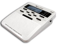
Midland WR-300 Weather RadioWhich weather radio do we use?  We are hesitant to recommend specific products but our radio of choice at the current time is the Midland WR-300.  This radio has the important SAME coding feature, a text display to show you what sort of alert is occurring, battery backup and more.  We have been pleased with the two we have.  NewEgg carries this model for $47.99.

Regional Weather Now at Rocky Mountain Weather Network

We are excited to announce a new regional weather website – the Rocky Mountain Weather Network (RMWN) – that you will find at www.rockymountainweather.net.

One of the prominent members of the personal weather station (PWS) community, Ken True of SaratogaWX, recently hatched the idea of a series of regional weather networks, all being fed data from weather stations in the areas they serve. Tony of ThorntonWeather.com has agreed to manage the regional network for the Rocky Mountain area encompassing Colorado, New Mexico and Wyoming.

These networks are to provide an overview of weather conditions across the region and will provide links to the stations within. The main page of the site displays a “mesomap” with a rotating display of current weather conditions across the three states. At the current time, 18 stations are online with RMWN and more are joining daily.

The Rocky Mountain Weather Network will not only serve as an online repository for current weather conditions in the area, but we are also hoping to see it grow into an online community . To this end, online discussion forums have been created on the RMWN website that anyone can participate in. These will be frequented not only by weather station owners / operators but also by the public and anyone just generally interested in the weather. The community will be a great way for anyone interested in the weather to congregate online and discuss their common interests.

So please check out the Rocky Mountain Weather Network at www.rockymountainweather.net and be sure to stop by the discussion forums for some weather talk!

Rocky Mountain Weather Network

Windsor Tornado – Amazing Photo and Video

Some pretty amazing video and photos of the Windsor tornado came to my attention.

First up are two photos captured by a fellow weather enthusiast’s webcam.  Ryan of MyWindsorWeather.com captured the tornado as it passed about 2 miles to the east of his home.  Absolutely amazing.

MyWindsorWeather.com Webcam Capture #1 MyWindsorWeather.com Webcam Capture #2

Second, raw video from the 9News camera crew that captured the tornado.  Again, absolutely amazing.

Remember Why – Memorial Day 2008

Memorial Day 2008Dear Friends and Family,

Of all the patriotic related messages I write, the ones I write for Memorial Day are always the hardest. It is the one and only holiday celebrated in our country that is specifically set aside to honor the dead. It honors the men and women who have not only made the ultimate sacrifice but those that have done so in service to our nation. No single sacrifice can ever come close to equaling that which is made in defense of others, in defense of an entire country. Continue reading Remember Why – Memorial Day 2008

Memorial Day Weekend Weather Shaping Up Okay

Memorial Day 2008After all of the drama earlier in the week, this Memorial Day weekend is shaping up to be pretty nice. Saturday there is a slight chance for thunderstorms in the afternoon along the Front Range but the threat is relatively minimal and we should reach a high of 73. Sunday looks to be the best day with sunny skies and a high of 77. Monday and into Tuesday though a passing low pressure system will result in an increased chance of showers and thunderstorms on both days. Those that are headed to the high country for some camping should be prepared for potentially cold conditions at night.

We wish everyone a happy and safe Memorial Day. Most importantly, we hope everyone remembers the real reason for the holiday.

Weld County Tornadoes Kill 1, Dozens Injured

Thursday saw the largest outbreak of tornadoes in Colorado that we have seen in years strike the town of Windsor, destroying homes and businesses, tossing cars and semi-trucks like toys and killing one man.

Windsor tornado radar image.At about 11:20am ThorntonWeather.com radar began to pick up rotation in the skies just south and west of Greeley. Within minutes, we were tracking what was to be this deadly and damaging tornado and at 11:50am radar (image at left) showed the twister virtually on top of Windsor. The National Weather Service is evaluating damage from the storm but early estimates place it as an EF-2 or EF-3 on the Enhanced Fujita Scale which would have generated wind speeds between 111mph and 165mph.

Image of tornado courtesy 9News.The tornado that struck Windsor was a wedge tornado, a type we don’t normally see here in Colorado. These are the largest and deadliest of all tornadoes because of their sheer size and ferocity and are like those that are common in Oklahoma.  This twister appears to have been on the ground for more than 30 minutes, was up to ½ mile wide and traveled 35 miles on the ground. In our state we usually see the well defined, thin “rope” tornadoes which while damaging, typically don’t last as long and are not near as big.

The Windsor tornado was but one of what were multiple tornadoes to strike north central Colorado Thursday. Some news outlets were reporting at one time that as many as eight possible twisters however we caution readers to take those numbers with a grain of salt. More often than not, the initial numbers are inaccurate as they reflect multiple reports of the same storm, simply as seen from a different location. The National Weather Service does the final determination and it would not be surprising to see that yesterday there were two or three twisters.

These tornadoes continue this year’s trend of increased tornado activity. As we previously reported, 2008 thus far ranks as the deadliest year for tornado-related deaths since 1998 and the severe weather season is not even half way over.

If you haven’t already, you may wish to read our article, “Severe Weather 101 – Tornadoes” which has some very important safety information about what to do when tornadoes strike.

Tornado Watch Issued. Hail and tornado reported north of Denver.

Windsor tornadoUPDATE, 1:13pm – Severe damage appears to have been caused by the first tornado to strike today. The Greeley Tribune is reporting one possible tornado death near the missile silo park near Colo. 257 near 10th Street in west Greeley. Reports are that old town Windsor has been heavily damaged.

UPDATE, 12:38pm – At 12:23pm law enforcement reported a tornado 4 miles west of Dacono (24 miles north of Denver). Storm is moving at 33mph. A Tornado Warning is active for the immediate area including Niwot, Dacono and Longmont.

Thursday, May 22nd, 2008 12:25pm MDT

The National Weather Service has issued a Tornado Watch effective until 8:00pm tonight for much of the central plains including the Denver metro area. Visual and radar indications show great potential for severe thunderstorms, hail and tornadoes in the area under the watch.

Radar image of tornado north of DenverAt 11:30am radar showed a tornado touching down three miles east of Milliken (about 45 miles north of Denver). The radar image at the right shows the cell in its early stages with a tornado signature. Reports indicate that there have been no injuries but officials have closed Highway 85 at Highway 60 after two semi-trailers were blown over in that area. Power is reported out in Greeley.

All readers should be reminded that a Tornado Watch is issued by the Storm Prediction Center in Norman, Oklahoma as a precautionary alert when conditions are favorable for the development of tornadoes in the specific area. You may wish to familiarize yourself by reading our Severe Weather 101 – Tornadoes article.

Please stay tuned to area media outlets for more information as this afternoon’s weather develops.

Storms on the Horizon – Celebrity Stormchasers Nearby

A storm front on the Colorado plains.After three consecutive days with temperatures over 85, change is in the air. Low pressure is intensifying over the foothills this afternoon and as a result the chance of thunderstorms is on the increase.

East of a line from Greeley to Byers will be where the greatest threat for severe storms will be. Large hail, damaging winds and tornadoes are a distinct possibility. Closer to the foothills and the metro area, late afternoon and evening will bring gusty winds and a chance for small hail. Scattered showers are possible through midnight.

The slow moving low will help keep temperatures down near normal for the foreseeable future after today however they also will provide for a chance of thunderstorms each day. Some of these storms may become severe although telling where and how widespread this activity will be is difficult. Certainly the northeastern plains have the greatest chance to see some excitement.

A number of advisories are in place at the current time. The southeastern part of the state is under Fire Weather Watches as things are tinder dry. In the mountains, much of the state west of the Continental Divide is under Flood Advisories. The recent warm temperatures have spurred fears of faster than normal snow melt and many rivers and streams are expected to reach flood stage.

This time of year just about anything can be expected. Keep an eye on the skies – especially if you are going to be outdoors for the upcoming holiday weekend.

StormChasersFor those that have seen the Discovery Channel’s StormChasers TV series, you may find it interesting to know that I have just learned that the StormChaser team is currently in Fort Morgan at this very moment.  As mentioned above, severe storms are likely over the northeastern plains this afternoon and evening and they apparently are there expecting the same and hoping to get some good data.  For those that haven’t seen this series, it is a MUST SEE for anyone interesting in severe weather or storm chasing!

Weather, natural disasters & climate news and information.