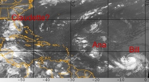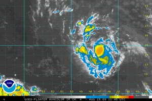
Following on the first two named storms of the 2009 Atlantic hurricane season forming Saturday, a third may form off the coast of Florida today. Tropical Storm Ana, the first of the season, formed early Saturday. This was followed by Bill later in the day. Today the National Hurricane Center is forecasting that a tropical depression near Florida will reach tropical storm strength by the end of the day and if so, will be assigned the name Claudette.
Tropical Depression Four is currently 90 miles west-southwest of Tampa, Florida and moving to the north-northwest at 16 mph. With maximum sustained winds of 35 mph, the storm is just below the 39 mph threshold to become a tropical storm.
Strengthening is expected and the NHC predicts the system will become a tropical storm before it hits the coast. In anticipation of this, a tropical storm warning has been issued from the Alabama / Florida border east to the Suwannee River in Florida. Rainfall accumulations from 3 to 5 inches are expected with coastal storm surge of 3 to 5 feet.
For more information:
 For complete details on this potential triple threat, read the full story on Examiner.com.

