In what may mean an end to all those frustrating and dangerous weather conditions that plague the planet, today Google announced Google Wind, a ground-breaking weather control system. Now in use in the Netherlands, the system has brought an end to the windy and cloudy conditions in that nation. This will surely have an impact across the globe soon.
April marks a transition between winter and summer for most of the country but for Denver it is especially true as we can see a stunning variety of weather.
The proverbial April showers are certainly a possibility for Denver. Snow? Tornadoes? Thunderstorms? You bet – all can happen!
For good measure throw in a chance for hail and even dust storms and April gives every type of weather condition you could like – or hate.
March 26 to April 1: This week in Denver weather history
Up until a few days ago, our March had been extraordinarily dry and warm. That isn’t always the case, particularly when it comes to snowfall. March is one of our snowiest months and our look back at this week in Denver weather history shows a number of notable snowfall events.
From the National Weather Service:
24-26
In 1959…the second major spring storm in less than a week dumped 10 to 20 inches of wet snow across northeastern Colorado. Snowfall totaled 14.3 inches at Stapleton Airport where north winds gusted to 36 mph…causing near- blizzard conditions with visibilities frequently reduced to 1/2 mile in snow and blowing snow. Many travelers were marooned when trains…planes…and buses were unable to make their schedules. Utility lines were again damaged as a result of the storm.
25-26
In 1899…a major storm dumped 13.1 inches of heavy snow over downtown Denver. Rain changed to snow around mid- morning on the 25th. Snowfall became heavy and continued until late evening on the 26th. North to northeast winds gusted to 30 mph on both days. The cold air mass plunged temperatures from a high of 55 degrees on the 25th to a low of 8 degrees on the 26th.
In 1995…a potent early spring storm produced heavy snow in the mountains…but skipped over metro Denver…before producing blizzard conditions and 6-foot drifts over eastern Colorado…causing the closure of I-70 and other highways. Only 0.7 inch of snow fell at the site of the former Stapleton International Airport. North winds gusted to 40 mph at Denver International Airport on the 25th.
In 2001…a persistent band of moderate to heavy snow showers with a few embedded thunderstorms formed in the foothills around Estes Park and spread to the southeast across Boulder and Denver and on the plains to the east of Denver. Thunder and snow was reported at Jefferson County…Centennial…and Denver International Airport during the evening of the 25th. Snowfall totals included: 7 inches at Boulder and Louisville; 6 inches at Broomfield…Niwot…and Westminster; 5 inches at Eldorado Springs…Nederland…and near Strasburg. Only 2.1 inches of snow fell at the site of the former Stapleton International Airport.
25-27
In 1904…heavy snowfall totaled 7.0 inches in downtown Denver.
26
In 1899…a major winter storm dumped 11.3 inches of snow over downtown Denver.
In 1910…west winds were sustained to 42 mph. A snow shower produced a trace of snow.
In 1935…a severe dust storm swept across the city. The dense dust blew in on a gale from the east-northeast. The dust “bank” was first visible on the northeastern horizon at about 2:00 pm. It advanced toward the city as a rolling…swirling…yellowish-to smoke-black cloud. At 2:06 pm…the cloud of dust enveloped the station. Before the storm the visibility was unlimited. At 2:08 pm…the visibility was reduced to 1/8th mile. By 2:25 pm…the visibility was increasing and was above 1000 feet at 3:10 pm. Thereafter…the sun appeared as a dim “ball of fire” at times. The dust was partially gone at 8:30 pm. During the storm…northeast winds were sustained to 32 mph with gusts as high as 35 mph.
In 1971…the highest recorded temperature in March…84 degrees…occurred. This was the highest temperature recorded so early in the season. Previously…84 degrees had not been reached until April 21st. The temperature also exceeded the previous daily record of 75 degrees set in 1960. Strong northwest Chinook winds gusting to 37 mph at Stapleton International Airport were partially responsible for causing the extremely warm weather so early in the season.
In 1985…strong winds occurred along the foothills. A wind gust to 76 mph was recorded in Boulder. A dust storm produced by the strong winds caused a 35-car pileup on I-25 north of Denver. In Denver…the high winds blew out windows in a few downtown buildings. West winds gusted to 52 mph at Stapleton International Airport.
In 1993…strong winds from high based thunderstorms blew a roof off an Englewood business onto several parked cars. The winds also caused half of a furniture warehouse roof to collapse in north Denver…ripped a mechanical shed off the roof of a building in downtown Denver…and downed power lines in Commerce City. Wind gusts ranging from 55 to 68 mph were recorded. At Stapleton International Airport… Where no thunder was heard…a microburst wind gust to 55 mph briefly reduced the visibility to zero in blowing dust.
In 1994…heavy snow fell in the foothills west of Denver and over the palmer divide to the south of metro Denver. Snowfall totaled 11 inches at both the Eldora Ski Area and at Idaho Springs. Only 1.3 inches of snowfall were measured at Stapleton International Airport where north winds gusted to 28 mph.
In 2006…post-frontal strong winds quickly dissipated the dense morning fog across metro Denver. West to northwest winds were strong and gusty from mid-morning until sunset. West winds were sustained to 37 mph with gusts to 52 mph at Denver International Airport.
26-27
In 1886…heavy snowfall totaled 7.1 inches in downtown Denver.
In 1911…post-frontal north winds were sustained to 48 mph on the 26th and to 47 mph on the 27th.
In 1931…a cold front brought snow and very cold weather to the city. Snowfall totaled 7.3 inches over downtown Denver with most of the snow…6.4 inches…occurring on the 26th… When northwest winds were sustained to 38 mph with gusts to 44 mph. High temperature of 31 degrees on the 26th equaled the low temperature of the previous day as the temperature plunged to a low of 1 degree below zero. High temperature of only 15 degrees on the 27th was a record low maximum for the date. Low temperature of 2 degrees below zero on the 27th was not a record.
In 1975…a major pre-Easter blizzard…the worst since the vicious storm of 1949…battered northeastern Colorado and left livestock losses in millions of dollars…but metro Denver escaped the main brunt of the storm and received only 5.0 inches of snowfall. North winds gusted to 38 mph at Stapleton International Airport where temperatures plunged from a high of 50 degrees to 18 degrees by midnight on the 26th.
In 1991…heavy snow fell over portions of the eastern foothills with 9 inches recorded at Lake Eldora west of Boulder. The snow spread across metro Denver…but snowfall totaled only 1.7 inches at Stapleton International Airport where north to northeast winds gusting to 31 mph on both days produced some blowing snow.
Coming off a very snowy and cold March, Thornton saw a relatively seasonal April 2016. Temperatures were right near normal but we did see a healthier than average dose of snow and precipitation.
The month started out quite mild. In fact 13 of the first 14 days saw above average high temperatures. That changed quickly though at the middle of the month when a storm system brought cold and snow to the Front Range. While most of the white stuff fell to our south, Thornton managed respectable totals over the 16th and 17th of the month.
We then returned to mild weather but only for a few days as a series of low pressure systems passed through the state. The final three days of the month saw well-below average high temperatures and periods of rain and snow.
Thornton saw an average temperature for the month of 48.0 degrees. Out at the airport where Denver’s official measurements are kept, the monthly average was a bit cooler at 47.2 degrees. Both were quite close to the April long term average of 47.4 degrees.
Temperatures in Thornton ranged from a maximum of 78.3 degrees on the 22nd down to a low of 21.9 degrees on the first of the month. DIA saw a maximum of 77 degrees on the 22nd and 23rd and a low of 25 degrees on the first.
In terms of precipitation, Denver’s long term April average is 1.71 inches. On this front, both Thornton and Denver came out above normal. We saw 2.47 inches of liquid precipitation in our bucket in Thornton while Denver recorded 2.56 inches.
Snowfall was above the 8.9 inch April average in Thornton and Denver. Thornton however only bested it by a half inch with a total of 9.4 inches for the month. Out at the airport, 15.6 inches was recorded.
Thornton, Colorado’s April 2016 temperature summary. (ThorntonWeather.com)Thornton, Colorado’s April 2016 precipitation summary. (ThorntonWeather.com)
CLIMATE REPORT
NATIONAL WEATHER SERVICE DENVER/BOULDER CO
244 AM MDT SUN MAY 1 2016

...THE DENVER CO CLIMATE SUMMARY FOR THE MONTH OF APRIL 2016...

CLIMATE NORMAL PERIOD 1981 TO 2010
CLIMATE RECORD PERIOD 1872 TO 2016

WEATHER         OBSERVED          NORMAL  DEPART  LAST YEAR`S
                 VALUE   DATE(S)  VALUE   FROM    VALUE  DATE(S)
                                          NORMAL
................................................................
TEMPERATURE (F)
RECORD
 HIGH              90   04/30/1992
 LOW               -2   04/02/1975
HIGHEST            77   04/23        90     -13       79  04/30
                        04/22
                        04/14
LOWEST             25   04/01        -2      27       27  04/03
AVG. MAXIMUM     59.4              61.5    -2.1     62.1
AVG. MINIMUM     35.1              33.3     1.8     35.3
MEAN             47.2              47.4    -0.2     48.7
DAYS MAX >= 90      0               0.0     0.0        0
DAYS MAX <= 32      0               0.3    -0.3        0
DAYS MIN <= 32     11              13.0    -2.0        7
DAYS MIN <= 0 0 0.0 0.0 0 PRECIPITATION (INCHES) RECORD MAXIMUM 8.24 1900 MINIMUM 0.03 1963 TOTALS 2.56 1.71 0.85 2.65 DAILY AVG. 0.09 0.06 0.03 0.09 DAYS >= .01        10               9.1     0.9        9
DAYS >= .10         6               4.5     1.5        6
DAYS >= .50         2               0.9     1.1        2
DAYS >= 1.00        1               0.5     0.5        1
GREATEST
 24 HR. TOTAL    1.22   04/15 TO 04/16           04/16 TO 04/17
                                                          04/17 TO 04/17
                                                          04/17 TO 04/17
 STORM TOTAL       MM                                 MM
 (MM/DD(HH))            MM                    04/17(00) TO 04/17(00)
                                                 04/17(00) TO 04/17(00)7
                                                 04/17(00) TO 04/17(00)7

SNOWFALL (INCHES)
TOTALS           15.6               8.9    6.7

DEGREE_DAYS
HEATING TOTAL     526               529      -3      481
 SINCE 7/1       5230              5731    -501     5205
COOLING TOTAL       0                 1      -1        0
 SINCE 1/1          0                 1      -1        0

FREEZE DATES
RECORD
 EARLIEST     09/08/1962
 LATEST       06/08/2007
EARLIEST      04/01             10/07
LATEST                          05/05
........................................................

WIND (MPH)
AVERAGE WIND SPEED              10.9
RESULTANT WIND SPEED/DIRECTION   2/243
HIGHEST WIND SPEED/DIRECTION    43/300    DATE  04/05
HIGHEST GUST SPEED/DIRECTION    53/300    DATE  04/05

SKY COVER
POSSIBLE SUNSHINE (PERCENT)   MM
AVERAGE SKY COVER           0.60
NUMBER OF DAYS FAIR            6
NUMBER OF DAYS PC             15
NUMBER OF DAYS CLOUDY          9

AVERAGE RH (PERCENT)     55

WEATHER CONDITIONS. NUMBER OF DAYS WITH
THUNDERSTORM              0     MIXED PRECIP               0
HEAVY RAIN                0     RAIN                       2
LIGHT RAIN                6     FREEZING RAIN              0
LT FREEZING RAIN          0     HAIL                       0
HEAVY SNOW                1     SNOW                       5
LIGHT SNOW                8     SLEET                      0
FOG                       9     FOG W/VIS <= 1/4 MILE      4
HAZE                      1

-  INDICATES NEGATIVE NUMBERS.
R  INDICATES RECORD WAS SET OR TIED.
MM INDICATES DATA IS MISSING.
T  INDICATES TRACE AMOUNT.
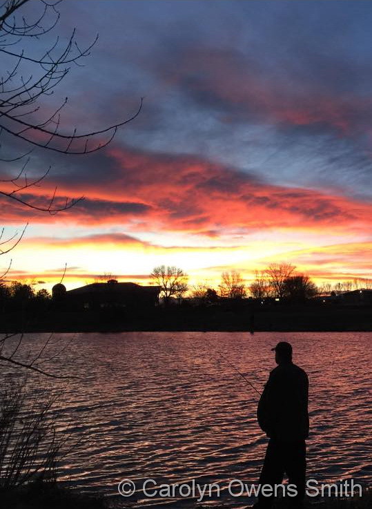
A picture perfect evening in Adams County. (Carolyn Owens Smith)
April can be a tricky month weather-wise with everything from mild temperatures to snow to severe weather being possible. The good thing about that is that it provides plenty of chances for great photos!
April marks a transition between winter and summer for most of the country but for Denver it is especially true as we can see a stunning variety of weather.
The proverbial April showers are certainly a possibility for Denver. Snow? Tornadoes? Thunderstorms? You bet – all can happen!
Throw in our usual wildlife plus the wide variety of birds that return to the Centennial State for the spring and summer and there is a lot going on.
Slideshow updated April 23, 2016.
To learn more about how to send your photo to us for inclusion in the slideshow, see below the slideshow.
Showcasing images captured by ThorntonWeather.com readers as well as some of our own, our monthly slideshow covers the entire gamut of weather-related imagery.
Sunsets, sunrises, wildlife and of course every type of weather condition are vividly depicted in images captured from yours and our cameras.
[flickr_set id=”72157666986103395″]
What is missing in the slideshow above? Your photo!
Our monthly photo slideshow is going to feature images that we have taken but more importantly images that you have captured. The photos can be of anything even remotely weather-related.
Landscapes, current conditions, wildlife, pets, kids. Whimsical, newsy, artsy. Taken at the zoo, some other area attraction, a local park, a national park or your backyard. You name it, we want to see and share it!
Images can be taken in Thornton, Denver or anywhere across the extraordinary Centennial State. We’ll even take some from out of state if we can tie it to Colorado somehow.
We’ll keep the criteria very open to interpretation with just about any image eligible to be shown in our slideshows.
What do you win for having your image in our slideshow? We are just a ‘mom and pop’ outfit and make no money from our site so we really don’t have the means to provide prizes. However you will have our undying gratitude and the satisfaction that your images are shared on the most popular website in Thornton.
To share you images with us and get them included in the slideshow just email them to us or share them with ThorntonWeather.com on any of the various social media outlets. Links are provided below.
April 24 to April 30: This week in Denver weather history
Weather in Colorado is always interesting but springtime can bring the entire gamut of conditions. Looking back at this week in Denver weather history we see just how varied this time of year – from flooding rains to heavy snowfall to severe thunderstorms it can and has all happened.
From the National Weather Service:
22-24
In 2010…a potent spring storm brought heavy… Wet snow to areas in and near the Front Range Foothills and widespread rainfall across the adjacent plains. In the Front Range Foothills and North-Central Mountains east of the Continental Divide…storm totals ranged from 15 to 30 inches. Storm totals included: 29.5 inches…3 miles southeast of Pinecliffe; 27 inches…8 miles northeast of Four Corners; 23 inches at Willow Creek; 22.5 inches… 13 miles northwest of Golden; 21 inches at Never Summer; 17 inches at Eldorado Springs; 16.5 inches…3 miles west of Jamestown. Denver International Airport reported just a trace of snowfall…but measured 2.01 inches of rainfall for the duration of the storm. In addition…a peak wind gust to 54 mph from the northwest was observed at the airport on the 23rd
23-24
In 1883…snowfall totaled 7.6 inches in downtown Denver.
In 1904…a thunderstorm produced hail during the late evening of the 23rd. Apparent post-frontal rain changed to snow during the early morning of the 24th…but totaled only 2.0 inches. Precipitation consisting of rain…melted hail…and snow totaled 0.60 inch. Northeast winds were sustained to 41 mph with gusts as high as 52 mph on the 24th.
In 1905…rain changed to snow and totaled 8.0 inches. Much of the snow melted as it fell with only 2.5 inches measured on the ground. Precipitation totaled 1.88 inches. Northeast winds were sustained to 20 mph on the 23rd.
In 1942…the South Platte River reached flood conditions in the city. As many as 15 thousand residents were warned to evacuate their homes temporarily. Two lives were lost in the city. Four bridges were washed out by the flood waters and other bridges were endangered. The damage was generally limited to bridges that were in poor condition. However…the flood waters did not overflow their channel banks within the city limits.
In 1980…heavy rain began in the eastern foothills on the night of the 23rd and turned to heavy wet snow on the 24th. Up to a foot and a half of snow fell in the foothills west of Denver. At Stapleton International Airport precipitation totaled 1.58 inches…but only 3.7 inches of snow fell from the storm. East winds gusted to 24 mph.
In 1997…locations in and near the foothills received the greatest snow of the year as a winter-like storm system moved into metro Denver. East to southeast winds at speeds of 15 to 35 mph were common with even stronger gusts above 9 thousand feet. Snow fell at a rate of 2 to 3 inches an hour as deep upslope combined with a moist and unstable air mass. The snow began in the foothills above 7500 feet during the evening of the 23rd. By sunrise the snow level had dropped to 5000 feet. The hardest hit areas extended from I-25 into the foothills. Snowfall totals in the foothills ranged from 1 1/2 to over 3 1/2 feet. In the city…snowfall ranged from 8 to 18 inches. Some snowfall amounts included: 36 inches at Coal Creek Canyon; 31 inches at Nederland and Wondervu; 20 to 24 inches near Blackhawk… At Echo Lake…and North Turkey Creek Canyon; 15 to 19 inches at Boulder…central city…conifer…Evergreen…Georgetown… And Louisville; 8 to 14 inches in Arvada…Broomfield… Westminster…Wheat Ridge…Castle Rock…and Ken Caryl Ranch. Only 2.3 inches of snow fell at the site of the former Stapleton International Airport on the 24th. East winds gusted to 36 mph at Denver International Airport on the 24th.
In 2003…a strong and deep northerly flow circulating around a closed upper low pressure center allowed heavy snow to fall in the mountains and eastern foothills. Snowfall totaled 14 inches in Idaho Springs. Rain was mixed with snow and thunder across metro Denver. Snowfall was only 0.9 inch overnight at the site of the former Stapleton International Airport. Precipitation totaled 1.34 inches at Denver International Airport…where northwest winds gusted to 55 mph on the 23rd.
In 2007…a storm system intensified over southeast Colorado… Allowing for heavy snow and rain to develop over much of north-central and northeast Colorado. Severe thunderstorms preceded the storm system on the 23rd…affecting the urban corridor. Nickel size hail was reported in Boulder and a small landspout touched down near Byers. On the 24th…heavy snow fell in the foothills west of Denver and Boulder…where storm totals ranged from 1 to 2 feet. Heavy snow also occurred along the palmer divide…with storm totals of 10 to 16 inches. Elsewhere…a steady moderate to heavy rainfall was reported. Denver International Airport measured 2.09 inches of rainfall…which shattered the previous 24-hr record of 1.29 inches for the 24th of April. The heavy wet snow caused several power outages. In some instances it took several days to restore power. Several road closures were reported…including interstates 25 and 70. A jackknifed semi-trailer backed up traffic for nearly 20 miles…on southbound I-25…between Denver and Colorado springs. In addition…a 50-ton Boulder blocked the southbound lane of State Highway 285…near Parmalee Gulch. Crews had to use explosives to break up the Boulder and clear the debris. Stranded buses and impassable roadways also forced several school closures.
23-25
In 1935…heavy wet snow fell across metro Denver. The storm started as rain on the 23rd and changed to snow early on the morning of the 24th. There was continuous precipitation for a period of 48 hours. Snowfall totaled 19.0 inches over the city and 20.0 inches at Denver municipal airport. However… Due to warm temperatures in the 30’s…much of the snow melted as it fell and did not seriously disrupt traffic. The greatest snow accumulation on the ground downtown was 12 inches…but it quickly melted. The highest sustained wind speed recorded during the storm was 28 mph from the north on the 23rd. The storm contained 3.16 inches of moisture.
24
In 1959…wind gusts to 60 mph recorded in downtown Boulder caused very limited minor damage. West winds gusted to 38 mph at Stapleton Airport.
In 1986…a wind gust to 60 mph was clocked at Golden Gate Canyon.
In 1989…1 3/4 inch diameter hail was reported in Lafayette. Boulder and Louisville reported 3/4 inch hail.
24-25 in 1890…rain changed to snow and totaled 7.0 inches in downtown Denver.
In 1931…heavy snowfall totaled 9.3 inches over downtown Denver. Winds were light during the storm.
In 1996…the second wind storm in less than a week developed east of the continental divide and spread over metro Denver. High winds gusted from 60 to 90 mph. Several power lines and poles were downed. Some of the stronger wind gusts included: 91 mph atop squaw mountain west of Denver…90 mph atop Table Mesa near Boulder…85 mph in Golden Gate Canyon…and 82 mph at Wondervu. Northwest winds gusted to 41 mph at Denver International Airport on the 25th.
24-26
In 1924…post-frontal rain changed to snow…which became heavy and totaled 10.2 inches over downtown Denver. The greatest amount of snow on the ground was 6.0 inches on the 25th due to melting. North winds were sustained to 38 mph with gusts to 42 mph on the 24th.
25
In 1902…northeast winds were sustained to 42 mph with gusts to 48 mph.
In 1908…north winds were sustained to 40 mph behind an apparent cold front. Snowfall was 0.5 inch.
In 1928…rain changed to snow…which became heavy and totaled 7.4 inches in downtown Denver. Due to melting…the maximum snow depth on the ground was 4.0 inches at 6:00 pm. This was the last snow of the season. Southeast winds were sustained to 19 mph with gusts to 20 mph.
In 1976…a south wind gust to 54 mph was recorded at Stapleton International Airport. The high winds toppled a 70-foot high cottonwood tree onto the rear of house and a neighboring residence in central Denver.
In 1989…lightning caused heavy damage to a radio transmitter in Parker…knocking a Denver area radio station off the air for 3 hours.
In 1994…weather spotters reported dime-size hail at the intersection of U.S. Highway 287 and c470 in Jefferson County. Marble-size hail covered the ground near Golden to a depth of 1 inch. Pea-size hail was reported covering the ground to a depth of 3 inches in Arvada.
25-26
In 1985…a spring storm brought much rain and snow to metro Denver. The foothills were buried with 15 inches of snow at conifer and 12 inches at Evergreen. At lower elevations… An inch or more of rain fell in Denver and Boulder. The heavy precipitation caused brief power outages in the Denver area. Precipitation totaled 1.06 inches at Stapleton International Airport…including only 0.7 inch of snowfall.
Mother Nature played a somewhat cruel trick on the Colorado Front Range. The week started with mild temperatures and a definite feeling of spring in the air. She closed out the week with a significant snowstorm and plenty of cold.
The long-expected storm arrived on the evening of Friday the 15th with rain. Overnight into the early morning of the 16th, the rain continued, heavy at times. In the early morning hours, as temperatures dropped, the rain changed to snow and would continue virtually non-stop through the morning of the 17th.
Thornton’s snowfall totals were certainly at the lower end of what was reported in the Denver metro area. We saw 7.3 inches, much of which melted as fast as it fell. Other locations not far to the west and south were pushing a foot and locations in the foothills and Palmer Divide saw nearly two feet.
The time lapse video begins at midnight on the morning of the 16th and continues through noon on the 17th.
April 17 to April 23: This week in Denver weather history
As we enter the latter half of April the weather history calendar starts to reflect shift in the type of weather events we see. There are still plenty of significant snowfall events. However spring severe weather starts to appear with greater frequency including heavy rain, hail and even tornadoes.
From the National Weather Service:
13-17
In 2001…a huge dust storm over southern and Inner Mongolia during April 3rd through the 6th lifted desert dust into the jet stream. This dust cloud moved over metro Denver on the 13th and persisted through the 17th. The cloud created widespread haze…giving the sky a milkish cast due to the scattering of incoming solar radiation.
15-17
In 1922…heavy snowfall totaled 9.0 inches in downtown Denver. Most of the snow…6.0 inches…fell on the 16th. This was the third major snow storm in a week. Northwest winds were sustained to 43 mph with gusts to 47 mph on the 15th.
16-17
In 1944…heavy snowfall totaled 7.5 inches in downtown Denver. Northwest winds were sustained to 18 mph on the 16th.
16-18
In 2009…a potent spring storm brought heavy snow to locations in and near the Front Range foothills. A deep easterly upslope produced nearly 5 feet of snow in parts of the foothills. The heavy snow resulted in the closure of Interstate 70…from Golden west to Vail…for approximately 16 hours. The heavy snow snapped power lines in Evergreen and Nederland. The ensuing outages affected 14200 residents. In the Front Range foothills…storm totals included: 56 inches…3 miles south of Rollinsville; 54 inches…3 miles southeast of Pinecliffe…43 inches at Aspen Springs…42 inches at Evergreen…38 inches near conifer; 37 inches at St. Mary’s glacier…and 34 inches near Nederland. Along the urban corridor and Palmer Divide…the heaviest snow occurred above 5500 feet on the 17th. Storm totals included: 22 inches…8.5 miles southwest of Franktown; 18 inches…10 miles south-southeast of Buckley Air Force Base; 17 inches near Cherry Creek and 7 miles south of Sedalia… 16 inches…6.5 miles southwest of Castle Rock; 15 inches near Beverly Hills; 12 inches near Highlands Ranch and Lafayette…with 11 inches in Broomfield. Elsewhere storm totals ranged from 4 to 10 inches. Officially…only 2.6 inches of snow was observed at Denver International Airport. The 24-hr precipitation for the day however was 1.16 inches… Which established a new record for April 17th.
17
In 1889…northwest winds were sustained to 48 mph.
In 1899…apparent post-frontal north winds were sustained to 42 mph with gusts as high as 48 mph.
In 1935…light dust moved over the city behind an apparent dry cold front…which produced northeast winds to 19 mph with gusts to 20 mph.
In 1978…winds estimated to 70 mph occurred in Morrison. Northwest winds gusted to 49 mph at Stapleton International Airport.
In 2000…strong pre-frontal winds and widely scattered thunderstorms caused high winds to develop across northern metro Denver and portions of the northeast plains. Peak wind gusts included 75 mph at Louisville. South winds gusted to only 28 mph at Denver International Airport.
In 2002…strong southwest winds in advance of a cold front gusted to 52 mph at Denver International Airport.
In 2003…severe thunderstorms produced 1 inch diameter hail 7 miles east of Brighton. Strong thunderstorm winds blew out an auto windshield near Denver International Airport where south winds gusted to 48 mph.
17-18
In 1878…the wind blew violently all day on the 17th with a maximum sustained velocity of 40 mph. Dust hung over the city like a cloud. The relative humidity was zero nearly all day. A terrific gale blew overnight. There was much damage to buildings…signs…fences…etc. Some wind gusts were so strong as to jar buildings to their foundations. The station anemometer recorded sustained winds to 50 mph with higher gusts before it was damaged by the winds. The winds moderated during the day on the 18th and ended at sunset.
In 1894…post-frontal rain changed to snow on the 17th around sunrise and continued through 9:00 am on the 18th. Snowfall totaled 10.5 inches…but most of the snow melted as it fell. The high temperature warmed to only 35 degrees on the 17th after a high of 76 on the 16th. Northeast winds were sustained to 30 mph with gusts to 32 mph on the 17th.
In 1998…more spring snow fell across metro Denver and in the foothills. Snowfall totals included: 11 inches at Golden Gate Canyon; 10 inches at Highlands Ranch; 9 inches at Elizabeth; 8 inches at Broomfield and Morrison; and 7 inches at Chief Hosa…Evergreen…Littleton…and Sedalia. Snowfall totaled only 3.2 inches at the site of the former Stapleton International Airport. North winds gusted to 22 mph at Denver International Airport.
17-19
In 1920…snow fell across the city continuously for 57 hours… From the early morning of the 17th until 11:40 am on the 19th. The heavy wet snowfall totaled 18.2 inches with the greatest accumulation on the ground of 12 inches. Winds during the storm were strong with sustained speeds in excess of 27 mph for over 40 consecutive hours…which created near-blizzard conditions. The highest recorded wind speeds were 44 mph with gusts to 50 mph from the north on the 17th and 39 mph with gusts to 48 mph from the northwest on the 18th. The strong winds piled the snow into high drifts which stopped all Denver traffic. Railroads were blocked with only one train entering the city on the 19th. All interurban trains were blocked…as were the 13 trolley lines. Thus…many workers were unable to get home at night and filled all of the downtown hotels to capacity. No grocery or fuel deliveries were possible… Except milk and coal to hospitals and to families with babies. No lives were lost in the city…but several people perished in surrounding districts. Stock losses were heavy on the plains. Temperatures during the storm were in the 20’s.
18
In 1877…strong winds blew all day with an average sustained velocity of 36 mph. The maximum sustained velocity was 60 mph. No significant damage was reported.
In 1903…northwest winds were sustained to 48 mph with gusts to 53 mph.
In 1936…light dust spread over the city from the east on southeast winds gusting to 25 mph. The surface visibility was reduced to about 2 miles at times.
In 1940…this date marked the start of the longest period without snow…200 days…through November 3…1940. A trace of snow fell on both April 17…1940…and November 4…1940.
In 1963…strong winds were prevalent all day across metro Denver. West-northwest winds gusting to 60 mph produced some blowing dust at Stapleton Airport.
In 1971…a microburst wind gust to 59 mph produced some blowing dust at Stapleton International Airport.
In 1978…high winds caused much blowing dust over the plains. Wind gusts from 80 to 96 mph were reported in Boulder with 80 mph measured on Lookout Mountain. Northwest winds gusted to 43 mph at Stapleton International Airport.
In 2000…high winds developed in the foothills of Boulder County. Peak wind gusts included 71 mph at the National Center for Atmospheric Research mesa lab near Boulder. In Aurora…three workers were injured when strong winds caused a home under construction to partially collapse. Two received minor injuries…while the third worker had to be hospitalized with severe back injuries. South winds gusted to 47 mph at Denver International Airport.
In 2002…strong northeast winds behind a cold front gusted to 53 mph at Denver International Airport where some blowing dust briefly reduced the visibility to 3 miles.
18-19
In 1884…a major storm dumped 13.8 inches of snowfall on downtown Denver. Most of the snow…10.0 inches…fell on the 18th. Light rain on the early morning of the 18th changed to heavy snow at 8:00 am and became light after 2:00 pm but continued until 4:00 am on the 19th. The snow melted nearly as fast as it fell. There were only 3 inches on the ground early on the morning of the 19th.
In 1941…heavy snowfall totaled 8.4 inches over downtown Denver. Northeast winds were sustained to 17 mph.
In 1993…sporadic high winds occurred across metro Denver. Significant wind gusts included 97 mph at Rollinsville… 80 mph in southwest Boulder…and 55 mph at Stapleton International Airport. The strong winds snapped a pine tree top…about 15 feet long and 8 inches in diameter…which crashed through the roof of a church in Evergreen…causing one thousand dollars in damage. Wind gusts of 50 to 60 mph caused structural damage to 3 homes under construction in Broomfield. Northwest winds gusted to 55 mph at Stapleton International Airport.
In 1995…the second spring storm of the month dumped heavy snow in the foothills. The upslope flow along with areas of thunder snow dropped 6 to 12 inches of snow in the foothills west of Denver and Boulder. Snowfall totaled 4.6 inches at the site of the former Stapleton International Airport…but most of the snow melted as it fell. East winds gusted to 29 mph at Denver International Airport on the 18th.
18-20
In 1966…sub-freezing temperatures caused thousands of dollars in damage to fruit trees across metro Denver. Minimum temperatures were in the teens each morning and failed to reach above freezing on the 19th. The low temperature of 13 on the 20th set a new record minimum for the date. Snowfall totaled 5.7 inches at Stapleton International Airport during the period.
19
In 1899…northwest winds were sustained to 48 mph with gusts as high as 60 mph in the city.
In 1941…the last snow of the season…0.4 inch…occurred… Marking the end of the shortest snow season…167 days. The first snow of the season…a trace…occurred on November 4…1940.
In 1954…strong gusty winds raked metro Denver for most of the day producing some blowing dust. At midday…a severe dust devil was sighted in the Westwood area of southwest Denver.
In 1955…cold west winds at 52 mph with gusts as high as 69 mph were recorded at Stapleton Airport where blowing dust reduced the visibility to 1/2 mile.
In 1960…the second wind storm in 3 days produced sustained west winds up to 44 mph with gusts as high as 58 mph at Stapleton Airport. Winds were strong and gusty most of the day…but no damage was reported.
In 1963…the second windy day in a row produced west- northwest wind gusts to 52 mph at Stapleton Airport.
In 1971…a tornado occurred in the southwest corner of weld County about 10 miles west-northwest of Brighton. The storm moved through a farm yard damaging equipment and structures. The strong tornadic winds lifted a stock tank over 2 fences into a corral 150 feet away. Later…a tornado touched down briefly west-southwest of Buckley Field…8 miles southeast of Stapleton International Airport. No damage was reported.
In 1985…high winds occurred in the foothills. Winds gusted to 97 mph atop Squaw Mountain in the foothills west of Denver. West winds gusted to 37 mph at Stapleton International Airport.
In 1987…a powerful cold front produced high winds and engulfed metro Denver in huge clouds of blowing dust that lowered the visibility to as little as 100 yards. The cold front generated winds as high as 72 mph at Brighton…67 mph in Thornton…and 54 mph at Stapleton International Airport. Winds of 50 to 70 mph were common along the Front Range from Denver north. The high wind gusts flipped a light plane taxiing at Stapleton International Airport…slightly injuring two people on board. The cold front dropped the temperature from a high of 80 degrees at 3:00 pm to a low of 33 degrees at midnight. Nearly an inch of snow…0.8 inch… Fell at Stapleton International Airport before midnight.
In 1988…a tornado touched down in Fort Lupton…following a path 50 to 75 yards wide for 2 1/2 blocks. The twister damaged roofs on 2 schools and broke numerous windows; about 10 houses were damaged and several cars had windows blown out. Several trees were downed.
In 1989…winds were clocked to 68 mph in Wheat Ridge. Microburst winds gusted to 35 mph at Stapleton International Airport.
In 1996…high winds gusting from 70 to near 100 mph developed in the Front Range foothills and adjacent plains. Numerous power outages were reported as power lines and poles were downed. The high winds blew the chimney off the roof of a house in Westminster. Numerous homes received minor shingle damage. Some of the stronger wind gusts included: 98 mph at Jefferson County Airport in Broomfield…91 mph atop Squaw Mountain west of Denver…and 75 mph atop Table Mesa near Boulder. West northwest winds gusted to 45 mph at Denver International Airport.
In 2001…westerly Chinook winds…gusting as high as 40 mph at Denver International Airport…prevented the low temperature from dropping below 51 degrees…setting a new record high minimum for the date. The high temperature of 77 degrees was not a record.
In 2005…severe thunderstorms produced large hail across metro Denver. Hail as large as 1 1/4 inches in diameter was measured in Arvada. Hail to 1 inch in diameter fell in Westminster…Northglenn…and Thornton. Hail to 7/8 inch was reported near Brighton…Barr Lake…and Castle Rock. Hail to 3/4 inch fell in Elizabeth and Broomfield and near Golden…Brighton…and Fort Lupton.
April marks a transition between winter and summer for most of the country but for Denver it is especially true as we can see a stunning variety of weather.
The proverbial April showers are certainly a possibility for Denver. Snow? Tornadoes? Thunderstorms? You bet – all can happen!
For good measure throw in a chance for hail and even dust storms and April gives every type of weather condition you could like – or hate.
April 3 to April 9: This Week in Denver Weather History
As we pointed out in our April weather preview, the month can bring just about any type of weather condition and we see that in our look back at this week in Denver weather history. From powerful, damaging winds to Arctic cold to heavy snowfall this has been an eventful week in the past.
From the National Weather Service:
31-3
In 1979…total snowfall of 6.6 inches was measured at Stapleton International Airport where north winds gusted to 31 mph on the 31st. The greatest accumulation of snow on the ground was 3 inches on the 1st.
31-4
In 1905…much rain and some snow occurred over the 5 days behind an apparent cold front. Precipitation totaled 2.00 inches. There was a thunderstorm on the 3rd. Snowfall totaled 3.0 inches on the 4th. North winds were sustained to 34 mph on the 1st and 2nd and to 30 mph on the 3rd. High temperatures during the period ranged from the upper 30’s to the lower 40’s. Low temperatures were in the upper 20’s and lower 30’s.
1-3
In 1945…snow fell across metro Denver for a total of 51 consecutive hours. While the storm was not accompanied by excessive snow…the long duration made the event a heavy snow producer. Snowfall totaled 10.7 inches in downtown Denver with 9.5 inches recorded at Stapleton Airport. North winds were sustained to 21 mph on the 1st; otherwise winds were not strong. The air mass was very cold for April. The high temperatures of 26 on the 2nd and 17 on the 3rd were record low maximums for the dates. The latter was also a record low maximum for the month. Warm weather following the storm quickly melted the snow.
In 1973…heavy snow fell at Stapleton International Airport where 8.7 inches were measured. Snow began late on the 1st and continued through early morning on the 3rd. Thunder accompanied the snow during the late morning and afternoon of the 2nd. North winds gusted to 33 mph on the 2nd and 37 mph on the 3rd. Snow only accumulated to a depth of 5 inches on the ground due to melting.
In 1977 a foot of snow fell in Boulder and Broomfield. The Denver-Boulder turnpike was closed for an hour after numerous minor traffic accidents. At Stapleton International Airport…snowfall totaled 4.7 inches and southeast winds gusted to 32 mph on the 2nd. The greatest depth of snow on the ground was only 3 inches due to melting.
2-3
In 1955…strong west to southwest winds raked metro Denver on both days. Sustained winds as high as 37 mph with gusts to 60 mph were recorded at Stapleton Airport where the visibility was reduced to 1/4 mile in blowing dust.
In 1974…a heavy snowfall of 6.7 inches was accompanied by northeast wind gusts to 33 mph which produced some blowing snow across metro Denver. Over eastern Colorado many highways and schools were closed due to near-blizzard conditions from the storm.
In 1986…the worst snow storm of the season blasted metro Denver. Heavy snow and high winds combined to close roads… Schools…and airports. Portions of all interstate Highways out of Denver were closed at times. The snow came after an exceptionally mild late winter and early spring; trees and bushes had already bloomed and leafed out. The snow and wind snapped many of these…causing power outages. Total snowfall amounts in metro Denver ranged from 1 to 2 feet with 2 to 3 feet in the foothills. Snowfall totaled 12.6 inches at Stapleton International Airport where north winds gusting to 39 mph reduced the visibility to 1/8 mile in snow and blowing snow. Most of the snow fell on the 3rd when temperatures hovered around 30 degrees for most of the day. The heavy snow halted traffic and closed businesses. A 59- year-old man was found dead from exposure in northwest Denver. The roof of a toy store in Northglenn collapsed. A 100 thousand square foot section of a greenhouse roof collapsed in Golden…destroying over a million dollars worth of plants.
In 2000…a combination of strong instability and moist upslope winds allowed for a heavy…wet spring snowstorm to develop in and near the Front Range foothills. The heaviest snow occurred in southern Jefferson County. Storm totals included: 14 inches near conifer…12 inches near Evergreen and on Floyd hill; 11 inches near Blackhawk…Morrison…and tiny town; 10 inches at Aspen Springs and Eldora Ski Area; 9 inches at Chief Hosa; and 8 inches at both Golden Gate Canyon and Rollinsville. Only 2.1 inches of snow fell at the site of the former Stapleton International Airport. North winds gusted to 36 mph at Denver International Airport on the 2nd.
In 2014…a storm system brought moderate to heavy snow to the Front Range Mountains…Foothills and Urban Corridor. Storm totals in the mountains and foothills included: 21.5 inches…8 miles north of Blackhawk; 15.5 inches near Rollinsville; 15 inches at Aspen Springs; 14.5 inches near Ward; 12 inches…6 miles southwest of Evergreen; 11 inches at Cabin Creek and 12 miles south-southwest of Georgetown; 10 inches at Winter Park; 8 inches near Conifer…Georgetown and Gross Reservoir; with 7.5 inches at Bailey and Intercanyon. In the Urban Corridor…storm totals included: 9.5 inches near Highlands Ranch…7 inches at Boulder… 6 inches near Castle Rock…with 5.5 inches at Lakewood and near Morrison. At Denver International Airport…3.4 inches of snowfall was observed.
2-4
In 1934…snowfall totaled 8.2 inches in downtown Denver from the afternoon of the 2nd through the early morning of the 4th. Most of the snow…6.8 inches…fell on the 3rd. Rain changed to snow behind a strong cold front on the afternoon of the 2nd. The cold front first appeared as a long-cigar shaped squall cloud to the north of the city. Strong north winds at sustained speeds of 33 mph with gusts to 43 mph produced much blowing dust and an abrupt fall in temperature…from a high of 68 on the 2nd to a low of 22 on the 3rd.
In 1964…a major storm dumped 10.9 inches of heavy wet snow on Stapleton International Airport where northeast winds gusted to 35 mph. Most of the snow…10.0 inches…fell on the 3rd.
2-5
In 1918…snowfall totaled 12.4 inches over downtown Denver. Most of the snow fell on the 3rd and 4th. Temperatures were in the 20’s and 30’s. Northwest winds were sustained to 24 mph on the 2nd.
3
In 1872…skies were cloudy and threatening until 11:30 am when it commenced to rain and continued to rain until 3:00 pm…when it turned into heavy snow with a very brisk north wind. Snow continued all night. Telegraph wires were downed between Denver and Cheyenne…and the night report could not be sent. Precipitation (rain and melted snow) measured 0.82 inch.
In 1887…north winds were sustained to 43 mph.
In 1894…northwest winds were sustained to 41 mph with gusts to 50 mph. The warm Chinook winds on the 2nd became a Bora as the temperature warmed to a high of only 52 degrees.
In 1900…southeast winds were sustained to 52 mph with gusts as high as 61 mph.
In 1945…the temperature warmed to only 17 degrees…the all-time record low maximum for the month.
In 1968…a snow storm of unusual severity for so late in the season caused ground blizzard conditions with near zero visibility in snow at times and severe drifting of snow over portions of northeastern Colorado and metro Denver. Highways were blocked to the north of Denver and to Colorado springs. Rain at the start of the storm contributed to power and communications outages. In metro Denver…snowfall totaled 7.0 inches at Stapleton International Airport where north winds gusted to 45 mph.
In 1978…a tornado was sighted by a national weather service observer 3 miles north of Stapleton International Airport near the rocky mountain arsenal. Security police on the arsenal called it a large dust devil…but four commercial airline pilots confirmed the phenomenon as a tornado or funnel cloud.
In 1981…a snowstorm hit northeastern Colorado…dumping 6 to 12 inches of snow in the foothills and 4 to 8 inches on the plains north of Denver. Snowfall totaled only 2.0 inches at Stapleton International Airport where north winds gusted to 24 mph.
In 1985…strong winds of 60 to 70 mph occurred in the foothills. The driver of a car in Nederland was slightly injured when the wind toppled an utility pole onto his vehicle. Northwest winds gusted to 53 mph at Stapleton International Airport where the visibility was briefly reduced to 2 miles in blowing dust.
In 1989…a northwest wind gust to 51 mph was recorded at Stapleton International Airport.
In 2011…high winds developing along the Front Range during the early morning hours. Peak wind gusts included: 92 mph… 7 miles northwest of Berthoud; 75 mph…2 miles west of Castle Rock; and 65 mph…2 miles west of Elbert. West winds gusted to 49 mph at Denver International Airport.
3-5
In 1996…the foothills west of Denver received 6 to 8 inches of new snow. Only 0.8 inch of snow fell at the site of the former Stapleton International Airport…along with some freezing drizzle on the 4th and 5th. North-northeast winds gusted to 30 mph at Denver International Airport on the 3rd.
3-6
In 1898…snowfall totaled 8.7 inches in downtown Denver over the 4 days. Northeast winds were sustained to 48 mph with gusts as high as 60 mph on the 3rd.
In 1983…a prolonged heavy snow storm blanketed the area along with very cold temperatures. The greatest amounts of snow fell in the foothills where 24 to 42 inches were measured. A foot of snow fell in Boulder. Snow fell for 50 consecutive hours at Stapleton International Airport on the 3rd through the 5th with a total snowfall of 8.8 inches and a maximum accumulation on the ground of 6 inches on the 5th. In Denver…the mercury failed to rise above freezing for 3 consecutive days…on the 4th…5th…and 6th…for the first time ever in April. Five daily temperature records were set from the 4th through the 6th. Record low temperatures of 12 degrees occurred on the 5th with 7 degrees on the 6th. Record low maximum temperatures of 25 degrees occurred on the 4th…27 degrees on the 5th… And 28 degrees on the 6th.