Tag Archives: February weather

Thornton’s February weather wrap – Cooler and drier than normal

Denver's February 2011 weather reviewFebruary 2011 in the Mile High City was a relatively uneventful one.  Temperatures were below normal and we received less snow and precipitation than what is typical for the month.

In terms of temperature, Denver officially recorded an average of 29.1 degrees during February as measured at Denver International Airport.  While this is 4.1 degrees below normal, it was not cold enough to make ‘top 10’ status.  Temperatures ranged from a high of 67 degrees on the 16th all the way down to a low of -17 on the 2nd.  Neither of these was a record.

Here in Thornton we were slightly warmer with an average temperature of 29.6 degrees.  We recorded a high of 69.3 degrees on the 16th and a low of -14.7 degrees on the 2nd.

One temperature record was set during the month and one tied.  A new record low maximum was set on the 1st when the high temperature only climbed to -1 degrees.  This broke the previous record of 2 degrees set in 1985.  On the 8th the low maximum temperature of 8 degrees tied the mark last set in 1933.

In terms of snowfall, the month saw us record 5.3 inches – 1 inch below normal for February.  This continued the trend for the snow season of below normal snowfalls and by the end of the month we were more than 20 inches below normal.  Nearly half of that snow, 2.6 inches, fell during one storm on the 7th and 8th of the month.  In all, only five days had snow and all of those were before the 9th of the month.

Precipitation was similarly below normal.  A total of 0.42 inch was recorded which was 0.07 inch below the normal 0f 0.49 inch.  Most of that was recorded during the same event that we received the biggest snow of the month mentioned above.  Precipitation was recorded on five days with two of those recording 0.10 inch or more.

Thornton matched the Denver snowfall total of 5.3 inches.  However we received much less precipitation from those snows and recorded only 0.29 inch of liquid moisture.

Below is the official Denver climate summary for February 2011.  Click here to view Thornton’s February climate report.

CLIMATE REPORT
NATIONAL WEATHER SERVICE BOULDER, CO
830 PM MST TUE MAR 1 2011

...THE DENVER CO CLIMATE SUMMARY FOR THE MONTH OF FEBRUARY 2011...

CLIMATE NORMAL PERIOD 1971 TO 2000
CLIMATE RECORD PERIOD 1872 TO 2011

WEATHER         OBSERVED          NORMAL  DEPART  LAST YEAR'S
                 VALUE   DATE(S)  VALUE   FROM    VALUE  DATE(S)
                                          NORMAL
................................................................
TEMPERATURE (F)
RECORD
 HIGH              77   02/28/2006
                        02/04/1890
 LOW              -25   02/01/1951
                        02/08/1936
HIGHEST            67   02/16        77     -10       52  02/27
LOWEST            -17   02/02       -25       8       -1  02/09
AVG. MAXIMUM     43.4              47.2    -3.8     39.7
AVG. MINIMUM     14.7              19.1    -4.4     18.5
MEAN             29.0              33.2    -4.2     29.1
DAYS MAX >= 90      0               0.0     0.0        0
DAYS MAX <= 32      7               4.3     2.7        8
DAYS MIN <= 32     25              26.0    -1.0       28
DAYS MIN <= 0       6               0.3     5.7        1
PRECIPITATION (INCHES)
 RECORD
  MAXIMUM         2.01   1934                                          
  MINIMUM         0.01   1970  
TOTALS           0.42              0.49   -0.07     0.30               
DAILY AVG.       0.01              0.02   -0.01     0.01               
DAYS >= .01         5               5.9    -0.9        9
DAYS >= .10         2                MM      MM        0
DAYS >= .50         0                MM      MM        0
DAYS >= 1.00        0                MM      MM        0
GREATEST
 24 HR. TOTAL    0.19   02/07 TO 02/08     0.10  02/07/10 TO 02/08/10
SNOWFALL (INCHES)
RECORDS
 TOTAL           22.1  1912
TOTALS            5.3               6.3     -1.0      5.8
SINCE 7/1        18.1              39.6    -21.5     46.0

DEGREE_DAYS
HEATING TOTAL     999               892     107      999
 SINCE 7/1       4151              4489    -338     4807
COOLING TOTAL       0                 0       0        0
 SINCE 1/1          0                 0       0        0              

FREEZE DATES
RECORD
 EARLIEST     09/08/1962
 LATEST       06/08/2007
EARLIEST                        10/07
LATEST                          05/05
.................................................................

WIND (MPH)
AVERAGE WIND SPEED              10.6                     7.6
RESULTANT WIND SPEED/DIRECTION   3/206                   MM
HIGHEST WIND SPEED/DIRECTION    38/250  DATE  02/20    25/360 2/18
HIGHEST GUST SPEED/DIRECTION    46/010  DATE  02/07    35/210 2/01

SKY COVER
POSSIBLE SUNSHINE (PERCENT)   MM    * SUNSHINE DATA DISCONTINUED 10/2009

NUMBER OF DAYS FAIR            6
NUMBER OF DAYS PC             19
NUMBER OF DAYS CLOUDY          3

AVERAGE RH (PERCENT)     52

WEATHER CONDITIONS. NUMBER OF DAYS WITH
THUNDERSTORM              0     MIXED PRECIP               0
HEAVY RAIN                0     RAIN                       0
LIGHT RAIN                0     FREEZING RAIN              0
LT FREEZING RAIN          0     HAIL                       0
HEAVY SNOW                1     SNOW                       4
LIGHT SNOW                5     SLEET                      0
FOG                      11     FOG W/VIS <= 1/4 MILE      5
HAZE                      5                                           

-  INDICATES NEGATIVE NUMBERS.
R  INDICATES RECORD WAS SET OR TIED.
MM INDICATES DATA IS MISSING.
T  INDICATES TRACE AMOUNT.

So how cold did it get in Thornton? Cold enough to freeze boiling water instantly

ThorntonWeather.com tested the theory that boiling water turns to ice crystals when thrown into sub-zero air.  It worked! Check out the video below. (ThorntonWeather.com)
ThorntonWeather.com tested the theory that boiling water turns to ice crystals when thrown into sub-zero air. It worked! Check out the video below. (ThorntonWeather.com)

To say it has been cold would be a major understatement.  Yesterday Denver’s “high” temperature only reached -2 degrees and this morning DIA dropped to -17 degrees, one degree shy of the record low temperature for the date.  We decided to have a little fun with the cold weather in our Thornton backyard yesterday. 

One fun experiment to do when the temperatures is so cold is to demonstrate how boiling hot water instantly freezes when thrown in the air.  We figured it would make a great story for our work on Examiner.com and thought we would share the results here.

Your intrepid local weather geek conducted the experiment at a time when the sun was partially shining but the temperature was a bone chilling 1.4 degrees below zero.  For what it is worth, with a 9 mph wind that was generating a wind chill of 14 degrees below! 

The experiment is conducted simply using a pot of boiling water.  When the water is taken outside in zero degree or colder weather and thrown into the air, the water instantly freezes in a cloud of ice crystals. 

It is interesting to note that if you do this with cold water, you simply end up dumping water everywhere – it doesn’t freeze!  That of course begs the question, how does boiling hot water freeze faster than cold water?

This phenomenon actually has a name – the Mpemba effect – named after Erasto Mpemba, a student in Tanzania in the 1960s who studied it.  While it is named after Mpemba, other luminaries including Aristotle spent time analyzing it.

Dr. Joe Larsen, a chemist at the Rockwell Science Center in Los Angeles, explains that the hot water breaks into tiny droplets when it is thrown because it is close to being steam.  The heat from the small droplets freezes virtually instantly resulting in the ice crystal cloud. 

This doesn’t happen with cold water because it is thicker and in a closer to solid state (or at least not as close to turning to evaporative gas as the boiling water is).  As such, it doesn’t break up as easily and falls to the ground in blobs. 

So, for those of you with kids at home because school is canceled, you can now put their time to good use by conducting a science experiment in the cold!

No tornadoes reported in February for the first time on record

For the first time since at least 1950, no tornadoes were recorded during the month of February. (Chris Foltz, NOAA)

While there was plenty of notable weather last month in the United States including the severe winter storms in the northeast, tornadoes were not one weather phenomena anyone had to worry about.

According to the National Weather Service, there were no twisters reported during February 2010 – the first time since record keeping began in 1950 that February did not have any. The previous low number of tornadoes in February was 2 in 2002.

Harold Brooks, a meteorologist with the National Severe Storms Laboratory, said the last time the United States went a calendar month without a tornado was January 2003. Through yesterday it has been 36 days since the last twister struck on the 24th of January in Tennessee.

Brooks cautions against reading too much into the statistic. He said it tells us, “Somewhere between a little and nothing at all.”

Most years that start out slow in terms of tornado events end average or below average Brooks said. However, he also points to 2003 when the year started out 45 days without a tornado but by the middle of May the season was above normal.

For the complete story including what Dr. Greg Forbes of the Weather Channel had to say, please check out the rest of the story on the Denver Weather Examiner.

Northeastern United States gets slammed by another winter storm

Satellite imagery of a major winter storm striking the northeastern United States, Friday, February 26, 2009. (NASA)

Yet another major winter storm smashed the northeastern United States on Friday snarling travel, closing schools and knocking out power to 1 million. The latest storm adds to the region’s astounding snow totals for the season and has already resulted in further breaking records.

With the latest storm, strong winds added another element to the heavy snowfall. From Pennsylvania through the nation’s capital to New York and New England, the havoc was widespread. All told, power companies across the region said more than 1 million residents and businesses were without power.

In New York, the city’s famed Central Park had received 16.9 inches of snow as of 7:00am today. That total gives the city 35.9 inches for the month sending February 2010 into the record books as New York City’s snowiest month on record.

Reflecting the extraordinary snow, New York Mayor Mike Bloomberg shuttered the nation’s largest public school district for the day. Three fatalities as a result of the storm have been reported, one of which was a man killed in Central Park when a snow-laden tree branch fell on him.

Other snow totals across the area were impressive. Greenwich, Connecticut reported 10.6 inches. Lodi, New Jersey led that state with 18.3 inches. In New York, Monroe reported 31.0 inches.

Rain was a problem on the northern parts of the storm system. Southern and coastal Maine is expected to receive up to 3 inches of rain prompting flood warnings in the state and in New Hampshire. Other portions of coastal New England were under similar advisories.

Travel was disrupted as well as more than 1,000 flights out of New York City’s three airports have been cancelled Friday. Philadelphia saw cancellations at its airport and ground travel was snarled.

Avalanche claims life of skier near Aspen

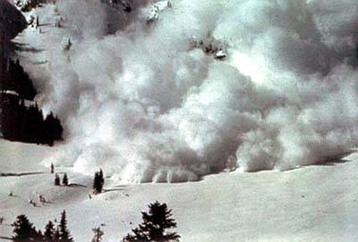
An avalanche near Aspen claimed the life of a backcountry skier on Tuesday. (File - Wikimedia Commons)
An avalanche near Aspen claimed the life of a backcountry skier on Tuesday. (File Photo - Wikimedia Commons)

The avalanche danger has been high throughout much of Colorado this year and that was highlighted today as rescuers pulled the body of a skier from a slide near Aspen. The victim is the third fatality of the season in Colorado.

Pitkin County Sheriff’s Department officials said the avalanche was triggered at 4:00pm on Tuesday in he Lindley Hut area and 911 received a call at about 6:00pm. The skier was part of a group of eight that supposedly had backcountry experience. Rescuers were on site this morning and pulled the victim out at about 9:00am.

Overall, the Colorado Avalanche Information Center (CAIC) said the avalanche danger was ‘considerable’ across much of the state. The center said that the danger is decreasing but “human triggered avalanches remain probable on steep mid and high elevation slopes.”

Dozens of incidents have been reported this season; two prior to yesterday’s were fatal. On January 6th the season turned deadly near Battle Mountain outside the Vail Ski Area when an out-of-bounds snowboarder died in an avalanche. The second fatality of the season occurred on February 11th in the Ridgway area in southwestern Colorado.

Heavy snow, in particular in the southwestern part of the state, has made conditions ripe for avalanches. Officials urge backcountry users to ensure they have appropriate gear with them and know the dangers of the area they are venturing. At a minimum, experts recommend all members of parties carry an emergency beacon, shovel and probe pole.

As seen from space – Second blizzard’s snow spread across the East Coast

As seen from spance, snow covers the Mid-Atlantic from Washington D.C. through Baltimore and Philadelphia to New York City. (NASA)  See a larger image below.
As seen from space, snow covers the Mid-Atlantic from Washington D.C. through Baltimore and Philadelphia to New York City. (NASA) See a larger image below.

Whether it is called ‘Snowmageddon’, ‘Snowpocalypse’ or any other array of the names, the amazing series of winter storms that have struck the Mid-Atlantic States has been nothing short of astounding. Two storms struck the region in less than a week and NASA satellites have captured images of what the scene looks like from space after the second storm struck.

Baltimore, Washington D.C., Philadelphia, Wilmington and Atlantic City have all set new records for seasonal snowfall. Baltimore has recorded nearly 7 feet of snow so far this winter eclipsing the previous record by more than 17 inches.

All of those cities have recorded more snow than ones in the Rocky Mountain region. That also led to the unusual event of 49 of the 50 states having snow on the ground on the same day.

The image to the right and below was taken by NASA’s Terra satellite on February 11, 2010 after the second blizzard struck.

Second Blizzard Strikes U.S. East Coast
As seen from spance, snow covers the Mid-Atlantic from Washington D.C. through Baltimore and Philadelphia to New York City. (NASA)

Amazing winter allows 49 states to record snow on the ground

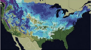
More than two thirds of the United States recorded snow no the ground on Friday.  (National Weather Service)
More than two thirds of the United States recorded snow no the ground on Friday. (National Weather Service)

It seems so improbable that no one was sure whether or not it has happened before but there was snow on the ground in 49 of the 50 states on Friday. The unlikely event was possible thanks to snow that hit unusual places like Texas and Florida.

According to the National Weather Service, 67.1 percent of the United States’ total land area was covered by snow yesterday. That far exceeds the 40 to 50 percent normally seen this time of year.

Dallas, Texas recorded an improbable 12.5 inches of snow breaking records for the date and pushing the city to its second snowiest winter on record and its snowiest in 32 years. Not to be left out, snow was on the ground in Arkansas, Alabama, Georgia and even the Florida Panhandle.

Residents in some places in the United States are wishing things weren’t nearly as snowy. The Mid-Atlantic region has experienced record setting snowfalls this year.

Baltimore, Washington D.C., Philadelphia, Wilmington and Atlantic City have all set new records for seasonal snowfall. Many of those cities have experienced more snow than their counterparts in the Rocky Mountain region.

So what was the one state that held out without snow? Hawaii. This is actually unusual as the Mauna Kea volcano peaks at 13,800 feet and often times has snow on it. Research meteorologist Tiziana Cherubini at the Mauna Kea Weather Center told the Associated Press the mountain had been without snow for a few weeks and none is in the forecast.

Officials at Rutgers University’s Global Snow Lab and with the National Weather Service are trying to determine if all 50 states have recorded snow on the ground at the same time. They have verified that 49 states have previously on January 19, 1977 when South Carolina was the lone holdout.

National Weather Service meteorologists attribute the snowy conditions to a moderate El Nino event in the Pacific Ocean and the Arctic Oscillation. In El Nino seasons, moisture streams across the south. The Arctic Oscillation brings colder air from the north dropping temperature and allowing any precipitation that might fall to turn to snow.

There's more to this story on Examiner.com!For a complete look at the crazy winter weather across the nation, be sure to visit the Natural Disasters Examiner.

It’s finally over – Mid-Atlantic digs out from record-setting snowstorms

The history making snowstorm that pushed many East Coast cities’ snow totals into the record books has moved out. Now residents begin the monumental task of digging out from snow depths the likes of which have never been seen.

Philadelphia, Washington D.C., and Baltimore were just some of the major cities on the east coast to be struck by what some have called ‘Snowmageddon.’ Last week a major winter storm dumped over two feet of snow on major cities in the Mid-Atlantic. Residents had just finished digging out from that event when Mother Nature delivered another wallop Tuesday and Wednesday.

Separately, the two storms in the past week and a previous one in December ranked each in many cities’ ‘top 10’ snow events. Collectively, the storms have dumped more snow than the region has ever seen in a single season.

How much snow fell?  Check out the astounding snowfall totals at the Natural Disasters Examiner.

‘Snowmageddon’ spotted by NASA satellite

e extent of snowfall from the major winter storm that struck the Mid-Atlantic states last week is easily seen from NASA satellites. (NASA) See a larger version below.
The extent of snowfall from the major winter storm that struck the Mid-Atlantic states last week is easily seen from NASA satellites. (NASA) See a larger version below.

This past Friday and Saturday the Mid-Atlantic states were smashed by a record-setting snowstorm that left more than two feet of snow in many areas. The snow brought the nation’s capital to a grinding halt and now the extent of the storm’s wrath can be seen from space.

NASA’s Terra satellite flew over the area on Monday and was able to capture amazing imagery showing the widespread snow cover. The image to the right and the larger version below clearly show Washington D.C., Baltimore, and Philadelphia buried under a significant blanket of white.

Even as area residents continue to dig out from the snow and power companies try to restore power to tens of thousands, a second blast of winter is set to arrive today. That storm may generate nearly as much snow and will certainly push most major cities in the area to record seasonal snowfall totals.

Heavy Snow around U.S. Capital – February 8, 2010 (NASA)
Heavy Snow around U.S. Capital - February 8, 2010 (NASA)

Mid-Atlantic digs out from historic snowstorm as another looms

Schools, businesses and even the federal government were shut down across the Mid-Atlantic Monday as the region tries to recover from a record-setting snowstorm. There will be little rest for the snow-weary however as another storm looms and threatens to add to the already tremendous snow totals.

A two-day storm that started Friday left a wide swath from Virginia across Maryland and Pennsylvania and into New Jersey left historic snowfall in its wake. Dulles International Airport recorded 32.4 inches, Baltimore / Washington International recorded 24.8, Ronald Reagan Washington National Airport recorded 17.8 and Philadelphia measured 28.5. All were record-setting or at least ranked in the top five snowstorms in those cities’ history.

On Sunday the area had time to begin digging out but the task was gargantuan and continues today. The federal government which employs 230,000 workers in the area was closed as were many local government offices. Businesses and school districts similarly left their doors shuttered to give the area time to recover.

Travel across the area continues to be problematic at best as airports struggle to clear the snow and resume flights. Reagan National Airport remained closed Monday morning with hopes of opening later in the day. Baltimore / Washington International Thurgood Marshall Airport opened one runway Sunday night and Dulles International was open although both warned passengers to expect continued delays and cancelations.

There's more to this story on Examiner.com!Get all the details on the record setting storm from the Natural Disasters Examiner.