Tag Archives: hurricane

Global hurricane activity at 30 year low

Florida researches believe a strong La Nina event is responsible for reduced global hurricane activity.

Researchers at Florida State University announced that global hurricane activity continues to decrease and is now at levels not seen since 1977.  The researchers say that, “Tropical cyclone (TC) activity worldwide has completely and utterly collapsed during the past 2 to 3 years.”

Last November we reported that hurricane activity in the northern hemisphere was at 30 year lows.  Now, in this follow-up research, we see that when including the southern hemisphere global hurricane energy has sunk to 30 year lows. 

Using a measurement called the Accumulated Cyclone Energy index (ACE), researchers see a tremendous drop in cyclone energy for the globe as a whole.  While the north Atlantic saw above normal levels of ACE in 2008, it represents a relatively small amount of the global hurricane energy and as such cannot compensate for the much reduced levels elsewhere on Earth. 

Just as there are active periods of hurricane activity around the globe, there are inactive periods, and we are currently experiencing one of the most impressive inactive periods, now for almost 3 years.
– Florida State University researchers

You can find complete coverage of this story as well as an incredible slideshow of hurricanes as seen from space on our Examiner.com weather news page.  Click here to go there. 

For all the details, read the rest of this story on our Denver Weather Examiner page. Examiner.com - Get inside Denver weather

2008 Atlantic hurricane season sets record

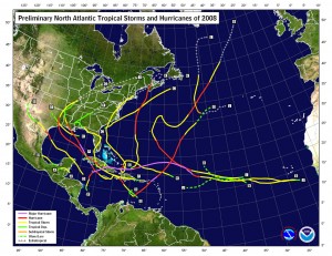
This image shows the tracks of hurricanes that occurred during the 2008 season.  Click for larger image.
This image shows the tracks of hurricanes that occurred during the 2008 season. Click for larger image.

Sunday, November 30th marks the close of the hurricane season and the National Oceanic and Atmospheric Administration says it was one for the record books.  The season marks one of the more active in the last 64 years overall and resulted in a record number of consecutive storms striking the United States.

According to Gerry Bell, Ph.D, the lead seasonal forecaster at NOAA, “This year’s hurricane season continues the current active hurricane era and is the tenth season to produce above-normal activity in the past 14 years.”  It is important to note however that comprehensive record keeping of hurricanes has only been occurring for the last 64 years so there is not a great deal of data to draw upon.

In all, a total of 16 named storms formed this season, eight of which were hurricanes.  Five of those were major hurricanes of category 3 strength or higher.  An average hurricane season has 11 named storms, six hurricanes and two major hurricanes.  In May at the start of the 2008 season, NOAA forecasters predicted 12 to 16 named storms and then in August upped their predictions to 14 to 18 named storms.  This represents the first time in recent years forecasters had accurately bracketed the number of storms.  In 2007 NOAA predicted 10 hurricanes and only six formed. The year prior, 2006, nine hurricanes were forecasted by NOAA but only five formed.  In 2005, the year Hurricane Katrina devastated New Orleans in the worst U.S. natural disaster, the forecasts underestimated storm activity.

2008 ties as the fourth most active season in terms of named storms (16) and major hurricanes (5).  It also tied as fifth most active in terms of hurricanes overall (8) since 1944. 

From NOAA, most notably:

For the first time on record, six consecutive tropical cyclones (Dolly, Edouard, Fay, Gustav, Hanna and Ike) made landfall on the U.S. mainland and a record three major hurricanes (Gustav, Ike and Paloma) struck Cuba. This is also the first Atlantic season to have a major hurricane (Category 3) form in five consecutive months (July: Bertha, August: Gustav, September: Ike, October: Omar, November: Paloma).

Bell attributes the active season to ongoing increased activity since 1995, lingering La Nina effects and warmer tropical Atlantic Ocean effects.

Here is a fascinating video from NOAA using satellite imagery of the entire hurricane season:

Remote control hurricane hunters set to deploy

NASA uses unmanned UAVs as hurricane hunters.

Anyone who has followed the wars in Iraq or Afghanistan has heard about the use of Unmanned Aerial Vehicles (UAV).  These are essentially remote control airplanes capable of performing a number of tasks from surveillance to actually carrying weapons. 

NASA and NOAA have over the last year been experimenting with a small UAV from Aerosonde, an Australian manufacturer.  NOAA currently uses manned hurricane hunter aircraft (WP-3D Orion and Gulfstream IVs) to take measurements from inside and immediately surrounding hurricanes.  This data is essential to not only predicting hurricane paths and guaging the storms’ strength but also to learning more about them. 

These new UAVs offer many advantages over the traditional, manned hurricane hunter aircraft.  For one, they can fly at much lower altitudes into the storms without endangering human lives.  Further, they can be called into service on much shorter notice than a manned crew and remain on station around a storm for longer periods of time.  In November of 2007 NOAA sent an Aerosonde UAV into Hurricane Noel and the unit was airborne for over 17 hours and collected more than seven hours worth of data. 

The technology has many applications within NOAA’s mission of monitoring our globe.  In addition to hurricane hunting, UAVs can be used to monitor ice flows, wildfires, severe weather, animal life and much more.  The program is really just getting started and funding is minimal in comparison to the military equivalent but the applications are very promising.  Maybe a tornado hunter is next!

Here’s a video from Aerosonde discussing the potential applications.

2009 National Storm Chaser Convention dates announced

The 2009 National Storm Chaser convention will be February 13 - 15, 2009.
The 2009 National Storm Chaser Convention will be February 13 - 15, 2009.

The dates for the 11th annual National Storm Chaser Convention have been announced.  The event will be held February 13th to the 15th at the Red Lion Inn in Parker.  As usual there looks to be a great lineup of speakers and of course it will certainly be informative and fun.  The agenda is still being finalized but some of the highlights announced thus far include:

This year’s convention promises to be the biggest and best yet! The convention is held each year in Denver, Colorado, and is geared for you, the storm chaser, spotter and storm enthusiast, to be the premiere gathering of the year. Because of the intense severe storm and hurricane season that 2008 brought, we have been able to gather some of the best scientists and forecasters in the world to present at this year’s convention. Dr Steve Lyons, hurricane expert for The Weather Channel, will be this year’s keynote speaker. From the National Hurricane Center, we welcome lead forecaster Dr Jack Bevens.

On the severe storm side, we welcome Dr Greg Forbes from The Weather Channel, and are also excited to welcome back Dr Howie Bluestein. We are also excited to have Rich Thompson, lead forecaster at the Storm Prediction center, as well as meteorologist Jon Davies. Tim Marshall will once again bring is attention getting presentation to our convention. We have several other speakers that you won’t want to miss!!! So sign up early and tell all your friends to come to the 2009 National Storm Chaser Convention.

For more information, visit the convention website at:  http://chaserconvention.com/

Hurricane Ike nears Cuba, Florida watches warily

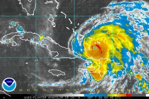
Infrared satellite image of Hurricane Ike as it nears Cuba.

Category 4 Hurricane Ike pummeled the Turks and Caicos Islands Saturday night and Sunday morning with dangerous winds, sea surge and rain as it continues its trek west.  At 3:00am MDT the storm was 215 miles east-northeast of Guantanamo Bay, Cuba moving west-southwest at 15 mph. 

The National Hurricane Center has described this storm as “extremely dangerous” so all countries and interests in the area are keeping a vary close eye on the storm.  On its current track the storm will move over the southeastern Bahamas this morning and then onto or near eastern Cuba Sunday night.  Latest measurements had the storm with 135 mph and some strengthening is indeed possible before it strikes Cuba.  Whether it holds that strength as it passes Cuba will depend on how long it interacts with land.  Current models showing it going directly over the island and weaking a bit but it is expected to regain strength as it enters the southeastern Gulf of Mexico. 

South Florida and those in the Florida Keys need to watch Ike very closely.  Vistors to the Keys were already being asked to leave in anticipation of the storm hitting the islands.  Florida Governor Charlie Crist said Saturday, “We continue to watch with much concern the track of Hurricane Ike. Ike has grown rapidly into a dangerous storm that continues to move … toward Florida.”

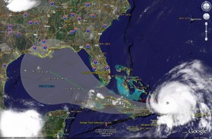
Satellite image of Ike and it's predicted path as of Sunday morning.  Click for larger image.
Satellite image of Ike and it's predicted path as of Sunday morning. Click for larger image.

It is still much too early to tell what the storm will do once it hits the Gulf of Mexico on Tuesday.  Models indicate a potential strike anywhere between Texas and Alabama later in the week.  Much can and most likely will change between now and then. 

For the latest on the storm’s location, please visit the ThorntonWeather.com Hurricane Tracker.

Hanna makes landfall, Ike continues west

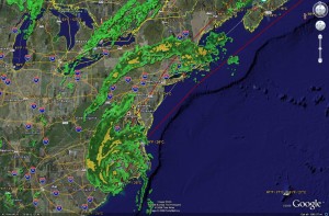
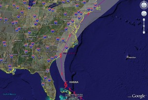
Tropical Storm Hanna has made landfall in the Carolina's.  Click for larger view.
Tropical Storm Hanna has made landfall in the Carolina's. Click for larger view.

What could probably be called “storm weekend” for the east coast hit in earnest early Saturday morning as Tropical Storm Hanna made landfall along the North Carolina / South Carolina border.  With sustained winds of 60 mph the center of Hanna was located about 25 miles west-northwest of Wilmington, N.C. as of 3:00am MDT.  The storm will follow the eastern seaboard today where heavy rain and strong winds are expected and tropical storm warnings have been issued from Virgina to Boston.  Travel delays, flooding and some beach erosion along the coast are an almost certainty. 


Everyone is really keeping a wary eye on Hurricane Ike, a storm that has the potential to cause serious damage.  As of 3:00am MDT was 400 miles west of Mayaguana in the Turks Islands and moving west-southwest at at 16 mph.  With winds of 115 mph Ike is a category three hurricane.  Some fluctuations in intensity are expected over the next 48 hours but it should remain a major hurricane.  Models indicate the storm will pass through the Florida straights with Cuba having the potential to suffer a big hit from the storm Monday and into Tuesday. 

Hurricane Ike continues its trek westward.  Click for larger view.
Hurricane Ike continues its trek westward. Click for larger view.

One thing that has changed over the last 36 hours or so is Ike’s forecast path.  Initially expected to “hook” and turn north onto Florida, it now looks like the storm will pass just off the southern tip of the state and head into the Gulf of Mexico.  This of course is not good news for the storm weary states along the Gulf Coast.  Further, some convection is expected once it hits the gulf and if this occurs, the storm will strengthen, possibly to a category 4 storm.  Ike is still too far out to draw too many conclusions on where its ultimate path will lead and the models all differ on their opinions.  However, once the storm enters the Gulf of Mexico toward the middle of next week, Gulf Coast residents should be prepared to evacuate if needed.  

For the latest on the storms’ locations, please visit the ThorntonWeather.com Hurricane Tracker.

Hanna settles down, Ike “extremely dangerous”

Tropical Storm Hanna set to hit the Carolina's.  Click for a larger image.
Tropical Storm Hanna set to hit the Carolina's. Click for a larger image.

The southeastern United States is in preparations for what could be a rough period as Tropical Storm Hanna, Hurricane Ike and Tropical Storm Josephine move through the Atlantic toward its shores. After reading the details below, be sure to check out our new Hurricane Tracker!

Tropical Storm watches or warnings were extended to areas just south of New York City on Friday as states along the Atlantic seaboard braced for Hanna.  Dry air and wind shear has helped to calm Hanna down and winds have most recently been measured at 65 mph however she could regain hurricane strength before making landfall early Saturday morning.  The storm is very large with tropical storm level winds extending 315 miles out from the center.  Significant rain accumulations can be expected from South Carolina through Virginia as can a 3 – 5 foot storm surge and dangerous waves. 
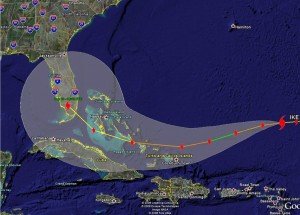
Hurricane Ike could be very dangerous and is on track to hit southern Florida.  Click for a larger image.
Hurricane Ike could be very dangerous and is on track to hit southern Florida. Click for a larger image.

Perhaps of greater concern is Hurricane Ike.  In a period of 24 hours Ike exploded from a tropical storm to a category 4 hurricane.  The storm has settled down a bit and as of this morning is a category 3 storm with 125 mph winds and is moving west at 15 mph.  This weakening is expected to continue for the next couple of days before it regains strength again and should become a major hurricane.  Ike should continue west through Monday morning before starting to turn northwest however a pressure ridge close to the U.S. could change that.  If it continues on the expected path, south Florida could take a direct hit from the storm late Tuesday into early Wednesday.  This storm has the potential for widespread and serious damage and area residents should be prepared to evacuate. 

Tropical Storm Josephine is a good ways from the U.S. and is not currently expected to be a threat to the mainland.  Winds are currently at 50mph with northwest movement at 9mph.  Josephine should continue on the northwest path and stay in the Atlantic. 

For the latest updates on the positions of all of these storms, see our new Hurricane Tracker!

Hanna, Ike, and Josephine – Mother Nature’s triple threat lines up

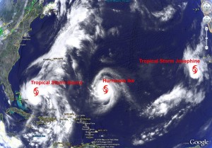
Hanna, Ike and Josephine are up to bat.  Click the image for a larger version.
Hanna, Ike and Josephine are up to bat. Click the image for a larger version.

Hot on the heels of Hurricane Gustav, an alphabet of storms is lining up to threaten the United States coast. 

Tropical Storm Hanna is the closest and can’t quite make up her mind what she wants to do.  The storm was a hurricane for a time but has been downgraded as its winds have dropped to 70mph.  Hanna has been battering the Bahamas with torrential rain and in Haiti it has claimed 61 lives, mostly from flooding.  After meandering around, it is now heading northwest at 12mph and will threaten the southeast coast of the U.S. Friday.  Her path is unpredictable but best guesses show the greatest threat of a direct hit from Hanna lies along the Carolina coast between Myrtle Beach, S.C., and Wilmington, N.C.  Late Friday night / early Saturday morning it is expected to make landfall as a category 2 storm.

Hurricane Ike is currently 550 miles northeast of the Leeward Islands and is moving west-northwest at 17mph.  This storm looks to hold the greatest danger of the three right now as it has grown from a tropical storm to a category 4 hurricane with 145mph winds in less than 24 hours.   It is too early to determine where a potential landfall might occur but by Sunday morning is should be near Haiti and the Dominican Republic.  Folks really need to be on the lookout as this storm could be catastrophic.   

Moving out further from the coast is Tropical Storm Josephine.  The storm is currently closer to Africa than the U.S.  – about 465 miles west of the southernmost Cape Verde Islands.  Sustained winds are at 60mph and the storm is moving west-northwest at 10mph.  The current hope is that the storm takes a turn to the north as it crosses the Atlantic and doesn’t hit land.

As Gustav winds down, Hanna and Ike spool up

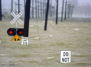
Water from the Industrial Canal floods a road in New Orleans after Hurricane Gustav made landfall Monday. Image courtesy Getty Images.

A weakend Hurricane Gustav came ashore Monday morning shutting down power and swamping much of the Gulf Coast with torrential rain.  Initially making landfall as a category 2 storm, by 3:00pm MDT the storm had lost much of its power and was downgraded to a category 1 system with winds of 80 mph. 

Much of the Louisiana and Mississippi coast lines were subject to extensive rains and high storm surge.  Winds pushed the water over many levees but the Army Corps of Engineers reported no major problems.  The largest provider of electric power in Louisiana, Entergy, said more than 700,000 homes and businesses were without power in the region. 

The Federal Emergency Management Agency (FEMA) reported two Navy boats, each about 350 feet long, that were being scrapped at a facility on the canal broke away from their moorings Monday. They are currently pinned against a wharf in the Industrial Canal but there is concern that should they move they could strike some of the canal walls. 

Much remains to determine the extent of damage from the storm.  The center of the storm is currently north of Lafaette, LA and steadily moving north.  As it does, it will weaken to a tropical storm tonight.

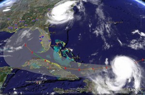
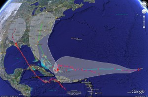
Satellite imagery of the potential tracks of Gustav, Hanna and Ike.  Click for larger version.
Satellite imagery of the potential tracks of Gustav, Hanna and Ike. Click for larger version.

A stark reminder that hurricane season is far from over is the appearance of two additional storms – Hurricane Hanna and Tropical Storm Ike.  Both will bear close watching over the coming days. 

Hanna became a category one hurricane today and as of 3:00pm MDT was  just east of Mayaguana Island in the southeastern Bahamas.  Hanna is expected to meander for a couple of days before making a turn to the northwest with a possible landing anywhere between southern Florida and the Carolinas late this week.   

Ike formed out of a tropical depression today and is currently in the middle of the Atlantic, 1400 miles east of the Leeward Islands moving west at 16 mph.  A warm ocean along Ike’s path is expected to help it reach hurricane strength in the next 36 hours.  It is still very early to tell where Ike will end up but on its current course, it could strike Cuba, the Bahamas and possibly Florida early next week.

Gustav ready to strike Monday AM

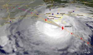
Satellite image of Gustav as of 5:00am MDT showing the storms predicted path.  Click for a larger version.
Satellite image of Gustav as of 5:00am MDT showing the storms predicted path. Click for a larger version.

Hurricane Gustav continues its march to the Louisiana coast Monday morning with landfall expected sometime between 5:00am and 7:00am MDT. At 5:00am MDT the eye of the hurricane was approximately 85 miles south of New Orleans and about 150 miles southeast of Layfayette moving at 16 mph.  Current tracks have it making landfall in the Terrebone / Lafourche areas, just to the east of New Orleans. 

**  Special Coverage:  Click here to view New Orleans radar  **

The good news, if there is any, is that Gustav has not strengthened as was originally expected.  The latest hurricane hunter aircraft report at 3:00am MDT reported sustained winds of 115 mph.  While that is still a category three storm, satellite observations show the storm is not as organized as it could be.  In fact, a station in southwest Pass Louisiana measured only 91mph as Gustav passed over it.  It is important to note that the greatest damage and danger associated with hurricanes is not the winds.  The severe rain, storm surge and the flooding associated with those present the greatest danger.  Rainfall of 6 to 12 inches can be expected and most notably storm surge of 10 to 14 feet. 

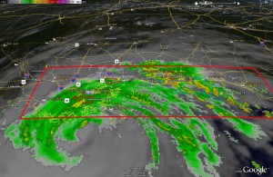
Radar image of Gustav showing current warnings and watches. Click for large version.

Also, one little known additional danger with hurricanes is that of the threat of tornadoes.  In fact, New Orleans and much of the surrounding area is under a Tornado Warning and some twisters have been reported by local law enforcement in Gulfport, MS.  Further, National Weather Service radar indicated the potential for tornadoes right near New Orleans in Jefferson Parish, Southern St. Charles Parish and Plaquemines Parish.

Here are a couple sites with webcams in Louisiana you may wish to check out:

Louisiana DOT

WWLTV.com