Tag Archives: national weather service

Denver’s March was warmer, drier than average

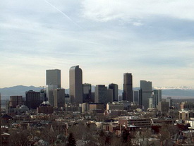
Denver's March 2010 snowstorm
Despite the snowstorm that struck on March 23rd and 24th and the rain that fell beforehand, the National Weather Service says Denver's March precipitation was below normal.

According to the Denver / Boulder office of the National Weather Service, Denver’s March weather was warmer and drier than normal. The latest climate summary from the service would seem to contradict what Denver residents actually experienced, at least in terms of precipitation.

The report starts with a seemingly contradictory statement saying, “Denver’s March 2010 finished with below normal liquid moisture in spite of finishing above normal in the snowfall category.”

According to the report, Denver recorded 0.80 inch of precipitation, well below the normal of 1.28 inches. Most of that occurred in conjunction with the snowstorm on the 23rd of the month when the official measuring station at Denver International Airport (DIA) reported 0.61 inch of precipitation.  By contrast, ThorntonWeather.com recorded 1.42 inches of precipitation from that storm alone and 1.90 inches for the month. 

March is Denver’s snowiest month recording on average 11.7 inches of snow. This year the month yielded 12.8 inches, most of which fell during the snowstorm that struck from the 23rd to the 24th. The service noted that this was the third month this snow season with above normal snowfall.  We recorded more snow here in Thornton with 15.3 inches. 

Overall for the season, Denver has recorded 58.8 inches of snow which is 7.5 inches above the average snowfall up to this point. Denver’s snow season runs from July through June and we average 61.7 inches over that period so for 2010 we are quickly approaching a ‘normal’ year.

The average temperature as recorded at DIA was 41.0 degrees which was 1.4 degrees above the normal of 39.6 degrees. Temperatures for the month ranged from a high of 82 degrees on the 30th down to a low of 13 degrees on the 20th. The 82 degree high temperature on the 30th broke the record for that date of 81 degrees set way back in 1879.

Controversy once again surrounds measurements in latest report

Questions have been raised numerous times about how the move of Denver’s official monitoring station to DIA has skewed the climate records for the city. Evidence shows that the 14 mile move has forever altered Denver’s records.

The March 2010 climate summary once again highlights the problem. Comparison of temperature records for DIA versus areas closer to historical monitoring locations continue to show discrepancies. Standing out even more are precipitation records that are curious at best, ridiculous at worst given the wet snowstorm that struck on the 23rd and 24th.

The Denver Weather Examiner is in the process of updating our previous investigation and will have an updated report soon. In the meantime, you may wish to look at the results of the investigation we conducted last year.

National Weather Service modifies hurricane scale

Hurricane Ike bears down onto the upper Texas coastline with category 2 wind speed of 110 mph, September, 2008. (NOAA)

Beginning this hurricane season, NOAA’s National Weather Service will use a revamped hurricane rating system that does away with storm surge effects of each category. The new scale, called the Saffir-Simpson Hurricane Wind Scale will use wind as its only determining factor.

Herbert Saffir and Robert Simpson developed the original Saffir-Simpson Hurricane Scale as a way to communicate the threat of hurricanes based on their power and released it to the public in 1973. In addition to wind, the scale used storm surge as a factor when determining a storm’s category rating.

Since then, scientists have realized that the amount of storm surge generated by a hurricane can vary greatly, well outside the wind guidelines of the original scale. According to NOAA, the storm intensity, size, pressure and the underwater topography near where a hurricane is going to make landfall make a large difference.

In announcing the new scale, NOAA pointed two recent storms to convey the problem with the old scale. Hurricane Ike made landfall along the Texas coast in 2008. While only a Category 2 storm, it produced storm surge of 15 to 20 feet. By contrast, Hurricane Charley in 2004 was a Category 4 storm that struck Florida but only generated a 6 to 7 foot storm surge.

Storm surge is extremely dangerous and flooding resulting from it and the tremendous rains generated by hurricanes claim more lives than wind. As such, storm surge forecasts will continue however they will be independent of the hurricane ratings. Beginning this year, when discussing surge, it will be expressed in height above ground level to help residents understand the potential for flooding in their area.

The revamped scale also was accompanied by new descriptions of wind impact while retaining the same wind speeds that were previously used.

There's more to this story on Examiner.com!To view the new scale, a summary of what each of the categories means and examples of each, please visit the Natural Disasters Examiner.

NOAA: Nighttime and winter tornadoes a real danger

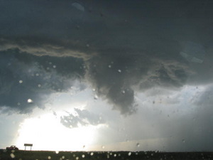
Tornadoes can and do strike at night and during winter months.  Are you prepared?
Tornadoes can and do strike at night and during winter months. Are you prepared?

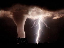
Tornadoes are one of nature’s most violent storms. Able to strike without warning, they bring death and destruction with frightening frequency. Twisters can be scary enough to just think about and when you consider one striking at night when you can’t see it and aren’t expecting it, the odds of survival diminish.

Over the last three years, there has been an average of 1297 tornadoes per year and on average 91 tornado-related deaths per year. While not as common during the winter months, tornadoes can and do occur every month of the year and they do strike at night.

Seeking to draw attention to the dangers nighttime tornadoes present, the National Oceanic and Atmospheric Administration (NOAA) and its National Weather Service announced an effort to increase awareness. In a press release today, the services said that with the El Niño conditions we are experiencing, Florida and the Gulf Coast region stand a greater risk of tornadoes.

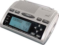
NOAA reminded all residents of the United States that a NOAA All Hazards Radio is the first line in defense against not only tornadoes, but all natural disasters. Also announced were new severe weather outlooks that will be issued when conditions are favorable for such storms.

There's more to this story on the Denver Weather Examiner's site!Get all the details from the Natural Disasters Examiner about what the National Weather Service said and learn what steps you can take to protect you and your loved ones.

Denver gets new National Weather Service weather station near downtown

Denver now as an official weather monitoring station closer to downtown but some say this doesnt solve the problem of the citys climate records being altered. (Examiner.com)
Denver now as an official weather monitoring station closer to downtown but some say this doesn't solve the problem of the city's climate records being altered. (Examiner.com)

It only took 14 years but Denver finally has an official monitoring station near downtown again. The new station amongst the greens of City Park Golf Course finally gives residents of Denver a place to see what the weather is doing closer to home.

With the opening of Denver International Airport in 1995, the National Weather Service moved its station to the new airport. That distance of 12 miles from the old Stapleton facility to DIA confounded citizens, television meteorologists and weather enthusiasts as they all noted that no one lives out at the airport and the conditions reported there do not reflect what is happening closer to town.

Recognizing the problem, a public-private partnership came together to do what they could to rectify the problem. The City and County of Denver, the Denver Museum of Nature and Science, the National Weather Service and NOAA, 7News Chief Meteorologist Mike Nelson and Colorado State Climatologist Nolan Doesken identified a site for the new station.

Eclar Fence and Mercury Electric donated the infrastructure for the new site. Weather equipment manufacturer Vaisala donated the weather monitoring hardware and services, estimated at up to $60,000.

Certainly there is little doubt the new station will provide area residents the ability to view conditions closer to where they actually live. The new station will not however address the very real problem of Denver’s climate records having been altered since the move to DIA. The National Weather Service has said the official records for Denver will still come out of DIA and as such many believe those records come with an asterisk.

There's more to this story on the Denver Weather Examiner's site!Why is there still a problem with Denver’s climate records?  What does the new station look like?  Check out the complete story including photos of the station, an interactive map and more on Examiner.com.

National Weather Service weather balloon zaps Thornton boy

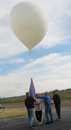
Hundreds of weather balloons like this are released daily by the National Weather Service. (NOAA)

A 12-year-old boy reportedly received a bit of a shock when he touched a National Weather Service balloon that had landed near Niver Creek Middle School in Thornton. The balloons which are launched twice daily from the old Stapleton International Airport facility and other locations across the nation are essential instruments for forecasters.

The boy complained of numbness in his hands after touching it and school officials called the fire department as they were unsure what the device was. Upon closer inspection they read the labels that said the unit belonged to the National Weather Service and was a weather instrument. The boy was transported to a hospital as a precaution and his father told Channel 7 Wednesday morning that he was fine.

Weather balloons are launched daily from 102 locations across the United States, Caribbean and Pacific and are essential forecasting instruments (see below for a map of sites in the contiguous United States). The six foot diameter balloons are launched twice daily and simultaneously at all the sites at midnight UTC and noon UTC (5:00am MDT and 5:00pm MDT). Once launched, the units can attain an altitude of 115,000 feet and travel up to 200 miles before they burst and fall harmlessly to the ground.

Called a radiosonde, the balloon’s payload measures air pressure, temperature, humidity, wind direction and wind speed. The data is transmitted in real time to receivers on the ground which is then fed into National Weather Service computers and monitored by forecasters. Information obtained by the units is essential for forecasters to evaluate and predict atmospheric conditions for forecasting, severe weather alerting and more.

For more details on what these instruments are used for, read the full story on Examiner.com.

There's more to this story on the Denver Weather Examiner's site!

Another chance at storm spotter training in the north area

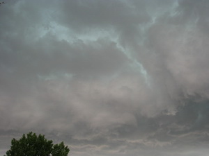
Do these clouds have the potential to bring a tornado?  Learn more at National Weather Service storm spotter training.
Do these clouds have the potential to bring a tornado? Learn more at National Weather Service storm spotter training.

We have written before about the great opportunity the National Weather Service provides by giving storm spotter training during the start of the severe weather season.  Normally these sessions are held in the spring but in response to the very active severe weather of early June, and the increased interest in severe thunderstorms, the National Weather Service in Boulder has added to additional spotter training session next week. 

  • When:  Saturday, July 11
  • Time: 10:00am
  • Where: Broomfield, CO.
  • Exact location: Rocky Mountain Metropolitan Airport, Terminal Building, 11755 Airport Way (formerly Jefferson County Airport)
  • For more information: robert.glancy@noaa.gov

The storm spotter program is a nationwide program with more than 280,000 trained spotters.  These volunteers report weather hazards to their local National Weather Service office providing vital information when severe strikes.  Data from spotters include severe wind, rain, snow measurements, thunderstorms and hail and of course tornadoes. 

Don’t think tornadoes can hit Thornton?  Click here for a look back at the June 3, 1981 twister that hit the city!

Storm spotters are part of the ranks of citizens who form the Nation’s first line of defense against severe weather. There can be no finer reward than to know that their efforts have given communities the precious gift of time–seconds and minutes that can help save lives.

By completing one of these training classes you can become an official storm spotter.  When severe weather strikes, you can report it by calling a special toll free number or submit your report via the National Weather Service’s website. 

Taking the training though doesn’t obligate you to being a storm spotter.  These are great sessions for anyone wanting to learn more about the severe weather we experience in Colorado, whether you want to be an official spotter or not.  All training is free.  Topics include:

  • Basics of thunderstorm development
  • Fundamentals of storm structure
  • Identifying potential severe weather features
  • Information to report
  • How to report information
  • Basic severe weather safety

To learn more about the program, see here:  http://www.crh.noaa.gov/bou/awebphp/spotter.php

Largest in-field tornado study ever set to launch in May

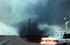
The VORTEX2 tornado research project will be the largest in-field study of tornadoes ever.

The single largest and most ambitious field study to increase our understanding of tornadoes is set to kick off next month.  The Verification of Origin of Rotation in Tornadoes EXperiment2 (VORTEX2 or V2) will feature more than 50 scientists utilizing 40 vehicles, 10 mobile radar units and an Unmanned Aerial Vehicle (UAV).

The study which will run from May 10 to June 13 will become the largest mobile in-field laboratory ever assembled to study tornadoes.  In a statement Louis Wicker, research meteorologist with NOAA’s National Severe Storms Laboratory and V2 co-principal investigator said, “Data collected from V2 will help researchers understand how tornadoes form and how the large-scale environment of thunderstorms is related to tornado formation.”

The VORTEX2 tornado research project will be the largest in-field study of tornadoes ever.

Operations will be controlled at the National Weather Center in Norman, Oklahoma while the mobile units chase tornadoes across Tornado Alley and the central Great Plains.  The target area for the study ranges from southern South Dakota through Nebraska, Kansas, Oklahoma and the Texas Panhandle.  Eastern Colorado, home of many tornadoes, is included in the study.

This unprecedented gathering of scientists and technology hold incredible promise for the research that will be gathered.  The original VORTEX program which happened from 1994 to 1995 documented the entire life cycle of a tornado from start to finish, the first time that had ever been done.   That research greatly enhanced our understanding of twisters and led to much improved tornado warnings that help to save lives today.

VORTEX2 seeks to build on that research and the research that has taken place since.  According to the project website it will seek to answer such important questions as:  How do tornadoes form? What exactly causes the wind to spin into a concentrated funnel? How can we tell exactly when a tornado will form and when it will die, or how long it will last? Why do some thunderstorms produce tornadoes and others do not? What is the structure of tornadoes? What is the relationship of tornadic winds to damage?

An important finding from the original VORTEX experiment was that the factors responsible for causing tornadoes happen on smaller time and space scales than scientists had thought.  New advances will allow for a more detailed sampling of a storm’s wind, temperature and moisture environment and lead to a better understanding of why tornadoes form – and how they can be more accurately predicted.
– Stephan Nelson, NSF program director for physical and dynamic meteorology.

VORTEX2 features scientists and students from the United States, Canada and Australia in collaboration with government agencies, private industry and educational institutions.  Many luminaries within the storm chasing and severe weather research community will participate including Dr. Josh Wurman of the Discovery Channel’s Storm Chasers TV show.  Some of the notable participating organizations include Center for Severe Weather Research, Rasmussen Systems, NOAA National Severe Storms Laboratory, OU/NOAA Cooperative Institute for Mesoscale Meteorological Studies, NSF-sponsored National Centers for Atmospheric Research, Penn State University, University of Oklahoma, Texas Tech University, Lyndon State College, University of Colorado, Purdue University, North Carolina State University, University of Illinois, University of Massachusetts, University of Nebraska, Environment Canada, and the Australian Bureau of Meteorology.

For more information:

[nggallery id=3]

Do Denver weather and climate records have an asterisk attached?

The old Stapleton International Airport site and Denver International Airport are separated by 12 miles.  Is it accurate tto compare weather between the two locations?
The old Stapleton International Airport site and Denver International Airport are separated by 12 miles. Is it accurate to compare weather between the two locations?

February 2009 is Denver’s least snowiest February on record.  A new record high temperature is recorded on January 21, 2009.  Record low temperatures are recorded on December 14th and 15th of last year

These announcements are common and we all take notice when we hear them and they make for great water cooler chat topics but are these claims accurate? 

In 1995 Denver finally opened its new airport, Denver International Airport, out on the plains east of the city.  This new facility, 12 miles as the crow flies northeast of the old Stapleton International Airport, moved the airport from an urban environment to a rural one and more than 19 miles from the center of Denver.  Following that move, the National Weather Service (NWS) began taking some of its official measurements at the glistening new airport.  In doing so, some say Denver’s climate records have forever been altered and as such any weather record should have an asterisk attached to it. 

On Examiner.com we have launched a three part investigative series on this topic.  It is a fascinating read – click here to read the rest of the story.

For all the details, read the rest of this story on our Denver Weather Examiner page. Examiner.com - Get inside Denver weather

Denver officially breaks high temperature record for March 2nd

Denver officially set a new record high temperature for March 2nd.

Updated, 5:30pm:  Denver’s official high temperature today reached 74 degrees at 3:08pm, beating the old record of 72 degrees by two.

Original post, 2:39pm:  Denver has officially broken the high temperature record for today, March 2nd.  At 1:52pm the thermometer at Denver International Airport reached 73 degrees, besting the old record of 72 degrees set way back in 1901.  Here in Thornton we were a touch warmer reaching a high of 74.1 degrees.

This afternoon there is a chance the temperature could go a degree or two higher thus further increasing the record.

Is this really a record?  Since moving Denver’s official weather recording station to DIA, many weather enthusiasts believe our weather and climate records are being unduly altered.  Examiner.com just launched an investigative feature into this problem today – check out part 1 of our series on Examiner.com:  Do Denver weather and climate records have an asterisk attached?

Snow on Halloween more fact than fiction

Snow on Halloween?  Popular belief is that we seem to have a lot of snow when the trick or treaters are out on the street.
Snow on Halloween? Popular belief is that we seem to have a lot of snow when the trick or treaters are out on the street.

Conventional wisdom in the Denver area is that it always seems to rain or snow on Halloween.   I know as a kid it seemed like Mother Nature always put a damper on our trick or treating. 

But, is there any truth to this urban legend?  Or is this just one of those times where our memory doesn’t serve us quite right? 

This year it certainly looks like we have nothing to worry about but  the National Weather Service has been kind enough to compile weather statistics just for Halloween.  As it turns out, the thought of snow and rain on Octboer 31st isn’t just in our minds! 

Click here to read all about Halloween and Denver’s historical chances of snow.