Tag Archives: snow

White Christmas brings joy and misery

Two thirds of the contiguous United States had a white Christmas.  (NOAA)
Two thirds of the contiguous United States had a white Christmas. (NOAA)

Christmas 2009 may have granted some people’s wishes for a white Christmas but for millions it equated to misery. A series of snowstorms blanketed two thirds of the nation in snow and snarled holiday plans for many.

From Texas to North Dakota and Nevada to Minnesota the breadth of the storms was tremendous. Holiday travelers were forced to spend their Christmas in airports and shelters while those already at home devoted their holiday to digging out from the heavy snowfall.

Dallas, Texas experienced its first white Christmas in 80 years. The three inches of snow that fell Christmas Eve was a record for the date and lasted long enough for residents to wake up to a cover of white early Christmas morning.

Oklahoma bore a big hit from the storms as 14 inches of snow was recorded in Oklahoma City on Christmas Eve, easily eclipsing the previous record for the date of 2.5 inches. Blizzard conditions forced Governor Brad Henry to order every interstate and highway in the state closed Christmas Eve due to the dangerous conditions. Will Rogers World Airport shut down for a period and was finally able to clear one runway Christmas Day.

There's more to this story on the Denver Weather Examiner's site!For a complete look at the havoc wreaked by the snowstorms and some of the photos from across the nation, please view the complete story at the Natural Disasters Examiner.

Winter weather moves out but the bitter cold remains

It certainly could have been a lot worse. The Mile High City escaped relatively unscathed with only minor accumulations of snow from the storm that is now moving to the east. Its lingering effects will continue to be felt overnight however.

Some blue skies are starting to be seen which is a welcome sight and the Winter Weather Advisory that was in effect has been cancelled. Temperatures however remain in the single digits across the Front Range and are below zero in the high country according to the Rocky Mountain Weather Network. With the slight breezes wind chills are easily dipping near the zero degree mark.

Overnight tonight, the mercury will continue to drop and likely enter negative numbers. The only consolation we have is that we do gradually begin to warm up tomorrow and may very well start hitting normal temperatures by Saturday.

The winter storm system that impacted Colorado struck Arizona and California before arriving here and as it travels east it will cover a widespread swath of the nation. Check out the story from the Natural Disasters Examiner for more information. Also be sure to look at the slideshow below of the winter weather.

Winter storms stretching 1,700 miles pounds the nation

A massive winter storm covering nearly 1,700 miles has brought Arctic cold, record snowfall and blizzard conditions to a large swatch of the nation. From southwestern Utah, across the Rocky Mountains and Great Plains to northeastern Michigan winter weather warnings have been issued as Old Man Winter arrives two weeks early.

Starting in California, parts of the Sierra Nevada saw up to four feet of snow. In Arizona the storm brought high winds to the Phoenix area which downed power lines leaving 250,000 people without power. Flagstaff, Arizona and Reno, Nevada were covered in blankets of snow.

In Colorado, the entire state was feeling the effects of the storm. The southwestern part of the state was experiencing blizzard conditions while the Denver area, spared significant snowfall, suffered through single digit temperatures and wind chills dipping to 10 degrees below zero.

As if often the case, winter storm can turn deadly and this system has not been an exception. Two people were killed in New Mexico due to traffic accidents on dangerously slick roads and the state’s road crews were struggling to keep up with falling snow.

There's more to this story on the Denver Weather Examiner's site!For all the details including a photo slideshow of the winter weather and details on the impact of travel, please visit the Natural Disasters Examiner.

Thornton begins digging out from early winter storm

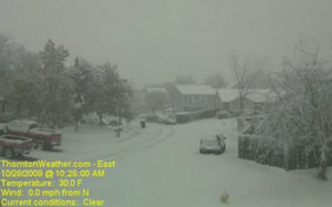
This image from the ThorntonWeather.com webcam was captured at the height of the storm.

A two-day storm that saw areas around Denver measuring snow in terms of feet has moved out of the area and onto the plains. The lingering effects of the storm will be felt Friday in terms of slick roads in Denver and blizzard conditions to the east.

The early winter storm, while not entirely unusual, was the first major snow storm of the season and put Coloradoans to the test. Mercifully, the snow never fell at a particularly heavy rate and while it lingered for a long time, it allowed road crews and residents time to stay on top of the snowfall. Most schoolchildren were pleased to have received at least one snow day from the storm and many were the recipients of two unplanned days off.

At Denver International Airport, initial success at holding the storm’s effects at bay on Wednesday began to whither under the white onslaught on Thursday as winds picked up and the storm shifted east. Hundreds of flights were canceled from the airport’s major carriers including United Airlines, Frontier Airlines and Southwest Airlines.

At the height of the storm’s effects, the airport was reduced to two operating runways from the usual six and delays of up to four hours were occurring. All airlines anticipate being able to operate a normal flight schedule today.

How much snow did the Denver area receive? Here are some of the snowfall totals:

Aurora: 16 inches
Boulder: 18.8 inches
Broomfield: 20 inches
Centennial: 17 inches
Coal Creek Canyon: 46 inches
Denver International Airport: 12 inches (as of 6:00am Thursday)
Evergreen: 30 inches
Highlands Ranch: 24.5 inches
Littleton: 28.5 inches
Longmont: 12.4 inches
Parker: 14.5 inches
Thornton: 14.1 inches
Click here for a complete listing of storm reports.

The storm did push Denver into the record books and the ‘top 10 snowiest Octobers’ list. The National Weather Service will publish the official snow total from DIA for yesterday but even without the snow from yesterday, October 2009 makes the list. As of 6:00am on Thursday, DIA had recorded 14.5 inches for the month (12 inches from this storm). That makes it number 7 on the top 10 list for snowiest Octobers on record since 1882. Once today’s measurement is released, it is possible it will climb further.

There's more to this story on the Denver Weather Examiner's site!For the rest of the storm recap, the latest photos and much more, please visit the story on the Denver Weather Examiner.

Incredible time lapse video – Thornton’s October 2009 snowstorm

From the evening of October 27, 2009 through October 29, 2009, the Denver metro area was struck by a major, early winter snowstorm. The mountains and foothills to the immediate west of Denver were measuring the snowfall in feet while in the city more than a foot of snow fell in less than 72 hours.  Here in Thornton we recorded 14.1 inches of snow during the event.

This time lapse video below was captured by our east facing webcam. It begins early Tuesday morning (October 27th) and runs through midnight on Thursday, October 29th. As it starts, you can see the first day started out nice enough but by evening the wind was blowing and rain was falling. That soon changed to snow and the snowstorm was in full force for two days.

Continuing snow sure to cause a rough afternoon commute

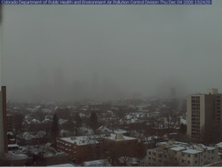
Where's Denver?  This webcam view from the Colorado Department of Public Health and Environment shows Denver obscured in the snowfall at 1:00pm Thursday.
Where's Denver? This webcam view from the Colorado Department of Public Health and Environment shows Denver obscured in the snowfall at 1:00pm Thursday.

If you can, get out of work early today as the roads are sure to be a mess during rush hour.  Snow has been falling across the Front Range all day and snow totals for the metro area are in the 2 to 4 inch range.  Probably just as notable is the bitter cold we are seeing – at 1:00pm DIA was showing 17 degrees and a wind chill of only 2 degrees.  Denver’s high temperature today will most likely be 22 degrees but that was reached at 1:00am!  The wind will continue to keep the wind chills down around zero so bundle up if you head out.

The snow will continue through 11:00pm although accumulations will be pretty light.  The north, west and southern suburbs could see up to 6 inches of snow while the central metro area will end up with around 2 to 4 inches.  Areas of Larimer and Weld Counties including Fort Collins and Greeley will see between 5 to 10 inches of snow. 

A Winter Weather Advisory is in effect for the I-25 corridor north of Longmont as well as most of the central and northern mountains areas.  The extreme eastern portions of the state are under an advisory as well.  In the mountains, eastbound I-70 has chain restrictions in place at the Eisenhower Tunnel, Loveland Pass and at Vail.

Tonight we will dip into the single digits but Friday brings us back into the 40’s and the weekend looks great.

A snowy and slick commute for Thursday

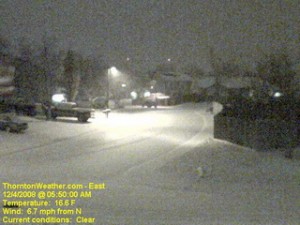
The scene at ThorntonWeather.com at 5:50am today.  Click the image for a current weather webcam view.
The scene at ThorntonWeather.com at 5:50am today. Click the image for a current weather webcam view.

The snow arrived overnight and as of 5:00am ThorntonWeather.com had measured 1.3” and it was still coming down pretty good.  Due to the extreme cold – 17 degrees and a windchill of 5 degrees as of this writing – the roads are quite slick.  This morning we found residential streets to be the worst of course but main arterials like 120th Ave were not in too good of shape either.  Please allow plenty of time to get the kids to school and yourselves to work, allow plenty of distance between you and other cars and just take your time. 

A surge of cold air from the north is expected to intensify the snowfall in the coming hours and a bit of upslope will keep the flakes falling for most of the day.  Accumulations though won’t be all that great – look for 2 to 4 inches overall.  Snow will taper off this evening from the north to the south and completely end in the metro area around midnight.

Friday and this weekend are shaping up great but that could be short lived.  We are watching a cold front coming from Montana that could bring more cold and snow toward the first part of next week.

Snow finally comes to the Front Range

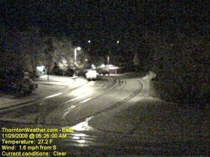
An early morning image from the ThorntonWeather.com east webcam.  Click for larger view.
An early morning image from the ThorntonWeather.com east webcam. Click for larger view.

With only two days to go in the month, things were pretty bleak and we were dangerously close to joining the “top 10” for the least snowiest Novembers in Denver.  That changed in pretty short order last night.  Forecasters were expecting about an inch of snow but the local storm reports indicate most areas exceeded that handily. 

Here in Thornton we started with a touch of rain in the evening which changed to snow as time went on and the temperature dropped.  In the end we recorded 4.1″ of the white stuff, most of which fell between 10:00pm and midnight. 

The National Weather Service in Denver is officially showing 2.4″ of snow at the old Stapleton International Airport site.  At Denver International Airport they recorded 1.6″. 

Some of the other snow reports that have come in (Updated @ 11:15am):

  • Arvada – 2.4″
  • Brighton – 1.5″
  • Conifer – 2.5″
  • Denver (north) – 1.5″
  • Denver (Stapleton) – 3.2″
  • Denver (DIA) – 1.7″
  • Elizabeth – 3.2″
  • Evergreen – 3.2″
  • Erie – 4.5″
  • Highlands Ranch – 3.0″
  • Henderson – 3.0″
  • Highlands Ranch – 4.5″
  • Lakewood – 3.8″
  • Lone Tree – 3.2″
  • Parker – 1.8″
  • Thornton – 4.1″
  • Westminster – 2.2″

For other totals, please see our local storm reports page.