Tag Archives: Thornton Weather

Happy birthday! ThorntonWeather.com enters 10th year of operation

Keeping an eye on the sky since October 2006. ThorntonWeather.com is now beginning its 10th year of operation.

It is hard to believe but it was on October 25, 2006 the digital switch was thrown and the first bits of live weather data from our weather station were fed to the Internet.  ThorntonWeather.com was born!

Since that date, we are extremely proud of what the site has become – an indispensable community resource for north Denver metro area residents, businesses and governmental agencies.

On the one year anniversary of the site’s launch, we were receiving on average 750 unique visitors a month.  On the second anniversary that had grown to around 5,000 visitors a month.  For 2015 we are on pace to average well over 25,000 per month!

The response has been absolutely overwhelming to say the least.

We launched the site simply because we wanted to know what was going on with the weather in Thornton and the north Denver metro area.  We don’t live downtown, we don’t live at DIA and the differences in weather between Thornton and those other locations can be considerable.  Apparently many of you agree!

Our site has not only grown in terms of visitors, but perhaps more importantly in terms of the amount of information available.  Certainly we provide the basics of live weather conditions, radar and forecasts.

  • Did you know ThorntonWeather.com is a completely non-profit venture run by a Thornton resident?  We are self-funded but do occasionally receive help from members of the community, something which allows us to keep things up and running. Learn more about how you can help here.

Far more than that, we now have educational information about various weather dangers, historical climate information, satellite imagery, webcams and so much more.  Our news and blog section is continually updated with the latest news and information including items important to the community.

Put simply, there is no other media outlet in the state that provides as much weather news, information and content as we do!

Since our launch we have became very ‘social’ with a growing Facebook page, a Twitter feed and a presence on Google +.  Interacting with our visitors is an integral part of our site and something we enjoy greatly.

  • Stay up to date with Thornton’s weather: Be sure to ‘like’ us on Facebook, follow us on Twitter and add us to your Google+ circles.

We’re just ‘weather geeks’ that love the weather and love our community.  Running ThorntonWeather.com can be a bit expensive and it is time consuming to maintain and operate it but it is worth it.

We’d like to thank all of our visitors for your support in the past and we look forward to continuing to be the best, truly local source for Thornton weather.

ThorntonWeather.com featured on the City of Thornton’s cable channel

ThorntonWeather.com logoThorntonWeather.com has been featured on the City of Thornton’s cable access channel show Thornton 360.  The interview which was conducted in June 2009 features the site’s chief amateur meteorologist Tony Hake discussing the features of ThorntonWeather.com, his interest in the weather and more.

Be sure to check out the video below and let us know what you think.  You can also watch it on channel 8 throughout the month of September if you have Comcast cable TV.

ThorntonWeather.com would like to thank the City of Thornton’s Communications Department for their work.  Oftentimes we forget how many people it takes to make a city of over 100,000 residents run as well as Thornton does and the city’s employees continually perform above and beyond! 

On to the show:

A Preview of Thornton’s June Weather – The Severe Weather Month

Denver is historically Thornton's true severe weather month.

June is historically Denver’s severe weather month and severe thunderstorms, tornadoes and hail are notorious visitors to Denver and across eastern Colorado during the month.  In fact, over 40 percent of the tornadoes that occur in Colorado are observed in June and these are typically the most destructive of the year.  Severe thunderstorms have also caused major property damage across the Front Range during the month.

In just the last 25 years or so, there have been some particularly notable storms in June.  Tornadoes have struck the metro area including one that longtime Thornton residents will recall on June 3, 1981.  53 residents were injured, 25 homes were destroyed and 239 other structures were damaged.  Others tornadoes in the metro area include southeast Denver and Aurora on June 8, 1986 and east Denver on June 13, 1984.  Severe thunderstorms occurring on June 13, 1984 dumped large hail making it one of the worst and the second costliest storm in Denver history.  More recently, on June 20, 2001, a major hail storm moved across Denver International Airport dropping hailstones as big as two inches in diameter. Damage was extensive on and near the airport.

For complete details on what we can expect in June, click here to view our June weather preview.

Winter-like storm brings more than 3 inches of precipitation to Thornton

As we begin to dry out from an incredibly wet April storm, we can take a look at some of the numbers from the three day event.  Being on the warmer east side of the Denver area, Thornton did not receive a tremendous amount of snow as temperatures here simply remained too warm.  What we did get though was rain – and LOTS of it. 

ThorntonWeather.com measured 3.06 inches of precipitation – the most we have recorded for a single weather event since we went operational in October 2006.  Friday was the wettest of the three days with 1.86 inches recorded – not a single day record for ThorntonWeather.com but still a great amount for our arid climate.  The steady and more or less constant rain brought much needed moisture and helps to make up for what has been a dry snow season thus far. 

Denver did officially set a record for Friday when 1.16 inches of precipitation was recorded at Denver International Airport – the most ever on April 17th.  The old record was 1.00 inch set in 1920. 

While we remain well behind normal on snow for the season, for the calendar year thus far, the storm put Denver ahead of the curve on precipitation.  Normally by this date we would have had 3.36 inches of precipitation.  Since January 1 Denver has now recorded 3.61 inches, 0.25 inch above normal, so that is definitely good news. 

As we mentioned, Thornton did not receive a lot of snow from this event.  We recorded 3.1 inches total as the rain / snow mix we saw at many times resulted in what snow did fall being compacted by rain immediately thereafter.  Other areas of the Front Range however, those primarily west and south, were a touch colder and received a great deal of snow.  A quick look at a few of the snow totals from the event:

  • Pinecliffe – 52 inches
  • Rollinsville – 51 inches
  • Nederland – 37 inches
  • Blackhawk – 36 inches
  • Evergreen – 29 inches
  • Cherry Creek Dam – 15.3 inches
  • Parker – 14 inches
  • Highlands Ranch – 13.4 inches
  • Boulder – 10 inches
  • Broomfield – 9.3 inches
  • Arvada – 8.8 inches
  • Denver, Stapleton – 3.3 inches
  • ThorntonWeather.com – 3.1 inches
  • Denver International Airport – 2.6 inches (Denver’s official site)

All of that moisture and a coming week of temperatures in the 70’s are sure to truly start greening up the landscape.  It won’t be long now for sure and you will be mowing the lawn!

A Preview of Denver’s April Weather – Something for Everyone

Do April showers bring May flowers?  Find out in our April 2009 weather preview!
Do April showers bring May flowers? Find out in our April 2009 weather preview!

April marks a transition between winter and summer for most of the country but for Denver it is especially true as we can see a stunning variety of weather. The proverbial April showers are certainly a possibility for Denver. Snow? Tornadoes? Thunderstorms? You bet – all can happen! For good measure throw in a chance for hail and even dust storms and April gives every type of weather condition you could like – or hate.

The good news is that sunshine and warmer temperatures are usually in abundance as the normal highs during the month move up from 57 degrees on the first to 65 degrees on the 30th. It is not unusual to have a number of days well into the 70’s and the low 80’s. We also see the normal lows move above freezing from 30 degrees at the start of the month to 39 degrees by the end. Temperature extremes can hit both ends of the spectrum with a record low of 2 degrees below zero on April 2, 1975 and a record high of 90 degrees on April 30, 1992.

Get all the details here in our complete April 2009 preview.

Denver blizzard moves out as the digging out begins

Thornton begins digging out from the March Blizzard of 2009.
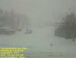
Thornton begins digging out from the March Blizzard of 2009. This image is from our webcam as the storm really began in earnest just before noon.

The sun is already beginning to shine in the wake of Denver’s biggest snowstorm of the 2008 – 2009 winter season.  The storm was also Denver’s biggest since December 2007 when a series of storms dumped more than 30 inches on the city.  While the snow brings much-needed moisture to the parched Front Range, it was a stark contrast to the 70 degree temperatures of just a few days ago. 

Here is Thornton we received 11.4 inches of snow from the storm which increases our season total to 38.1 inches.  While yesterday’s snow helps, that is still barely half of what we average in a season so much more is needed if we want to make up lost ground.

Cold and wind were also part of the story.  Thornton’s high temperature yesterday was 35 degrees but that occurred before 11:00am.  Once the storm arrived, the mercury plummetted 15 degrees and we saw temperatures in the mid-teens.  Winds are what made the storm a blizzard and we had plenty of that with gusts to 33 mph.  The cold temperatures and wind coupled to give us wind chills in the low single digits and Thornton actually recorded a maximum wind chill of 1.3 degrees below zero.

If you haven’t seen it yet, check out these two Thornton weather stories from the blizzard:

For a complete recap on Denver’s March Blizzard of 2009, see our story on Examiner.com.

For all the details, read the rest of this story on our Denver Weather Examiner page. Examiner.com - Get inside Denver weather

Thornton’s March Blizzard 2009 – Time lapse videos

The March Blizzard of 2009 is winding down and it gives us a chance to look at all that happened in the last 36 hours or so.  One of the neat things to look at is the 24 hour time lapse video from yesterday.  Check out the video from our two webcams:

East Webcam Time Lapse – 3/26/09


West Webcam Time Lapse – 3/26/09

November 16th – 22nd – This week in Denver weather history

This week in Denver weather history - November 16th to the 22nd.

Looking back into the Denver weather history books for this week, November 16th to the 22nd, we see a lot of the normal things we would expect to – lots of wind and snow.

 PUBLIC INFORMATION STATEMENT
NATIONAL WEATHER SERVICE DENVER CO
645 PM MST SAT NOV 15 2008
 
..THIS WEEK IN METRO DENVER WEATHER HISTORY…

14-18 IN 1964…THE FIRST MEASURABLE SNOWFALL OF THE SEASON
        TOTALED 6.0 INCHES AT STAPLETON INTERNATIONAL AIRPORT
        WHERE NORTHEAST WINDS GUSTED TO 32 MPH ON THE 14TH.
        MOST OF THE SNOW…4.2 INCHES…FELL ON THE 14TH.  THIS
        WAS THE ONLY MEASURABLE SNOW OF THE MONTH.
15-16 IN 1894…WINDS BEHIND AN APPARENT STRONG COLD FRONT WERE
        SUSTAINED TO 60 MPH WITH GUSTS TO 75 MPH ON THE 15TH.
        SNOWFALL TOTALED 2.6 INCHES IN THE CITY.  TEMPERATURES
        PLUNGED FROM A HIGH OF 72 DEGREES ON THE 15TH TO A LOW
        OF ONLY 5 DEGREES ON THE 16TH.  THE HIGH TEMPERATURE
        ON THE 16TH WAS 24 DEGREES…WHICH OCCURRED SHORTLY
        AFTER MIDNIGHT.
      IN 1996…AROUND A FOOT OF NEW SNOW FELL IN THE FOOTHILLS
        WEST OF DENVER WITH 3 TO 6 INCHES AT LOWER ELEVATIONS
        ACROSS METRO DENVER.  SOME OF THE SNOWFALL TOTALS
        INCLUDED:  15 INCHES AT GEORGETOWN…12 INCHES AT IDAHO
        SPRINGS…10 INCHES AT CHIEF HOSA…AND 9 INCHES IN COAL
        CREEK CANYON.  SNOWFALL TOTALED 2.9 INCHES AT THE SITE
        OF THE FORMER STAPLETON INTERNATIONAL AIRPORT.  NORTHEAST
        WINDS GUSTED TO 23 MPH AT DENVER INTERNATIONAL AIRPORT ON
        THE 16TH.
Continue reading November 16th – 22nd – This week in Denver weather history