24 hours in one minute with yesterday’s east facing webcam time lapse. We start off with fog then after a few hours, the surprisingly strong snow and it is closed out with the rising moon. Kind of fun.
24 hours in one minute with yesterday’s east facing webcam time lapse. We start off with fog then after a few hours, the surprisingly strong snow and it is closed out with the rising moon. Kind of fun.
From rain to blizzard. This is time lapse video from our east-facing webcam showing Saturday AM to this morning. 48 hours in 2 minutes.
Thornton ended up with 20.6 inches. Our anemometer (wind sensor) froze up early yesterday morning so unfortunately no wind was recorded during the height of the event but I sure wasn’t going to climb on the roof to get it unstuck.
Thornton resident Shannon Dizmang put his camera to good use and captured a stunning time lapse video of some lenticular clouds that developed this afternoon.
Also known by their scientific name of altocumulus standing lenticularis, these clouds are not entirely unusual in Colorado on the Front Range during the winter. Strong jet winds force moist air to be pushed up by the rugged terrain of the adjacent Rocky Mountains. This creates a wave-like pattern of air flow that condenses at high altitudes (usually around 20,000 feet).
Mother Nature seems intent on starting out 2017 the way she ended 2016 – cold. A deep trough coupled with successive, reinforcing cold fronts sent Thornton’s mercury plunging and delivered a healthy shot of snow over the last couple of days.
Below is a time lapse video from our east webcam covering the majority of the event. It begins at 6:00am on Wednesday, January 4 when we were only seeing flurries. From there you see the varying intensities of snow over the next 24 hours or so and end with some hints of blue sky but the afternoon of the 5th. In all, the video covers 36 hours in about 83 second.
Thornton ended with 7.1 inches of snow over the two-day period, our biggest snowfall of the season thus far.
Mother Nature played a somewhat cruel trick on the Colorado Front Range. The week started with mild temperatures and a definite feeling of spring in the air. She closed out the week with a significant snowstorm and plenty of cold.
The long-expected storm arrived on the evening of Friday the 15th with rain. Overnight into the early morning of the 16th, the rain continued, heavy at times. In the early morning hours, as temperatures dropped, the rain changed to snow and would continue virtually non-stop through the morning of the 17th.
Thornton’s snowfall totals were certainly at the lower end of what was reported in the Denver metro area. We saw 7.3 inches, much of which melted as fast as it fell. Other locations not far to the west and south were pushing a foot and locations in the foothills and Palmer Divide saw nearly two feet.
The time lapse video begins at midnight on the morning of the 16th and continues through noon on the 17th.
To say the storm that pounded the Colorado Front Range was a big one does not do it justice. In less than 24 hours Thornton would see blizzard conditions and our second heaviest snowfall of the previous 10 years.
Light rain began in the early morning hours but that soon transitioned to snow. The white stuff would continue to fall into the evening. Strong winds helped whip the snow and create blizzard conditions grinding the Colorado Front Range to a halt.
Thornton would tally 20.1 inches of snow, one of the heftier totals from the area.
The video below begins at midnight and runs through 7:00pm.
A fast-moving storm brought a quick shot of snow to the Denver metro area on Veterans Day. This time lapse video captures the snow just as it starts at 1:00am on November 11, 2015 and runs until 1:00pm that same day but which time the sun had come out and the snow was quickly melting. Thornton, Colorado recorded 4.1 inches from the storm.
Late winter in Colorado can bring a wide variety of conditions, oftentimes within a very short time span. This was fully evident yesterday and last night as we went from a high of a daytime 62 degrees to receiving a healthy dose of snow before midnight.
Thornton received a total of 2.9 inches of heavy, wet snow from about 9:00 p.m. on March 4 through 1:00 a.m. on March 5. A healthy 0.45 inches liquid precipitation was recorded from the snow.
The time lapse video below captures the event from its start through sunrise. Below that is a satellite imagery time lapse from 7:00 a.m. to noon to show just how fast that snow disappeared.

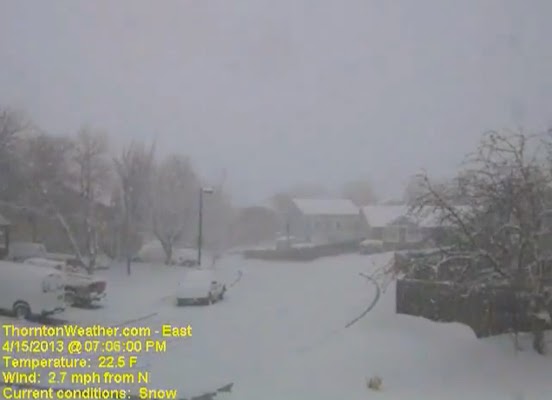
Mother Nature delivered a potent blast of wintry weather for Tax Day catching forecasters and residents off guard. The mid-April snowstorm brought a hefty shot of snow and cold temperatures to Denver and northeastern Colorado.
Two days before the event models pointed to significant snowfall for Tax Day. Soon however those same models shifted their target to the north and the metro area was only expected to receive light snow.
The heavy snow moved further south than anticipated however and by mid-afternoon on Monday, April 15 the storm was getting started in earnest. Snowfall rates of up to 2 inches per hour were seen from then through midnight.
The video below captures 24 hours of the event from 6:00am on April 15 to 6:00am to April 16. Only light snow is seen through about 2:00pm on the 15th before things really start to pick up.

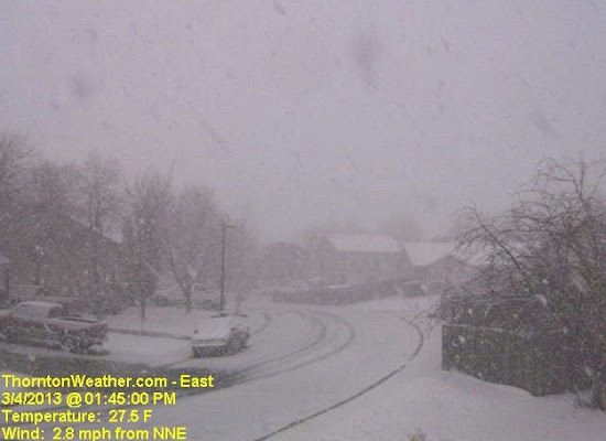
March is historically the Denver area’s snowiest month and only four days into it Mother Nature delivered a nice, wet shot of the white stuff. The storm moved through quickly Monday afternoon and now we focus on a potentially significant storm this coming weekend.
Today Thornton recorded 2.4 inches of snow and a very welcome 0.15” of liquid precipitation from it. Similar totals, many a bit less, were seen in other locations of the Denver metro area.
This brings Thornton’s seasonal snow total to 28.9 inches. That is still well below normal but given the progress made in recent weeks, we are hoping these storms continue to arrive.
As we discussed in this morning’s forecast, models are pointing toward a far more significant storm arriving as early as late Friday and lasting well into the weekend.
One model, the European ECMWF, has been relatively consistent with its projection of a powerful storm with a hefty shot of snow. Other models have been less optimistic but on later runs today they are starting to come in line with the same thinking.
This system will bear close watching. Click here for the latest forecast.
Below is a time lapse video of today’s snow showing 4 hours compressed to 8 seconds.