Tag Archives: tornado

City of Thornton addresses residents’ concerns about tornadoes

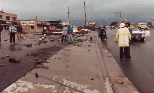
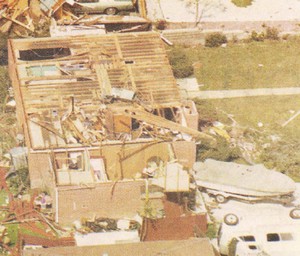
On June 3, 1981 a tornado struck Thornton in what is the worst twister to have struck the Denver metro area. Despite this, Thornton does not have any sort of emergency alert system to warn citizens of tornadoes or other civil disasters.  Image courtesy the City of Thornton archives.
On June 3, 1981 a tornado struck Thornton in what is the worst twister to have struck the Denver metro area. Despite this, Thornton does not have any sort of emergency alert system to warn citizens of tornadoes or other civil disasters. Image courtesy the City of Thornton archives.

As we have discussed before, the City of Thornton is lacking any type of system to alert citizens of severe weather like we have seen recently. In the last week, parts of Thornton have been under Tornado Warnings as funnel clouds circled in the sky and citizens are understandably concerned.

We at ThorntonWeather.com continually remind people that the Denver metro area is at the far western edge of Tornado Alley and funnel clouds, tornadoes, hail and other types of severe weather are not unusual at all. It was 28 years ago last Wednesday in fact that the costliest tornado to ever hit the Denver metro area struck Thornton. Accounts vary but 53 people were injured, at least 25 homes were destroyed and hundreds more damaged.

The danger is real – tornadoes can and do strike in the Thornton area. In some ways it is surprising that the city did not implement some sort of system in the wake of the tornado in 1981. Many municipalities in the metro area do have warning sirens including Denver, Aurora, Englewood, Commerce City and Brighton.

Thornton Mayor Erik Hansen has told ThorntonWeather.com that the city will look at ways to inform citizens when severe weather is imminent. This may take the form of utilizing the reverse 911 system or as we suggested to him, a possible new text alert system that would deliver alerts to citizen’s mobile phones. It is our firm belief that some sort of system to be used not only for severe weather but for other civil disasters is a wise and prudent investment for the city to take.
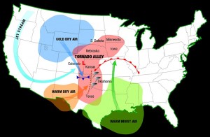
The Denver area is at the western edge of Tornado Alley and as we have seen historically and in recent days, the danger is real.  Click image for larger view.  Image courtesy NOAA.
The Denver area is at the western edge of Tornado Alley and as we have seen historically and in recent days, the danger is real. Click image for larger view. Image courtesy NOAA.

This week the city posted some tornado safety tips on its website that are worth reviewing. You may also wish to review our Severe Weather 101 series which provides more in depth information on the entire array of spring and summer severe weather (links below).

We will continue our conversations with the city about how they can improve communication with Thornton residents about severe weather and keep you updated as appropriate. If you are so inclined, contact your city council representatives and let them know you want to see Thornton implement an emergency alert system.

ThorntonWeather.com Severe Weather 101 Series

Severe weather returns as funnel clouds spotted over Thornton, tornado near Firestone

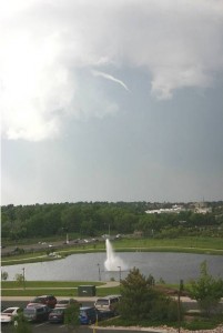
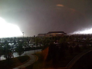
This funnel cloud was seen on Tuesday from the Thornton Civic Center (looking north).  Image courtesy the City of Thornton.
This funnel cloud was seen on Tuesday from the Thornton Civic Center (looking north). Image courtesy the City of Thornton.

Severe weather has returned to the Denver metro area and the Front Range Tuesday afternoon.  At approximately 4:50pm and for nearly one half hour afterwards trained spotters reported numerous funnel clouds over the Northglenn, Thornton, and Broomfield areas.  No tornadoes touched down however.

At 5:11pm local law enforcement reported a tornado four miles northwest of Firestone moving at 20mph.  This area remains under a Tornado Warning until 5:00pm. 

If you are in an area under a Tornado Warning, do not try to outrun the storm or chase it in your vehicle.  Immediately seek shelter in a building.  If no structure is available, seek shelter in a ditch or low spot.  If in your home or other building go to an interior hallway or ideally the basement.

[nggallery id=5]

Tornado in Aurora rated an EF1

The tornado that struck Aurora, Colorado has been rated an EF1 with 100 mph winds by the National Weather Service.  Image courtesy Sean Strachan. Follow the link below to go to Examiner.com for more images.
The tornado that struck Aurora, Colorado has been rated an EF1 with 100 mph winds by the National Weather Service. Image courtesy Sean Strachan. Follow the link below to go to Examiner.com for more images.

The tornado that touched down in the Denver suburb of Aurora and caused damage to a local mall and apartment complex has been rated an EF1 by the National Weather Service.  After two days of evaluations, the service said that the twister most likely had winds of 100 mph, placing it in the middle of that rating.

The four other twisters that struck the area will be rated later this week.  Because they were short lived and struck in open areas, they mostly likely will be rated as EF0 twisters with winds from 65 mph to 85 mph. 

The other tornadoes were reported in the area of 144th and I-25, one was reported five miles south of Bennett, one five miles south of Deer Trail and one three miles north of Byers.

For all the details including photos of the damage and video, check out the complete story on Examiner.com. Examiner.com - Get inside Denver weather

Sunday storm brings funnel cloud and hail to Thornton

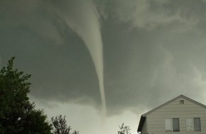
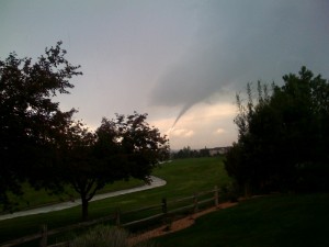
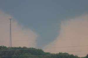
A funnel cloud near Thornton on Sunday, June 7, 2009.  Image courtesy John Wagner, Warrior Legacy Foundation.  Click for larger image.
A funnel cloud near Thornton on Sunday, June 7, 2009. Image courtesy John Wagner, Warrior Legacy Foundation. View our slideshow below for more images.

For a brief period of time this afternoon, Thornton and western Adams County were under a Tornado Warning as a funnel cloud was spotted passing.  Thankfully the storm quickly weakened and the threat diminished.  The image at the right is courtesy John Wagner of the Warrior Legacy Foundation.  This was from approximately 136th & Washington looking northwest. 

Do you have images of the severe weather to share?  Email them to info@thorntonweather.com

View images from ThorntonWeather.com visitors in our slideshow below.  Also check out two videos of the twister below!

Please stay aware of the latest severe weather in Thornton.  As of this writing a Severe Thunderstorm Warning remains in effect and conditions could rapidly deteriorate again. 

[nggallery id=4]

28 years ago today – Thornton is struck by a tornado

Damage along Washington was extensive from the tornado that struck Thornton on June 3, 1981. (City of Thornton archives)

It was 28 years ago today that the worst tornado to ever strike the Denver metro area hit Thornton.  June 3, 1981 is a day that will forever be remembered by longtime residents of the north metro area. 

Last year the Northglenn-Thornton Sentinel did a story about it which you can read by clicking here.  Also, below is the entry from the National Weather Service’s history calendar – it is very interesting and serves as a good reminder that severe weather can strike anywhere.

In 1981…severe thunderstorms produced tornadoes over metro Denver.  The first tornado touched down at the intersection of Alameda Ave. And Sheridan Blvd.  The twister moved north along Sheridan Blvd….damaging businesses…apartment buildings…homes…and vehicles.  Over ten homes were unroofed.  The roof of one landed in the middle of a neighborhood park.  At least 10 mobile homes were wrecked.

The tornado curved to the northeast into northwest Denver… Hopping up and down in several places.  Very strong winds outside the actual funnel caused 20 to 30 thousand dollars in damage in downtown Denver.  The third floor of one old building was demolished.  No major injuries were reported from the tornado…although several people were hurt slightly in traffic accidents on Sheridan Blvd. in the confusion caused by the storm.  Damage in Lakewood alone was estimated at 200 thousand dollars. 

At the same time… The worst tornado to ever hit metro Denver struck Thornton. Coming from the same thunderstorm that spawned the Denver twister…the Thornton tornado tore a swath through the heart of the city.  87 homes were destroyed…110 others damaged at least moderately.  In all…600 homes in a 100 block area sustained some damage.  The twister also hit shopping centers…several restaurants…and other buildings. Seven of the 42 injured were considered serious.  The storm was strong enough to snap lamp posts in half and drive a 6- inch slab of wood 2 feet into the ground.  Damage was estimated at up to 50 million dollars. 

The same storm that struck Thornton produced another damaging tornado that touched down in the northwest section of Fort Lupton.  This twister damaged 16 homes and numerous cars and campers. Two children were slightly injured when the car they were in was knocked about and its windows shattered by the storm.  The twister also damaged two commercial buildings.  Damage was very spotty…and observers said the storm hopped up and down at least 3 times.  Dollar damage was estimated at 500 thousand dollars. 

The thunderstorm complex that produced 3 damaging tornadoes also dropped large hail which damaged many cars over northwest Denver.  One to 2 inches of rain fell in less than an hour…flooding a mobile home park with 3 to 4 feet of water on the northwest edge of Denver.  The high water damaged about half of the 392 homes in the park.  Local flooding was also reported in other areas across metro Denver.  A tornado was also sighted near Franktown…but caused no damage.  A thunderstorm wind gust to 52 mph was recorded at Stapleton International Airport.

Windsor marks one year anniversary of EF3 tornado

The town of Windsor, Colorado was forever changed when an EF3 tornado ripped through it one year ago today.

May 22, 2008 was like most any spring day along the Colorado Front Range.  The morning started out a bit warmer than usual and it was more humid but there was nothing to indicate the havoc that was soon to be visited upon Windsor, Colorado.

As the morning wore on, high above the plains the jet stream was moving at 120 mph and temperatures were warming quickly.  From Denver looking north huge clouds began to build miles into the sky – an ominous sign of what was to come.  A supercell thunderstorm, one more like what you expect to see in Oklahoma, was forming quickly.

At 11:30am the warnings were going out from the National Weather Service.  This was not your typical thunderstorm.  Soon a Gilcrest police officer radioed, “We have a tornado on the ground!”

Three tornadoes touched down that morning in northern Colorado but one stands out.  The supercell that was near Windsor was growing in size and the twister that developed was massive – ¾ of a mile wide.  Rated by the National Weather Service as an EF3 on the Enhanced Fujita Scale with winds in excess of 136 mph, what was described as a “big, black monster” would tear a path 35 miles long.

For the rest of this story including video and a photo slideshow, please visit Examiner.com.

Rare tornado touches down in Mesa County

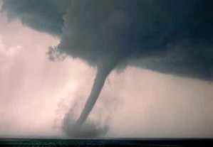
A tornado touched down in Mesa County on Tuesday - only the ninth twister since 1950 in the county.  (File photo)
A tornado touched down in Mesa County on Tuesday - only the ninth twister since 1950 in the county. (File photo)

Mesa County, Colorado reported a rare tornado on Tuesday afternoon.  The National Weather Service in Grand Junction reports that the twister touched down in an open area around 3:25pm yesterday near Mount Garfield (map). 

The Associated Press reported that Meteorologist Jeff Colton said a National Weather Service employee was in the area and saw it happen. No damage or injuries were reported.

This was only the ninth tornado recorded in Mesa County since 1950 and the first since August 2, 2005. 

For more information:  Click here to view a history of tornadoes in Mesa County.

Tornadoes wreak havoc, kill three in Missouri

A tornado tears through Adair County Wednesday evening. This photograph was taken by Dr. Curtis Roof from Highway 6, facing west. The tornado traveled on a northeastern path, damaging several homes along the way. (Dr. Curtis Roof/Kirksville Daily Express)

The quiet rural area of Kirksville, Missouri was ripped apart Wednesday evening by four tornadoes that destroyed and damaged homes and claimed the lives of three people.  The first of the series of tornadoes was reported at 5:49pm local time near this town 120 miles northeast of Kansas City.

Adair County bore the brunt of the line of severe storms as they moved northeast across the nation’s midsection.  Two twisters were reported near Novinger, one near Troy Mills and the most damaging one in Kirksville.  The Kirksville tornado destroyed at least one house and damaged 30 – 40 others as well as a car dealership. 

Two victims were killed in Adair County according to the Missouri State Highway Patrol.  No details on the circumstances or their names have been released other than to say they were tornado related.  One woman was killed in neighboring Sullivan County when a tornado struck her mobile home.

Get complete details on the twisters and see some incredible images of the destruction on Examiner.com.

Colorado Severe Weather Awareness Week highlights weather dangers in the state

Last year's Windsor tornado highlighted just how dangerous weather in Colorado can be.  Are you and your family prepared?
Last year's Windsor tornado highlighted just how dangerous weather in Colorado can be. Are you and your family prepared?

As is customary, the governor has declared this week Severe Weather Awareness Week.  This is an opportunity for the public to get reacquanted with the dangers severe weather presents in Colorado. 

Tornadoes, lightning, hail, severe wind and flooding are very real hazards that Coloradoans face every year during severe weather season.  It is important that you know what to do to protect you and your family. 

In conjunction with the National Weather Service, Examiner.com will be publishing our Severe Weather 101 series.  Each day this week a weather hazard will be discussed in depth and we will outline protective measures you can take to keep yourself and your family safe.  Please be sure to check back every day to read these important message.

From the National Weather Service

Thunderstorm hazards around the corner…are you prepared?

Severe thunderstorm season will be soon upon us.  Do you know how to stay safe around tornadoes, flash floods, lightning, hail, and damaging winds?  This is the week to learn.  This week, April 19th to 25th, is Colorado severe weather awareness week.   This is the time to learn more about severe weather in Colorado, develop severe weather preparedness plans, and test vital communications.

Can we learn lessons from the past severe weather events?  Just last year on may 22nd an EF3 tornado raced north through Weld and Larimer counties resulting in one fatality.  Several injuries and destroyed or heavily damaged hundreds of homes.  Two years ago, on March 28, 2007 the town of Holly was heavily damaged by another EF3 tornado that resulted in two fatalities.  Twelve years ago on July 28, 1997 a devastating flash flood occurred in Fort Collins resulting in 5 fatalities and millions of dollars in damage.

Each year for the past 20 years there have been an average of 50 tornadoes in Colorado, 3 people killed by lightning and another 15 injured by lightning.  

The National Weather Service offices which cover Colorado will issue a series of public information statements during the week covering the following topics:

  • Monday…Watches and warnings
  • Tuesday… Tornadoes and tornado safety
  • Wednesday…Flash floods and flash flood safety
  • Thursday…Downburst wind and hail
  • Friday…Lightning and lightning safety
  • Saturday…A review of the week

A time to test your warning reception and communications systems is planned.  Each national weather service office serving Colorado will send test tornado warnings on Tuesday April 21 between the hours of 8 am MDT and 11 am MDT.  These test warnings will be sent to the emergency alert system, the internet, NOAA weather radio and law enforcement communications systems. 

Safety information, watches, warnings, forecasts, past weather and much more information is available at your local National Weather Service web sites:

     www.weather.gov/denver      NWS Denver web site
     www.weather.gov/pueblo      NWS Pueblo web site
     www.weather.gov/goodland    NWS Goodland web site
     www.weather.gov/gjt         NWS Grand Junction web site


Largest in-field tornado study ever set to launch in May

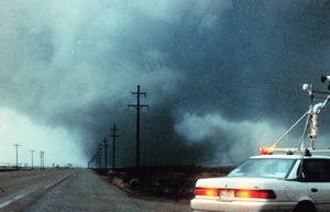
The VORTEX2 tornado research project will be the largest in-field study of tornadoes ever.

The single largest and most ambitious field study to increase our understanding of tornadoes is set to kick off next month.  The Verification of Origin of Rotation in Tornadoes EXperiment2 (VORTEX2 or V2) will feature more than 50 scientists utilizing 40 vehicles, 10 mobile radar units and an Unmanned Aerial Vehicle (UAV).

The study which will run from May 10 to June 13 will become the largest mobile in-field laboratory ever assembled to study tornadoes.  In a statement Louis Wicker, research meteorologist with NOAA’s National Severe Storms Laboratory and V2 co-principal investigator said, “Data collected from V2 will help researchers understand how tornadoes form and how the large-scale environment of thunderstorms is related to tornado formation.”

The VORTEX2 tornado research project will be the largest in-field study of tornadoes ever.

Operations will be controlled at the National Weather Center in Norman, Oklahoma while the mobile units chase tornadoes across Tornado Alley and the central Great Plains.  The target area for the study ranges from southern South Dakota through Nebraska, Kansas, Oklahoma and the Texas Panhandle.  Eastern Colorado, home of many tornadoes, is included in the study.

This unprecedented gathering of scientists and technology hold incredible promise for the research that will be gathered.  The original VORTEX program which happened from 1994 to 1995 documented the entire life cycle of a tornado from start to finish, the first time that had ever been done.   That research greatly enhanced our understanding of twisters and led to much improved tornado warnings that help to save lives today.

VORTEX2 seeks to build on that research and the research that has taken place since.  According to the project website it will seek to answer such important questions as:  How do tornadoes form? What exactly causes the wind to spin into a concentrated funnel? How can we tell exactly when a tornado will form and when it will die, or how long it will last? Why do some thunderstorms produce tornadoes and others do not? What is the structure of tornadoes? What is the relationship of tornadic winds to damage?

An important finding from the original VORTEX experiment was that the factors responsible for causing tornadoes happen on smaller time and space scales than scientists had thought.  New advances will allow for a more detailed sampling of a storm’s wind, temperature and moisture environment and lead to a better understanding of why tornadoes form – and how they can be more accurately predicted.
– Stephan Nelson, NSF program director for physical and dynamic meteorology.

VORTEX2 features scientists and students from the United States, Canada and Australia in collaboration with government agencies, private industry and educational institutions.  Many luminaries within the storm chasing and severe weather research community will participate including Dr. Josh Wurman of the Discovery Channel’s Storm Chasers TV show.  Some of the notable participating organizations include Center for Severe Weather Research, Rasmussen Systems, NOAA National Severe Storms Laboratory, OU/NOAA Cooperative Institute for Mesoscale Meteorological Studies, NSF-sponsored National Centers for Atmospheric Research, Penn State University, University of Oklahoma, Texas Tech University, Lyndon State College, University of Colorado, Purdue University, North Carolina State University, University of Illinois, University of Massachusetts, University of Nebraska, Environment Canada, and the Australian Bureau of Meteorology.

For more information:

[nggallery id=3]