Tag Archives: weather warning

Major storm continues on path, Denver could get 12+ inches of snow

A major spring storm could bring more than 12 inches of snow to Denver and Thornton.

The major winter storm we have been tracking for the last couple of days continues on its path toward Denver and the Front Range and before it is over, Denver could see more than a foot of snow.  The latest computer models indicate the storm is coming a bit further north than previously thought which increases the changes for what will be a very significant snow event for us. 

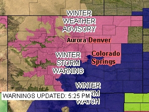
Snow in the mountains tonight will begin to spread to Denver and the Front Range Thursday morning and it will last through Thursday evening and beyond.  Highlighting the significance of the storm, the National Weather Service has issued a Winter Storm Warning (see below for text of warning) for all of northeastern Colorado including Denver. 

The NWS is forecasting snow totals from 8 to 15 inches for the metro area (see image below) and from 1 to 2 feet along the Palmer Divide.  I think that may be a bit optimistic myself but there is little doubt we are in for our biggest storm of the snow season.  Areas south and west like Highlands Ranch, Parker and Golden will almost certainly experience the most snow in the metro area.  See the image below for potential snow totals.

Continue reading Major storm continues on path, Denver could get 12+ inches of snow

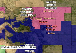
Winter Storm Warning issued in anticipation of major storm

A major winter storm will hit Denver and the Front Range Thursday morning where some areas will be measuring snow in feet.

The National Weather Service has issued a Winter Storm Warning for Denver and much of northeastern Colorado in anticipation of a significant storm now approaching the state.  The warning takes the place of the previously issued watch and signifies the increased potential for a major snow event.  The warning goes into effect at 6:00am Thursday morning and runs through 6:00am Friday.

Computer models are beginning to coalesce around solutions that involve snow amounts that could exceed a foot along the Palmer Divide and the foothills.  Snow will begin falling in the foothills in the morning and by midday will encompass the entire Front Range.  By the time the storm ends, much of the metro area will have in excess of six inches of snow.  Tomorrow afternoon’s commute is almost certainly going to be a rough one.

The spring snowstorm could be our biggest storm to date for the 2008 – 2009 winter season.  We are desperately in need of moisture so while it may be troublesome, we really need the precipitation. 

Click here to get all the details on our warning page.

Winter Weather Advisory issued for the Front Range

Current ThorntonWeather.com webcam image.

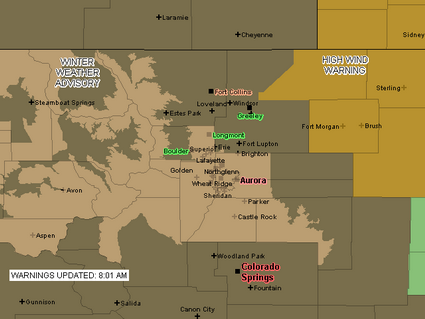
Due to the deteriorating weather conditions, the National Weather Service has issued a Winter Weather Advisory for snow and blowing snow.  Areas under the advisory include the Denver metro area and areas south to Castle Rock as well as some of the mountain areas (see advisory map below).  The storm seems to be lingering over the Front Range longer than expected but the snowfall is still expected to end quickly late this morning.

URGENT – WINTER WEATHER MESSAGE
NATIONAL WEATHER SERVICE DENVER CO
757 AM MST MON JAN 12 2009

..Winter weather advisory in effect until 11 am MST Tuesday…

The National Weather Service in Denver has issued a Winter Weather Advisory for snow and areas of blowing snow…which is in effect until 11 am MST Tuesday.

Snow…heavy at times…will continue within the greater Denver metro area…the southern Front Range foothills and the palmer divide south of Denver. A band of moderate to heavy snow now over the Denver metro area will continue to move south over the palmer divide south of Denver within the next hour. In addition to snowfall…areas of blowing snow will significantly reduce visibilities at times.

Snowfall is expected to taper off rather quickly later this morning…first over the northern Denver metro area and then eventually over the palmer divide and southern foothills by early this afternoon.

Additional snow accumulations by noon today will range from 1 of 3 inches in Boulder and across the northern Denver suburbs to another 3 to
6 inches in the southern Denver and over the palmer divide.

In addition…north winds of 15 to 25 mph will produce areas of blowing snow and very poor visibilities especially over the higher terrain south and southeast of Denver.

A winter weather advisory means that snow…blowing snow…or freezing drizzle will cause travel difficulties. Be prepared for slippery roads and limited visibilities…and use caution while driving.

A Winter Weather Advisory is in effect for much of the Front Range until 11:00am Monday.