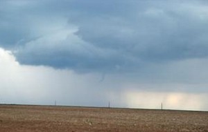
Saturday afternoon’s thunderstorms brought some pretty interesting weather to Denver and the Front Range. Our wettest and cloudiest month seems to be intent on finishing out right on par with what we would expect this time of year.
Thunderstorms and showers moved across the metro area in the late afternoon Saturday producing thunder, lightning and rain across much of the area. Some stations on the Rocky Mountain Weather Network reported quite heavy rain, particularly those on the west side of town. Some of the rain totals along the Front Range since yesterday:
- Arvada – 1.17 inches
- Broomfield – 1.03 inch
- Windsor – 0.37 inch
- Commerce City (Reunion) – 0.39 inch
- Denver (West) – 0.35 inch
- Thornton – 0.14 inch
- Parker – 0.08 inch
- Denver (North) – 0.04 inch
In yesterday’s forecast we warned of the possibility of landspouts which are small, short-lived tornadoes. None were observed however a funnel cloud was reported over north central Aurora about three miles south of DIA at 4:50pm. The funnel lasted about two minutes and never touched down and did not cause any damage.
