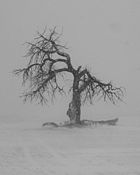
With only three days of winter left, Thornton is looking to have its warmest day of the year thus far on St. Patrick’s Day. We will enjoy those warm temperatures today and tomorrow but Friday brings big change in temperatures and the chance for significant snowfall.
For Wednesday, there will be sunny skies across the Front Range and that will help to warm the Mile High City to temperatures nearly 15 degrees above normal. Highs today look to be in the upper 60’s and will likely mark the warmest day of the year thus far.
Thursday we will enjoy one more day of unseasonably warm weather. There will be a few clouds starting to intrude and highs will be in the mid to upper 60’s.
The big weather day in the forecast we are watching is Friday and winter looks like it may go out as a lion. A significant storm system is now getting organized and will begin to move from the Pacific Northwest and arrive in the state Thursday night and into Friday morning. This system is bringing with it plenty of cold air but also a lot of moisture. Highs of Friday may not even reach the freezing mark – almost a 40 degree drop from what is expected Thursday.
Overnight Thursday there will be a chance for snow and the timing of this system may shift a bit but right now but it looks like starting around 6:00am Friday is when it really gets spooled up. How much of the precipitation falls as rain and how much as snow is going to depend greatly on the temperatures.
As it stands, it looks like there should be plenty of cold air to make most of it fall as snow. Assuming so, Thornton may be looking at getting one of its biggest snowstorms of the year. This early it is tough to put a number on the snowfall but preliminary indications are that the mountains and foothills could receive a foot of snow and up to 10 inches is possible along the Palmer Divide.
For the Denver area including Thornton, particularly the northern part of the Front Range to Wyoming, 5 to 8 inches is possible. Assuming this storm system remains on track, it is likely that the National Weather Service will start posting Winter Weather Advisories in the next 24 hours or so.
The snow will continue throughout much of the daylight hours Friday before tapering off in the late afternoon. There may be some lingering snow showers lasting throughout the night into early Saturday morning but additional accumulations should be light at that point.
As the storm system moves out, Saturday will remain chilly but we should start seeing some sun. On Sunday, temperatures will rebound to the upper 40’s.
A lot could change between now and Friday but the models are in good agreement thus far. Be sure to check back for the latest with this developing weather situation.
As always, stay tuned to ThorntonWeather.com for truly local weather for Thornton.
- Latest forecast for Thornton
- Current Advisories and Warnings
- ThorntonWeather.com Denver Doppler Radar
- Live Conditions in Thornton
- ThorntonWeather.com Weather Webcams
- Current Road Condtions
- Follow ThorntonWeather.com on Twitter
- Become a fan of ThorntonWeather.com on Facebook
If you haven’t done so, be sure to follow us on Twitter and become a fan on Facebook! They are great ways to stay up to date with the latest weather news, forecasts and conditions! You can also signup to receive the latest weather alerts and forecasts via email here.
