
National Weather Service Weather Story |
Thornton Weather Forecast 48 Hour Graphical Forecast |
| WEATHER STORY Denver/Boulder Weather Forecast Office |
|
|||
 |
|||
|
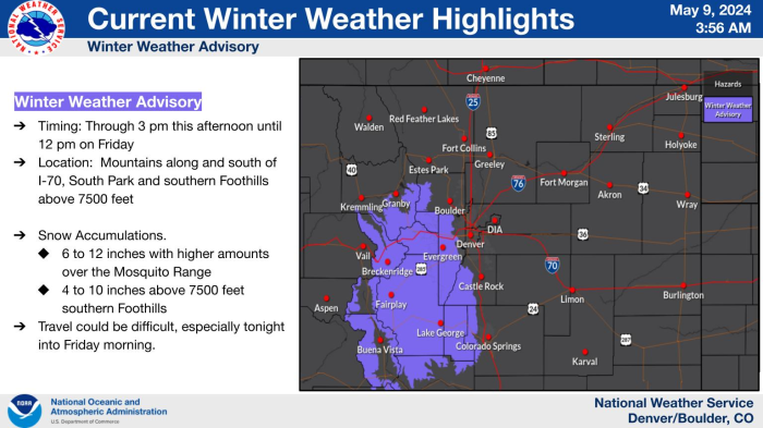
Once again, confidence has increased in the potential for numerous severe thunderstorms across eastern Colorado later this afternoon and tonight. Thunderstorms are forecast to begin developing mid-afternoon, although the greatest coverage and intensity of storms is expected this evening, lasting into the early morning hours. Intense supercells will be possible, with a heightened risk of very large hail (between 3" to 4" in diameter), damaging winds gusts, and isolated tornadoes. Be weather aware, consider pre-emptively protecting livestock, plants and vehicles, and plan on travel impacts at Denver International Airport later in the day.
|
Select a Different Office Below

Data Courtesy of Denver/Boulder Weather Forecast Office